By clicking "ACCEPT", you agree to be the terms and conditions of each policy linked to above. You also agree to the storing of cookies on your device to facilitate the operation and functionality of our site, enhance and customize your user experience, and to analyze how our site is used.
In 2008, Anna and Andrew Johnson started a side project to build an outdoor search site called trailbehind.com. By fall 2009, they had formed a company and launched Gaia GPS. Gaia GPS is the leading backcountry navigation app that lets you know your exact location on the map, even when you're offline and far from cell service. While Gaia GPS started as a navigation tool for hikers, the offroad community quickly adopted the app.
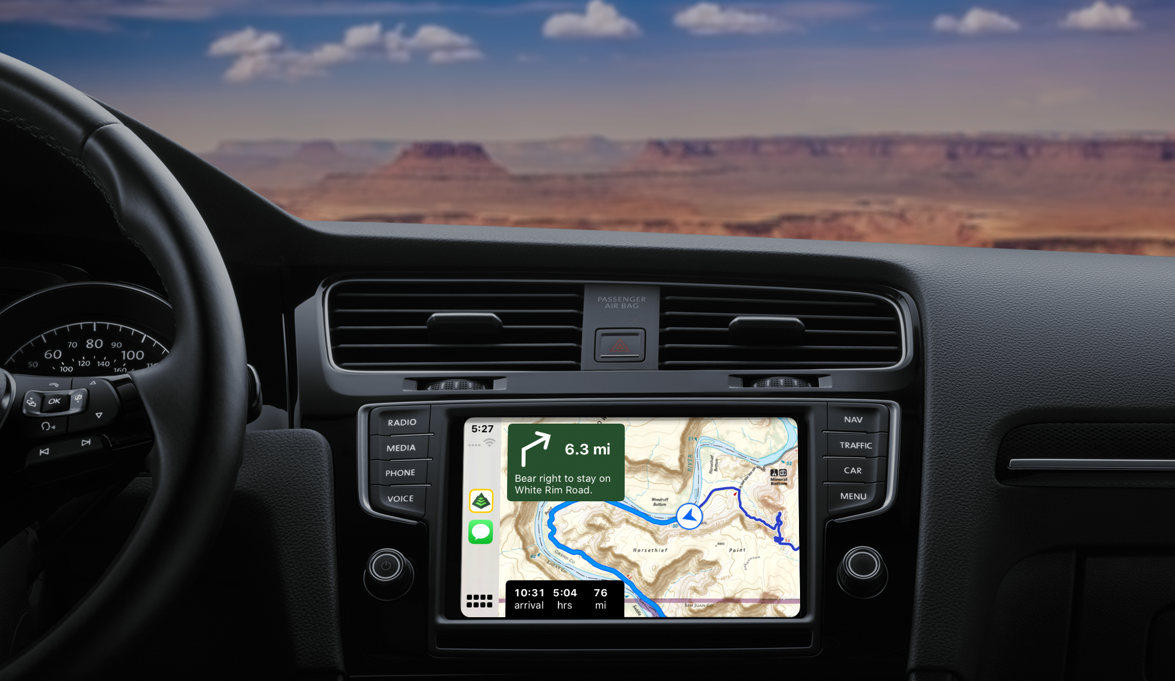
Now, thousands of overlanders use Gaia GPS as their preferred mapping app because it gives them access to high-powered planning and navigation tools. It's the first backcountry app available for Apple CarPlay, bringing the best outdoor maps directly to your vehicle's dashboard navigation screen.
Gaia GPS offers a whole catalog of maps that are ideal for overlanding, including the USFS Motor Vehicle Use Maps, which show seasonal closures and restrictions for 4x4 and offroad trails. Gaia GPS also offers maps that show public land designations like BLM and National Forest property and ownership of privately owned parcels. Tap into the classic favorites like USGS and USFS Topo Maps and check out the high-resolution satellite imagery maps for landscape details on your next trip. Gaia Topo is optimized for fast, efficient downloads. Based on OpenStreetMap data and styled similarly to USGS topo maps, this do-anything base map contains everything from up-to-date roads and trails to labeled water sources and points of interest.
Take your planning and mapping offroad with a Gaia GPS Premium subscription and get the entire map catalog along with the ability to download maps for exploring outside of cell service.
In our opinion, GAIA GPS is the number one navigation app. Since our beginning, GAIA has been the number one tool we use for all things navigation, GPS, and research. Based on the feedback we receive from the community, it seems that GAIA GPS is your number nav app as well. With that, we are happy to announce that we have integrated the ability for you to push our Trails Offroad proprietary GPX files directly to GAIA GPS.
What is included?
| Trails Offroad Feature | Limited-Access Members | All-Access Members |
| Push (Upload) GPX Files Directly to GAIA | No | Yes |
| Waypoints Included | No | Yes |
| Color-Coded Difficulty Ratings Included | No | Yes |
| Download GPX Files | No | Yes |
We made this functionality extremely easy to use and only require a few clicks. You can say goodbye to downloading from us and then uploading to GAIA; it's all seamless.
Step 1:
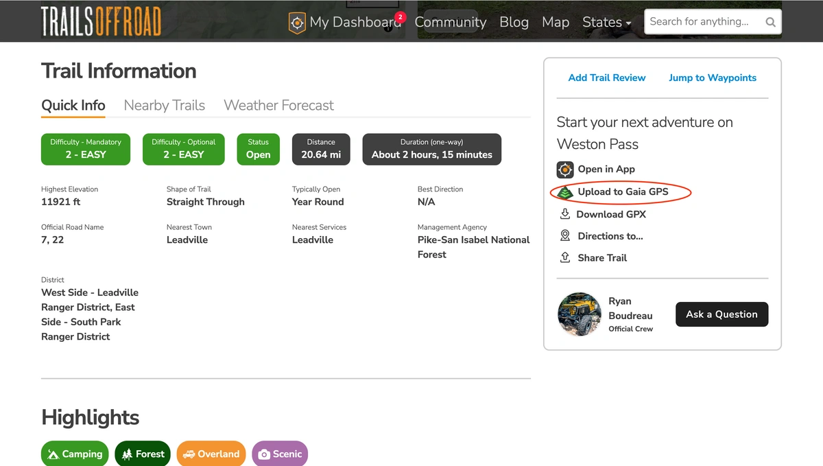
Click the upload to GAIA GPS button.
Step 2:
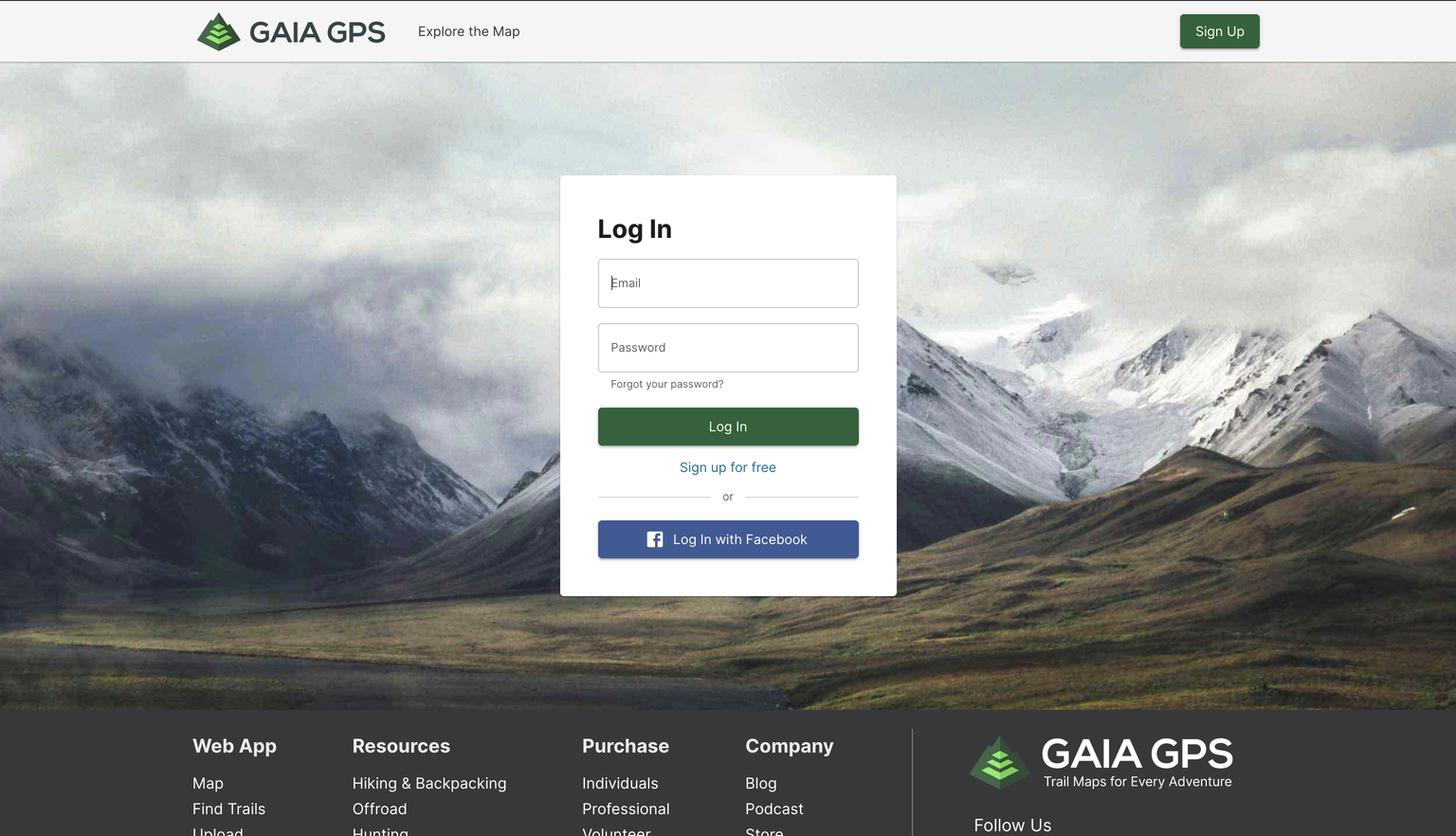
Once you click upload to GAIA GPS, you will be prompted to log into your GAIA account.
Step 3:
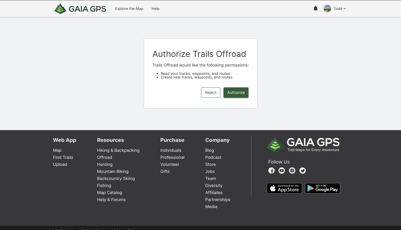
Once you have logged in, you are requested to authorize Trails Offroad to upload the file on your behalf. You will only need to perform this authorization one time, or until you clear your cookies from your browser(s).
Locating the Files on GAIA and Syncing to Your Phone/Tablet
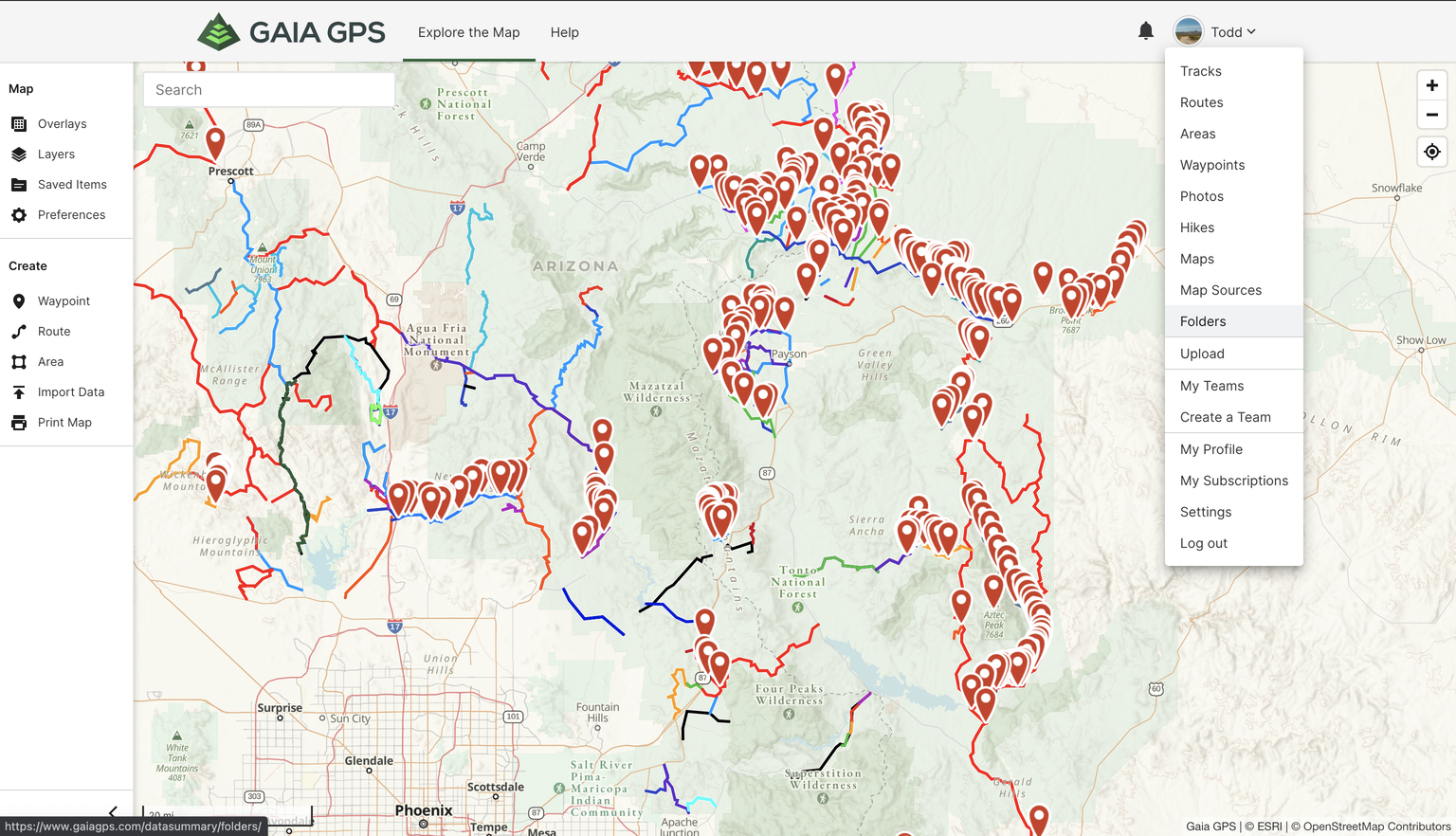
Our proprietary GPX files are upload to GAIA in the form of "folders". To find them, log onto GAIA and look for the folder section in the pulldown underneath your name. Be sure to sync your phone or tablet GAIA GPS application after upload. To sync, all you need to do is open the GAIA app on your preferred phone and or tablet.
