Please wait - Uploading to Gaia GPS
Recent snow and rain have caused many trails to be temporarily closed. Please check with the local agencies for the most up-to-date information.
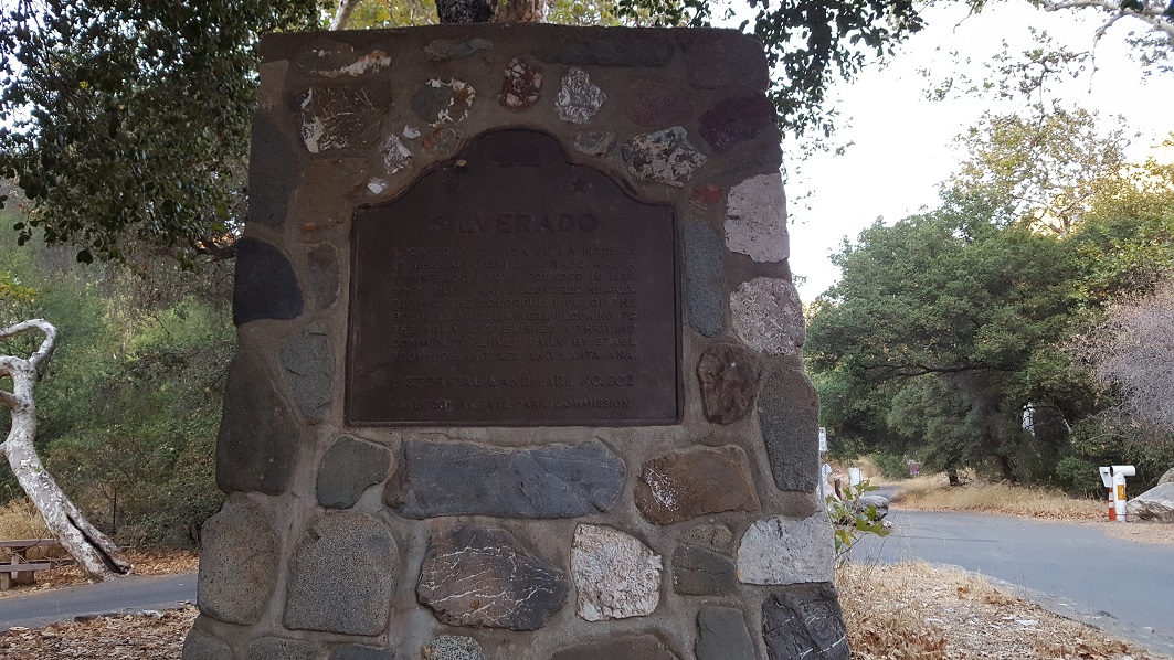
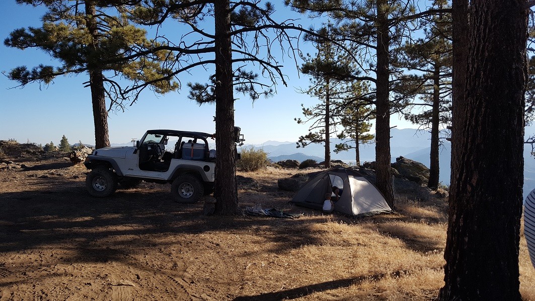
Maple Spring Road - Silverado Canyon - 5S04

Trail Information
Difficulty - Mandatory
1 -
EASY
Difficulty - Optional
3 -
MODERATE
Status
Open
Distance
7.26 mi
Duration (one-way)
About 1 hour
Highest Elevation
4850 ft
Shape of Trail
Connector
Typically Open
Year Round
Best Direction
East
Official Road Name
5S04
Nearest Town
Orange
Nearest Services
Orange
Management Agency
Cleveland National Forest
District
Trabucco District
Highlights
 Altitude
 Desert
 Forest
 Iconic
 Overland
 Sand
Sand Scenic
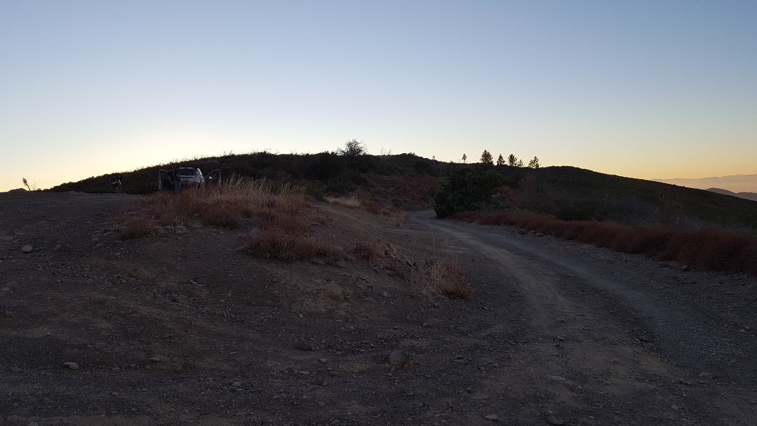
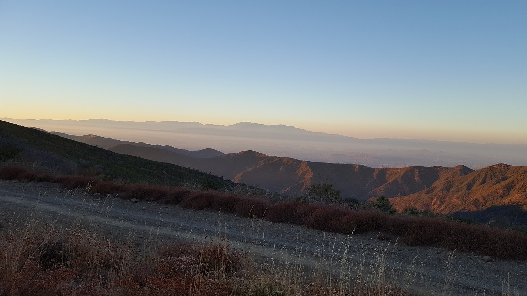
Maple Springs Road is the backdoor to Saddleback Mountain from Mid Orange County. One of Orange County's few trails, this is a popular overland route for people to take when wanting to get out of the house and stay local. Others say the reason they enjoy this road is that it leads to the best view of Orange County.
If you are fortunate to have a few hours around sunset, the view from the top of Saddleback Mountain has been known to create some of the best views / photographs of the sunset as it sets over Catalina Island / Pacific Ocean with Orange County in the foreground.
Trail Difficulty and Assessment
Recommended Vehicle:
2WD Vehicle with High Clearance
Concerns:
Summary:
Compressed dirt road.
Community Consensus
5 votes
10 votes
0 votes
Easier
Spot On
Harder
The weighted average of your fellow members agreement of our trail rating. As trail conditions change this helps us keep the community aware of changes.
Mandatory
1 -
EASY
The hardest part of the trail that you
cannot bypass - you have to drive it.
Optional
3 -
MODERATE
The hardest part of the trail that is
purely optional - you can bypass it.
Dirt and/or rocky road. Potential rocks and/or tree stumps less than 5" tall and/or vertical ledges less than 5" tall and/or near vertical ledges or waterfalls less than 6" inches. Good tire placement likely. Can be steep, but with good traction. Read More about our Rating System
Start your next adventure on Maple Spring Road - Silverado Canyon - 5S04

Upgrade your Membership
Unlock all of the details on every Trail Guide and Scout Route.
Start a 7-day Free TrialUploading to Gaia GPS
Share Trail
Trail Navigation
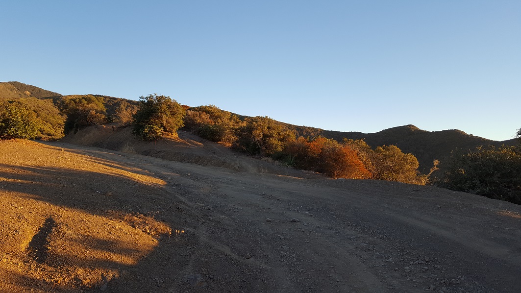
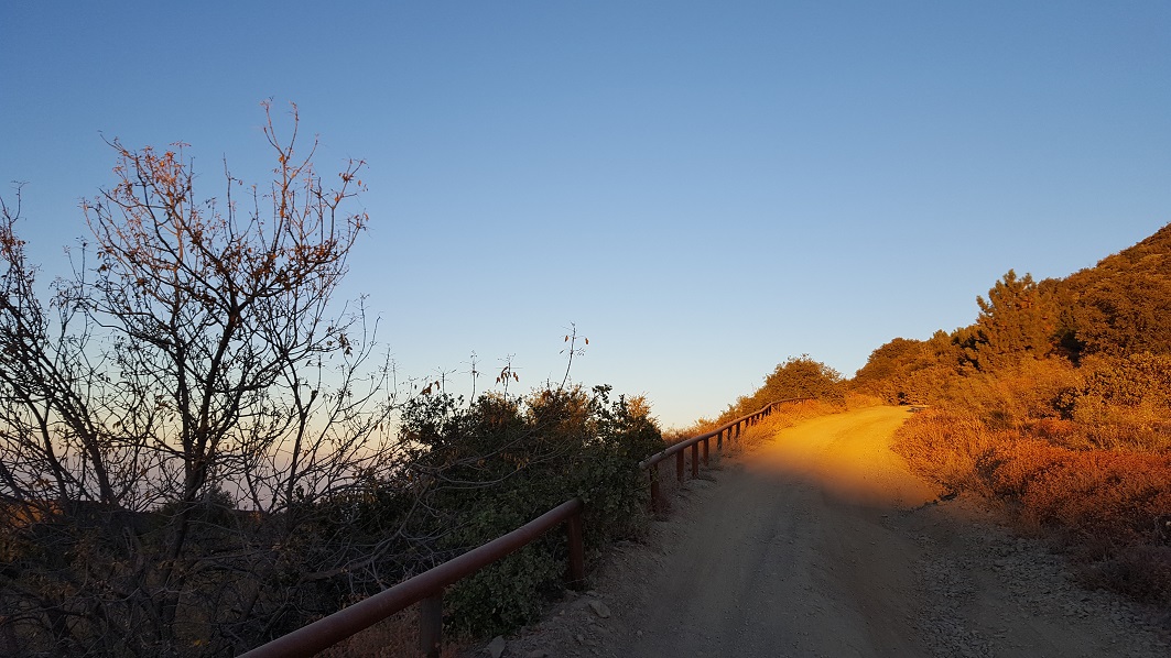
Maple Springs Road begins where Silverado Canyon Road ends, hence the name Silverado Canyon Trail. While traveling this overland route, you will find it to be mostly a dirt road with a couple of water crossings, an ample amount of shade, and an abundance of views. Even though the trail is mostly a dirt road, there are several very tight hairpin corners that could potentially be an issue if traveling at a high rate of speed.
The risk of pin stripping is mostly along the lower section of the pavement. The bushes can get overgrown during the winter as the gate is often closed for long periods of time allowing the bushes to grow into the trail. This is rare but noteworthy. Passing is the other time pin stripping can be an issue as the path is only one vehicle wide. So making space to pass means both people have to pull off the side of the trail.
For a number of reasons, including weather, this trail closes often and without warning. Please read below for the number to call to determine if the Forest Service has the gate locked or not.
Please check with Cleveland National Forest for trail open or closed status. This trail closes for many reasons throughout the year.
Click Here For Current Trail Closures
Trabuco Ranger District - (951) 736-1811
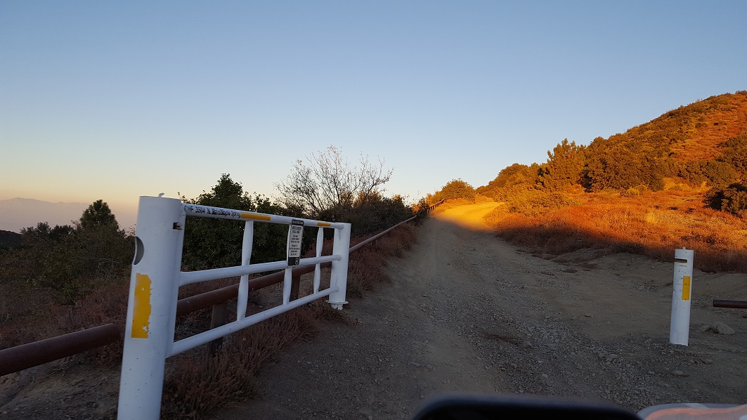
1. Silverado Gate (0 mi)
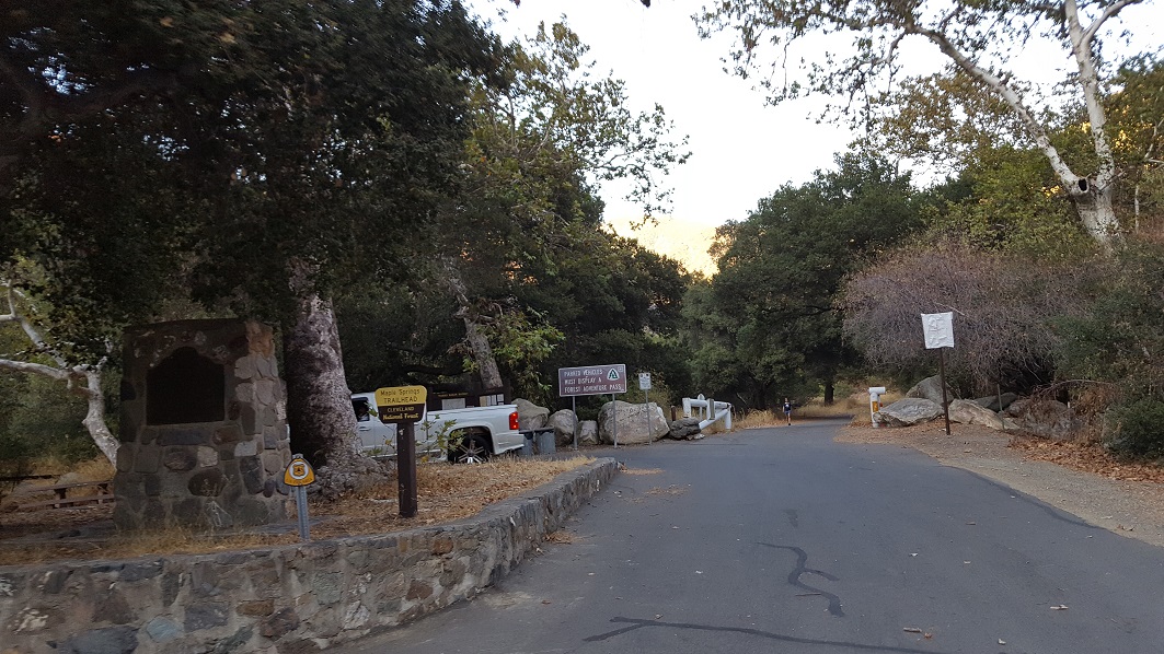
The gate at the bottom of the trail is a popular spot to airdown if you plan on doing it.
There are parking spots on the asphalt for hikers and bikers. People often park on the other side of the gate as well. If you park in this area, you will need an adventure pass.
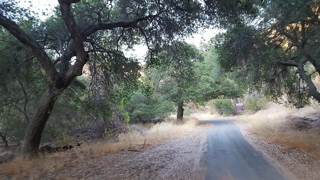
2. Trail Turns To Dirt (2.7 mi)
.jpg)
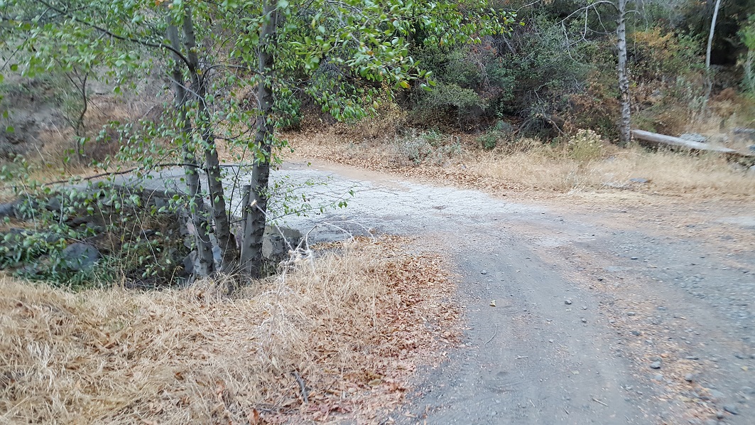
The trail transistions to dirt at this point.
This area is known for its lady bug migration and tarantula run.
3. Play Spot (Closed) (5.7 mi)
.jpg)
*** This area has been closed by the forest service***
The mountain range has a few play spots for those people that want a little bit more out of the trail. This used to be a challenging alternate route along the trail.
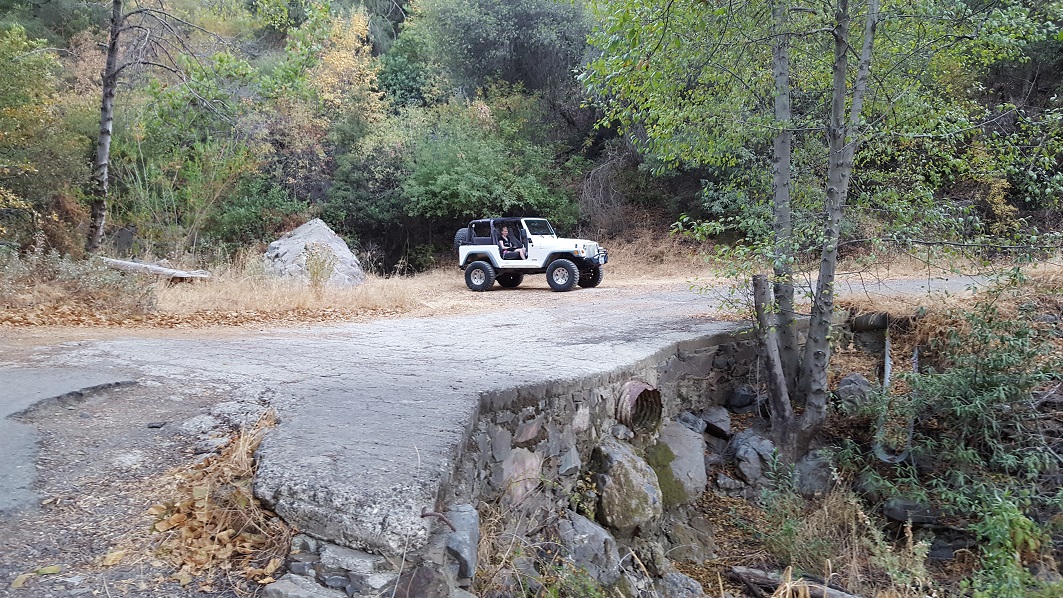
4. Play Area (6.5 mi)
The mountain range has a few play spots for those people that want a little bit more out of the trail. This is the play area along the trail.
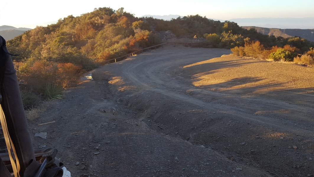
5. Maple Springs Connects to Main Divide (6.7 mi)
.jpg)
Maple Springs Road connects with Main Divide Road. If you go right, it takes you up to the top of Saddleback. If you go left, it takes you to Bedford Road and Corona.
For more information on Main Divide Trail Click Here
Dispersed
You can camp along the trail in this area, but there is only a couple of spots near the bottom that are large enough to camp. But due to a large amount of traffic on this trail, most people choose to either camp at Santiago Peak or not camp at all.
All three Ranger Districts offer remote camping, also known as “dispersed camping”, where camping outside of developed campgrounds is an option. Please note: wood or charcoal fires are never allowed outside of developed campgrounds or picnic sites on the Cleveland National Forest, but portable stoves or lanterns that use gas, kerosene, jellied petroleum or pressurized liquid fuel are permitted unless elevated fire conditions prohibit their use in identified locations.
Descanso - permit required for areas outside of the Laguna Recreation Area.(619-445-6235) or click here Descanso Ranger District
Palomar - no permit required, contact District Office for desirable locations.(760-788-0250) or click here Palomar Ranger District
Trabuco - allowable only in the San Mateo Canyon Wilderness, permit required. (951-736-1811) or click here Trabuco Ranger District
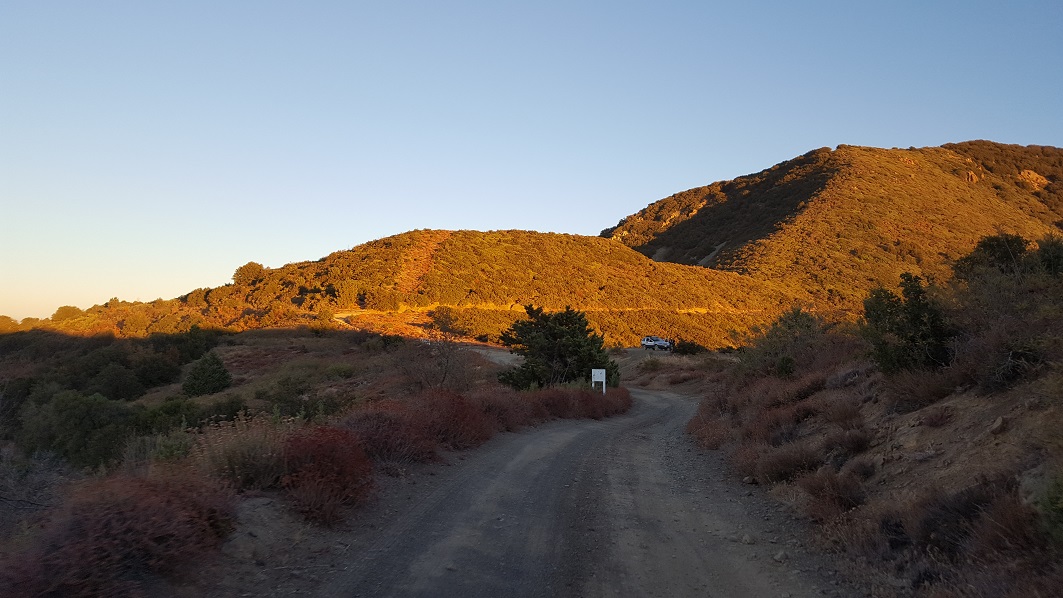
Starting Point
Silverado Canyon, CA
Take Silverado Canyon Road east all the way to the end.
Please check with Cleveland National Forest for trail conditions. This trail closes for many reasons throughout the year.
Click Here For Current Trail Closures
Trabuco Ranger District - (951) 736-1811
Trail Reviews
4.5/5 (74)
Open
Rated
3/5
Visited: 02/11/2023
Difficulty Accuracy:
Spot On
Very easy trail that takes you up to a junction point where you can branch off to other trails. This trail was kind of crowded on a Saturday due to how easy it is. Some spots to pull off and have lunch, but beware of broken glass. This trail hasn’t been treated nicely by the community because there is tons of trash and broken glass. Please clean up after yourself and leave the trail better than you found it.
Temporary Closure
Rated
5/5
Visited: 09/12/2022
Difficulty Accuracy:
Spot On
So, I live and work in the area and have been a little frustrated about all the closures in the past several years on every accesible trail EXCEPT Maple Springs Rd. So, I’ve been looking at maps and studying possibilities for alternate routes up the mountain, and finally found one on Monday. I came up the mountain on the Corona side and ended up working my way up to Beek’s place. From there I checked the website for trailer closures, and the forest service website said that Maple Springs was open, so I decided to make the long drive around to that gate before heading home. Problem was, when I got there at almost 9pm, the gate was locked up tight. I ended up having to make my way all the way back to my “secret entrance” and didn’t get off the mountain until 12:30am. What a bummer.
I can’t lie, it was a lot of fun having the whole mountain to myself all night, but on the other hand, it frustrates me that we continue to be shut out of public land more and more at the whim of Rangers, or whomever it is that makes the decision to close gates…like Skyline, Indian Truck Trail, Elsinore, Black Star Canyon, Weir Canyon, Gypsum canyon. I have a hard time understanding their motivation and/or reasoning.
Open
Visited: 07/02/2022
Difficulty Accuracy:
Spot On
Was there today and had a great time. I love the variation in landscape, trees, and greenery. For being IN Orange County it really feels like you’re getting away from the city. Gonna take the wife and kids tomorrow and go all the way to Santiago Peak.
Open
Rated
5/5
Visited: 06/09/2022
Great place for locals as well as folks from a far. Panoramic views in every direction in many spots. Best views from Santiago Peak. Been through many times from various directions in truck, suv, mtb, etc... Easy enough for most suvs and even honda accords depending on the grading conditions.
Open
Rated
5/5
Visited: 02/11/2022
Difficulty Accuracy:
Spot On
Took my Tacoma offroad 4x4 and it handled it no problem with no lift or tires. I did have to use 4x4 once on the trail but other than that it is fine. Takes about one hour each way to finish the trail. I loved it because it’s a great beginner trail!
Open
Rated
4/5
Visited: 09/24/2021
Difficulty Accuracy:
Easier
Trail is open and in my rookie opinion EASY but definitely a lot of traffic on a Saturday noon and with the traffic and lack of offroading experience gets a little harder. we saw a bunch of subaru's so if you have a low clearance car can do too.
Open
Rated
5/5
Visited: 06/06/2021
Took the kid and his friends up this weekend and had a great time. Super easy trail anyone can do in a stock higher clearance vehicle such as a Subaru. We went through to Main Divide Mid all the way to the radio towers, unfortunately the gate was locked from there so we had to turn around.
Open
Rated
4/5
Visited: 05/15/2021
Difficulty Accuracy:
Spot On
The Maple Springs Trail is a pretty easy trail, but the views and easy access for a lot of residents in Orange County makes it a go to spot. There’s also a lot of cool play areas and spots where you can test your rig’s abilities along the way up.
Open
Visited: 01/10/2021
Adventure Rig: 2020 Toyota Tacoma TRD Off-Road Stock
Trail Experience: Beginner
This is a great trail for beginners and isn't too rough unless your passenger(s) are pregnant or get car sick easily. There are a lot of windy turns, bumps, and awesome views that aren't too difficult. I would personally rate this trail more on the moderate side as their are some tight corners, dips, and during rainy season would require several shallow water crossings. I even saw snow at the very top of the peak! If you want solitude, I would go on weekdays or early weekends because it's a very popular spot. We didn't make it all the way to the top because one of my passengers was pregnant so didn't want to push it too much. But overall it's a fantastic trail. I think a 2WD with high clearance can do it no problem. Highly, highly recommended!
Open
Rated
5/5
Visited: 08/23/2020
Took Maple Springs to Bedford Road in Corona. Such an easy and smooth ride. Definitely need ground clearance in a few areas but 4wd wasnt needed. Saw two cars in the beginning of trail and a crew camping. That's it for almost 2hrs. Would definitely do it again and maybe camp with rooftop tent. The recent grading sure makes a difference. Best conditions I've ever seen this trail.
Open
Rated
5/5
Visited: 07/07/2020
it was my birthday today 7-6-20 I wanted to go to the top of saddleback, i have not been back since the late 70's when 2 cousin's were racing each other down from the top, both were driving vw baja bug's and at the hair-pin turn the first vw baja went thru it and some IDIOT was coming up hill and took the inside of the hair-pin and the second vw baja had to take the outside of the hair-pin turn and ran out of road and went over the side it had just happened right in front of us we were in my friends early ford courer p/u, the first cousin had turned around because he seen the IDIOT driver and his cousin was not behind him anylonger , we stoped and climbed down the side of the cliff?? to the 2nd guy with his cousin in the 1st baja and helped him back up to the road, thank GOD he was ok, but he did get a broken finger and a concussion,, he said what i wrote and going over he said that the door would not open from the inside DARN VW'S and as he went over the side head on, the vw baja bug hit huge rock with the front nose and went down the side END OVER END that's when he had to jumpout and that's what he did
he was ok as i said and we climbed back over and stripped out the vw baja bug and roped up all the part's wheels - motor-shocks- everything we could it was like PICK A PART, after we all drank a beer and smoked a joint , other then the time warp the road was 90% better than the late 70's because i rember deep rut's,
and there was a lot more built all over the O.C. now, ,me and my lady stopped at the silverado cafe and grabbed some burger's and fries, and drink's before the trip up to the top, it was her first time up we both grew up in so, oc. and she allway's looked at it so she was amazed with the view's and my 3rd time up, so that's my story i hope you liked it, CAMP CRICKET ( where it brake time all the time ) HERE IS THE VEIW LOOKING TOWARD MY HOUSE IN LAKE MISSION VIEJO,
catalina is in the upper right corner of pic's
Open
Rated
5/5
Visited: 07/07/2020
We took Maple Springs Rd in both directions as a path to and from the North Main Divide. Id put this trail at a difficulty level 1. The first few miles are paved with some holes and the dirt section was obviously recently scraped so that made it much more accessible but it was still very dusty and with some small rocks strewn about. I saw a compact 2wd car going on the dirt section going up the hill with a trailer towing a motorcycle and also several pickups several pickups. There are not many sections that would not allow 2 vehicles to pass each other. Also watch for hikers and bicyclists. We encountered 4 hikers and a mountain biker going up the trail When I saw them ahead I stopped to allow the dust cloud to move on avoiding them. There are mountain lion warnings posted at the trailhead and on a prior trip we did spook a lion who ran across the road ahead of us.
Open
Rated
5/5
Visited: 05/30/2020
Trail is great for beginners. Nothing too extreme or technical. First quarter of trail was paved road. Rest was combo of dirt and loose rocks. About half way up the dirt portion, you come to an area with several different trails. The trail that leads to TV/Cell towers was open and was the path most were taking. It was narrow in places, but very manageable for two way traffic. The View from very top by the TV/Cell towers was phenomenal. Go to the end where the American flag is to get best panoramic view of Orange County and Catalina. Took a 9 year old and and and 18 year old, as well as my wife, and all had fun!
Open
Rated
4/5
Visited: 05/24/2020
*5/25/20 can't add today's date for some reason.
It is a great trail for beginners and smaller SUVs that don't have those big old tires. It connects to a lot of other cool trails. Unfortunately some people were blocking one of those trails with their pick ups and wouldn't let me pass. I didn't want any trouble so I just turned back. Did the trail and back in a few hours with my tracker. Saw a lot of butterflies and even a snake! Also, on my way down, I stoped at a local diner, accidentally left the lights on while having breakfast and my battery died, luckily, there is a mechanic right across the street and we were able to jump start it.
Open
Visited: 05/16/2020
Trail was open Sunday 5/17/20, moderately busy. Was able to take the trail very easy to the end of the trail where it meets with "Main Divide - Middle Section to Saddleback - 3S04" & "3S04 - Main Divide Middle Northern Section" at what the directions call the Play Area. The Play Area around 2pm had many jeeps and 4x4 vehicles stopped for lunch and hanging out. Coming from this trail and into the play area I decided to take the second left turn gate that leads you up to the Lookout Point where the huge cell towers are for the highest point in OC. Not many shady areas once you get out of the large pine trees coming up this trail. If you're looking to stop for lunch in a nice shaded area then the Play Area is not for you. Stop early on in the section where you go through lots of trees and pines.
Open
Rated
5/5
Visited: 12/21/2019
Super easy trail. This trail is a great little afternoon or early evening trip. Nothing technical at all. It's good for the first timers or if you just installed something new and you want to see how it changed your rig. The trail itself has a few areas that you can play on but as mentioned before nothing that is technical or requiring lockers. Watch for traffic as the weekends tend to be busier and it's easy to get distracted with the views. Watch for Hikers and Mountain Bikers. Sunsets are awesome from a few different spots on the trail.
Open
Rated
4/5
Visited: 12/15/2019
Trail is open. It was pretty crowed yesterday, with lots of traffic. The trail is in good shape. We made it all the way to the top of Santiago Peak. There are some narrow spots and my 2019 Raptor definitely got some pin stripes.
Open
Rated
5/5
Visited: 09/15/2019
This the closest open trail for OC folks. Nice and easy, so you can take the whole family, with a couple fun spots at the top and several miles past the left gate to play with your rig. Today we took it to Bedford Trail, which drops you into Corona. We stopped at Tom's Farm there for lunch and a train ride with the kids.
It can get very busy with rigs, dirt bikes, mountain bikers, and hikers. Stay alert.
Open
Rated
5/5
Visited: 06/15/2019
super fun trail, first time going up there and had a blast. some steep areas but still do able with 2wd i believe. really cool views. pretty narrow trail so just be on the look out for on coming vehicles. highly recommend.
[url=https://postimg.cc/NKSFZbnK][img]https://i.postimg.cc/NKSFZbnK/mapletrail.jpg[/img][/url]
Open
Rated
5/5
Visited: 05/27/2019
Gate was finally open after trying a few times. Drove up with the family just for a day drive and the trail made the drive that much better. The kids enjoy being out on the trails so when we were finally able to hit this one, we were all excited to check it out. Especially with this being in our backyard, I’d say we’ll be up here a lot more if the gates remain open. As mentioned above, the trail is very easy and mellow for a leisure drive. Even saw a minivan coming down on our way up so that should tell you something haha overall I think this is a great “beginners” trail for this wanting to get their boots in the dirt. Highly recommended.
Open
Rated
5/5
Visited: 05/10/2019
As stated below, it is open, but they are doing a lot of work up there. Reason it was closed so long is because they were fixing potholes and grading the road as well as clearing it from the last series of storms. There are a lot of pallets and things up on Main Divide so be aware, and many of the fences have been put back after being ripped out from the fire. Stay on the trail, don't tear down any of the new fences, otherwise the FS may decide it's not worth it and close it again. Don't be that guy that ruins it for everyone!
Open
Visited: 05/07/2019
TRAIL IS OPEN!! Went up Maple Springs today to North Main with a couple others. Found that North Main is open over to Bedford Rd, so we were able to go up and over. Finally, trails open in Cleveland NF! They are working on putting back many of the guard rails to the closed areas that were ripped out by the dozers and other fire rigs during the fires, so beware of the work areas along North Main Divide. Lots of stacked rails and pallets of concrete.
Open
Rated
5/5
Visited: 03/24/2019
Spoke with a Ranger today out at Trabuco Canyon. The trail is “officially” open but the gate has been closed due to the amount of rain. It should be open as of now but I haven’t been up there to see if the gate has been physically opened... he was not aware if another ranger has gotten to it yet.
Temporary Closure
Visited: 03/09/2019
Still closed. Anyone know why?
Open
Rated
5/5
Visited: 01/16/2019
Maple Springs was indeed open today (despite it raining for 5 days straight, but you know, govt shutdown= no money to shut the gate.) Road is extremely torn up, creek was ripping, it was flooded across the crossings on the paved portion, but we made it through. Lots of long, deep, off camber ruts, some large boulders that have fallen recently, and many areas that the hills are 'sketchy' looking at best. I think this next major rainstorm forecasted for tomorrow might do it in until the FS can clear the road. Lots of mud puddles up on Main Divide too. Overall it was fun, nice to see it a little more torn up than just the smoothly graded road it has been lately. Top end of Main Divide is closed at Santiago Peak gate, west MD is open to Bedford and beyond.
Open
Rated
5/5
Visited: 11/20/2018
My wife and I drove Maple Springs this evening just before sunset. It's a great drive, as always, with views of the OC and IE as well as Catalina Island off in the distance. The trail must have been graded recently because it was WAY smoother than it was just a month or two ago making for a quicker than usual trip to the summit.
Open
Rated
5/5
Visited: 09/19/2018
The Forest Service reported Maple Springs would be open on the 15th after being closed due to the Holy Fire. It was indeed open today. Our goal was to view the damage from the Holy Fire when reaching Main Divide road. Very dusty and with its share of users including mountain bikes, dual sport motorcycles, bow hunters and an occasional Jeep.
Open
Rated
5/5
Visited: 07/25/2018
With the heat and fires I was wondering it they would close Maple Springs but the Forestry notice showed it was open. https://www.fs.usda.gov/detailfull/cleveland/alerts-notices/?cid=stelprdb5340229. And indeed it was open. Not a sole on the trail which made it especially nice.
Open
Rated
4/5
Visited: 06/28/2018
Open obviously and started at the end of Silverado. The lower section follows the creek and was heavily oak tree'd, for a nice cool morning ride starting at 9am on a beautiful day. A thursday so hoping for light traffic. Pulled over for a couple mountain bikes going in both directions. Very dry and rocky so glad I aired down. At Play Spot 3 saw a couple apparitions in my dusty cloud and pulled over for a couple dual sport bikes who blew by in a scary race up the mountain.
Permanently Closed
Visited: 01/13/2018
Gated closed as of 1/13/18. Found out the hard way. Indian Truck Trail gate closed as well from 1/13/18.
From the Community
Be the first to ask a question!
Josh Noesser
Mapping Crew - California
Joshua Noesser grew up in Southern California but has lived in different parts of the country during his young adult life. Josh was first turned to four wheeling when he road with one of his friends dad up Surprise Canyon in the Panamint Valley at age14. After nearly 3 different roll overs later and a half dozen intense waterfalls, Josh was hooked. At 16 he purchased his first Jeep a CJ 7 and by 17 was putting his first locker in it.
Currently, Josh is the owner and CEO of Nybble, an IT Solutions Company based in Orange County, California. Nybble isn't your normal IT company where everyone stays in and plays video games. Nybble's average company trip is out on the trails since a good amount of his staff enjoy wheeling too. As Josh likes to say, he offers the only IT Company with the ability to provide services in extreme locations. "If you want a server at the top of The Hammers, we will take care of that for you."
Today you can find Josh out on the trail behind the wheel in one of his three different off-road vehicles. See the vehicles below for more information.
If you ever run into Josh, please say high, he is a very friendly person and is always happy to have a new person join the group.
Visit Profile
Start a free trial and get this level of detail on every trail
guide
Start Free Trial
Print Trail Guide
Purchase
Company
Community
Recent Updates
By clicking "ACCEPT", you agree to be the terms and conditions of each policy linked to above. You also agree to the storing of cookies on your device to facilitate the operation and functionality of our site, enhance and customize your user experience, and to analyze how our site is used.