Please wait - Uploading to Gaia GPS
Middle Fork Swan River

Trail Information
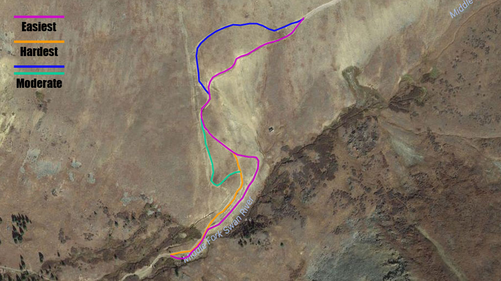
Difficulty - Mandatory
4 -
MODERATE
Difficulty - Optional
6 -
DIFFICULT
Status
Seasonal Closure
Distance
7.59 mi
Duration (one-way)
About 1 hour, 30 minutes
Permit Required
Highest Elevation
12600 ft
Shape of Trail
Straight Through
Typically Open
05/20 - 11/23
Best Direction
East
Official Road Name
6, 6.2, 5
Nearest Town
Breckenridge
Nearest Services
Breckenridge
Management Agency
White River National Forest
District
Dillon Ranger District
Highlights
 Altitude
 Camping
 Forest
 Ghost Town
 Iconic
 Mine
Mine Rock
Rock Scenic
 Snow Wheeling
The Middle Fork Swan River 4WD trail follows the river up its valley through picturesque pine forest and onto the high alpine tundra between Whale Mountain and Wise Mountain. From the high saddle, there are spectacular views with Breckenridge Ski Resort visible to the west, and the iconic Red Cone descent to the east.
Trail Difficulty and Assessment
Recommended Vehicle:
Stock SUV with High Clearance and 4 Low
Concerns:
Summary:
The crux of this trail is a very rocky hill climb just above treeline, Tombstone Hill. This climb has several variations. A good stock truck, with good driving technique, taking the right line, can summit. However, a built rig, taking the hardest lines will find plenty of challenge.
Note: The shelf road that serves as the easy bypass at Tombstone Hill is where snow lingers latest. It can be blocked with snow, especially at the top, well into July. If you're not sure, it's best to make the arduous hike up to check for snow before driving up this shelf road. You may not enjoy backing down it!
Community Consensus
0 votes
5 votes
7 votes
Easier
Spot On
Harder
The weighted average of your fellow members agreement of our trail rating. As trail conditions change this helps us keep the community aware of changes.
Mandatory
4 -
MODERATE
The hardest part of the trail that you
cannot bypass - you have to drive it.
Optional
6 -
DIFFICULT
The hardest part of the trail that is
purely optional - you can bypass it.
Typically, more rock or undulated road surface. Potential rocks and/or tree stumps less than 18" tall and/or vertical ledges less than 18" tall and/or near vertical ledges or waterfalls less than 36" inches. Tire placement becomes more difficult. Can be steep and off-camber. Read More about our Rating System
Start your next adventure on Middle Fork Swan River

Upgrade your Membership
Unlock all of the details on every Trail Guide and Scout Route.
Start a 7-day Free TrialUploading to Gaia GPS
Share Trail
Trail Navigation
The Middle Fork Swan 4WD trail begins as a tight, rocky, but easy road. The crux of the trail is a very rocky hill climb just above treeline, Tombstone Hill. This climb has several variations. A good stock truck, with good driving technique, taking the right line, can summit. However, a built rig, taking the hardest lines will find plenty of challenge.
Note: The .gpx track offered here takes the easiest route. As noted in the waypoint descriptions below, there are some more challenging lines that will deviate a bit but should end up back on the track after the obstacle. Enjoy the challenge, but please stay the trail!
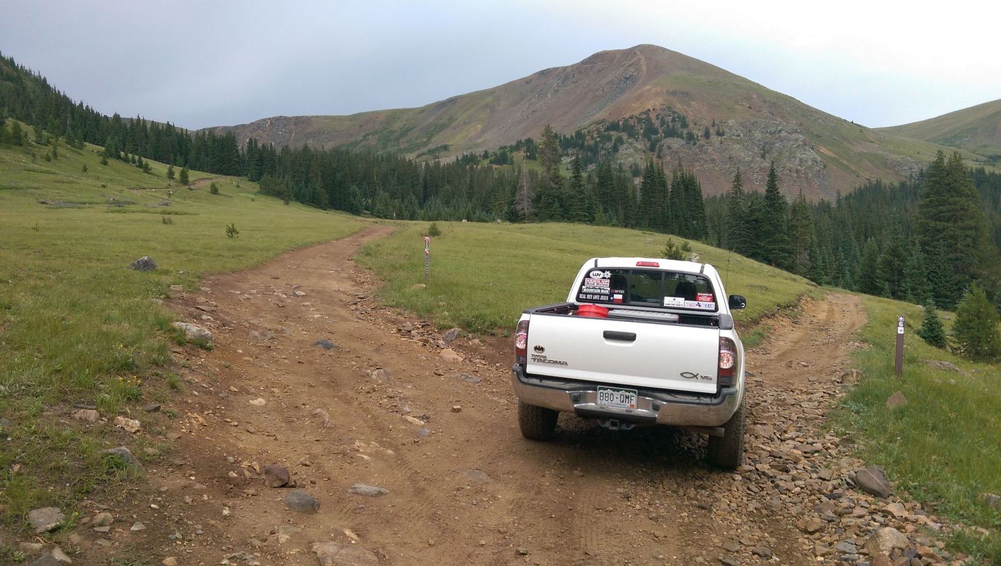
After summiting at a high saddle, Middle Fork Swan traverses high tundra to intersect with several other, popular trails.
Because of the challenge of Tombstone Hill, Middle Fork Swan is usually run from west to east, beginning near Breckenridge. Connecting to North Fork Swan River makes a loop. Continuing on Deer Creek or Saints John leads down to Montezuma.
Cell service is nonexistent in the Swan River Valley and only spotty on the high tundra.
The nearest emergency room is at St. Anthony Summit Medical Center (970-668-3300), located just off CO-9 south of Frisco. Summit County Sheriff office (970-453-2232) is on CO-9 in Breckenridge.
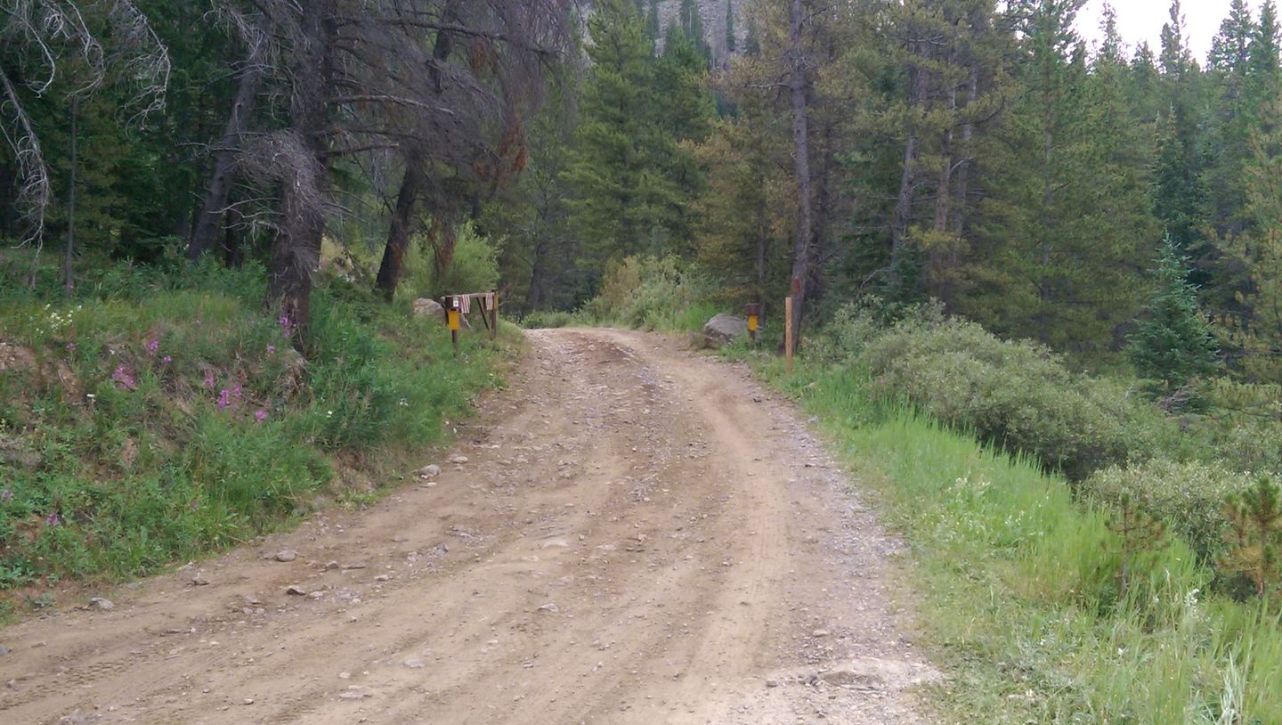
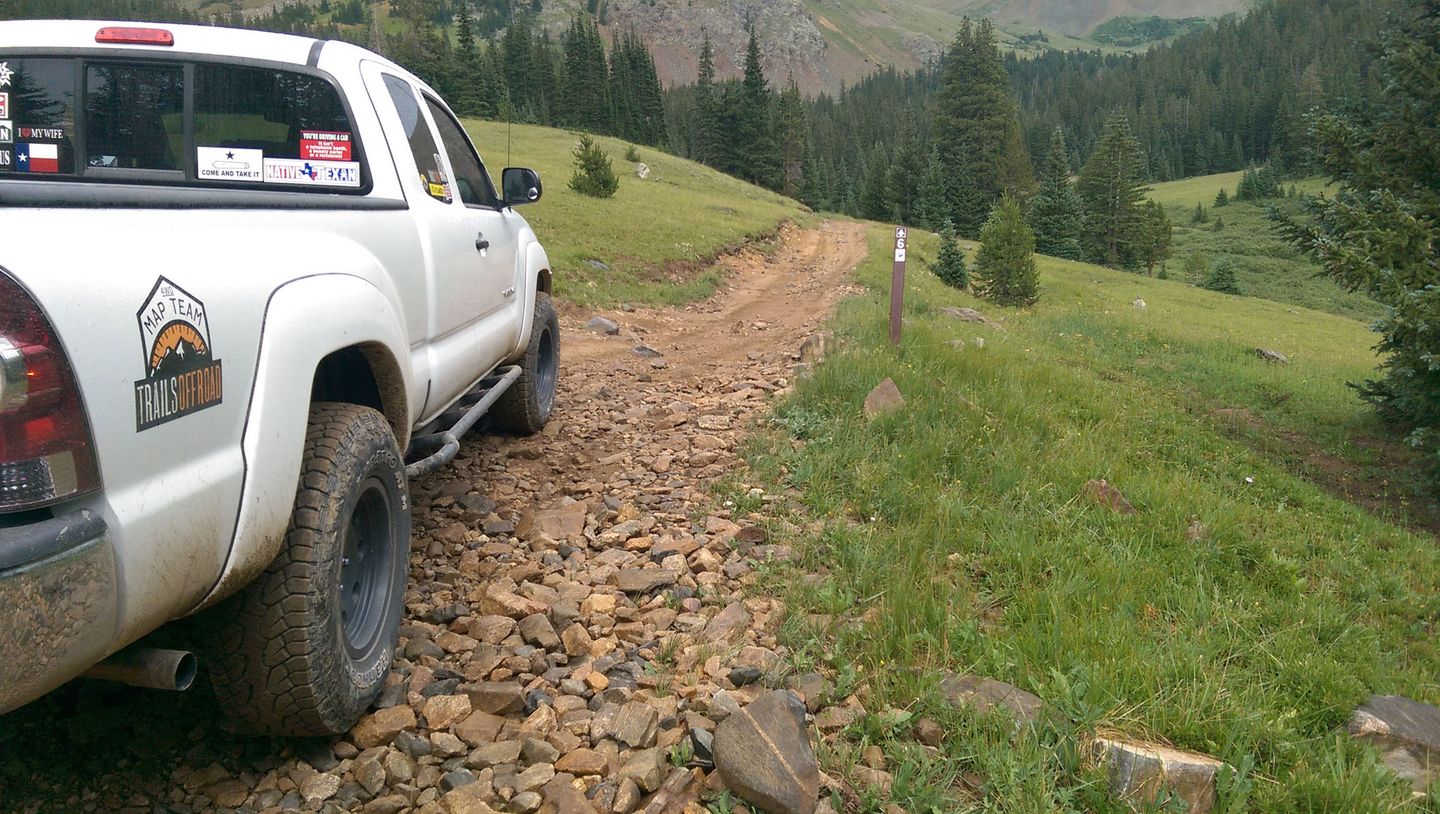
1. Trailhead (0 mi)
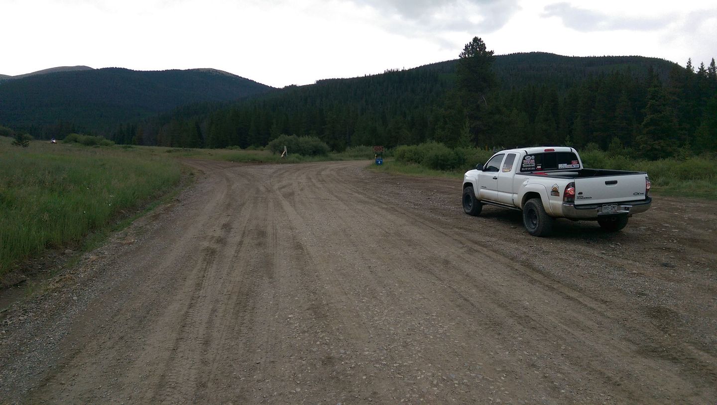
Middle Fork and North Fork Swan River share a western trailhead at a well marked fork. North Fork Swan is FS 354 to the left. Middle Fork Swan is FS 6 to the right across a narrow bridge. There is a small parking area to the right.
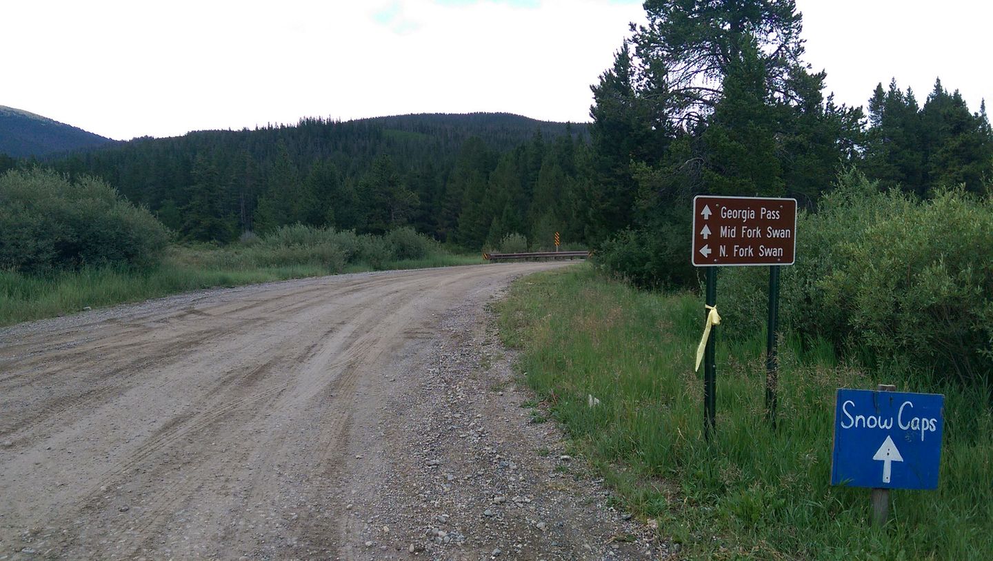
2. Georgia Pass (0.4 mi)
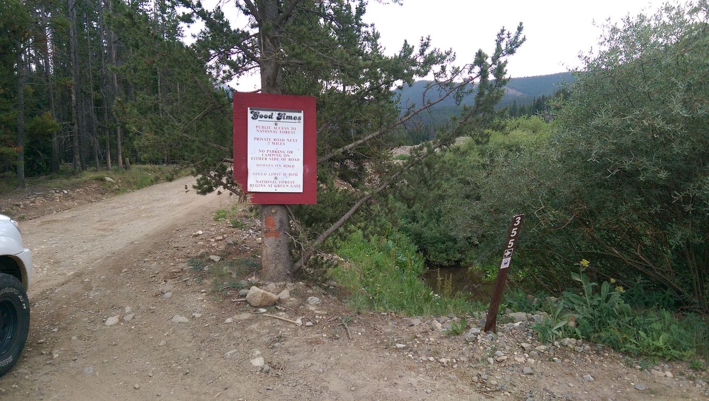
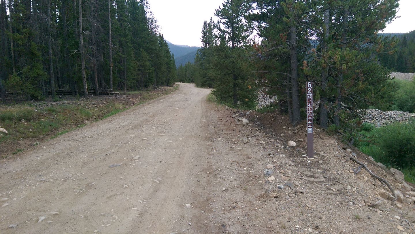
After passing a snowmobile and sled dog business on the left, FS 355, Georgia Pass, departs to the right. Continue straight on FS 6.2.
3. Seasonal Gate/Georgia Pass Shortcut (1.2 mi)
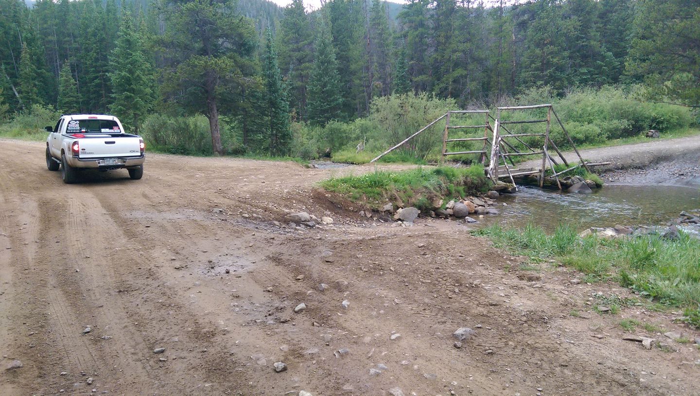
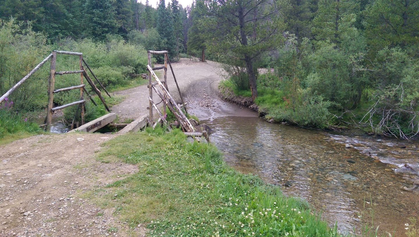
To the right are the ruins of an old bridge and a water crossing. On the other side are some great camp sites and quick access to Georgia Pass. Note: During Spring run-off, this water crossing can be more than floorboard deep and very fast.
Just around the bend is the seasonal gate. This gate is closed from November through May, although some parts of the trail can be impassible with snow as late as July.
4. SOB Hill (2.4 mi)
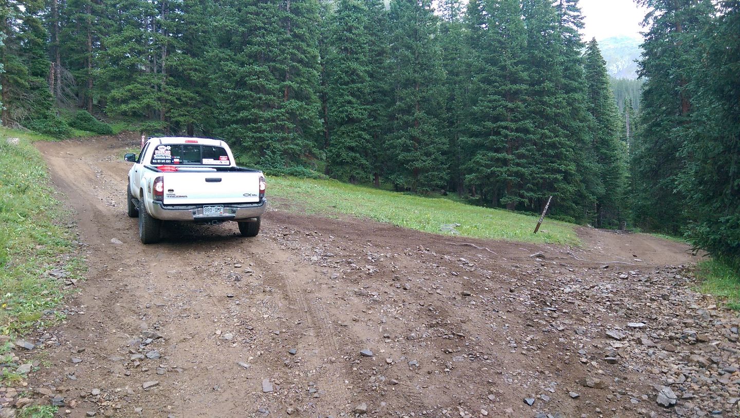
SOB Hill, FS 258, forks to the right and continues up to Glacier Ridge and the summit of Georgia Pass.
Continue left on FS 6.
5. Bypass (4.2 mi)
The right option is a bit rockier, but not difficult. The left option is smoother. A couple more such bypasses have been blocked off. Remember to stay the trail!
Immediately after this, an unmarked and rough trail to the left leads up to some ruins of old Swandyke.
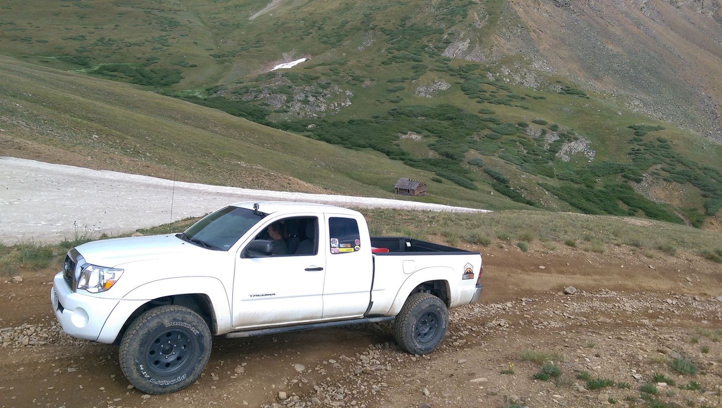
6. Swandyke Cabin (4.6 mi)
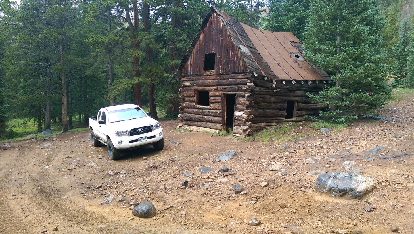
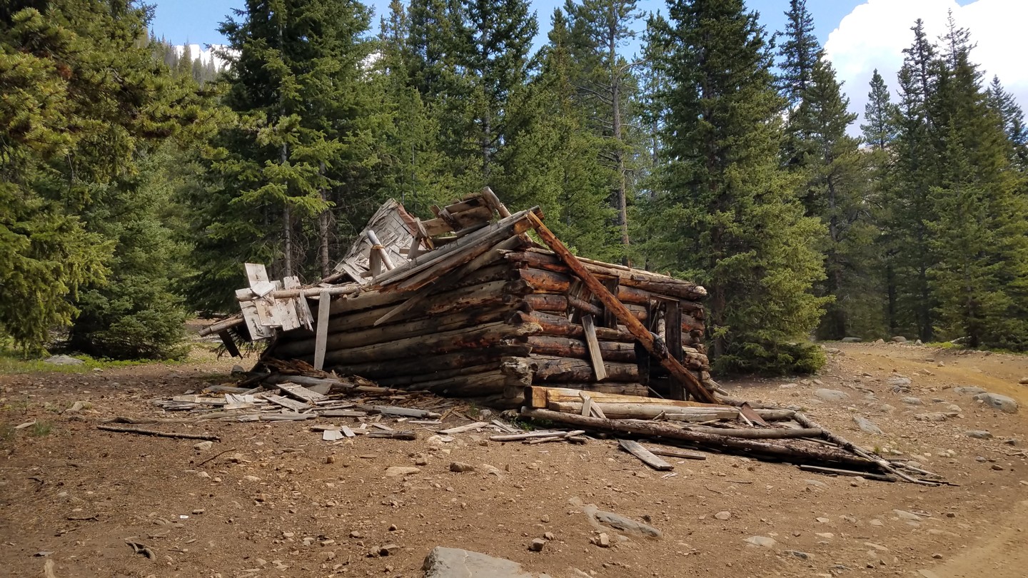
Update: Tragically, the record-breaking snow of the winter of 2018-2019 was too much for the old cabin. See the 3rd pic for the carnage.
The large cabin on the left is nearly all that remains of the booming mining camp of Swandyke. The population peaked at 500 in the late 1890s. The camp was home to a 75 bed hotel and even had stage coach service to Jefferson via Georgia Pass. An avalanche destroyed the ore mill during the brutal winter of 1898-99, after which the population fell to about 20. None the less, mining around Swandyke continued for another 30 years.
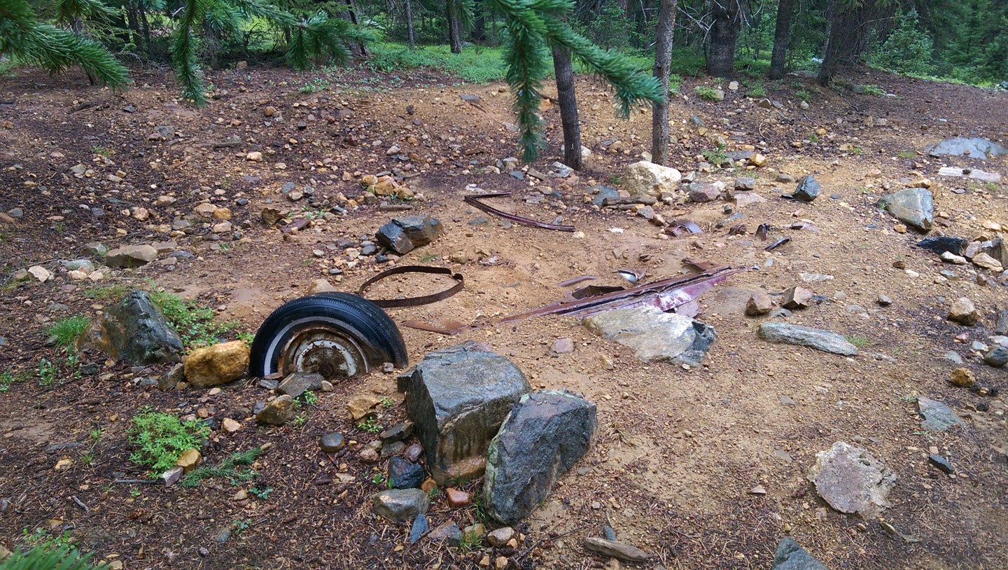
Exploring the woods in this area, you'll find many artifacts, including a mysterious buried vehicle. No one knows how it got there, although it seems likely it was left by the hippies who took up residence along Swan River in the 1970's much to the chagrin of the Forest Service.
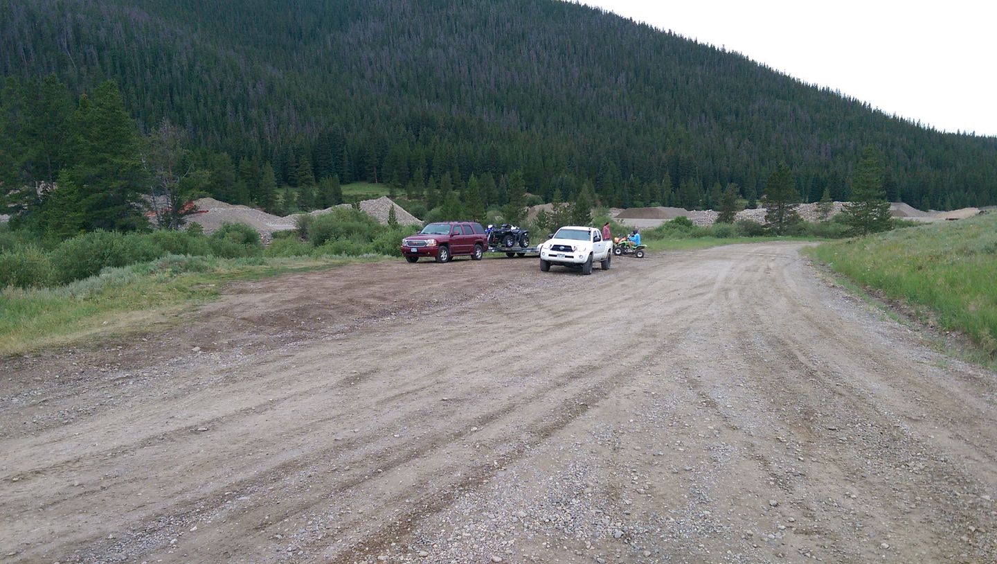
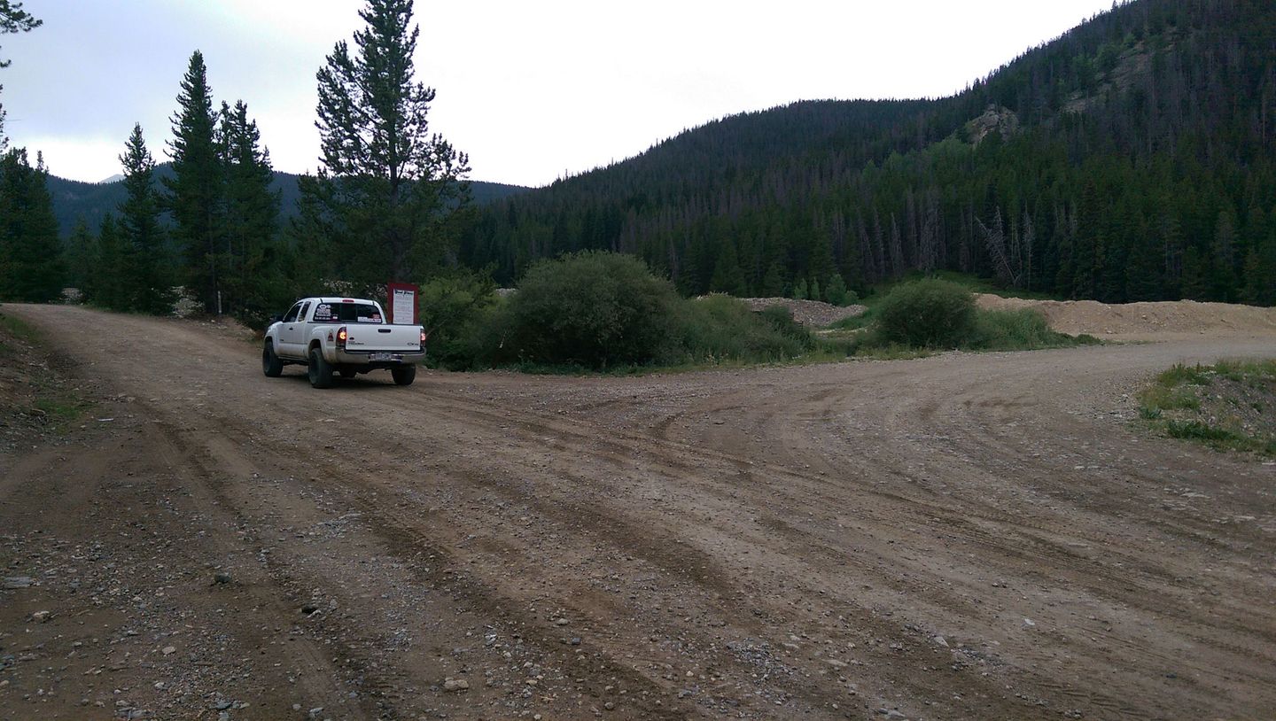
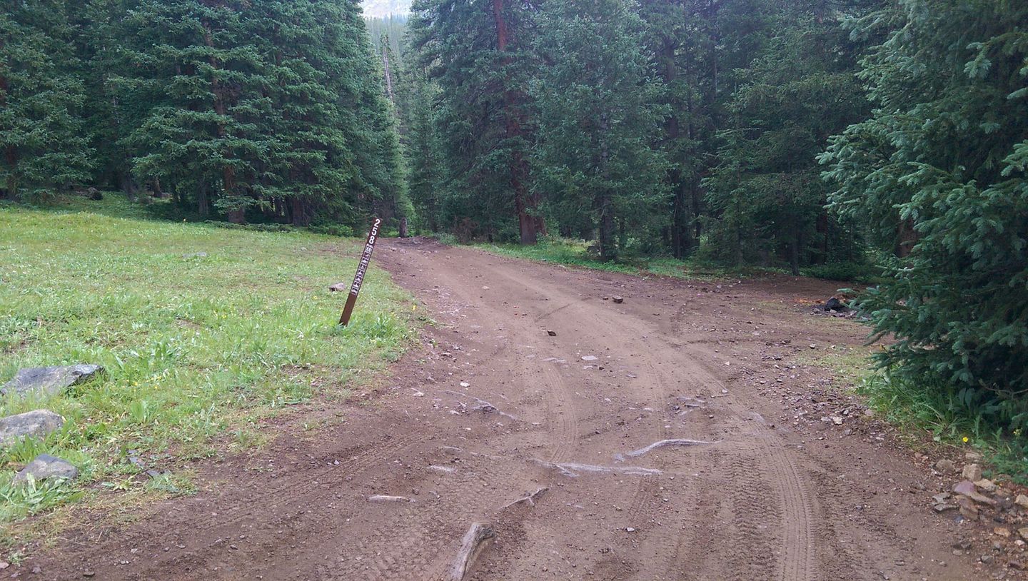
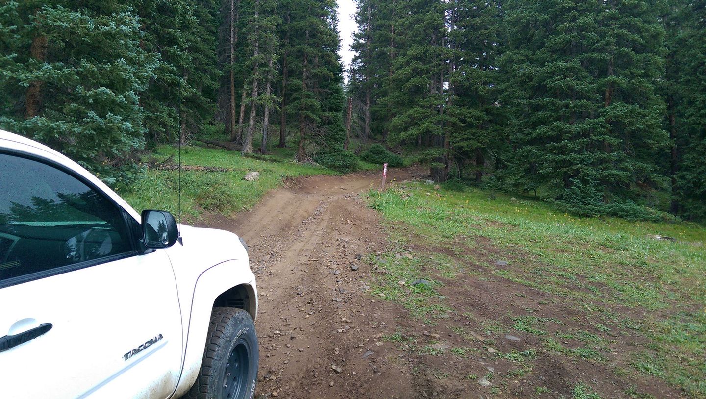
7. FS 325 (4.9 mi)
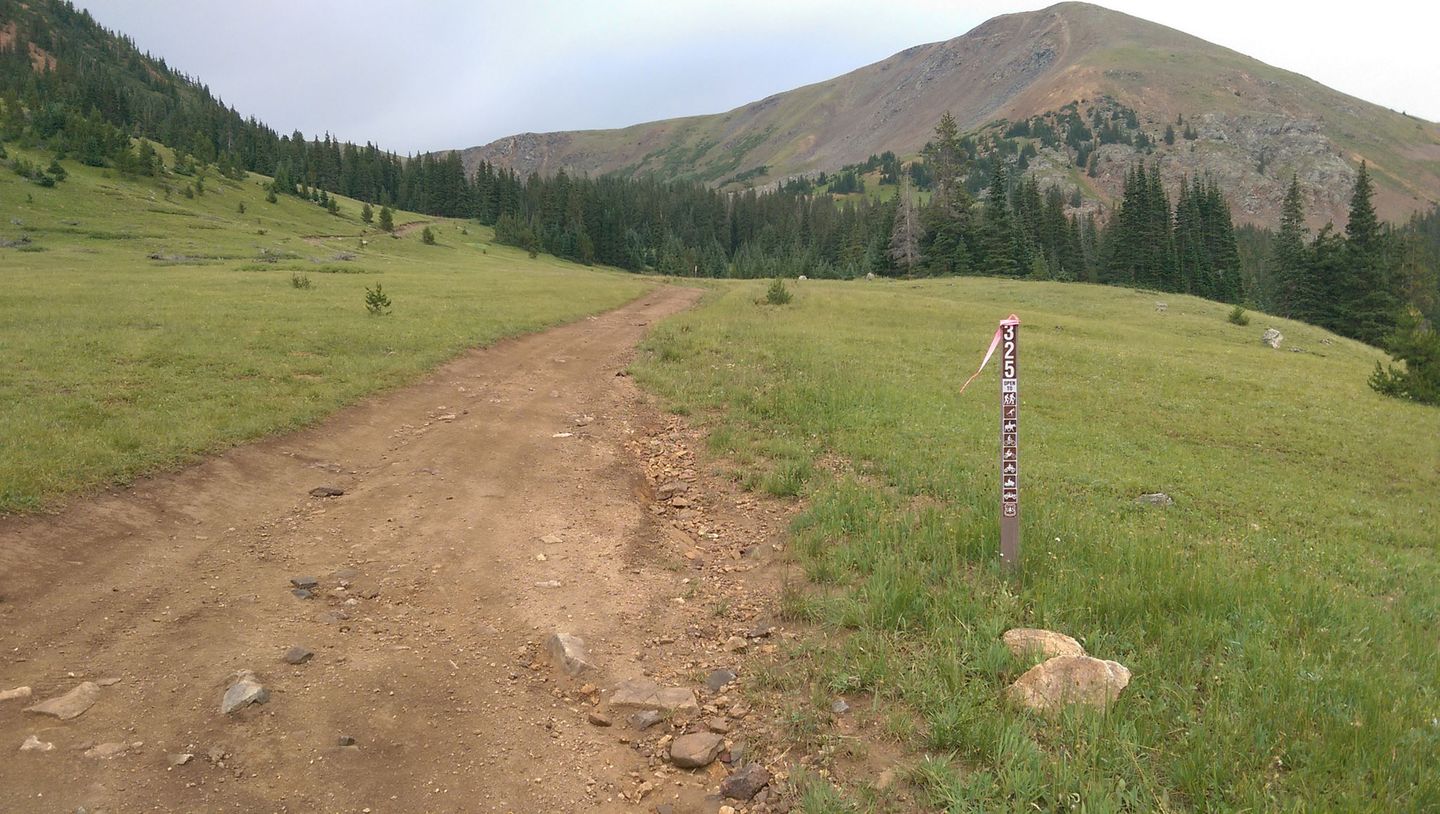
FS 325 forks off to the left. This easy trail goes up over the ridge line and dead ends at the tailings of a small mine.
Continue on FS 6 to the right.
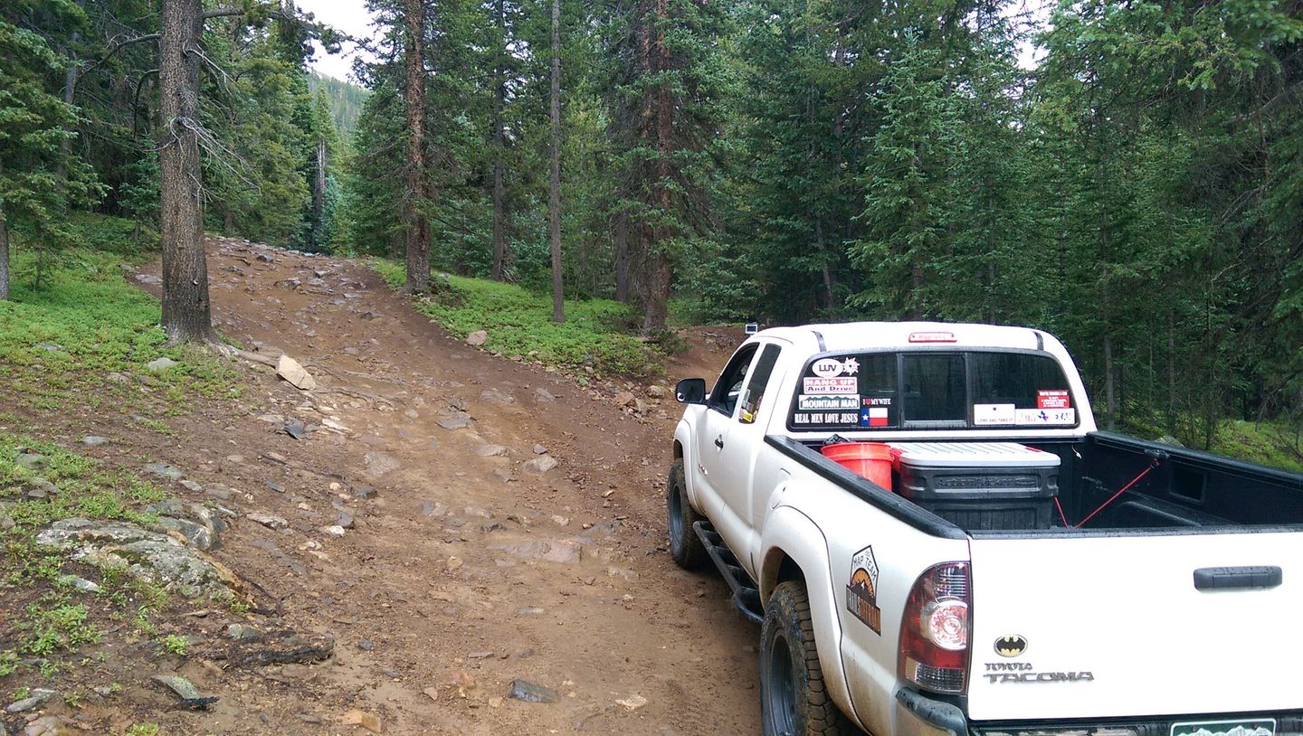
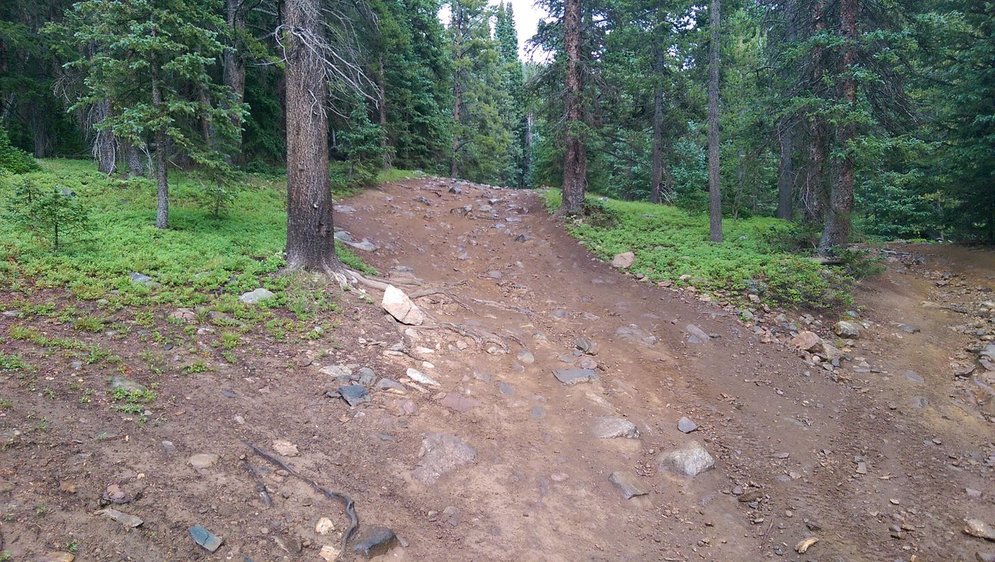
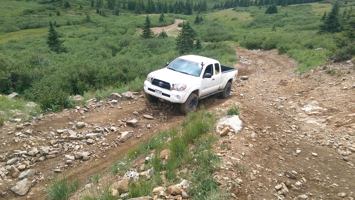
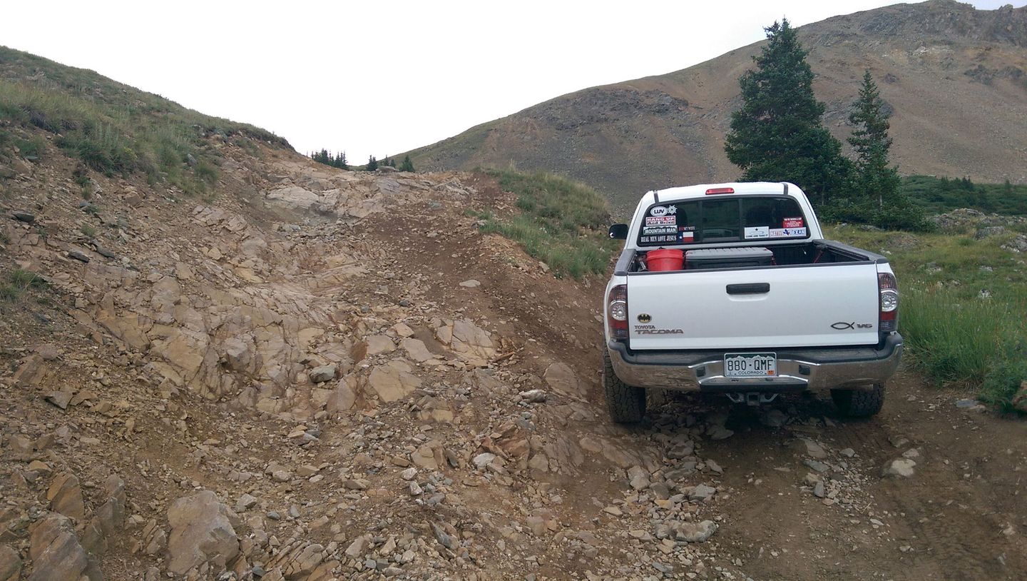
8. Rough Spot (5.7 mi)
Some large, embedded rocks protrude form the middle of the trail. This is the first spot where stock vehicles need to take care. Larger rigs will hardly notice. This spot is also known to be blocked with snow as late as July. There is no bypass here. Let's keep it that way! Stay the trail!
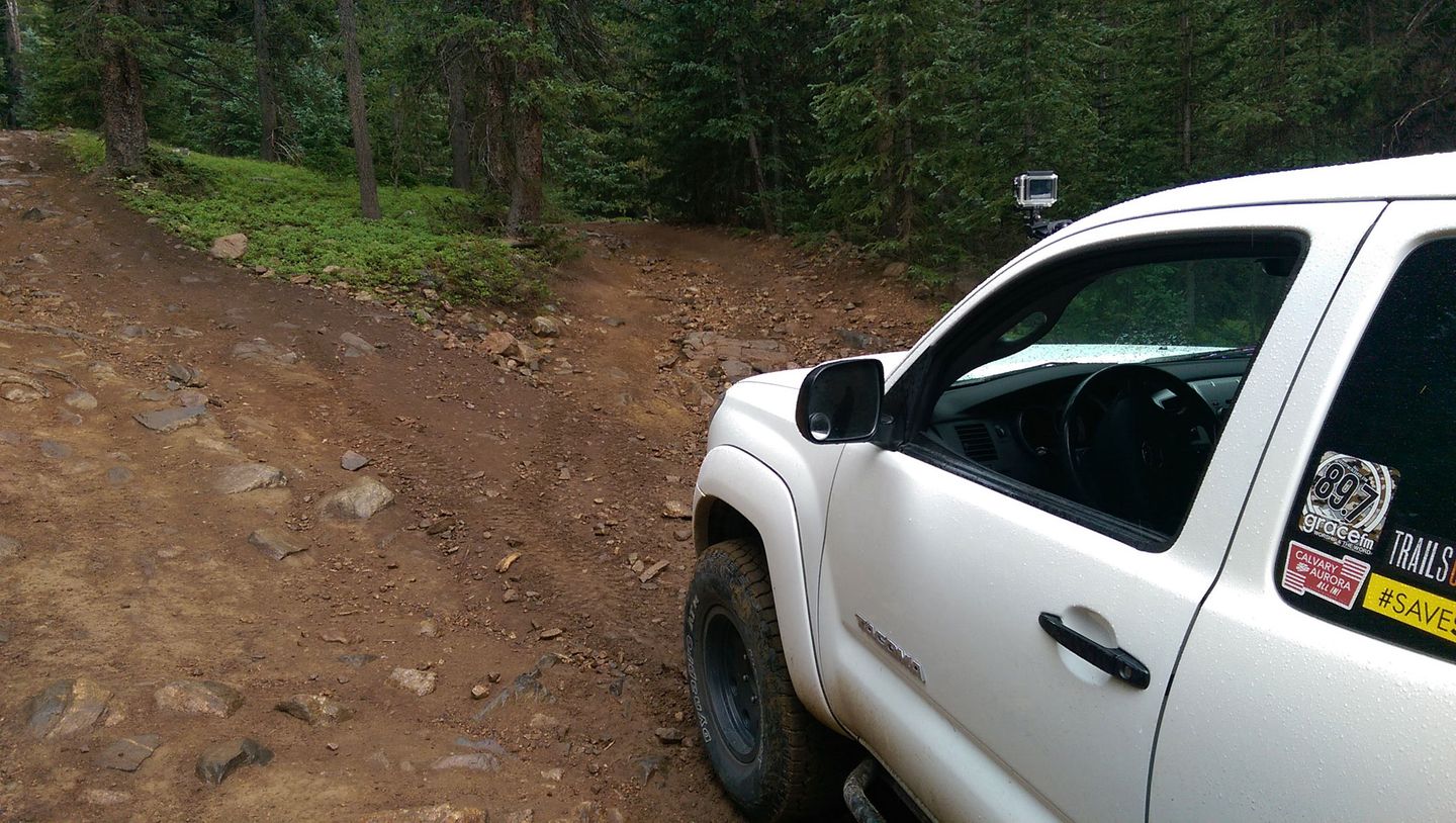
9. Rock Shelf (5.7 mi)
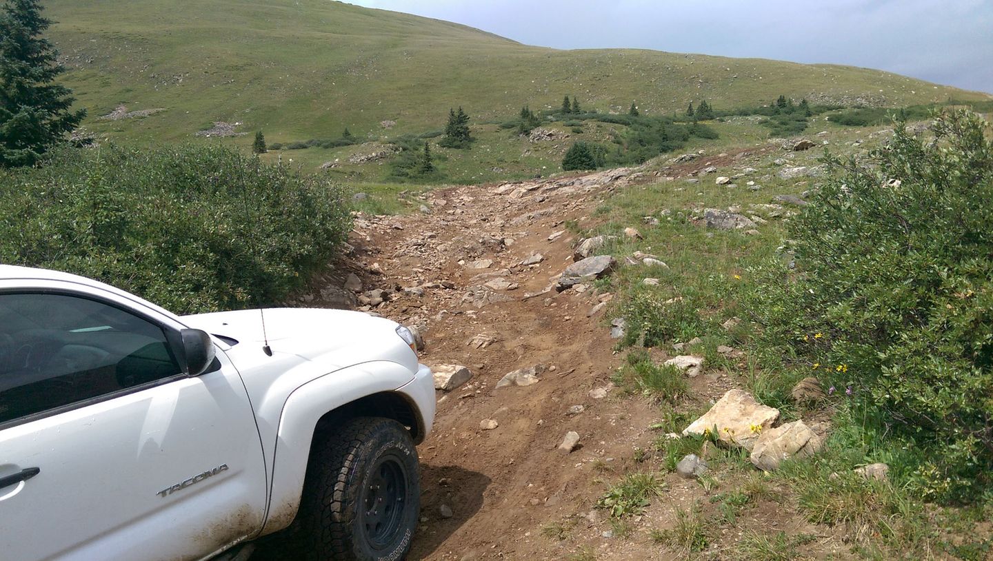
Just as the trail breaks above treeline, a couple of switchbacks are interrupted by a small rock shelf. Stock vehicles should have no problem if they chose their line carefully. It's not as bad as it looks (as seen in the video above at 3:19).
Notice the fresh, illegal shortcut to the right. Please do not take this line! Stay the trail!!
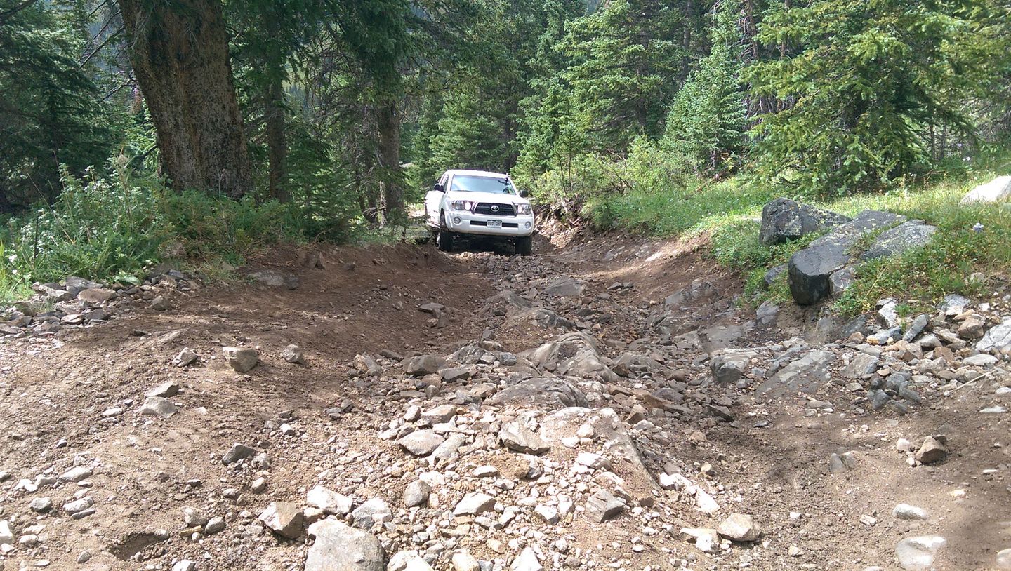
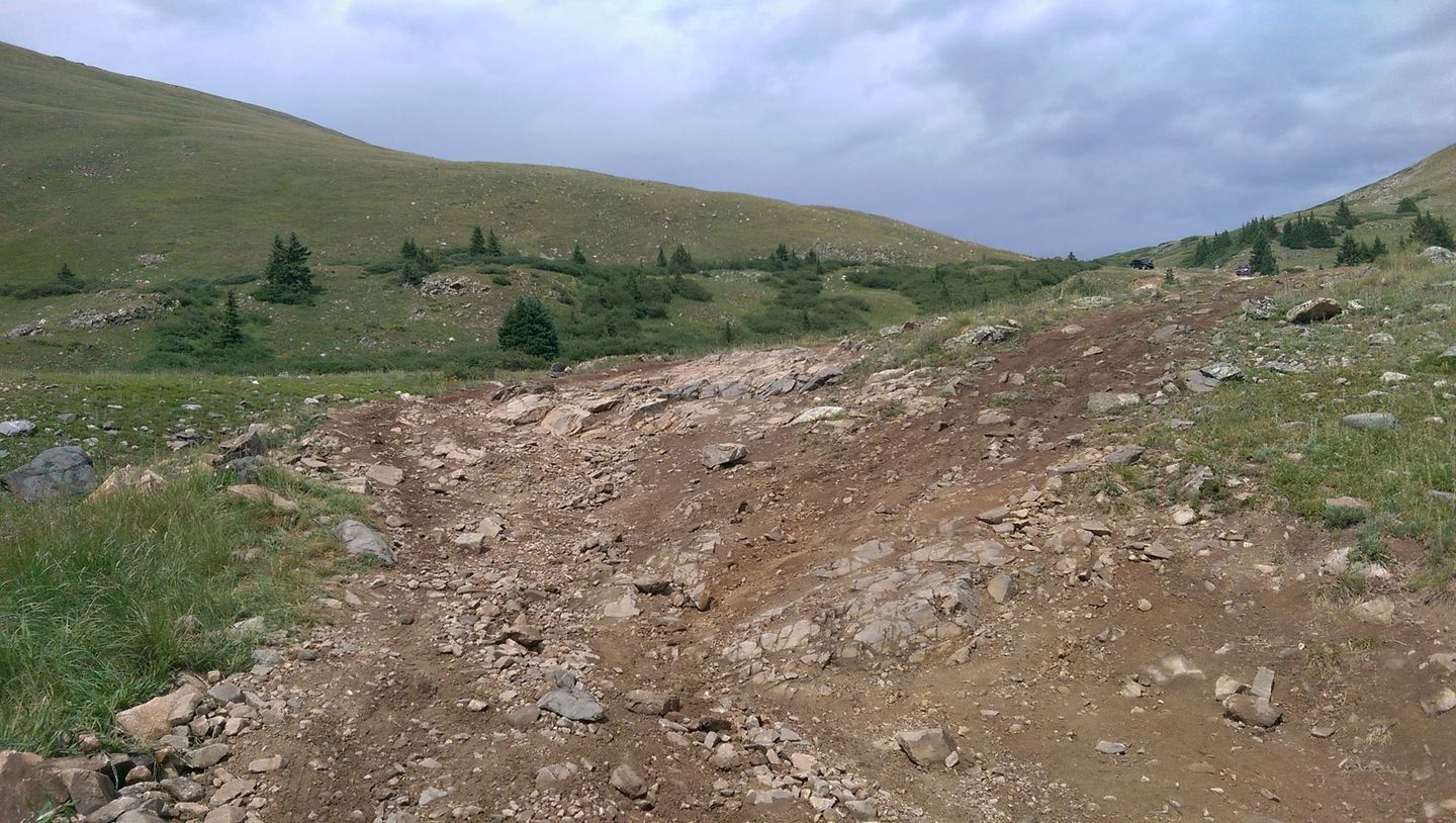
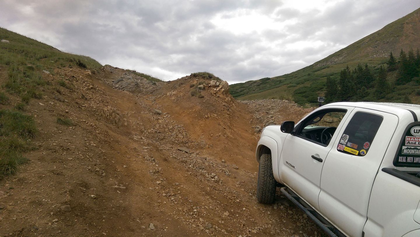
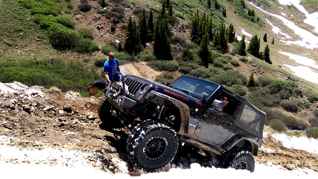
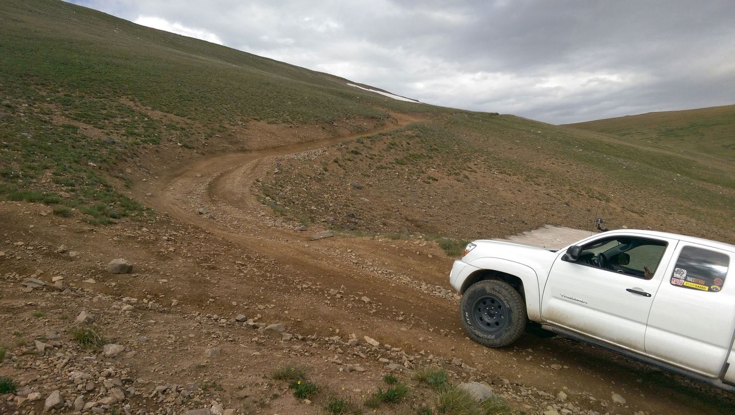
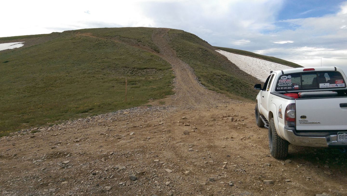
10. Tombstone Hill (6 mi)
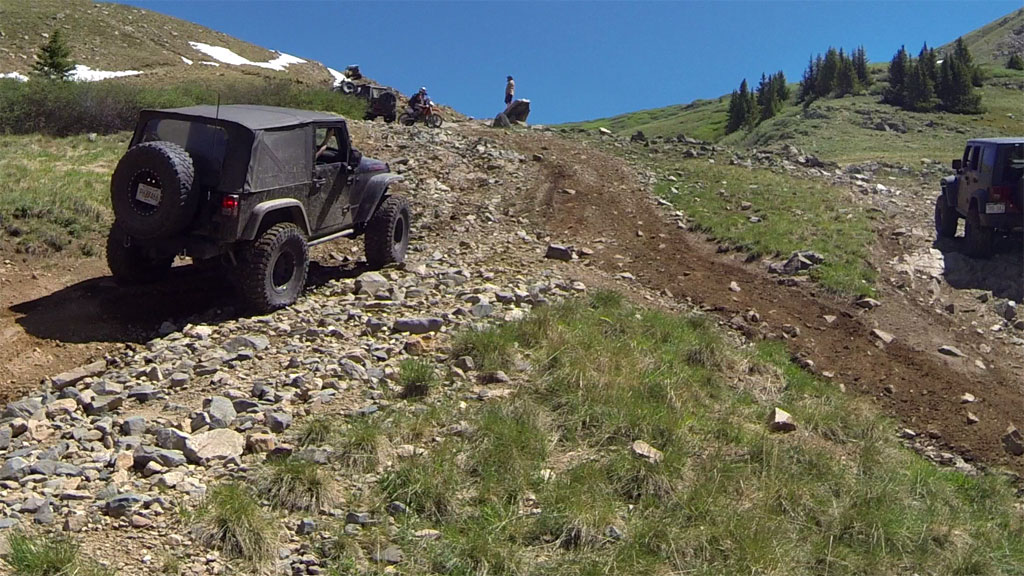
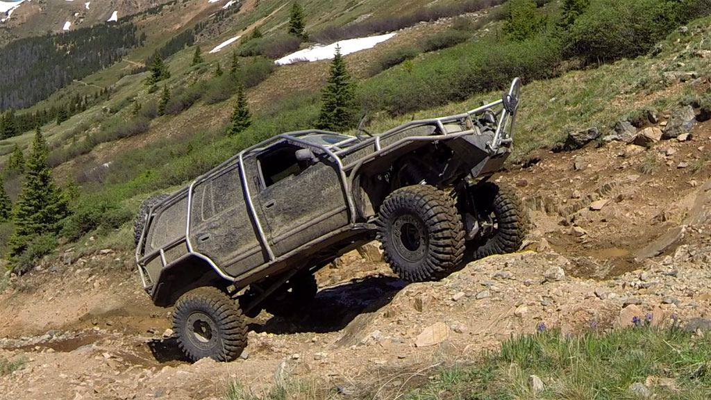
The next quarter mile is what gives Middle Fork Swan a high-end rating of 6. Taking the easiest bypasses up the hill, you will only face the low-end rating of 4. Those easy bypasses are, from the bottom, right crossing to the center at waypoint 11, right at waypoint 12, and then, above the hill, right at waypoint 14.
Coincidentally, all of the easy bypasses are also where the snow lingers longest. While the harder side of waypoints 12 and 14 will be clear of snow by early July, the easy routes can still be covered for two or three weeks longer.
See the video above beginning at 3:55 to see both the hard and easy routes.
11. Tombstone Hill, 1st Bypass (6 mi)
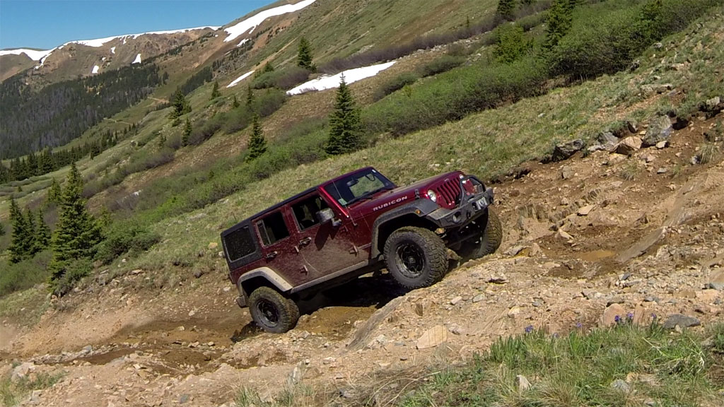
The difficulty of the rock ledges to the left depend, somewhat on wheelbase. Longer trucks, like the Jeep JK Unlimited, will find both front and rear wheels hitting ledges at the same time. In early Summer, this section will be even more difficult as it will be wet with snow run-off.
To avoid this set of rock ledges, take the easy bypass to the right, then cut back across to the center line, passing just to the left of the "Tombstone" rock. Staying to the right leads through a more rocky patch, but ends up in the same place.
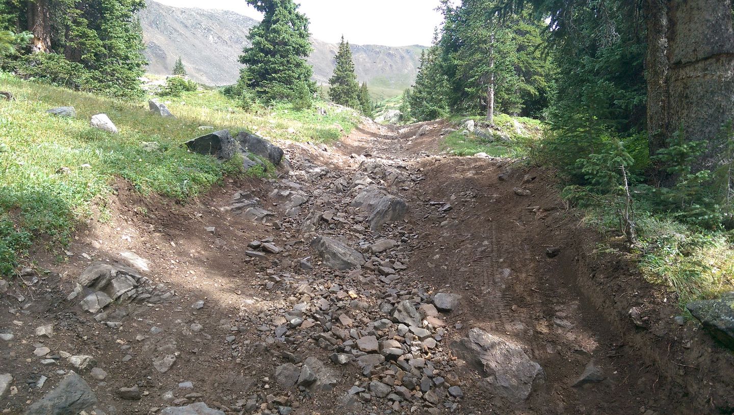
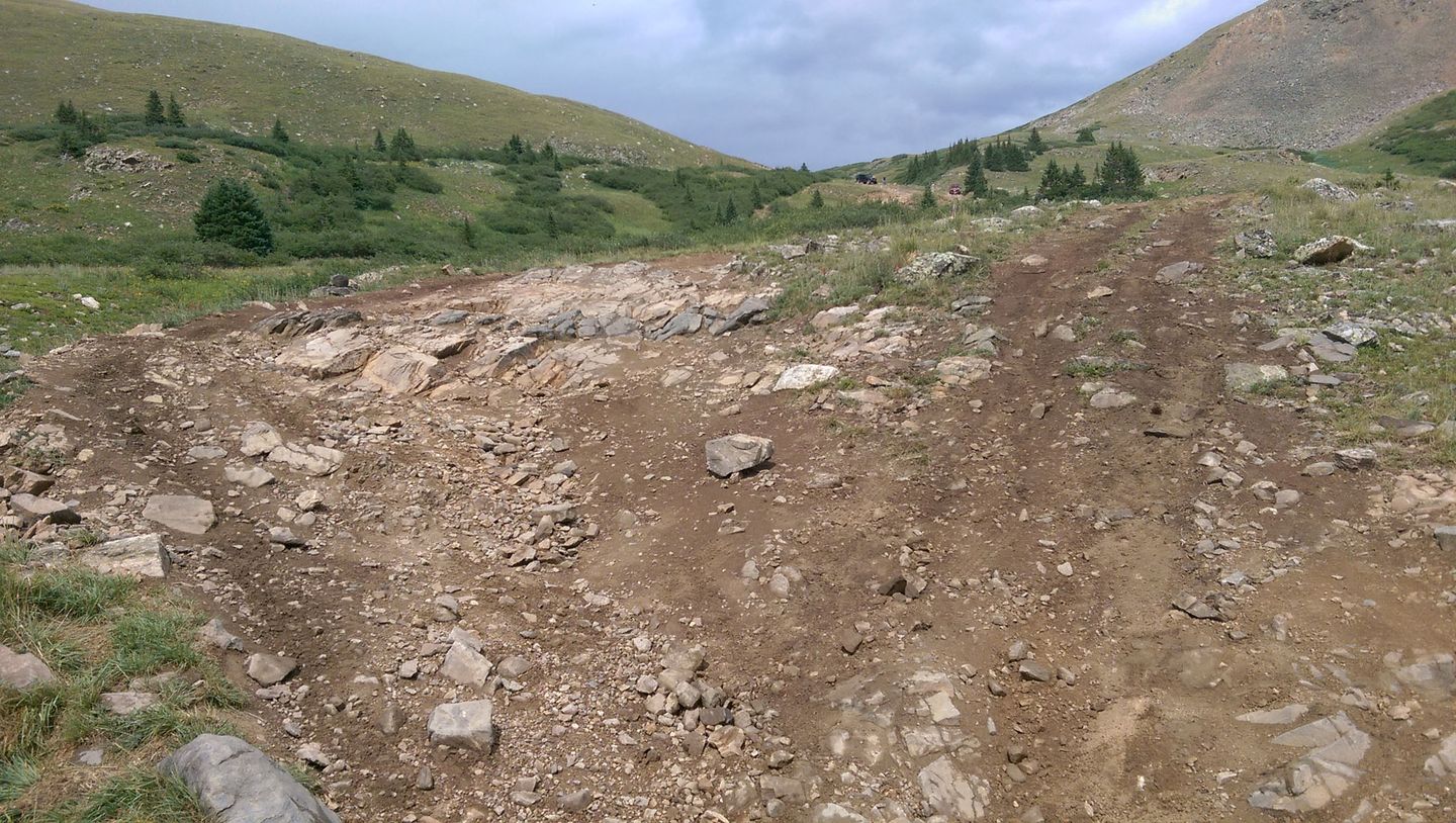
12. Tombstone Hill, 2nd Bypass (6.1 mi)
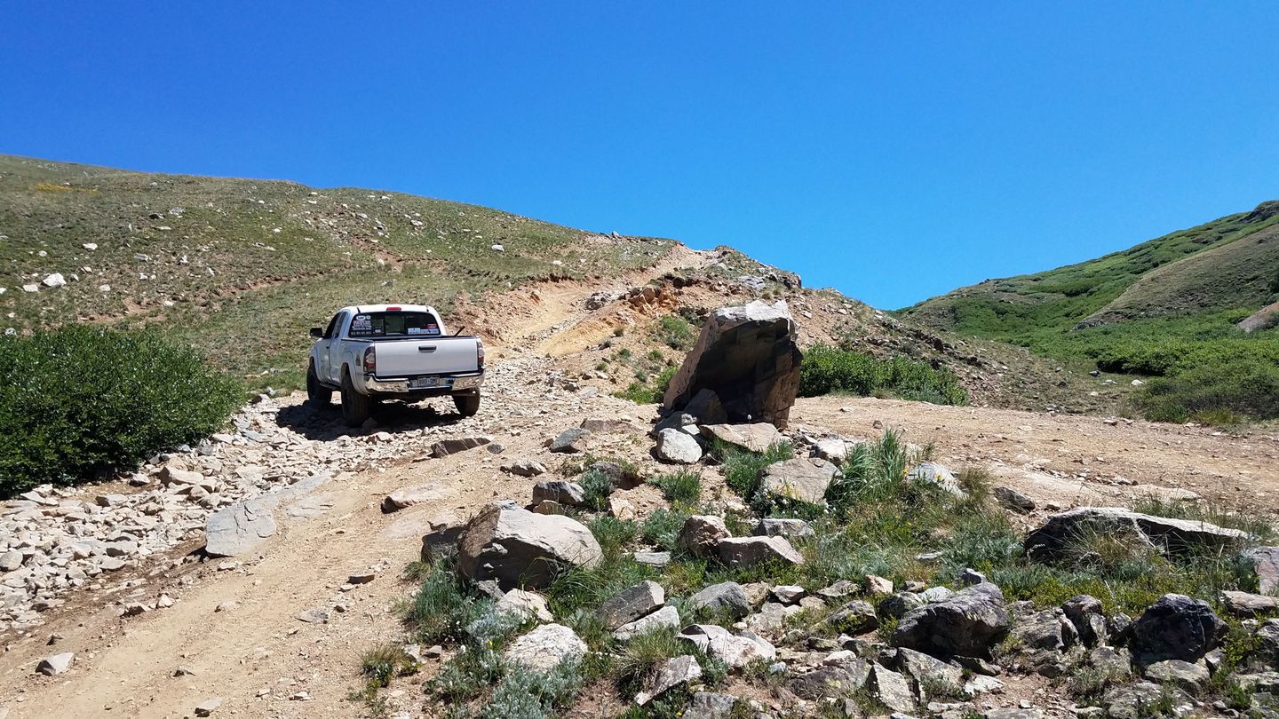
The trail widens out a bit above the "Tombstone" rock, allowing a few trucks to wait and watch the show as folks tackle the next section. Although it might be tempting, please do not "pose" by driving up onto the Tombstone. The rock isn't all that stable.
The next section is much longer. The left side has a couple of ledges separated by a 100 feet or so. These ledges are bigger than the set on the previous section. Additionally, this section of trail is less embedded rock and more loose dirt and stones, making traction harder to come by.
The right side is easily passable by stock trucks, although the very narrow, rocky stretch does have some pucker factor. This shelf road has the latest lingering snow drifts, sometimes lasting into late July.
13. Top of Tombstone Hill (6.2 mi)
After tackling Tombstone Hill, take a breather here and take in the stunning views of Glacier Ridge to the south and, on a clear day, Breckenridge Ski Resort to the west. This is also a nice spot to wait for the rest of your party to catch up.
If traveling east to west and thus descending Middle Fork, the right option here leads to the harder side of the hill described above. The left fork goes to the easy bypass. The same is true for the next fork a few yards further down. Stay left for the easiest route.
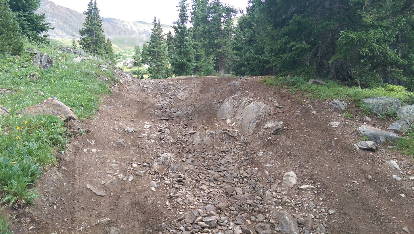
14. Bypass (6.3 mi)
One final fork here separates an easier route to the right and a moderately harder to the left. The right fork may be blocked with snow well into July. The left is loose, so traction can be tough to find, especially if you lose momentum, but it's not that difficult.
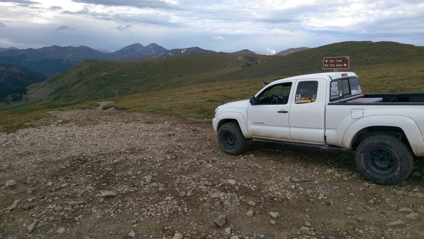
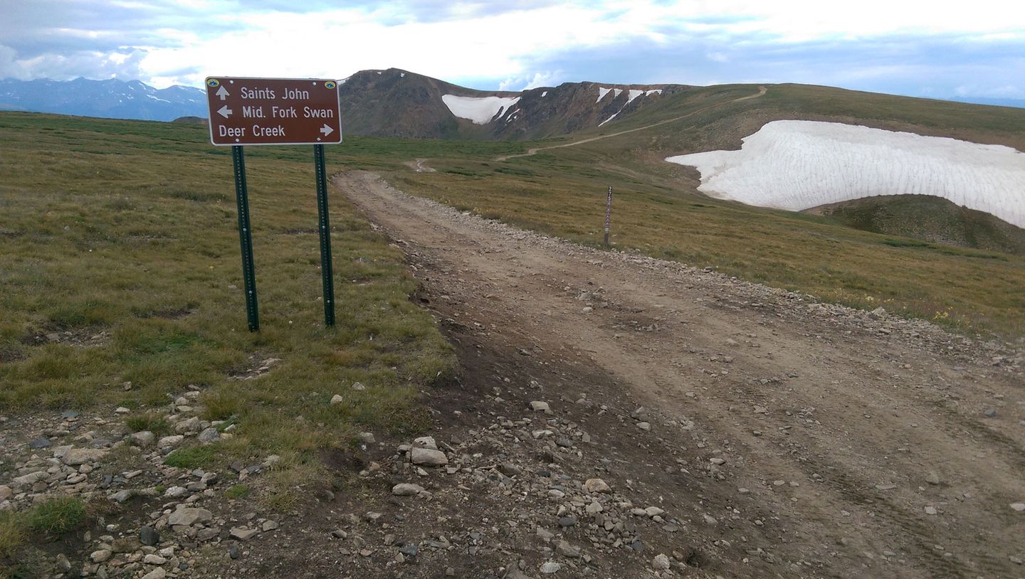
15. Summit (6.9 mi)
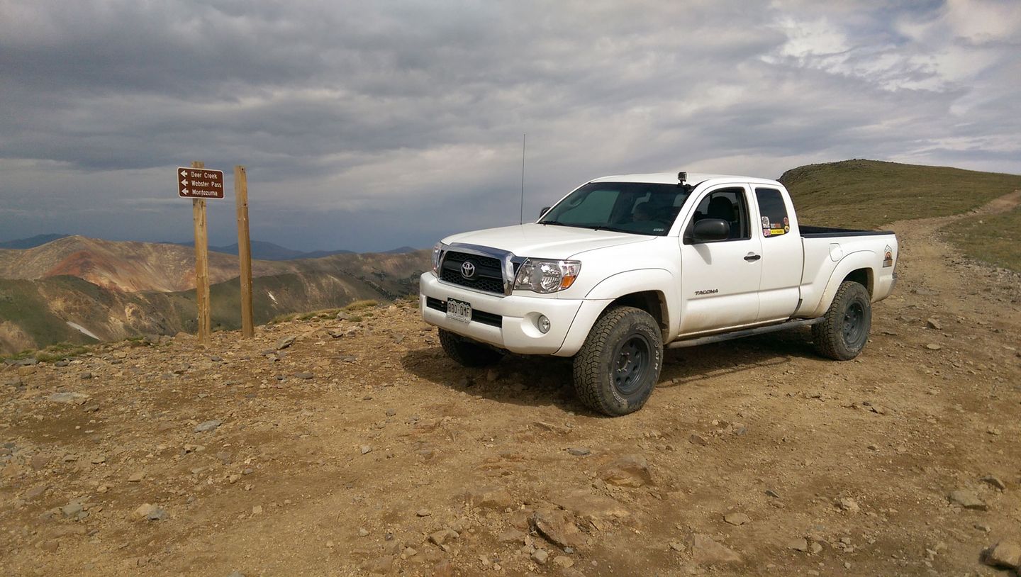
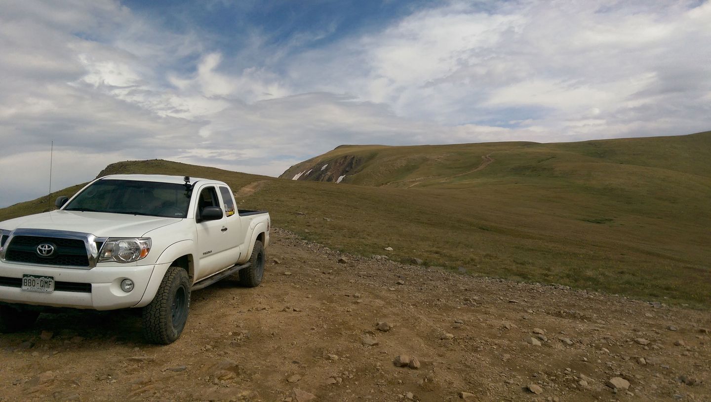
This high saddle has a well marked T-intersection. A short, out-and-back trail to the right runs along the shoulder of Whale Mountain. It's worth the time for this short side trip. More often than not, there will be several mountain goats grazing near the trail. This route, sadly, shows the serious consequences of leaving the trail to drive out on the tundra. Please stay the trail!
Go left and continue on to FS 5. There are two options up this small hill. The easier is to the left.
While you're here, don't miss out on the great views! Red Cone can be seen to the east just beyond Handcart Peak and Hall Valley below.
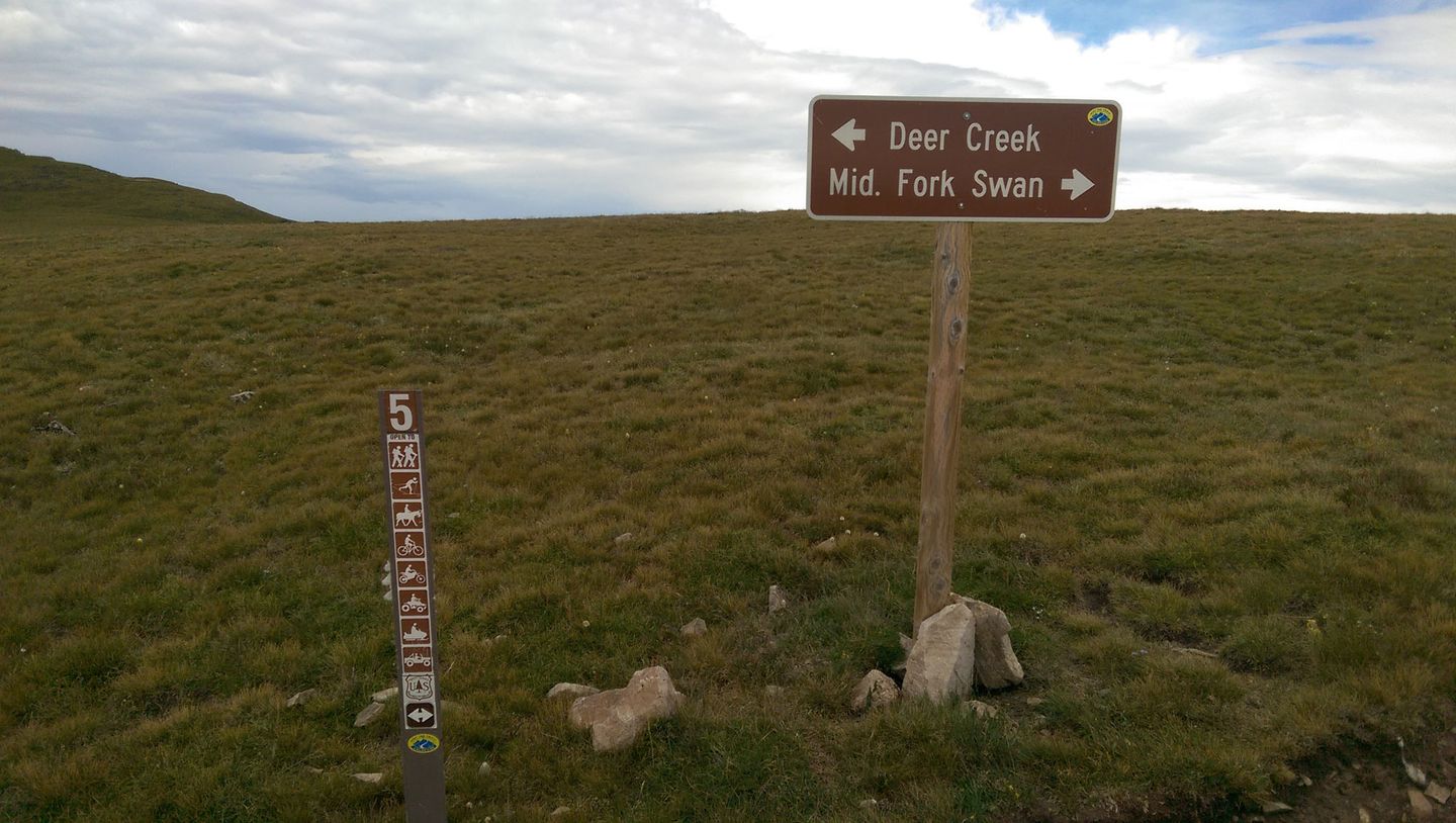
16. Deer Creek/Saints John (7.6 mi)
Middle Fork Swan ends at a three-way intersection. To the right, FS 5 continues down Deer Creek to Montezuma, with a connector to the top of Radical Hill. To the left, FS 275, Saints John Road, connects to North Fork Swan River, then makes its way down to Montezuma.
Dispersed
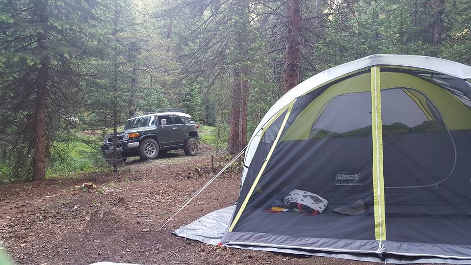
Dispersed camping is allowed along all but a small section of Middle Fork Swan. This section is private land and is well marked. There are a few large, flat sites suitable for small RVs early on the trail. However, once the trees close in, the remaining sites are all small tent sites and there are few places to turn around with a trailer.
In 2017, the Forest Service demolished many of the camp sites near the river siting "riparian impact."
More RV acceptable sites can be found on North Fork Swan River.
There are a few National Forest campgrounds at nearby Lake Dillon. More civilized lodging can be found in Breckenridge, Frisco, Dillon, and Silverthorne.
Starting Point
Breckenridge
On CO-9, between Frisco and Breckenridge, turn northeast at the traffic light onto Tiger Road/Shores Lane. Pavement ends after approx. 3 miles. Continue on Tiger Road past dredge tailings and a wide parking area on the right. At an obvious fork in the road, reset mileage. Left (north) is FS 354, North Fork Swan River. Right (east), and across a narrow bridge, is FS 6, Middle Fork Swan River.
Trail Reviews
4.9/5 (54)
Open
Rated
5/5
Visited: 09/04/2022
Difficulty Accuracy:
Harder
Well, as I was heading up the bypass at Tombstone hill I thought to myself "I don't remember it being this hard, and it seems like more than a 4", but I'm still novice enough to not trust my opinion. But I feel a lot better reading Trint's 7/17 review down below.
I think this is my favorite of any trail I've driven. Fun and challenging enough for me and tremendous views at the top. We combine with Sts. John for an awesome day. As a bonus there were several good-sized herds of mountain goats up there.
Open
Visited: 08/06/2022
Difficulty Accuracy:
Harder
Great trail. Love the different options and challenges of tombstone hill. I agree with the last few review that it’s a little harder then described or rated. It was a good challenge for my Cherokee which now has lockers front and rear. Made it all the way to the top with no issues but could see it being more challenging with stock rigs. I did not take the easiest route to the top took the moderate route as I was alone. It’s a great way to connect to other very cool trails.
Open
Rated
5/5
Visited: 07/26/2022
Difficulty Accuracy:
Harder
Beautiful trail and loads of fun, really appreciate all the different options for tombstone hill for each skill level. 2000 Nissan Xterra, 2 in lift, 33s, front lunchbox, rear LSD. I tried a couple different spots and would have to agree with others that even the bypasses are around a 5. The rock shelf is doable stock but you'll be scraping or fighting your way up, I had to bump a few times on the passenger line and still ended up in the hole on the driver's side. But the first ledge of it is the toughest. Above this you do have to know ahead of time which way you want to go but most are similar. Steep, loose rocks/boulders eating up all your momentum and traction. I took the bypass around the last vertical part since I didn't have a spoter and there's still rocks that tip you towards the edge on a steep climb and then a wash out on a tight turn that tips you pretty far towards the downhill if you don't have the suspension travel to compensate. Past that it's steep enough that I had to keep on the gas to hold momentum on the rest of the loose rock up to the summit. Although admittedly my rig is pretty gutless compared to most with the stock 2:1 transfer case gears.
Open
Rated
5/5
Visited: 07/22/2022
Difficulty Accuracy:
Harder
Did this with unlifted 4runner with AT tires and rci skids. Hardest obstacle is at bottom of hill at waypoint 10 which is easy 5 on mosb scale if u pick line at drivers side of rock outcrop. Upper stuff easier using bypasses. Pretty trail.
Open
Rated
5/5
Visited: 07/17/2022
Difficulty Accuracy:
Harder
I think the top of this trail is now more of a 5+ than a 4. The "easy side" of Tombstone hill has gotten really nasty. Bit embedded rocks and bigger loose ones. Good news, the really bad washouts above Tombstone have sort of self-corrected. Looks like the dirt has washed down into the bottom of the washout and filled it in somewhat. It can be straddled now.
Partially Open
Rated
5/5
Visited: 06/27/2022
Difficulty Accuracy:
Harder
Good news - the snow is continuing to melt, and only the bypasses are sporting it now. Bad news - the high country rock obstacles are more like a seven in my mind, with some of the bypasses pretty rugged as well. A lot of the earth around the rock obstacles seems to be more worn down than in the trail guide video. Looks like water damage has washed away a lot of the earth in places.
Enjoyed the water crossings, and at one point runoff follows the road, giving you a cool sensation of driving in a creek bed. That was unique and fun. The scenery is beautiful with a couple of beaver lodges early on, and tons of streams/run off to check out in the meadows.
The spur to the abandoned mine is pretty rocky; definitely not easy. It's similar to the rocky ascents before the Tombstone obstacles, and in my opinion solidly moderate.
Partially Open
Rated
5/5
Visited: 06/25/2022
I came down from the top to check on things. I stopped above Tombstone Hill and took some pics. The "easy" option (that follows the gpx) at waypoint 14, "Bypass", is not only blocked with snow, it is DESTROYED by washouts. Seriously, like 3 feet deep. [Edit: The washouts have somewhat self-corrected as of 7/17/22. See above.). The "easy" option between waypoints 12 and 13 has a LOT of snow. Probably 10 feet. Plan on the "hard" side being the only way up for at least two more weeks. Maybe more. Oh, and the easier option just above the saddle (waypoint 15, 3rd pic) is also blocked with snow. The steeper right option is clear.
Open
Rated
5/5
Visited: 06/24/2022
Difficulty Accuracy:
Spot On
Ran all the way through today with stock rubicon JLU and LJ on 35’s. 1st bypass on tombstone is open but you cannot use 2nd bypass as the snowbank completely blocks it at the end. We originally tried the 2nd bypass and had to back down the shelf road and take the main line. If you can handle 2nd tombstone obstacle then you’re good to run the whole trail. We exited through deer creek trail with no issues on that side.
Open
Rated
3/5
Visited: 09/04/2021
Ran this trail backwards according the the waypoint numbers but trail was still fun. I think running tombstone hill as a decent made the obstacles more difficult as you don’t have a great idea of what lines to pick so having a spotter was a relief. Ran in stock 2-door JK and hit skids/diff in a couple spots but was never stuck on anything. Cell reception is spotty closer to Breckinridge but non existent in the valley.
Open
Rated
5/5
Visited: 08/23/2021
Difficulty Accuracy:
Harder
I ran middle swan today. Several months ago I got up to Tombstone hill only to be stopped by snow. It was a good recon for a future run. This whole area has been effected by washout due to the rain in mid july. The rocks were much bigger and more difficult than months ago. There was definitely a touch of fall in the air and no smoke at all.
I went down Saints john trail then up Santa Fe peak to 13,000 feet before a storm hit.
The goats were super cool to see and brought me good luck.
Open
Rated
5/5
Visited: 08/02/2021
Ran on 8/2 in my Ram 1500 with sliders and 33s from Breckenridge to Deer Creek. Nothing was too difficult with the right line besides a spot right after waypoint 11. Going right on the easier bypass after the fork at waypoint 11 was a small rock garden that looked to be a little more eroded with more rocks sticking out than last year. I was able to force my way up with some scratches to my rock sliders but I think I could have gotten up unscathed if I had taken more time and a better line. Also ran it with a 4runner TRD on 33s who had no issue besides hitting his skid plate on a rock he didnt see. I think a rating of 4 is right for this trail and would recommend it for those looking for a slight step up from the "3"s but wouldn't recommend it for a first time wheeler.
Open
Rated
5/5
Visited: 07/04/2021
Took it to the top from West to East per the description. Although I took the 'easy' bypass at WP 12, I don't recommend it yet as it is narrow and tippy. You'll get no traction in the snow--instead you'll slide sideways away from the drift. I started sliding off to the right and luckily was able to get back over--THANK YOU JESUS!!!. You can see where my back wheels slid in the photo. I don't recommend this until the snow field melts. The 'hard' side was very steep with numerous ledges--when I walked it I nearly fell down it is that steep and loose. Maybe another time with more recovery gear and some serious rock stacking for my IFS Lexus.
Partially Open
Rated
5/5
Visited: 06/16/2021
The trail is open up to Tombstone Hill. The "hard side" has almost no snow. The "easy side" is completely buried near the top. It looks like the high tundra before waypoint 15 is also buried. Give this another few weeks before trying to connect to Deer Creek.
Partially Open
Visited: 06/13/2021
I ran north and middle swan to the snow on June 13th Sunday. I could go no higher. North swan I got just past the water crossing on the right before I ran into snow ice mix. I had to back down from there which was tricky before the V notch. On middle I got up to the bypass shelf road above tree line. The snow was drifted in there but not alot on the bypass to the right. With the heat wave over the next week 100° in Denver I think it will go to the top soon. Awesome area can't wait to go back after I mount up my new 35s.
Impassable
Rated
5/5
Visited: 11/11/2020
Snow is FINALLY falling in Summit County. There is still some time to get snow wheeling in before the gates close. There is somewhere around 4 to 8 inches on the trail down in the trees. I assume there will be much more higher up. There is a tree down just past WP 3, but it's not enough to force you off trail. Tire tracks in the snow stopped about halfway between WP 3 and 4. I made it to WP 4 with no problem but turned around there as I was riding solo and didn't want to get into trouble.
Open
Rated
5/5
Visited: 10/25/2020
Well it was open when we went through, doubt it is now!
This trail in the snow took every bit of ability this stock FJ has. I tried to make it up here during the summer but the snow drift on the shelf section near the top stopped me.
This trail has some amazing views, good obstacles, and connects to other trails as well!
Open
Rated
5/5
Visited: 07/21/2020
Ran this trail today in my stock 2020 Chevy Colorado Z71 with sliders and skids. We turned around between waypoints 4 and 5 right before that steep rocky incline. The trail has a small creek running through it and has eroded a bit more than the video from 2016 showed leaving many large rocks sticking out. You might be able to make it in a stock truck if you didn't care about body/underbody damage. We decided to play it safe and turn back. The trail before that was no issue and was a lot of fun!
Open
Rated
5/5
Visited: 07/19/2020
Ran this trail yesterday - it was the perfect mix of technical obstacles and excellent views at the top. Didn't hit any snow on the Tombstone Hill bypasses - easy wheeling all the way to the top! Managed to come across a cool herd of mountain goats at the top near the Saints John trailhead, which was super cool.
Open
Rated
5/5
Visited: 07/18/2020
I dropped in from Deer Creek today. Just above waypoint 15, I ran into this great group of folks from Dillon. (Great to meet ya'll!)
I went down to check the snow at Tombstone Hill. It is all clear of snow. However, I did have to shovel a bit of snow just to get past a drift above Waypoint 14. There was a second drift that was so hard-frozen that my Tacoma drove over the top of it without breaking through. Stay the trail, folks!!
Open
Rated
5/5
Visited: 07/12/2020
Ran this trail all the way to summit today. Only the first bypass of tombstone hill was open, the remaining bypasses were blocked due to snow drifts and will most likely be at least another week or two before they can be traversed. At waypoint 12 the only way was straight up the hardest route which made for an interesting time in my Tacoma. Running 33's and a 3 inch lift, it was drizzling and I was able to make it up but just barely. Had a very careful line and spotter. Fun trail!
Open
Visited: 07/04/2020
Visited this trail today. We have a stock Wrangler Sport S and decided to turn back at way-point 8 the rough spot. Probably could have passed through this area, but with the thunderstorm with heavy rain and not seeing any other stock vehicle we played it safe. Really enjoyed the trail otherwise and we will be back!
Partially Open
Rated
5/5
Visited: 10/12/2019
This trail was definitely a blast! Though, I encountered a 2+ foot deep snow drift at the top of Tombstone Hill that I couldn't seem to bust through (seemed super deep for this time of year). I'm on 33's with a 2.5" lift, so vehicles with bigger tires and a lift could probably make it through. Honestly, I probably could've used traction boards to get through, but since I had my kids with me, I didn't feel up to the challenge! The part of the trail in question comes up at about 6:15 in the video above. Most of the trail was covered in snow and made the rock obstacles pretty challenging, but still fun. I'd really encourage anyone going up after this point in the year to make sure they have necessary recovery gear and a partner truck before trying to make it to the summit. It gets slick and steep fast!
Impassable
Visited: 07/13/2019
Avalanche debris blocks the trail at Waypoint 8. (See drone pic.) PLEASE do not bypass this blockage by going off trail!!
I flew my drone up to Tombstone Hill (Waypoints 10-14). The easy route of the climb is blocked by deep snow. The hard route looks clear but very wet. Both routes above Tombstone are blocked with snow. The high route is nearly clear and might be bustable. The low route is buried deep.
Based on this, it's very likely that the tundra will be blocked further up.
Tragically, the record breaking snow from last winter was too much for the Swandyke cabin. Check the last pic for the carnage. We lost an icon here.
Partially Open
Rated
5/5
Visited: 06/25/2018
The gates are open. We made it up to Tombstone Hill. The easy side is still blocked with a massive snow drift. Expect at least a couple more weeks before stock trucks can go up.
The hard side is clear to the top of the hill, but, from what I could see, there still may be some drifts in the tundra above.
Partially Open
Visited: 10/20/2017
Planned to drive up and over to Montezuma, but didn't make it. There's a fair amount of snow just below the saddle (waypoint 15). There was one set of tracks in the snow, but I was flying solo and it was getting late, so I didn't risk it. It's still passable, but getting stuck in the snow is a possibility and there's nothing winch on up there.
Also, there's ice at the "rough spot" (waypoint 8) that required a dab of Toyota ATRAC.
Is it just me or is the that rock shelf on the hard side of Tombstone Hill getting bigger every day?!
Open
Visited: 08/20/2017
We took our SxS up North Fork and looped around Saints John, Deer Creek, and Middle Fork. I guess since school has started the crowds are winding down. We only saw a handful of SxS's and and two trucks the whole day.
We descended the hard part of Tombstone Hill. It was really too much for our near-stock RZR 800. Rode the skid plate over a couple of the ledges. A bit too much pucker factor!
Even with some recent rain, the trails are pretty dry and sometimes dusty. Afternoon storms rolled in and made us nervous about lightning, but we only got a few sprinkles of rain.
Over all, a great day!
Open
Visited: 07/09/2017
Middle Fork is now open and clear with the exception of the easy option between waypoints 12 and 13, Tombstone Hill. The hard side is dry. The easy side is blocked by a large snow drift near the top.
All of Summit County is under a strict fire ban: absolutely no open flames. It's warmer than usual and extremely dry!
Open
Visited: 11/12/2016
The late coming of winter in 2016 means that most of the high passes are still open in mid November.
The lower sections have a couple of places where the river flows into the trail. These are extremely icy. Still passable, but very slick.
The forest service will be closing gates on November 23rd, so there's only one weekend left.
From the Community
Be the first to ask a question!
Trint Ladd
Mapping Crew - Colorado
Trint grew up riding dirt bikes in the creek beds of the Texas Panhandle. While attending college in Colorado in the late 1990's, he saw a magazine article about a Ford Explorer four-wheeling club. He never saw his Explorer as an adventure vehicle before, but quickly joined up and caught the bug.
With his engineering background, Trint has always respected the factory design of a good truck (and recognized when manufacturers put cheap parts into something marketed for off road use). "A good driver, with a well built, stock truck can do trails that would break a $50k, built-up rig with an inexperienced driver."
He put that 1st gen Explorer though hell and it always held up, earning great respect from the "big dawgs" in the club. (And earning the nickname, "The Idiot Stocker.") The truck was christened "BamBam" because of the frequent sounds ringing out from the factory skid plates.
Now that Trint is "grown-up" (quotation marks intentional), he's a bit less inclined to dent up his 2011 Toyota Tacoma, but still feels the same way about superior engineering. The "Stocko Taco" wheeled for over 10 years with no mods other than trail armor. In 2021, it finally got a couple of inches of lift... and a new name: "Taco Supreme."
Trint's love for the mountains was ingrained at a very early age. 8mm film exists of 18-month-old Trint in a backpack on his dad's back while riding dirt bikes through the mountains of Red River, NM. Although Trint does enjoy a good, tough, technical rock trail, he can often be found on easier, winding, Alpine roads just taking the glory of God's country.
Visit Profile
Start a free trial and get this level of detail on every trail
guide
Start Free Trial
Print Trail Guide
Purchase
Company
Community
Recent Updates
By clicking "ACCEPT", you agree to be the terms and conditions of each policy linked to above. You also agree to the storing of cookies on your device to facilitate the operation and functionality of our site, enhance and customize your user experience, and to analyze how our site is used.