Please wait - Uploading to Gaia GPS
Red Cone

Trail Information
Difficulty - Mandatory
5 -
DIFFICULT
Difficulty - Optional
7 -
SEVERE
Status
Impassable
Distance
6.05 mi
Duration (one-way)
About 2 hours
Highest Elevation
12800 ft
Shape of Trail
Straight Through
Typically Open
07/01 - 03/31
Best Direction
North
Official Road Name
565
Nearest Town
Grant
Nearest Services
Bailey
Management Agency
Pike National Forest
District
South Platte Ranger District
Highlights
Red Cone is one of the most iconic trails in central Colorado. This four-wheel-drive trail provides spectacular views of the divide with several rocky obstacles at the beginning and a once-in-a-lifetime decent near the end. The upper portion of the trail traverses the ridge lines around 12,000 feet with views for miles, but the steep, one-way descent at the end is a unique feature of this trail.
Red Cone is also a key connecting trail to other nearby trails such as Webster Pass and the Montezuma trail system. Combining this with those trails creates a full day of offroad fun.
A well-equipped vehicle with high clearance and low range is required.
Trail Difficulty and Assessment
Recommended Vehicle:
Lightly Modified 4X4 (Small Lift and Larger Tires)
Concerns:
Summary:
The trail has many large rock sections within the first 2 miles that are not suitable for stock vehicles. Steep descents along the final mile of the trail can be extremely dangerous for novice drivers.
Community Consensus
2 votes
16 votes
2 votes
Easier
Spot On
Harder
The weighted average of your fellow members agreement of our trail rating. As trail conditions change this helps us keep the community aware of changes.
Mandatory
5 -
DIFFICULT
The hardest part of the trail that you
cannot bypass - you have to drive it.
Optional
7 -
SEVERE
The hardest part of the trail that is
purely optional - you can bypass it.
Rocky or undulated road surface. Potential rocks and/or tree stumps less than 24" tall and/or vertical ledges less than 24" tall and/or near vertical ledges or waterfalls less than 54" inches. Tire placement becomes more difficult. Can be steep and off-camber. Read More about our Rating System
Start your next adventure on Red Cone

Upgrade your Membership
Unlock all of the details on every Trail Guide and Scout Route.
Start a 7-day Free TrialUploading to Gaia GPS
Share Trail
Trail Navigation
The south end of the trail climbs steeply as you wind through the forest with sporadic rock obstacles, small creek crossings, and several muddy sections. The climb continues above tree line, across a few ridges untill you reach the very top of Red Cone. At this point the trail becomes one-way and descends down hill till it meets up with Webster Pass. The east side of Webster Pass stays snowed in till late July or August, but Red Cone only opens for the season once the west side of Webster Pass is clear, so there is always an exit from the trail. Heading east down Webster would return you to highway 285, heading west on Webster will drop you into the towns of Montezuma or Keystone.
If you are not comfortable with steep descents, avoid this trail.
1. Trailhead (0 mi)
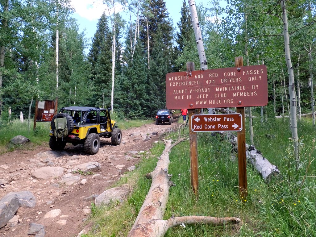
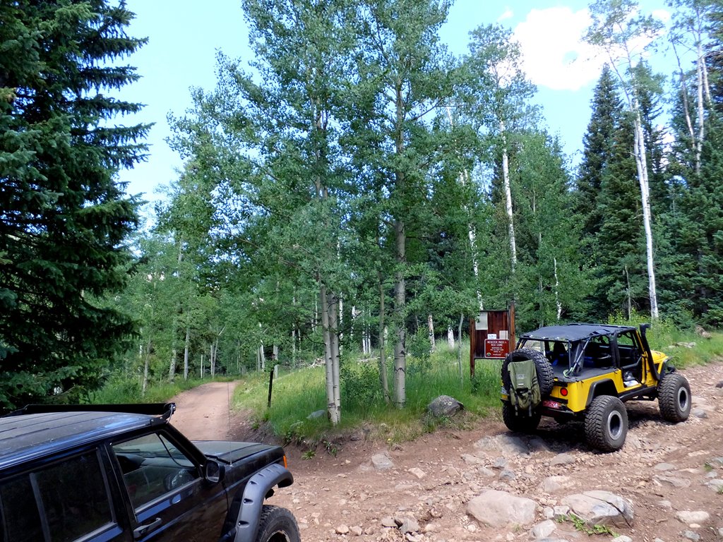
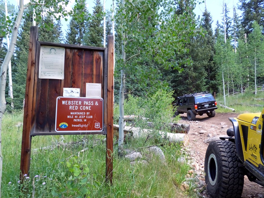
After about 5 miles on C.R. 60, begin Red Cone at F.S. 565. The intersection is well marked with signage.
2. Rock Obstacle (0.44 mi)
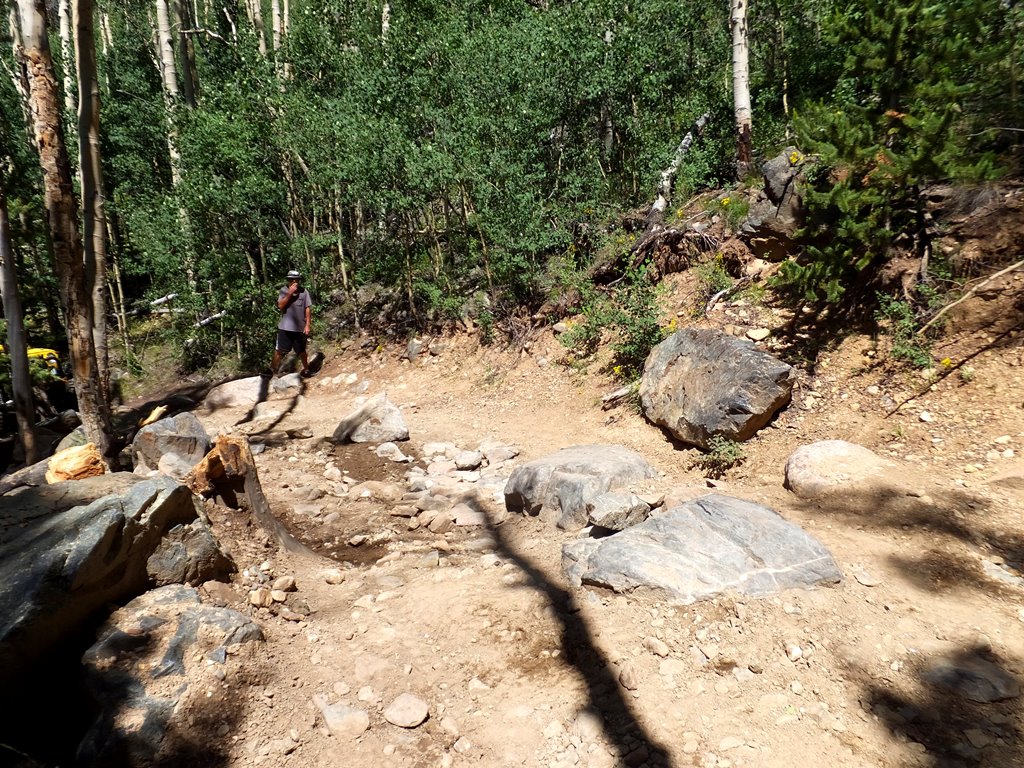
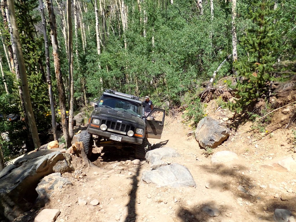
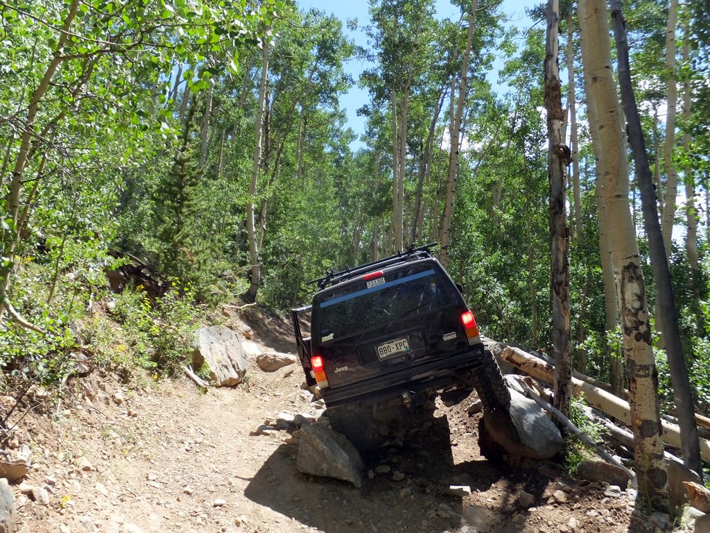
This obstacle is the first rock obstacle you will encounter on the trail. Small tires will make this obstacle difficult as the boulders are relatively large and require careful tire placement to keep your undercarriage from getting snagged.
3. Creek Crossing (0.76 mi)
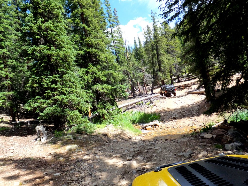
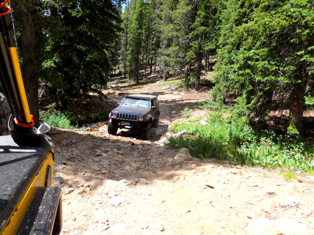
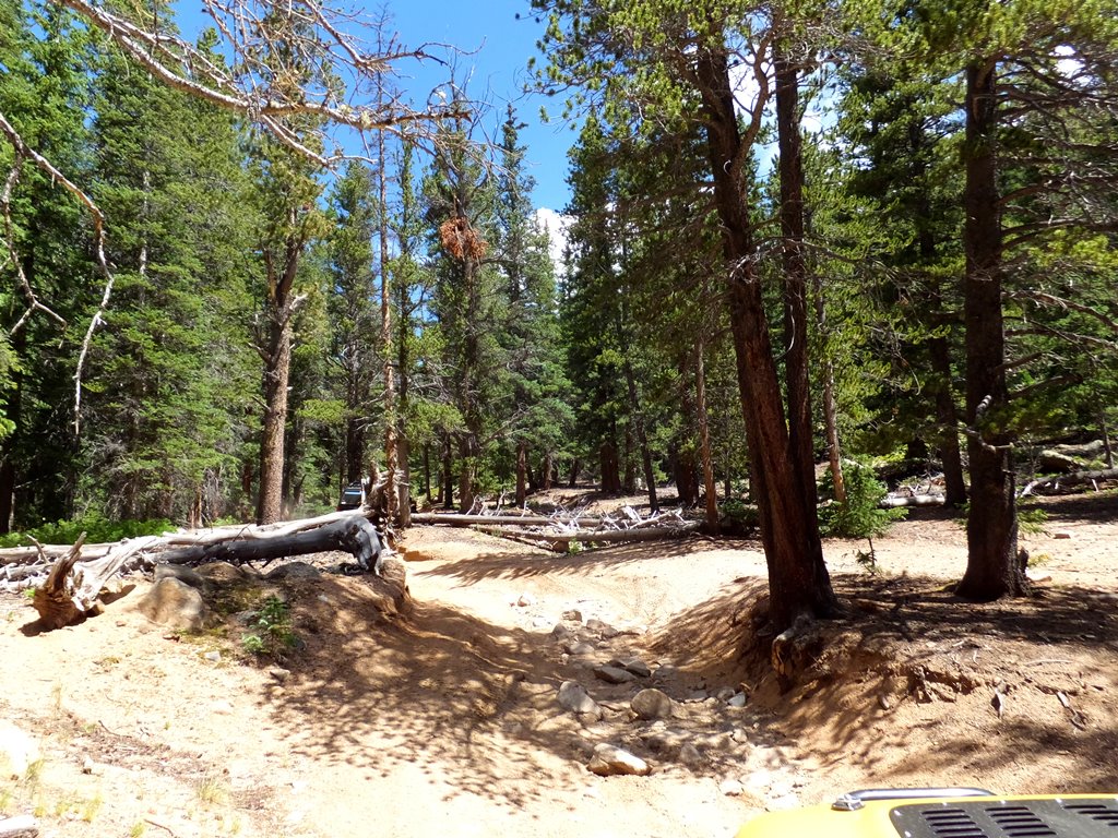
Cross a small creek and then veer slightly left as the trail follows a brief section of wash.
4. Rock Obstacle (1.1 mi)
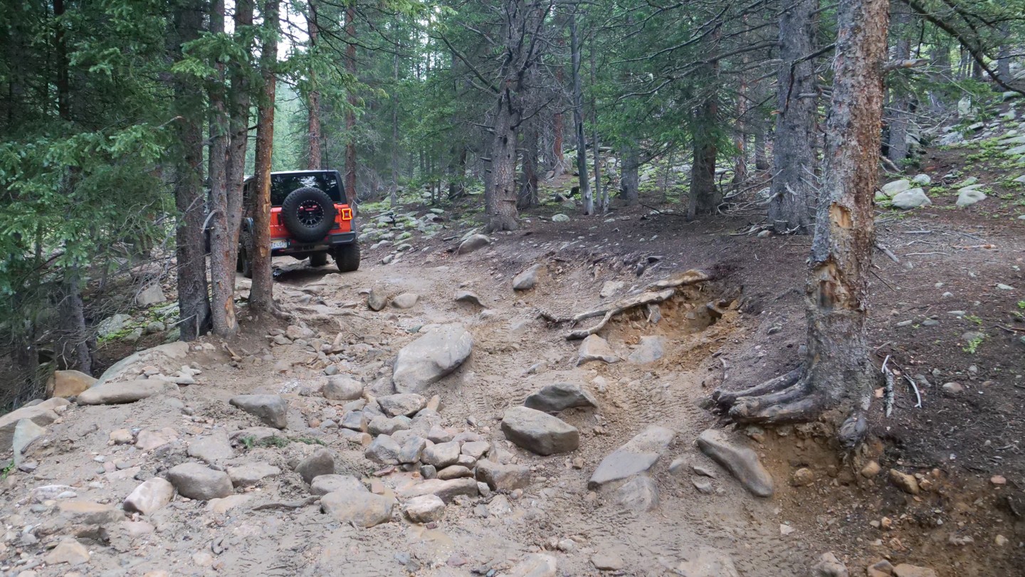
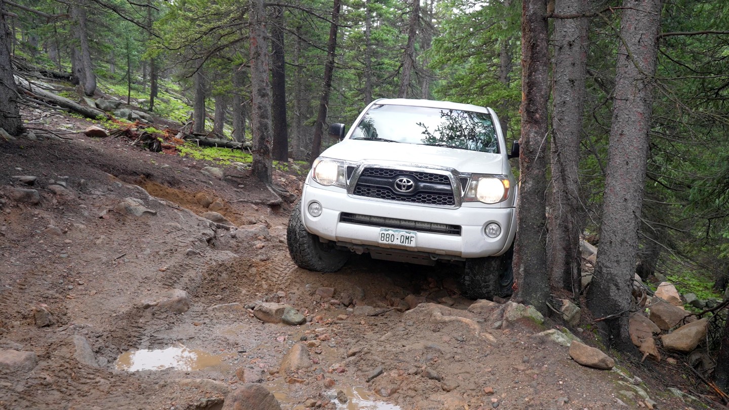
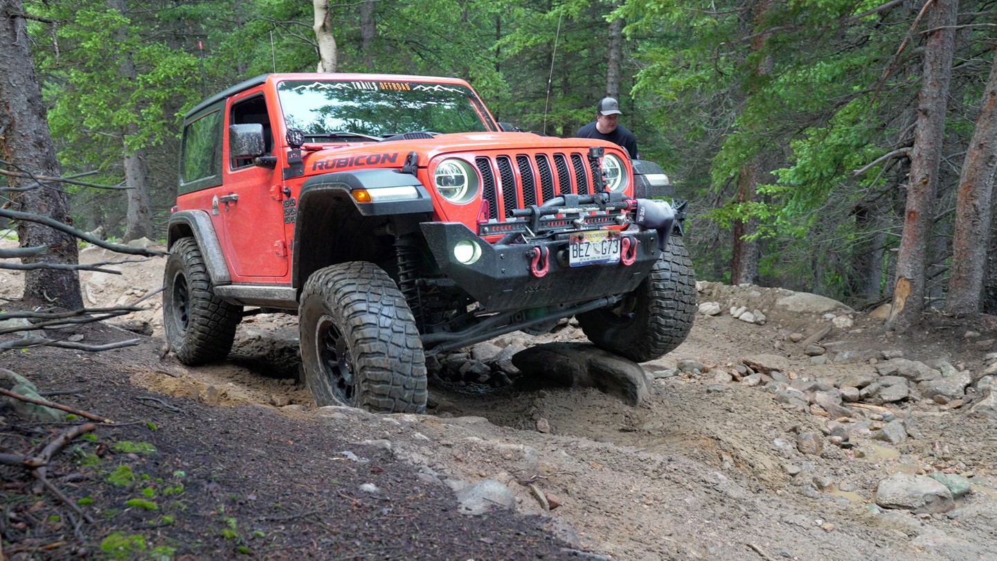
Here is one of the most challenging obstacles along this trail. There are 2 line choices as there is a boulder in the middle that you might get hung up on if you have smaller tires. The line to the driver's right will require a bit of clearance to get up and over the slippery roots. The line to the left is super tight and has the potential for body damage.
5. Rock Garden (1.42 mi)

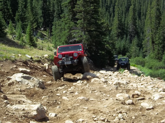
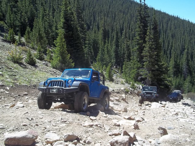
The Rock Garden is a short, wide area with a handful of large boulders to the right where a vehicle can test a few different lines. Each year this area changes. Some years the boulders seem massive; other years, the earth appears to bury the majority of the challenge.
6. End of Tree Line (2.99 mi)
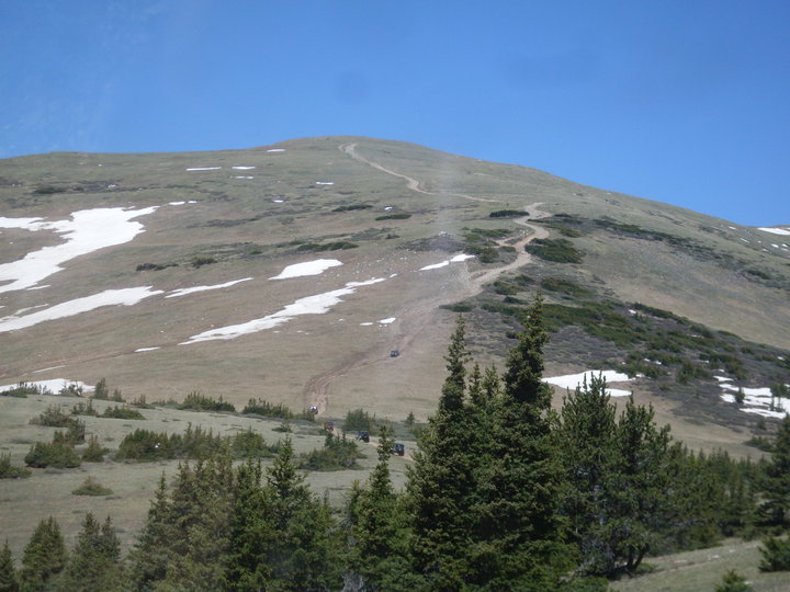

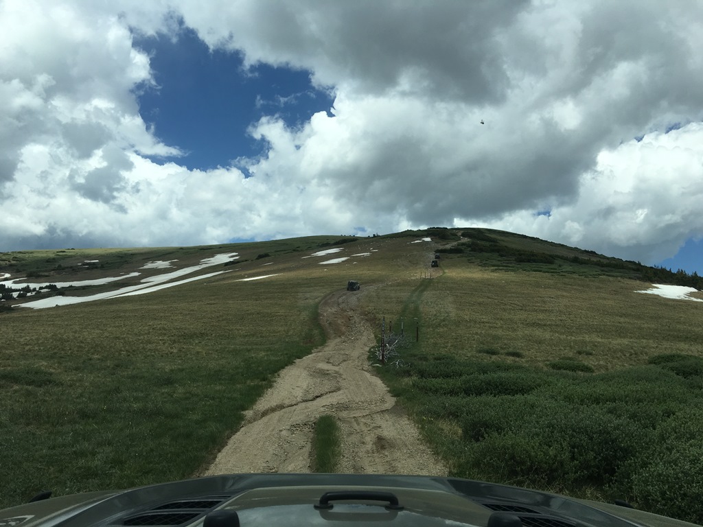
You have now reached the end of the tree line. This would be a good time to stop for the last, covered, potty break of the trip.
7. Red Cone Peak (5.29 mi)
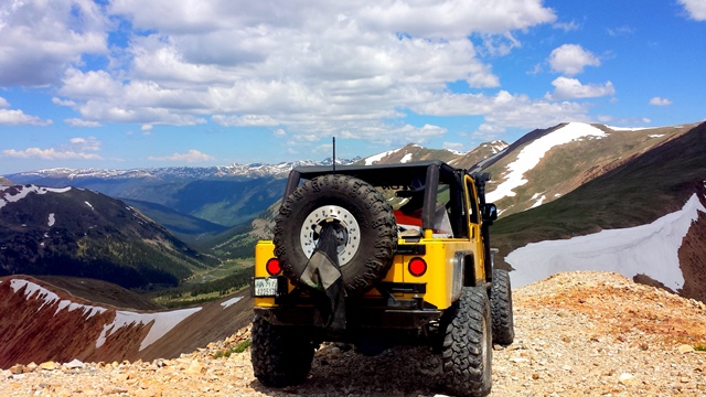
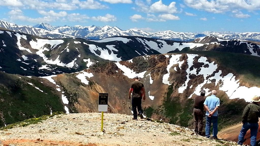
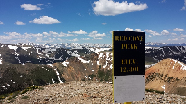
You have finally reached the Red Cone Peak. If you bunch up together, there is room for about 15 vehicles at the top. If you see a large group already ahead of you before reaching this point, it's probably a good idea to wait a bit and let them continue past the top. Likewise, if you see a large group behind you while staying at the top, it's probably a good idea to pack up and get moving. But stop, take some pictures, and enjoy the views of Whale Peak (13,078'), Handcart Peak (12,518'), Landslide Peak (13,298'), and many others before you descend.
Red Cone is One Way Downhill Only from this point forward.
8. Descending Red Cone (5.29 mi)

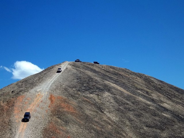
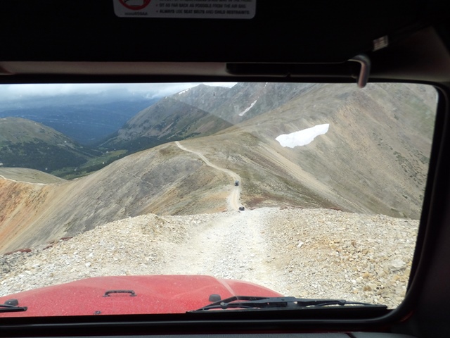
If steep descents bother you, this would be the time to turn around or gather your courage and hold on tight!
Do not lock up your brakes on this descent. It will mean disaster for you! Keep the vehicle in its lowest gear and let the engine do the work of braking for you. About 3/4 of the way down the hill, when you think you have conquered it, the trail takes one more quick, even steeper decline before leveling out across the ridge.
9. Second Descent (5.9 mi)
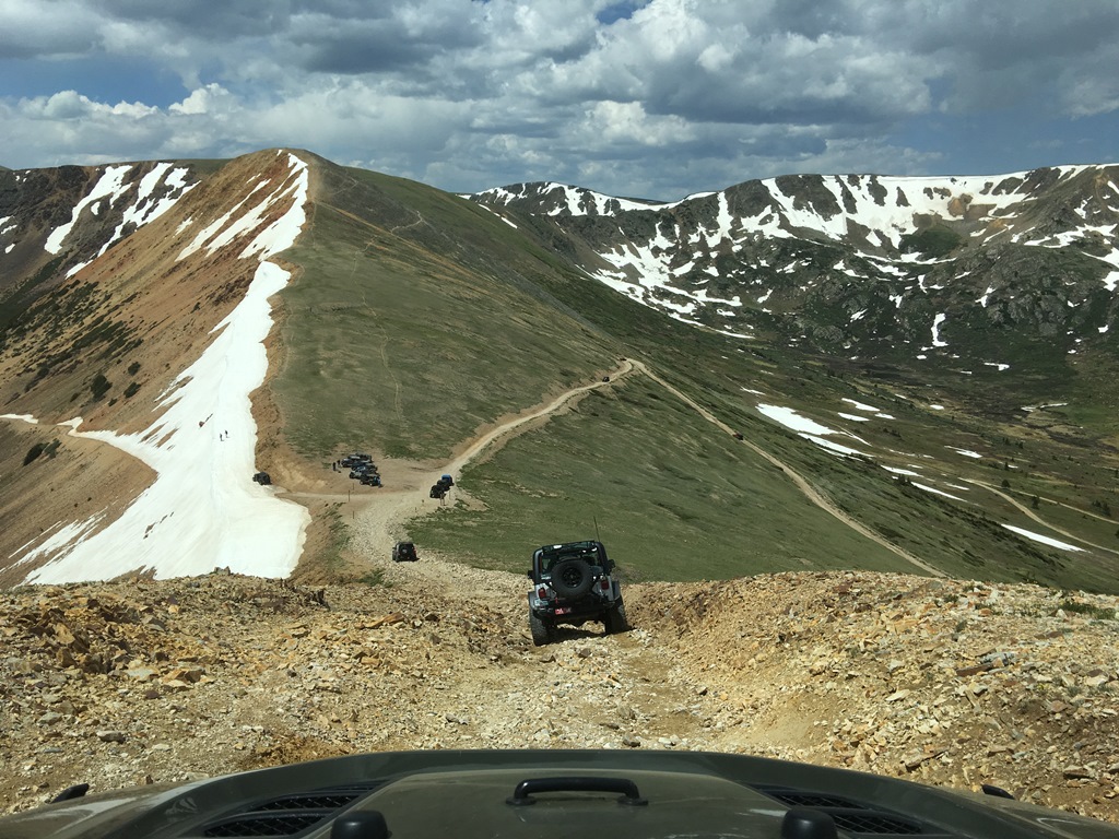
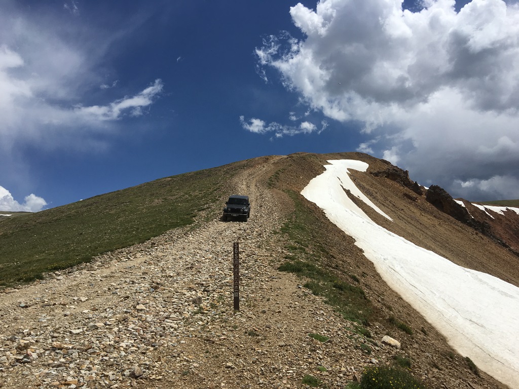
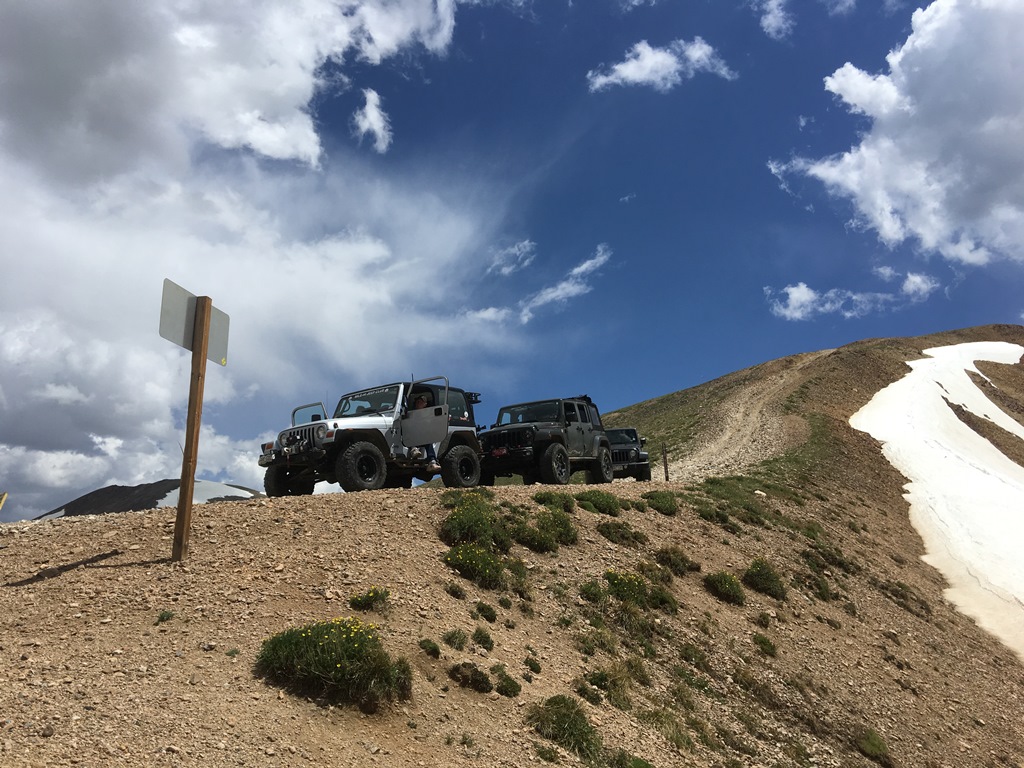
Don't be fooled and assume there was only one descent from the top; you still have one more steep descent to tangle with. The good news, you have already conquered one descent. The bad news, this one is a bit steeper than the previous one. But more good news, it's a lot shorter in length!!
10. Merge with Webster Pass (6.5 mi)
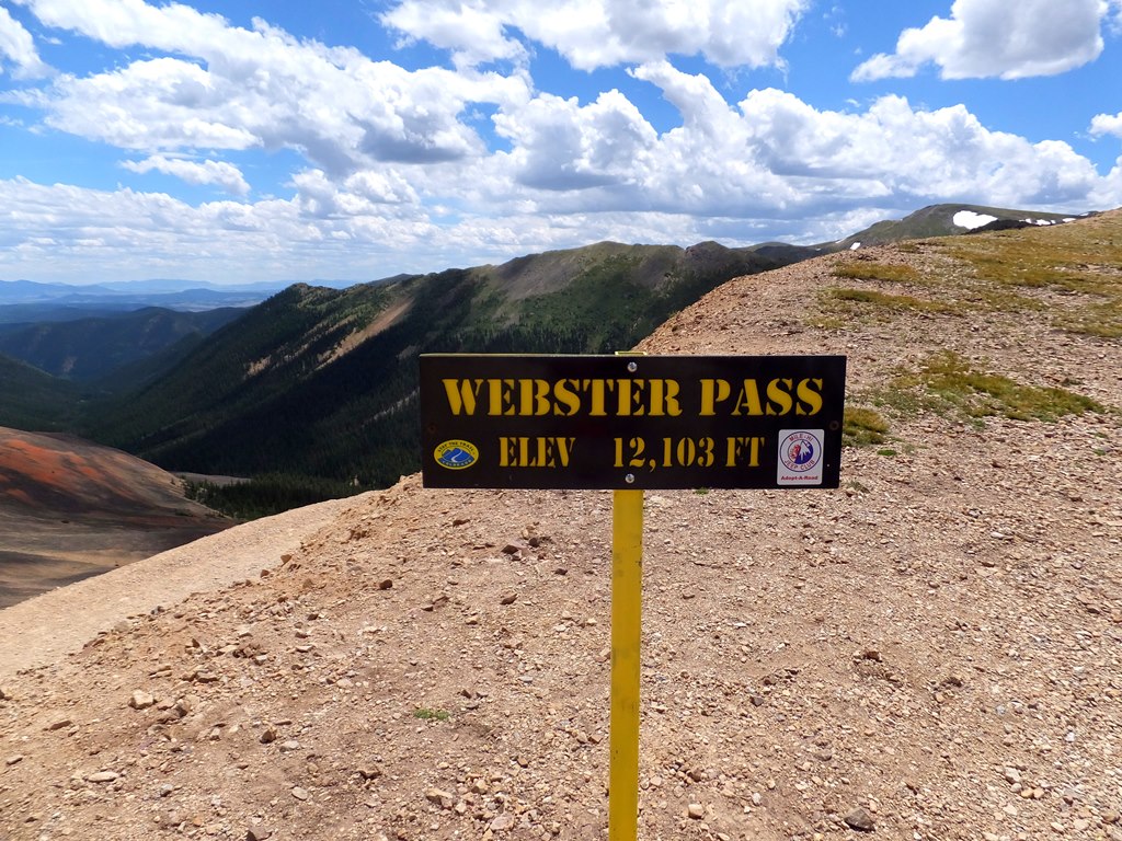
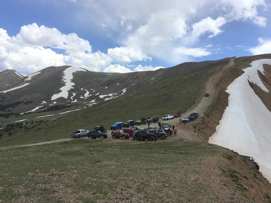
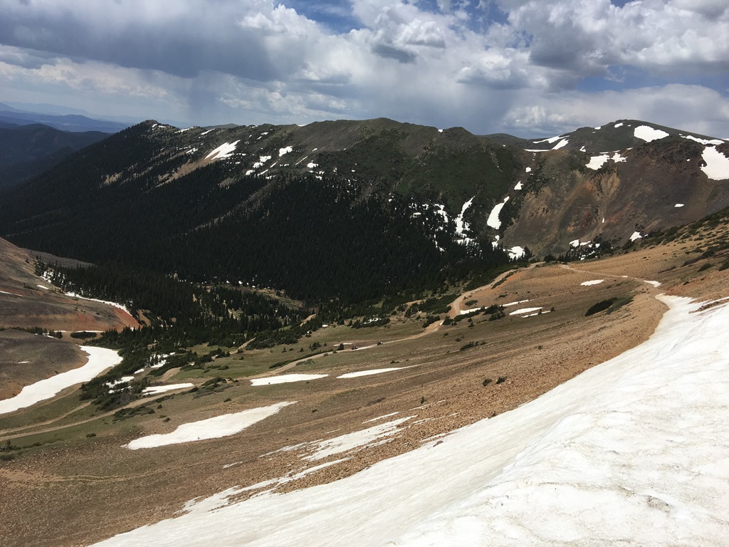
Congratulations! You have completed Red Cone! You are now at the top of Webster Pass and need to decide whether to go downhill towards the left, which will take you down the Southside of Webster Pass and back to highway 285, where you came from. Or you can go right, which will lead you north to the towns of Montezuma and Keystone.
It is not uncommon for the south side of Webster Pass to be impassable by snow till late July or early August.
Improved
Designated
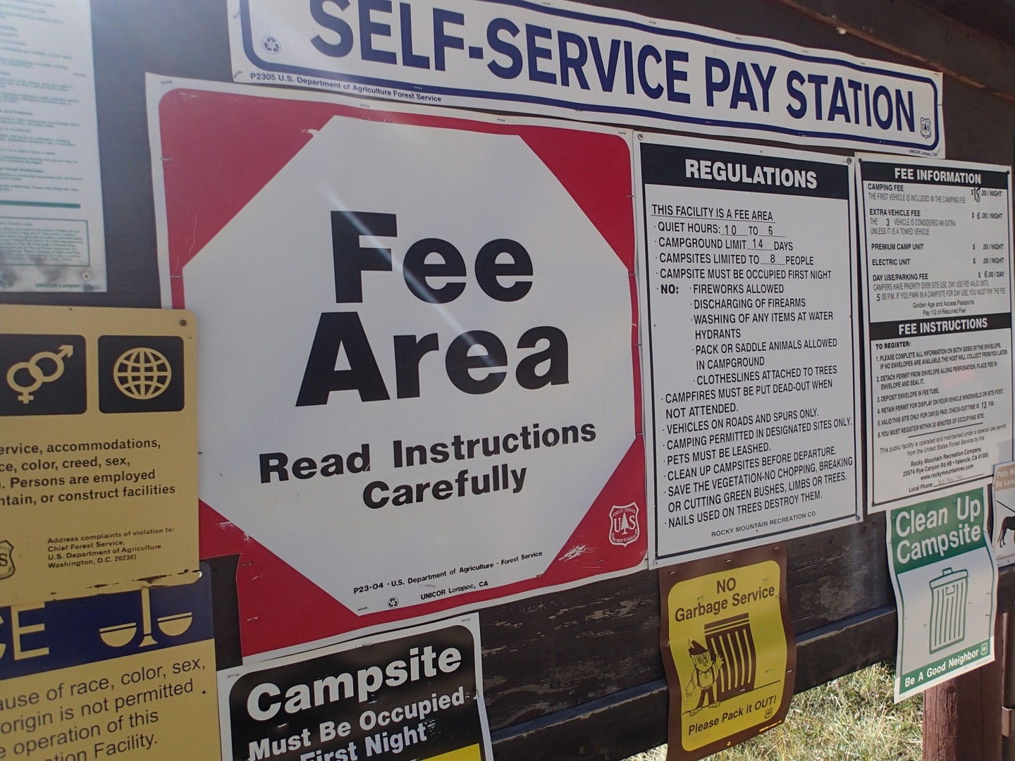
C.R. 60 has 2 campgrounds before you reach the start of Red Cone;
Hall Valley Campground and Handcart Campground, each with less than a dozen first come first serve camp spots.
On Red Cone itself, there is hardly any dispersed camping. However, you can find a lot of dispersed camping along nearby roads such as Webster Pass.
Starting Point
Denver
Take highway 285 west from Denver. Go about 3 miles past the town of Grant and turn right onto County Road 60. Continue on this main road for 5 miles and avoid all roads that turn left. The trailhead is marked by F.S. 565 on your right, along with a wooden bulletin board with the trail name.
Red Cone is a high alpine trail that begins to see snow in October or November. The trail is impassable to 4x4 vehicles during the winter months and should only be traversed by over the snow vehicles. Red Cone is seasonally closed during the Spring run-off season to prevent excess erosion. Exact closing and opening dates can vary from year-to-year depending on conditions, but according to the MVUM it is typically closed April 1st-June 30th.
Trail Reviews
4.9/5 (86)
Open
Rated
5/5
Visited: 09/23/2022
Difficulty Accuracy:
Harder
This wet summer was NOT kind to the trail. Everything was harder. All the rocks were bigger. The "gate keeper" is a solid 6 now. Forget doing this in a stock unless you've got ALL the armor, lockers (or ATRAC), and a LOT of driver skill. The "moguls" on that one switch back must have been a foot and half deep. Still, it was a glorious, sunny day, but VERY windy. I'm talking 60+ mph at the summit. Felt like it was going to blow my truck over.
Open
Rated
5/5
Visited: 09/18/2022
Difficulty Accuracy:
Spot On
This trail has everything a Colorado trail can offer, and is definitely a 5/6 depending on vehicle. The 'gatekeeper' obstacle seemed easier than the washed out, rutted switchbacks. The narrowness through the trees and their exposed roots will make this difficult for full size vehicles. The portion above timberline has some of the best views you will experience exploring Colorado. If you are in the area and have a moderately modified rig, do not skip Red Cone. Easily one of my favorites.
Open
Rated
5/5
Visited: 08/27/2022
Difficulty Accuracy:
Spot On
Ran this trail with the following:
2000 Frontier, 33's, 3" lift, no lockers, winch.
2004 4Runner, 32's, 2" lift, no lockers, no winch.
The 4Runner got stuck on 1 line and I had to pull him about 1 foot to get off the rock that high-centered him on the frame. Probably could have been avoided with a different line.
The entire trail is pretty rocky/rough the whole way, so don't expect dirt road status.
There's a section one 1 of the switchbacks that is pretty chewed up right now with really deep holes left/right/left/right/etc. It flexes you out and if you don't have lockers, you may not be able to drive this section. I tried a bunch of times an ended up having to winch a bit to get past it. But I also have completely open diffs, IFS, and no lockers. The GX470 that went after me made it without lockers, but it has really good traction control, he stacked some rocks, and sent it.
Whatever, I digress - the trail's awesome and you're going to have a good time. See pictures.
Open
Rated
5/5
Visited: 08/12/2022
Difficulty Accuracy:
Spot On
What an awesome trail! Moderate rock crawling with a couple extra credit hard lines that are avoidable if you want. The main obstacle isn’t hard but it’s a scraper unless you take it just right! The climb to the top was beautiful and the descend fun and exciting but quite easy.
Open
Rated
5/5
Visited: 07/07/2022
Difficulty Accuracy:
Spot On
If you are familiar with this trail:
Trail is open and in good shape. Snow drift at Webster Pass saddle is still there. The final decent is in good shape with no traction issues.
If you have never done this trail:
I’ve done this trail a few times and in different rigs and the subjective difficulty rating is REALLY depends on what your driving.
Below tree line can get technical with tire placement if you’re not in Built Rig, Keeping your painted parts off the rocks and trees is more challenging in a stock vehicle. In comparison, my JK (see bio for build details) only had one rock strike and I did this trail without a spotter. I have also gotten high centered in my full size truck and had to winch my way off the “Gatekeeper”
Above tree line-the route gets more rocky but far less technical. The views are worth getting bounced around though.
Enjoy the ride.
Open
Rated
5/5
Visited: 07/04/2022
Difficulty Accuracy:
Spot On
Ran this trail last year for the first time but still loved it the second time! Met up with some cool people from South Carolina and rolled with them for Red Cone. Webster Pass is still closed on the South slope. Few more weeks. Trail has a couple of minor challenging obstacles the dangers are above tree line when you just need to be paying attention.
Open
Rated
5/5
Visited: 07/03/2022
Difficulty Accuracy:
Spot On
Ran Red Cone on Sunday, July 3rd with a small group and pretty much had the entire trail to ourselves! One of my favorite trails out there and offers a variety of challenges along with beautiful views! No issues with our rigs on any of the obstacles. We did observe a dirt bike go up the one way section so please note this is a one way trail once you get to the top.
Open
Rated
5/5
Visited: 06/28/2022
Difficulty Accuracy:
Spot On
We ran Red Cone today and it was the best. We never saw another rig on the trail which was nice. I ran it last July and the trail seemed more washed out in areas this year. We had great weather and even had a mountain goat on the summit. When we got to Webster there was not another sole around. That was great because we needed the room for a dance off.
We then headed up radical hill and ran it to the snow which was right below the cabin.
Open
Visited: 06/25/2022
Happy to report Red Cone is now open for the season as well as the north side gate of Webster Pass. The snow cornice on the top of webster is still huge and several weeks away from being passable. Untilthat melts, you can only exit Red Cone by traversing the north side of Webster, into the then of Montezuma. Remember that from the summit, it is a one-way trail downhill only. If you are in an unlicensed vehicle, you will have no way of returning to the start of Red Cone if you opt to continue down from the summit. You can easily see the snow blockage from the top of Red Cone, so there is no reason someone should not know it was blocked. Both Webster signs will read closed until the pass is fully melted out.
Open
Rated
5/5
Visited: 10/11/2021
Difficulty Accuracy:
Spot On
The trail is still passable all the way through. The decent is icy and there were spots that you slid for 50’ or so which got your attention. After the initial decent there were a few spots we had to break trail but the snow was 1’ at most.
Open
Visited: 10/03/2021
Much of the snow melted on the bulk of the trail, leaving a wet and no-dust day, which was great. The north facing descent from the peak of Red Cone was still covered in snow with ice underneath (particularly on top). Many vehicles, side-by-sides, and ATVs made the trip down. I witnessed one Wrangler get sideways from locking the tires up, but it safely came to a stop. After releasing the brakes, it straightened back out and continued under control. A side-by-side on desert tires needed to be rescued after losing control and also getting sideways. The attached pic is taken from Webster Pass to show how much snow remained; didn't think to take one from the top of Red Cone.
Open
Rated
5/5
Visited: 10/02/2021
The first snow of the season has fallen! Snow began to accumulate just below treeline, and once above that, there were several inches of snow on the ground. The deepest was maybe 4"-5". The last 10 feet efore the summit was the most difficult as there was a little deeper snow drifted there and there was a thin layer of ice under the snow. Made the first tracks to the summit though, and then hung out a while and watched a couple jeeps and some UTVs take the descent down. When I went, it was a Bob sled run! Definitely a bit sketchy. I then headed down webster back towards hall valley to help on a trail repair project. As the day progressed, it got warmer and I saw a lot of snow melt off. With the warm weather expected, this trail will remain open a big longer. I would say the first time we have back to back snows it was close it off. Just be careful and don't try the descent if it looks icy or you are not comfortable. There are no problems with turning around.
Open
Rated
5/5
Visited: 09/25/2021
Difficulty Accuracy:
Spot On
We LOVED this trail! This was our first difficult-severe trail and it was so much fun! We watched an FJ get hung up/ wedged on the gate keeper in the beginning, so high clearance is a must! Watch your brakes and keep a very low speed on your decent as locking up can be pretty easy on the lose rock. We are definitely doing the trail again soon!
Open
Visited: 09/14/2021
Difficulty Accuracy:
Easier
2006 LJ, 3” lift and 33”, no lockers. Never even scraped on anything, in my video it sounds like it but it was just a rock kicked up off a tire bouncing off something. Waypoint 2 was no problem just suggest getting way over to the right. Rock garden has easy or more difficult lines. Only place I could have used a locker was in the switchback section, there was a turn that was dug out pretty bad but all I had to do was get a little run at it and made it up with little drama. The descent seemed overrated, there are spots on nearby Saints John only rated a 4 that I found way more sketchy.
Open
Rated
5/5
Visited: 08/15/2021
Difficulty Accuracy:
Spot On
You can't do Red Cone without doing some other trails to get there. In our case, we did Webster Pass, Radical Hill, Red Cone, and then up to Saints John back to Montezuma. The hill from Webster Pass to Saints John (called different things in different trail guides) is one of the hardest trails in the area. Our video covers all of the trails we did that day.
Open
Rated
4/5
Visited: 08/15/2021
Fun trail, having a little more clearance helps. The first obstacle touched but made it over without much issue and through to the top. Wasn't as steep on the descent as I was expecting but low gear was enough to hold and get down without much trouble. I think one of the coolest things with this trail is going right over the top and over a saddle like most pass roads. Awesome views from the top.
Open
Visited: 08/13/2021
Ran this in a stock Rubicon with 32" tires. Scraped the bottom a few times at some of the more difficult sections but overall did not have a major issue. The most difficult obstacle was the first rock obstacle (#2). As the description states, avoid touching your brakes on the steep decent. Low gear seemed to be just enough to keep us at the right decent pace.
Open
Rated
5/5
Visited: 08/07/2021
Calvary 4-Wheelers took a trip over Red Cone on Saturday, August 7, 2021. It was the first time back on the trail for my Green, lifted XJ after a 9-month break for a complete steering re-build and a cylinder head swap. Also along we're my nephew, Jon in his red XJ and Mike and Jessica in their brand new Rubicon. The trail was fairly busy but traffic was not as bad as expected so we were able to take our time and enjoy the obstacles on the way up. The smoke and haze from all the wildfires made the view from the top a lot different, kind of eerie and other-worldly. Overall a very fun and enjoyable day.
Open
Visited: 08/07/2021
Red Cone is my all time favorite trail. We run it at least once a year. It has gotten a little more washed out but not terribly bad. The rock obstacle at the bottom is a little bigger than the last few years. The most noticeable change to me this year is on the descent from the summit, there is a washed out spot that is a little bigger than in the past. It’s maybe a foot tall and not difficult but being where it is located, it could intimidate some drivers. This trail never disappoints. I want to live on the top of Red Cone.
Open
Rated
5/5
Visited: 08/07/2021
Awesome experience in stock Bronco Badlands 4 Door with Sasquatch. We asked some Jeep guys at the bottom of the trail if we could join up with them and they were amazing. Trail was extremely busy (Saturday morning) with lots of vehicles, buggy and ATV traffic which created pressure to keep a solid pace. Wildfire smoke from out West robbed us of the typically great view but the fun was still there. Descent was really easy and the highlight of the tail for us.
Open
Visited: 07/24/2021
This was my first time to experience Red Cone. A great trail with much diversity. It rained heavily the night before so, although the trail was not dusty, the moisture added mud and water as an unexpected twist. The sky was filled with smoke from northern fires and the haze took away some of the distant views once we were above timberline. Because it was a weekend, we encountered quite a few other vehicles including ATVs, motorcycles, and really nice and well built jeeps. One of the rigs in our group was a stock Taco. It's driver, Trent, was well experienced and managed the trail in the Taco with no problems. This is a trail to go back to in the future.
Open
Visited: 07/23/2021
I ran red cone with a very experienced group of 5. It was my first time on the trail. 4 jeep big tire and my lifted
F-150. The first couple of obstacles went well then unexpectedly I hit a rock and gashed my new 35 mud terrain. It went completely flat in less that a minute.
Geoff of Colorado 4x4 YouTube channel and his good buddy Camron the dream team of offroad fixed my tire in like 5 minutes and said your going upward.
I said yes sir !!
We went higher and a short time later found a lifted Lexus high centered on a rock. I started to not feel so bad.
Geoff and Camron and the owner and a few others worked about 1 hour to get the Lexus unstuck.
We all then a group of 6 continued to the summit of red cone 12,801 feet. This place is amazing and wow what a trail !! The view from the summit was unbelievable !! Must do trail but bring your A game and be prepared.
Open
Visited: 07/18/2021
Ran this trail in my Tacoma DCSB only real issue I had was the first obstacle at about 1/2 mile wrong line got me high centered. I should have stuck closer to the passenger side, especially after cresting the rock on the driver front wheel. Once my wheel dropped off I was quickly high centered. The decent off red cone is about 30 degrees no really that bad just gear down and engine brake.
Open
Rated
5/5
Visited: 07/15/2021
This is a must do trail. It’s not very difficult technically, but not everyone will like the exposure once you get above tree line. Webster is open now, but instead of heading down Webster I went up Radical Hill (an even more sheer trail) and out through Montezuma.
Open
Visited: 07/11/2021
Group ran Red Cone for the first time. 3 JLURs, with lift ranges of 4” to 2.5” with 35s to 37s, 1 stock JLUR and our 2 door JK with a 4” and 37s. 2 door wheel base a definite advantage through the gate keeper as all the 4 doors scraped at least their rock rails. Trail is a little dug out in areas but passable with thoughtful tire placement. After breaking through the tree line…the views are breathtaking…..
The peak can introduce some pucker factor if you’re uncomfortable with heights. The descent was uneventful, just let your equipment do it’s job. Connecting trails were still closed due to snow so we exited at Montezuma.
Open
Rated
5/5
Visited: 07/10/2021
Red Cone is an iconic Colorado off-road trail! 4th time running this trail and first time in the eco diesel Rubicon on 37 tires and was not disappointed. Ruts heading out of the treeline are a little deeper and have more standing water, but nothing a stockish high-clearance 4x4 can't get through with right angle. Hit 26 degrees of pitch going down from Red Cone which is fun. Webster Pass still closed at the intersection with several feet of snow, though likely melt off in the next week or two.
Open
Rated
4/5
Visited: 07/04/2021
Red Cone is an iconic Colorado trail, and like all of them it has gotten more difficult in recent years. This trail used to be a joyride for a stock Jeep with open differentials, today would be tough for a novice driver in a stock SUV. The descent however, is much easier that it used to be. Don't get me wrong, its still steep, but it appears to have been flattened side to side with a dozer blade or something. As others have reported there is still a cornice across the Webster Pass route back down (see photos), but the Montezuma side is open. Its fine if you've got a plated vehicle.
Open
Rated
5/5
Visited: 06/26/2021
Officially Opened today ran with a group from MHJC to open this trail today lead by Ryan Boudreau. Great time this trail was a bit harder than i remembered it from the last time i ran it. However the Jeep made it seem easy. I took 168 photos today of our group. Got to see some other jeepers playing around on Webster although the huge snowbank at the top may keep it closed for a bit. We exited via Montezuma an d stopped to have a brew with some New friends David & Kim.
Not Reported
Visited: 11/06/2020
For me it was impassable, in a 2008 H3 on 33s with no lift, but for someone on taller tires or more experience in the snow it might be ok.
I did some night wheeling Friday, November 6, and decided to do this one after I did Webster Pass. Most of the early parts of the trail were more difficult than I remember from the last time I went on August 15. That first waypoint in the write up, it appeared someone had moved the rock on the east so I drug the frame a little going up and a lot coming back down. There was quite a bit of snow and ice on the way up. I was able to find lines to get past the icy spots. But on the saddle leading up to the peak, the snow got pretty deep and it became impassable for me about 311 feet from the peak. I saw some tracks keeping to the right on the rocks with one tire in the snow, but I forgot to grab my flashlight, and my phone light wasn't shining far enough ahead for me to see what was going on, and I didn't want to take the chance of that final ascent to the peak being even worse, so I backed down the saddle to a spot wide enough for me to turn around.
Open
Rated
5/5
Visited: 10/16/2020
This review is from 10/16/20 - the trail is no longer passable at time of writing this review (12/28/20).
This is my new all time favorite trail when showing friends and out of state guests off-roading. It has it all all, from the best views I have yet encountered, extreme adrenaline rush on the descent, and some fun technical parts to flex on and mess around with on the ascent. We paired with the second half of Webster Pass for an extremely fun river-crossing as well. On the first steep descent a portion had rutted out providing a major challenge for two jeeps we were with - the longer wheelbase 4Runner did not have an issue, but it definitely made for a "leap of faith" type moment sticking the nose into it on an already very steep descent!
Open
Rated
5/5
Visited: 09/27/2020
Red Cone is a beautiful trail but it definitely has its challenging sections. I ran it in a 2012 Kawasaki Teryx4 and didn't have any real issues. I hit bottom a few times but could navigate around lots of obstacles. We were on the trail by 8:00 am and we were one of the first. After that, it gets pretty busy. We finished Red Cone and went to Radical Hill. Radical Hill is far worse than Red Cone. Red Cone is just a warm up for Radical Hill.
This climbs on Red Cone are fun and the descents are pretty serious. Take your time and be sure to look ahead. The descents will get you if you aren't prepared.
This is one of my favorite trails in Colorado. Views from the top are spectacular but, given the weather of the day, if might be a short stop at the top. The wind was in excess of 45 mph and cold!
Open
Rated
5/5
Visited: 09/17/2020
Ran this as part of a two day trip with Radical hill, deer creek, saints john, middle fork swan, SOB hill, and georgia pass. What a great 2 days! Epic scenery even with the smoke. WP2 definitely the hardest part. Ran this in 2017 and they have widened the path thru the trees at the right hand 90 near the tree line. Also the descent is much easier and looks like they leveled it a bit. Great trail though
Open
Visited: 08/22/2020
beautiful area . Definitely a few tough spots ..
I did it in a lifted subaru 5inch lift
Long travel suspension. Skids at tires and rear locker. .this trail is Definitely way too difficult for anything less that what I brought.
K recommend any subaru owners run webster pass or something else .
Mostly because the large hills and no low range. The biggest reason is the rock gardens ..
Open
Rated
4/5
Visited: 08/15/2020
We ran this trail in my 2011 4Runner w/ 2” lift and 31.6” tires. I feel like the descent is a little over-hyped, I didn’t feel my anxiety level go up at all as we went down. I did scrape pretty good at the gatekeeper and on a few boulders in the rock garden; rock sliders and skid plates are a beautiful thing. One of the last switchbacks was a pretty decent challenge as well, I watched another vehicle struggle through it for a while but I pulled right through, I think I found the right line.
Open
Rated
5/5
Visited: 08/04/2020
I guess I defied the laws of physics and took my Ram 2500 up this trail on Tuesday. The rock obstacle at WP #2 was my biggest challenge (and my only rock strike of day). The previous review shows this in their first pic. The rest of the trail through the woods was rough but all passable. The climbs above tree line a little easier with some momentum. The descent off Red Cone was firmer than I expected. Came down it without any wheel slippage-not an easy feat in a 7,000lb rig. Handcart Gulch and Webster Pass both open
Open
Visited: 08/03/2020
Took my Tacoma up. 33" tires, 3" lift, NO LOCKER, and made it just fine. There is one section around a switchback where you need careful tire placement and have to give it a little bump to make it up with no locker, but otherwise and easy trail, super fun. My pictures show the one spot I'm talking about. There were stock tacomas up there (with locker) and they made it without scraping, but said it was close.
Open
Rated
5/5
Visited: 08/01/2020
Trail is super fun and in great shape. We did the loop back down Handcart. Made it without issue (traction and clearance wise) in a GX470 with 2-in lift and 31s. There is one tricky switchback where locking diff or good traction control is needed. Lots of sharp rocks along the way so good tires are required.
Did get a good scuff on the paint, probably from an off-camber section but I did not notice until after. Also lost a mud flap but that will go back on with a plastic rivet. So, be careful if you are worried about such things.
Open
Visited: 07/12/2020
Ran this trail with no doors and of course it would rain and turn chilly but I wouldn't expect anything less wheeling in the high country in Colorado. This trail was one we had been wanting to do for a while but just never had a chance to do so but finally did and it was great, despite the weather. We actually will be leading a group up there at the end of August so fingers crossed it won't be raining. There wasn't too many obstacles that caused us issues.
Open
Rated
5/5
Visited: 07/12/2020
Definitely a great trail to do! Some of the best scenic views Colorado trails have to offer. I would recommend to have at least a locker in your vehicle to get up the first half of the trail. We had my 92 XJ on 35s with front and rear locked, a Suzuki Samurai with a 3" lift and 29s with rear locker, and a 2019 Ford Ranger FX4 on 4" lift with the rear locker package with 33". Once you get past the first few way points its pretty smooth sailing. At WP9 the trail ends and the Tail end of Webster pass is still closed due to snow. You will have to exit taking the first half of Webster where you leave into Montezuma. If you take a side-by-side or atvs, due to this being a one way trail at the top you'll be having a long day. Over-all this trail is quite spectacular and definitely should do if you've never done it.
Open
Rated
5/5
Visited: 07/12/2020
Red Cone is one of those trails you have to do at least once if you have a capable rig. I was in a bone stock JLU Rubicon, my buddy was in a 2020 Tacoma TRD Tacoma with 33s. Both of us used our lockers to get up WP 2. After that, a few hairy spots but nothing too bad. At very minimum, I would recommend at least 33's and a vehicle with a decent amount of flex to get through - ideally a locker.
This trail definitely deserves all the 5-star ratings. Truly epic area of Colorado!
Open
Visited: 06/27/2020
After a very long and extensive day of trail repair, Red Cone is now open for the season. Be aware that you have to exit via Webster Pass to Montezuma and there is still an avalanche field you have to traverse that is still pretty deep. With the tracks we put on it and the shoveling, it will likely be melted in a week.
Not Reported
Rated
5/5
Visited: 09/23/2019
I recommend starting in Montezuma, and making the big figure 8 by doing Webster Pass, Red Cone, Radical Hill, and Deer Creek. Of those Radical Hill is the toughest. I think the first rock garden, and the switch backs through the woods were the toughest part for my long bed taco. Otherwise this trail is mostly about scenery, and possibly fear of heights. Just be warned, the views are very distracting.
Open
Rated
5/5
Visited: 09/10/2019
I drove Red Cone with a group of eight Land Cruisers and Tacoma's visiting from back east (Keystone Cruisers, Capital City Land Cruiser Club). We're all experienced wheelers and had no issues. The rocks at Waypoint 2 require good line selection, and the switchbacks above Waypoint 5 (the last segment of road before leaving the treeline) was off-camber and deeply rutted. This was my second trip on Red Cone, having first driven it in 2015.
Take the author's precautions about braking on the descent--the road surface is loose rock and some segments are steep!
Open
Rated
5/5
Visited: 08/17/2019
Always a great trail. I heard from a friend that going down Webster Pass towards 285 after Red Cone is very scary this year. I ran Red Cone then descended towards Radical Hill. His story was confirmed at the Webster Pass summit by a guy who had just come up with his 2 toddlers. He said he about had a heart attack coming up. Felt like this info should be out there for anyone else attempting. edit** another buddy ran it down Webster yesterday (8/21) and said "it's the same as any year."
Open
Rated
5/5
Visited: 09/03/2018
Ran this trail with a group of stock and very modified vehicles. The most stock vehicle we had was an 89 YJ with 30" tires and 1" lift, fully open diffs. Waypoint 2 is much narrower than it seems in the pictures. Our YJ had to be aired down to 8 psi in the rear in order to get traction to get up and over the center rocks. He ended up hitting his rear bumper on the way off but it didn't really show other than a few scratches.
If you don't know how to let your engine do the braking on the way down the slopes, don't try this. One of the guys in our group locked his rear brakes up and fish-tailed about 4 feet before letting off, almost got real nasty for him and us.
A word of advice don't run the top half of this trail with your sway bar disconnected! We had a few Jeeps (3 - 6" of lift) run without their sway bars and they were puckering as they were coming down.
Open
Rated
5/5
Visited: 08/14/2018
I drove the trail yesterday with my daughter and labrador retriever and had a fabulous time. The reason for writing the review is just to add a word of caution to others that may be driving a somewhat stock older vehicle. I found it to be very difficult. I drive a 1989 FJ62 Toyota Land Cruiser, with a very mild lift (2”) and 31” tires on stock wheels. Fortunately I have a rear diff locker which helped tremendously. I was also loaded pretty heavy with camping gear and a roof-top tent.
The first half of the road is very rocky and I just didn’t have enough clearance to progress at a reasonable pace. We had to stop frequently to realign and to move and stack rocks and bolders. The trail description indicated a few hours, but it took us about 5-1/2 hours to reach the top. Of course, to make things interesting, we encountered a hail storm and lighting before reaching the top, so we had to sit in the vehicle for a while and wait for the storm to pass. Fortunately, it did pass pretty quickly.
I was a little worried about the downhill parts, given the dire warnings to avoid using the brakes and the fact that my tires are barely larger than stock and don’t have a lot of width. It actually wasn’t bad at all, but I think having the rear locker helped tremendously to keep the tires from skidding. I went very slow, not nearly as fast as shown in on-line videos and I did stand on the brakes pretty heavily. But because I kept the speed so low, I never was actually decelerating, the brakes were used to keep from speeding up. I would have been uncomfortable at a speed where the engine was doing the braking, and yes, I was in 4WD low, with the locker engaged and I have a Vortec V8 instead of the tired old Toyota six. It’s not that scary if you’re careful. What would have been scary for me would be to turn around and go through the rock crawling back the way we came! We continued northward over Webster pass.
I also thought that it was interesting that there was NOBODY on the road save for a young couple in a OHV quad.
Anyway, tons of fun but just wanted to give a bit of additional perspective if you’re not driving a built-out trail rig.
Open
Rated
5/5
Visited: 08/11/2018
Great day for a trip up Red Cone. It was my 1st run over this pass but we managed it okay. I think the hardest part of this trail is WP2 but I got over it. The decent down was not as bad as I was thinking it was going to be. Not much done to my Jeep other than 33's and a 2.5" lift. I would say traffic was moderate.
Open
Rated
5/5
Visited: 07/01/2018
Got to do this trail on July 1st. Everything was wide open on the trail. Traffic was heavy with Jeeps, Toyota's and atv's (I was driving the only full size K5 seen up there). Trail is tight in the trees for a full size but it is do-able with careful driving. Some corners required a 2 or 3 point turn, but again no damage taken by the trees. Up top was windy, but clear. The climb to the peak had to wait for traffic to clear, but I can't imagine a better place to be stuck waiting for traffic to clear. Once on top the 360 degree view was breathtaking. You could even see the smoke rising from the Weston pass fire to the south.
The decent down was fun and spooky at the same time. Gear down, point it straight ahead and pay attention, the Webster summit took no time to get to even creeping down to it. Webster still had the snow cornice at the summit to the south side and it was marked closed at the trailhead below.
We returned heading up the valley to the north and hooking up with dear trail and going back up to the top and intersecting with the middle fork of the swan river. We came back to the road at hwy 9 in Breckenridge. 9 took us down back to Fairplay and on to home from there. Great trail to run, if you are afraid of heights it may not be the trail for you.
Open
Visited: 09/30/2017
Decided to do Red Cone with my friend Brian in my 1986 Toyota 4Runner. The trail was wet, and there was a good bit of snow as we got higher. Then it started to snow pretty hard. We hit a really muddy patch on a right hand switchback with big rocks in it. I tried to power through that section and took out my left front turn signal and damaged my fender and bumper pretty good on a tree, coming to an abrupt halt. When I tried to back up, the right rear tire got in a deep pit and the 4Runner started to tip right and backward. The left front tire was several feet in the air. Brian jumped out to take weight off the right side, then jumped on the hood and scrambled to the left front corner. That teetered the truck part of the way to level and got me enough purchase to move a bit and alleviate the impending rollover.
A Jeep pulled up (thanks Alex and Ryan). We cobbled together my come along, my chain, their chain, and their tree strap. After some trying we got moving again. However, the right rear tire now had a damaged valve stem and was losing air quickly. Using the original equipment bottle jack was difficult, but we eventually got the spare tire on.
We were pretty far up at that point, and it was getting late in the afternoon. I thought it best to turn around because of the sloppy conditions on the trail and the possible (probable) slippery nature of the descent down Red Cone. The Jeep guys advised me that in point of time continuing on over Red Cone and back down Webster Pass was probably the same without having to go through the really rutted out boulders that we bottomed out and high centered on a few times coming up.
We got to tree line. Their plan was to have us follow them to the top, where they would walk a bit down the descent to see how it was. We watched them slip and slide and get high centered going up the sloppy climb above tree line to the ridge on top and realized we would not make it to the top. They dislodged their Jeep and disappeared over the top. We gave the Jeep about ten minutes and turned around to head back down the way we came up, assuming they decided to continue. It was very windy and cold with snow.
Now after sunset and getting dark quickly, we struggled taking the 4Runner back down through rocks that were much more exposed than normal from trail wear during the rain and snow this past week. Eventually the Jeep guys caught up with us coming back downhill. Their story--not ours--was that at the very top there was 6 inches of snow, it was 32°F, and blowing 80 mph. Not sure how they know that last figure, but the passenger said he was unable to open his door against the wind when they got near the edge of the descent.
They did show us a video on their phone of the last time they could exit the vehicle nearing the top. It was clear from the snow depth and blizzard conditions in that video that going down the Red Cone descent had a low probability of successful outcome.
On the way back down to 285 my left rear bumper got caught in the mud on a tight canted left hairpin turn. That corner of the bumper slowly twisted itself apart as it acted like a keel or drag anchor guiding me through the turn. It damaged the vehicle, but it did help keep us in the turn.
Lessons learned include knowing that the weather is to be respected, stay off sloppy trails, snow and Red Cone do not mix, just because someone else suggests you continue does not make it true, and ego can get your vehicle damaged and endanger your life. That seems like enough lessons for one day.
Damage report includes left front bumper, left rear bumper, left front fender, left front turn signal, one tire off the bead, a new squeal/whistle possibly from the differential, and unknown damage to the bottom of the vehicle from rock impacts.
In all, a pretty fun day that turned out a lot better than it could have.
Open
Visited: 08/06/2017
Wonderful trip over Red Cone! It had been over 15 years since I last drove this trail. It seems like there has been quite a bit of errosion that was not evident the last time I was here... Our trail run was done with fellow members of the Colorado FJ Cruiser club. There were about 16 rigs on our run. We always like doing runs with this group as everyone is patient and helpful on some of the difficult portions of this trail. The views up top of Red Cone are amazing to say the least. This is one of my favorite trails in Colorado. I strongly recommend!
Open
Visited: 07/30/2017
The plan was to hit Red Cone for sunrise and then continue on to Webster Pass to Radical Hill. From Radical Hill we would take Deer Creek to Saint John then finishing on North Fork Swan River leading us back down to Breckenridge. Starting at 4:30 am we were able to be on Red Cone for sunrise and beat all the crowds for the remainder of the trails.
Open
Rated
5/5
Visited: 06/27/2017
Thanks to the hardworking folks from Mile-Hi Jeep Club, Red Cone will officially open for the season today. This past weekend was a work weekend spent installing new signage, removing tree debris, picking up trash, and clearing snow. Please note that you have to exit via Webster Pass into Montezuma. Webster is not yet clear to return back to 285.
Permanently Closed
Visited: 04/15/2017
The seasonal gate on Red Cone is closed for the season. The trail is adopted by the Mile-Hi Jeep Club and anticipates the opening to be the weekend before 4th of July.
Open
Visited: 10/02/2016
Great trail, heading up through the trees and then above the tree line, to s steep climb and steeper decent on the other side of the Red Cone. A fall day with lots of colors in the trees and likely the one of the last weekends the trail will be open this year. Continue on to Radical Hill for a little more challenge with off camber short section of shelf road and a narrow area with just enough room for a Jeep to pass.
Open
Visited: 07/04/2016
Decided to celebrate July 4th with a quick run over Red Cone Pass. We left town around 7:30 AM to hit the trailhead just about 8:45.
Brought the dogs and the ladies to enjoy the views. Hall Valley Campground was packed, and Webster Pass was still closed. As we got to the summit it was evident why. The cornice at the top of Webster (very last switchback) was still about 30' deep. Red Cone Pass was dry and had some recent trimming done, making for a very easy accent to the top. We didn't encounter any other people on Red Cone until reaching the junction of Webster and Red Cone, where we found a lone mountain biker. We ate lunch on the summit of red cone where we had the pleasure of seeing 3 mountain goats that were curious what we were doing but not so interested in my dogs. I was amazed at how mellow the decent from the top was. We went down the Montezuma side where the river crossing was around 30" at the deepest point. A young group of campers approached at the crossing and asked if we had and jumper cables. We landed a quick hand to get this groups up and running again. It was around 2:00 when we made it to Montezuma to air up.
From the Community
Be the first to ask a question!
Ryan Boudreau
Mapping Crew - Colorado
Hi, I'm Ryan!
I am a Colorado native and I've been wheeling since I was 16 years old. I grew up with a relentless passion for all things Jeep and off road related, and that passion has never died out. I am a member of the Mile-Hi Jeep Club, and currently own a customized '05 Jeep Wrangler Unlimited (LJ) with a 5.7 Hemi swap.
I am a huge supporter of Stay the Trail and Tread Lightly, and have participated and even been in charge of many trail restoration projects. I have been a trail leader several times for events such as All-4-Fun, ColoradoFest, Set Them Free, 14er Fest, and others. I am also the creator of the Unlimited LJ Adventure.
My rig is built for extreme offroading, but I love to get my tires dirty on any kind of trail whether it's rock crawling or just scenic high Alpine drives. I've wheeled all over the country and love a great adventure, especially if I get to share those adventures with others.
Visit Profile
Start a free trial and get this level of detail on every trail
guide
Start Free Trial
Print Trail Guide
Purchase
Company
Community
Recent Updates
By clicking "ACCEPT", you agree to be the terms and conditions of each policy linked to above. You also agree to the storing of cookies on your device to facilitate the operation and functionality of our site, enhance and customize your user experience, and to analyze how our site is used.

