Please wait - Uploading to Gaia GPS
Bill Moore Lake

Trail Information
Difficulty - Mandatory
4 -
MODERATE
Difficulty - Optional
5 -
DIFFICULT
Status
Impassable
Distance
5.28 mi
Duration (one-way)
About 3 hours
Highest Elevation
11515 ft
Shape of Trail
Out & Back
Typically Open
Year Round
Best Direction
N/A
Official Road Name
183.1
Nearest Town
Empire
Nearest Services
Idaho Springs
Management Agency
Arapaho National Forest
District
Clear Creek Ranger District
Highlights
About an hour from Denver and situated within the Arapahoe National Forest, Bill Moore Lake 4X4 Road is one of the Empire Loop trails just above Empire, Colorado. This trail offers amazing alpine scenery and fun hill climbs for novice and seasoned wheelers. At the end of the rough terrain, you are rewarded with a magnificent alpine lake on the edge of the James Peak Wilderness.
Trail Difficulty and Assessment
Recommended Vehicle:
Stock SUV with High Clearance and 4 Low
Concerns:
Summary:
The hardest non-optional parts of this trail are between Waypoints 3-6, where erosion has created very deep washouts, whoop-de-doos, and exposed many medium-sized rocks. A loose, rocky hill climb at Waypoint 14 is also non-optional and will challenge vehicles that barely make it through the beginning of the trail. Optional lines which drive the higher 5 rating can be found at Waypoints 3 and 10 to challenge vehicles even more and really stretch suspension components.
Community Consensus
(Last reset on 07/04/2022)
0 votes
6 votes
3 votes
Easier
Spot On
Harder
The weighted average of your fellow members agreement of our trail rating. As trail conditions change this helps us keep the community aware of changes.
Mandatory
4 -
MODERATE
The hardest part of the trail that you
cannot bypass - you have to drive it.
Optional
5 -
DIFFICULT
The hardest part of the trail that is
purely optional - you can bypass it.
Typically, more rock or undulated road surface. Potential rocks and/or tree stumps less than 18" tall and/or vertical ledges less than 18" tall and/or near vertical ledges or waterfalls less than 36" inches. Tire placement becomes more difficult. Can be steep and off-camber. Read More about our Rating System
Start your next adventure on Bill Moore Lake

Upgrade your Membership
Unlock all of the details on every Trail Guide and Scout Route.
Start a 7-day Free TrialUploading to Gaia GPS
Share Trail
Trail Navigation
The Bill Moore Lake Trail is an out-and-back trail considered to be part of the Empire 4X4 Loop. Ninety-five percent of the trail has passing areas except for a quarter-mile stretch between Waypoints 16 and 17. The trail begins by following County Road 251 for the first couple miles through a more wooded area filled with whoop-de-dos and washouts. Once you pass the Conqueror Mine, it follows a shelf road before one last narrow switchback. The road first joins with Forest Service Road 171.1 for 300 yards and then joins 183.1, where the forest thickens before it climbs to the fringes of the timberline, giving way to a general alpine and open space. Once in the alpine zone, there are plenty of moderately steep climbs with loose rocks. 4 low and high clearance are recommended for this trail, along with undercarriage protection.
1. Trailhead (0 mi)
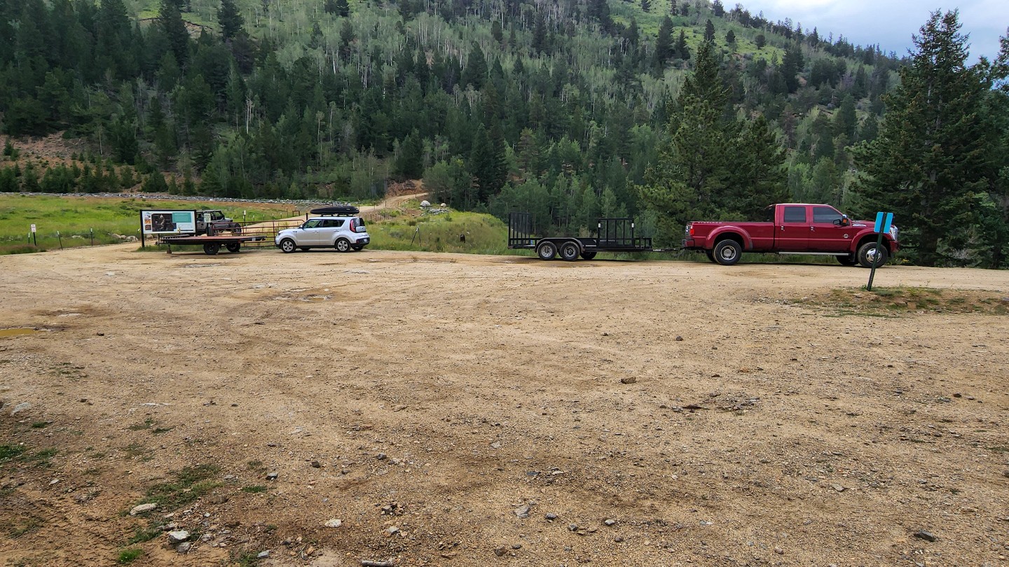
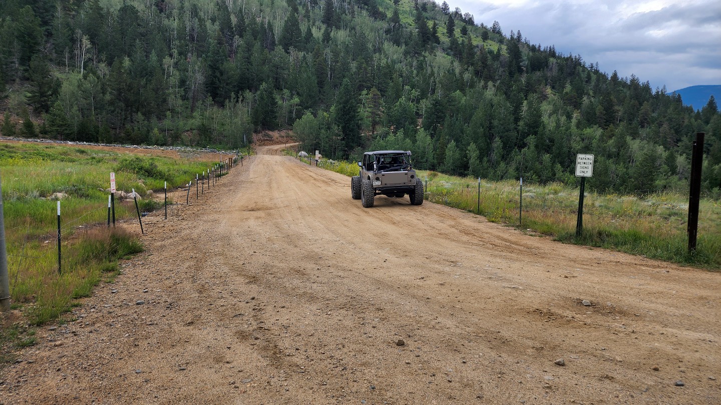
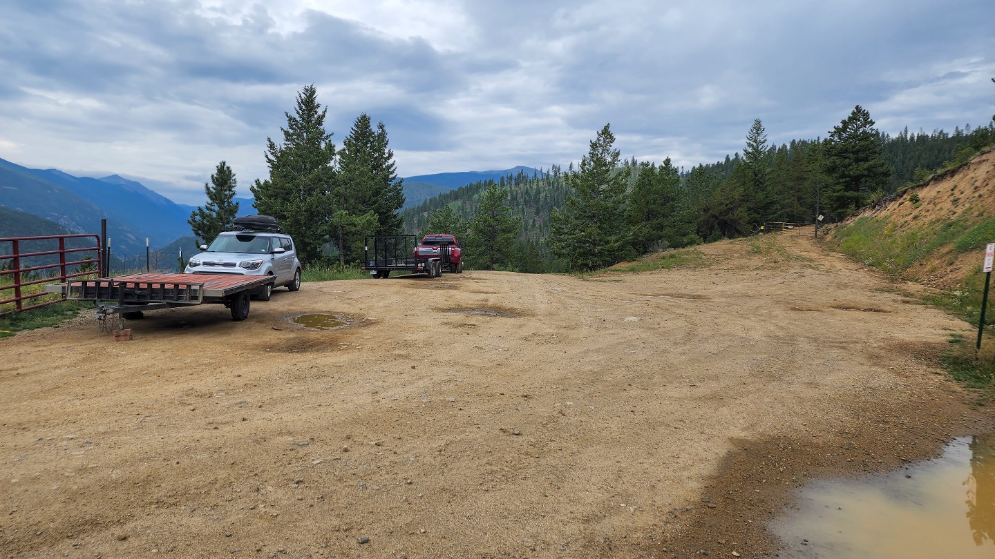
There is a small staging area for the trail, which is good for only a few trailers. Parking is only allowed on the east side of the road, against the fence line. The west side of the road is private property and does not allow public parking. When airing down, it is best to form a single line against the fence to allow vehicles to pass. Head east and begin climbing right away.
2. Mine (0.86 mi)
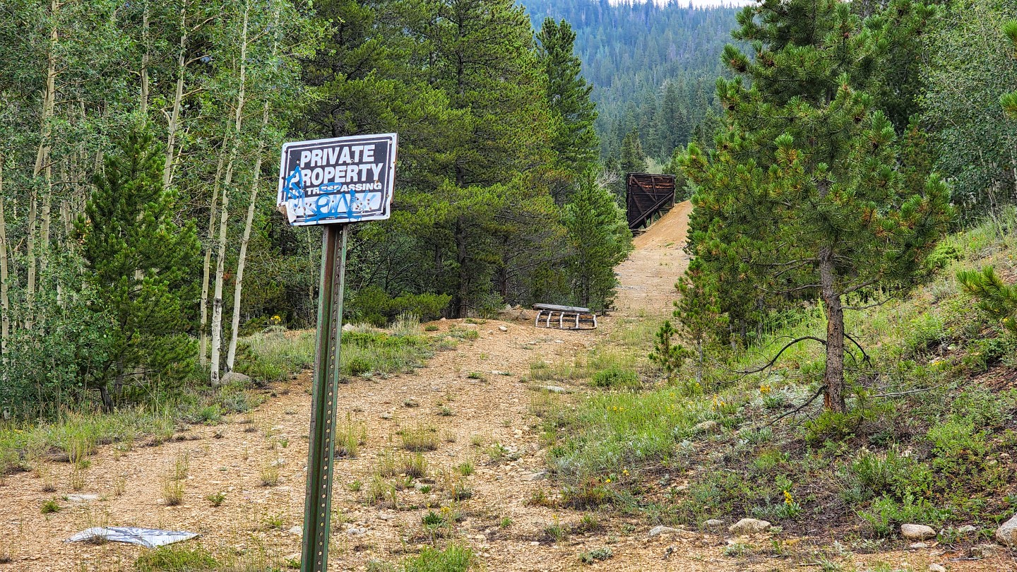
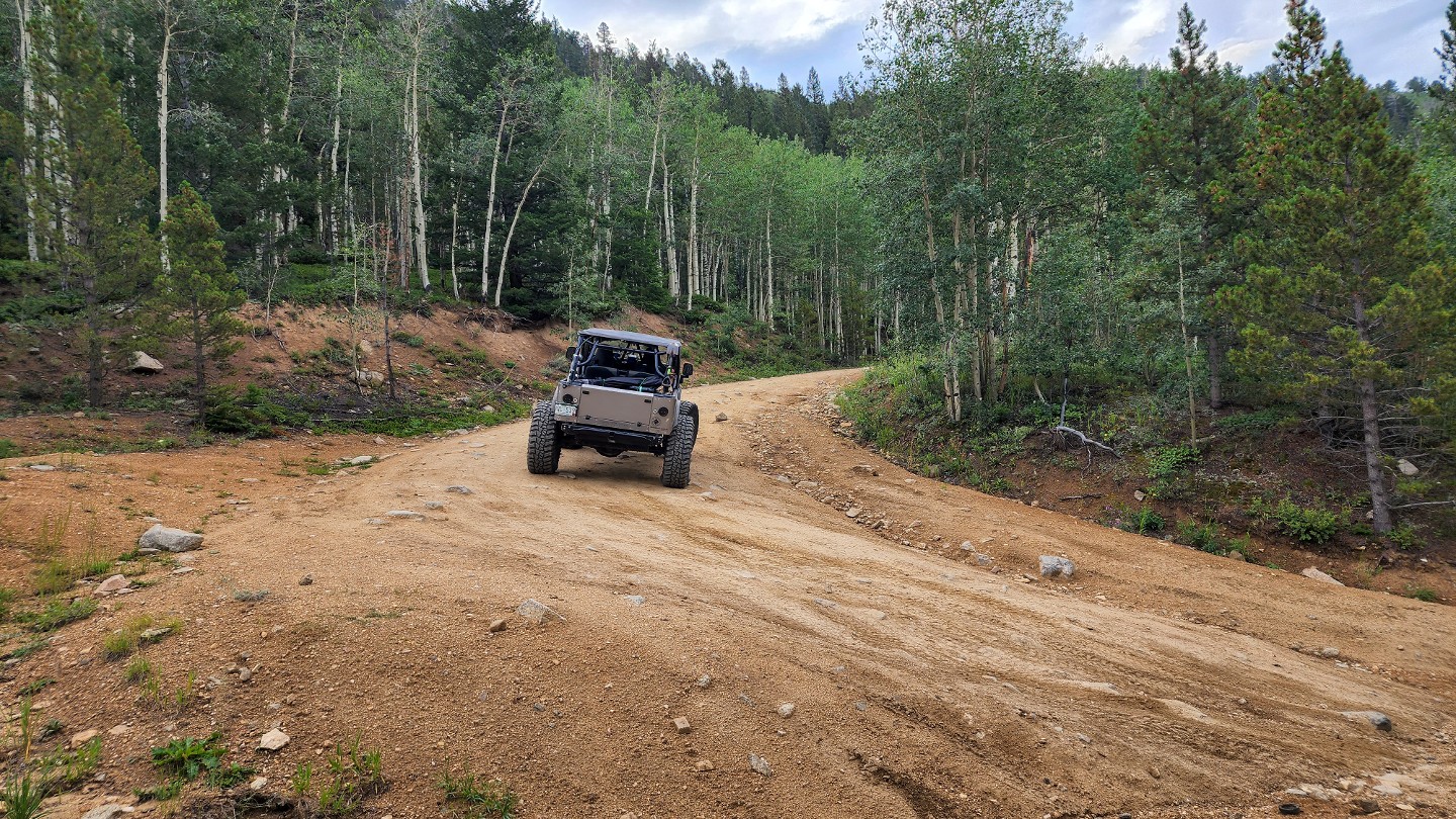
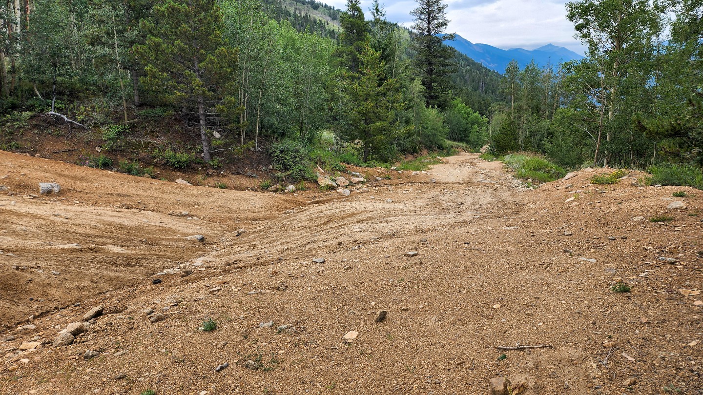
Be respectful of the private mining sites along the road. Keep your distance and only take photos. Follow the switchback uphill, where you will soon navigate a series of erosion ruts.
3. Erosion Ruts (0.94 mi)
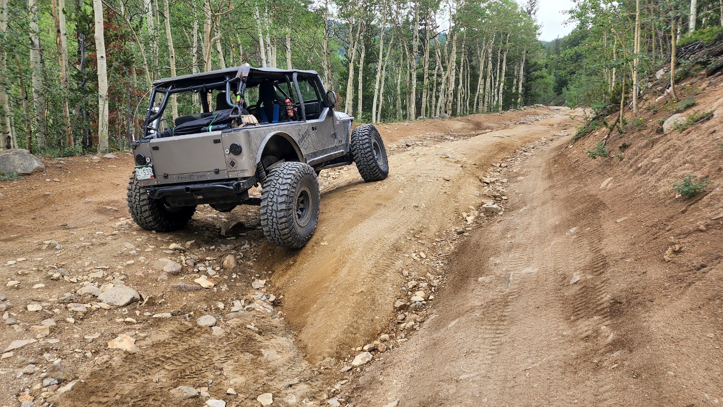
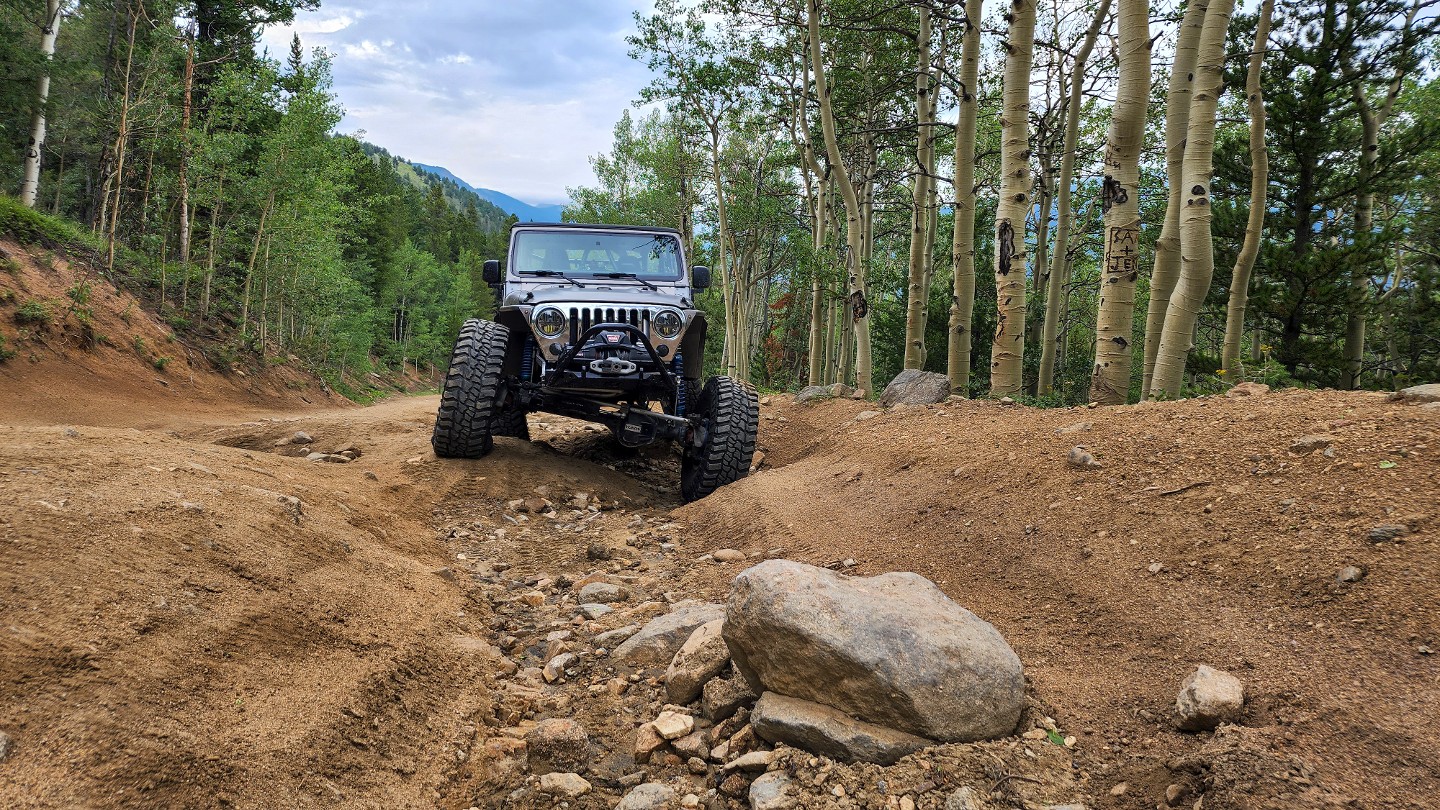
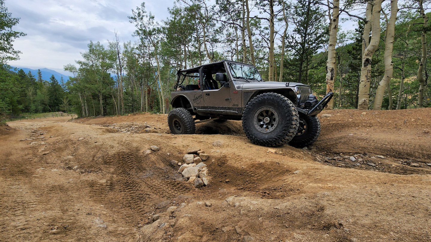
Pick your way through a long stretch of erosion ruts that snake along both sides of the road. Erosion has exposed many large rocks here and the next quarter mile will be extremely rough and bumpy.
4. Conqueror Mine (1.24 mi)
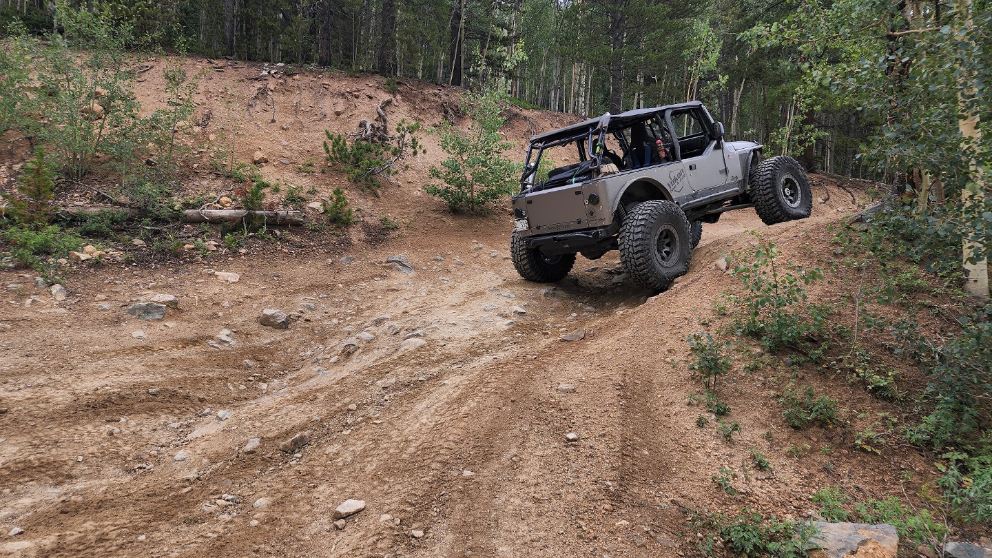
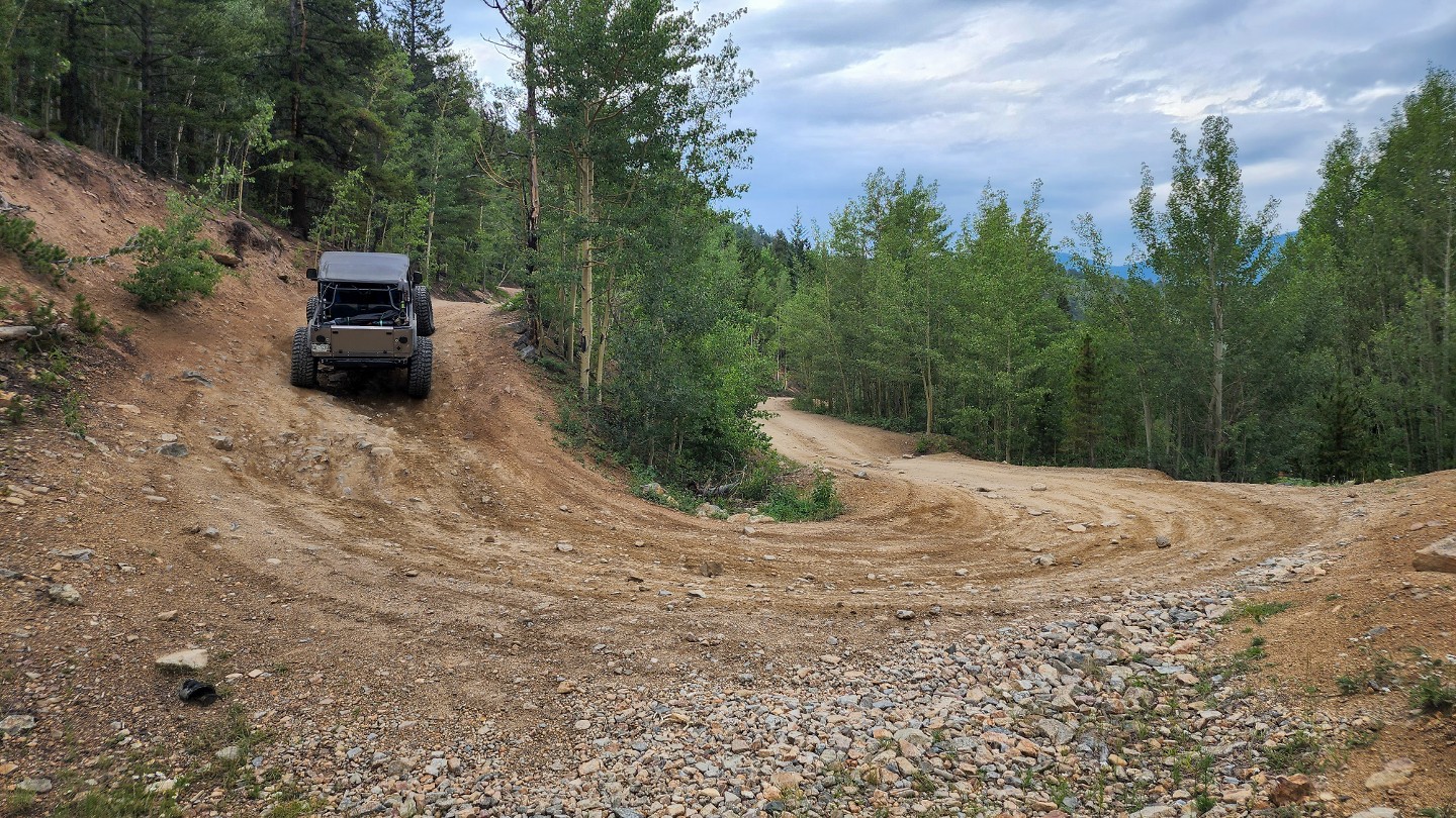
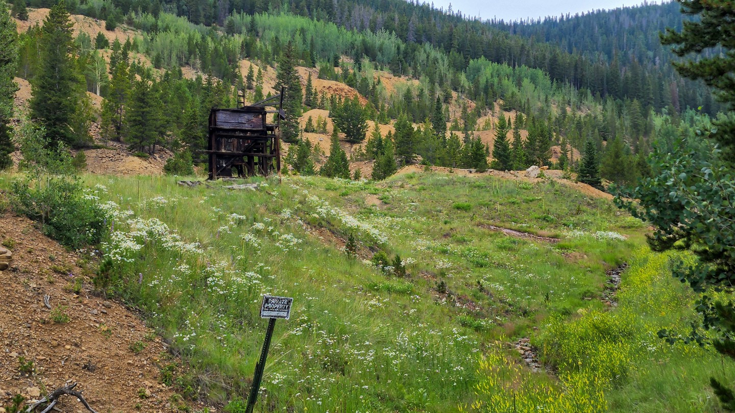
Follow the switch back uphill across a deep whoop-de-do. This spot will flex your suspension and damage low-hanging running boards.
The Conqueror Mine located in this switchback was an active gold mine back in the mid to late 1800s. Production from this mine helped establish the town of Empire.
5. The Chutes (1.52 mi)
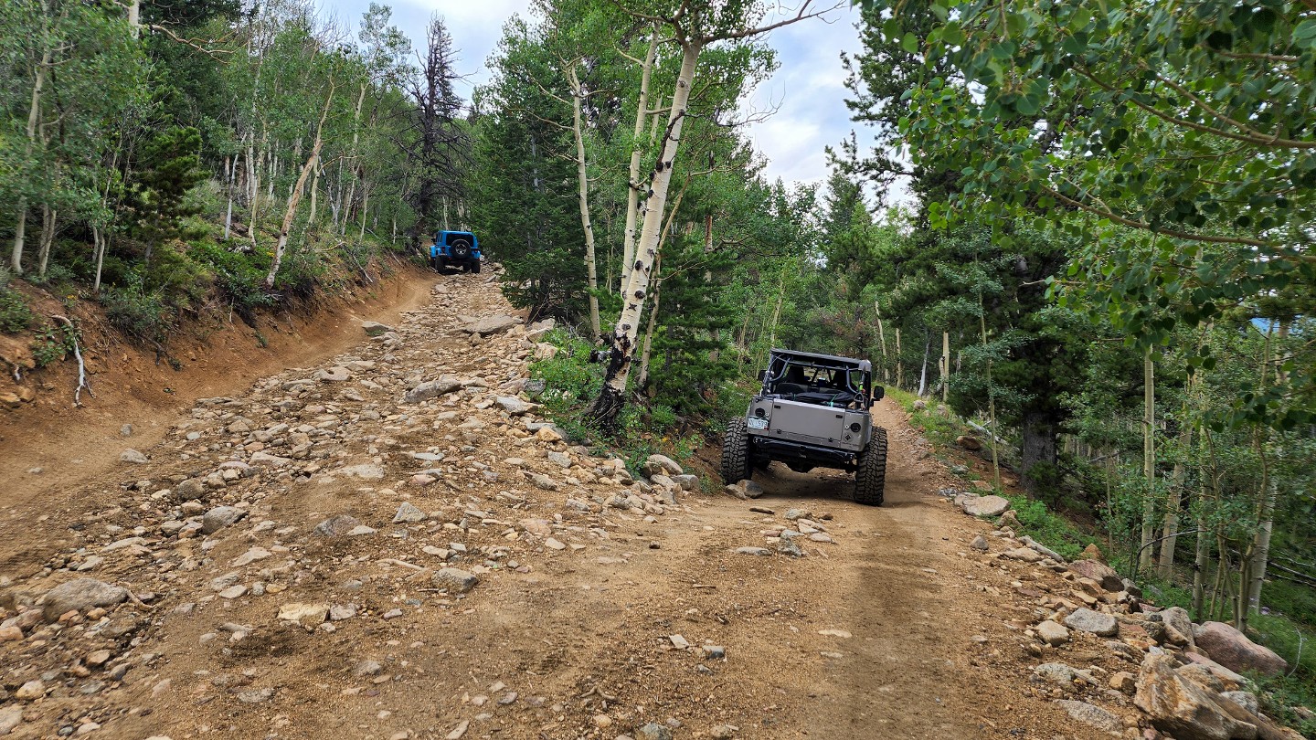
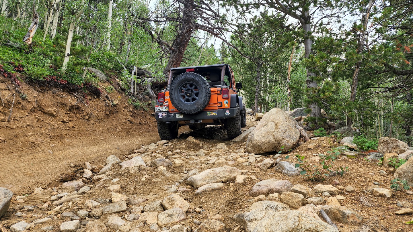
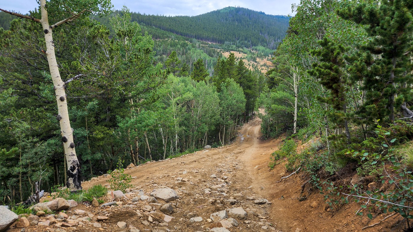
The trail comes to a y-intersection, with the main route staying right and a trail shortcut known as The Chutes on the left. The main route continues another two-tenths of a mile before hitting a switchback and cutting north. Be sure to watch for oncoming vehicles as there is little to no passing spots until you reach the next waypoint. The optional shortcut to the left is a more challenging route up a narrow and steep hill peppered with large rocks and small boulders. It reconnects with the main route at Waypoint 8.
6. Trail Split - Stay Right (1.83 mi)
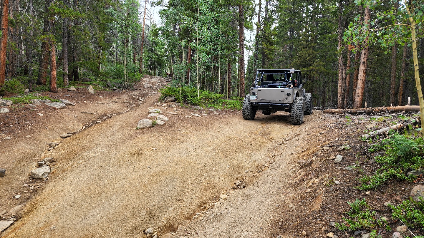
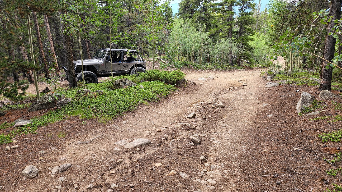
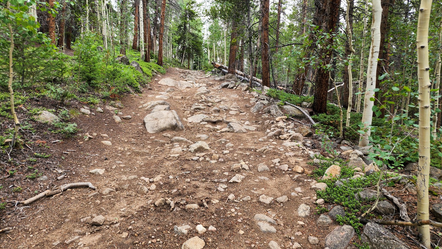
Shortly after the switchback, the trail makes another split. Both routes reconnect in a short distance. The lower route on the right is noted as the official route on county maps.
7. The Chutes Reconnect (2.01 mi)
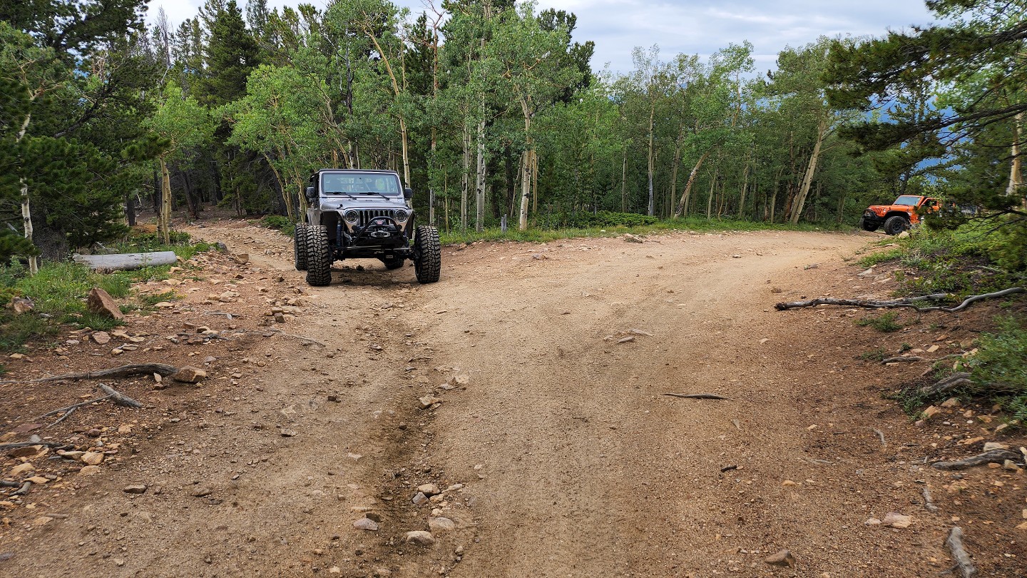
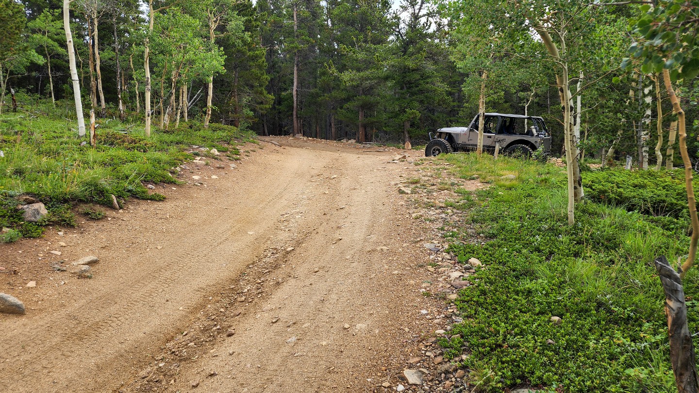
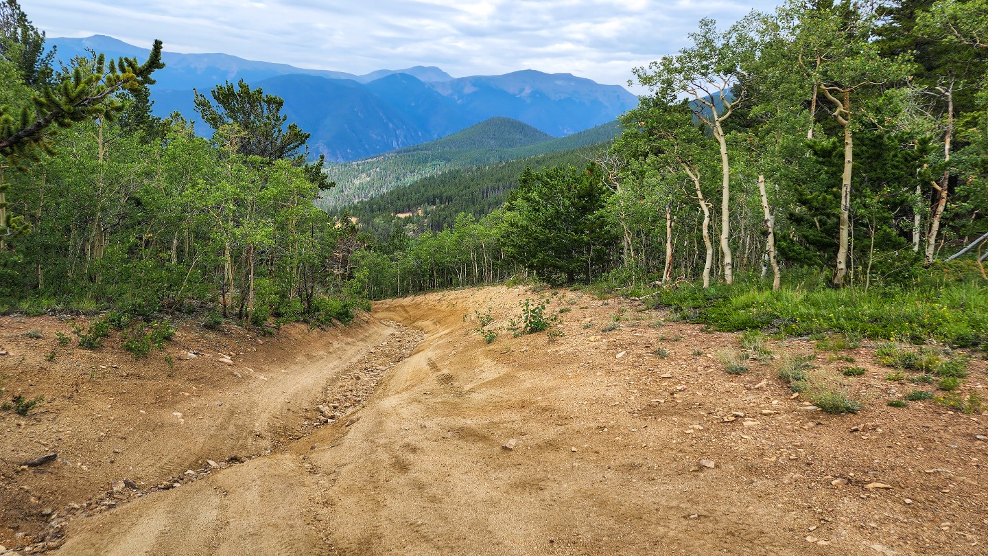
Continue heading north as The Chutes shortcut reconnects on the left.
8. 171.1 and 171.2A - Stay Left (2.07 mi)
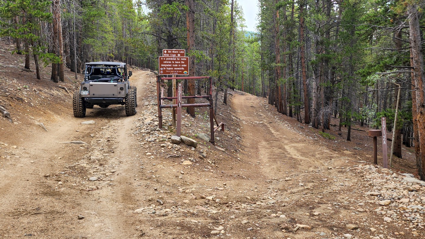
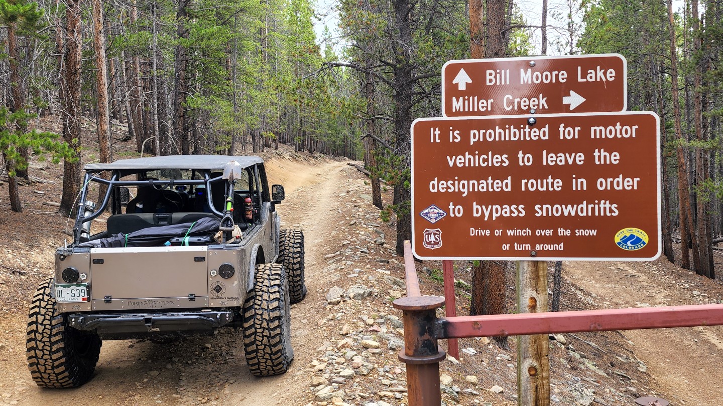
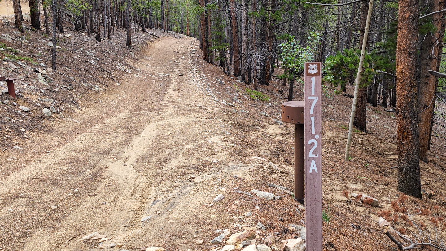
The road transitions from County to Forest Service here. Stay left on 171.1 and follow signs for Bill Moore Lake. 171.2A to the right, is a dead-end route down Miller Creek.
9. 183.1 and 171.1 - Stay Left (2.24 mi)
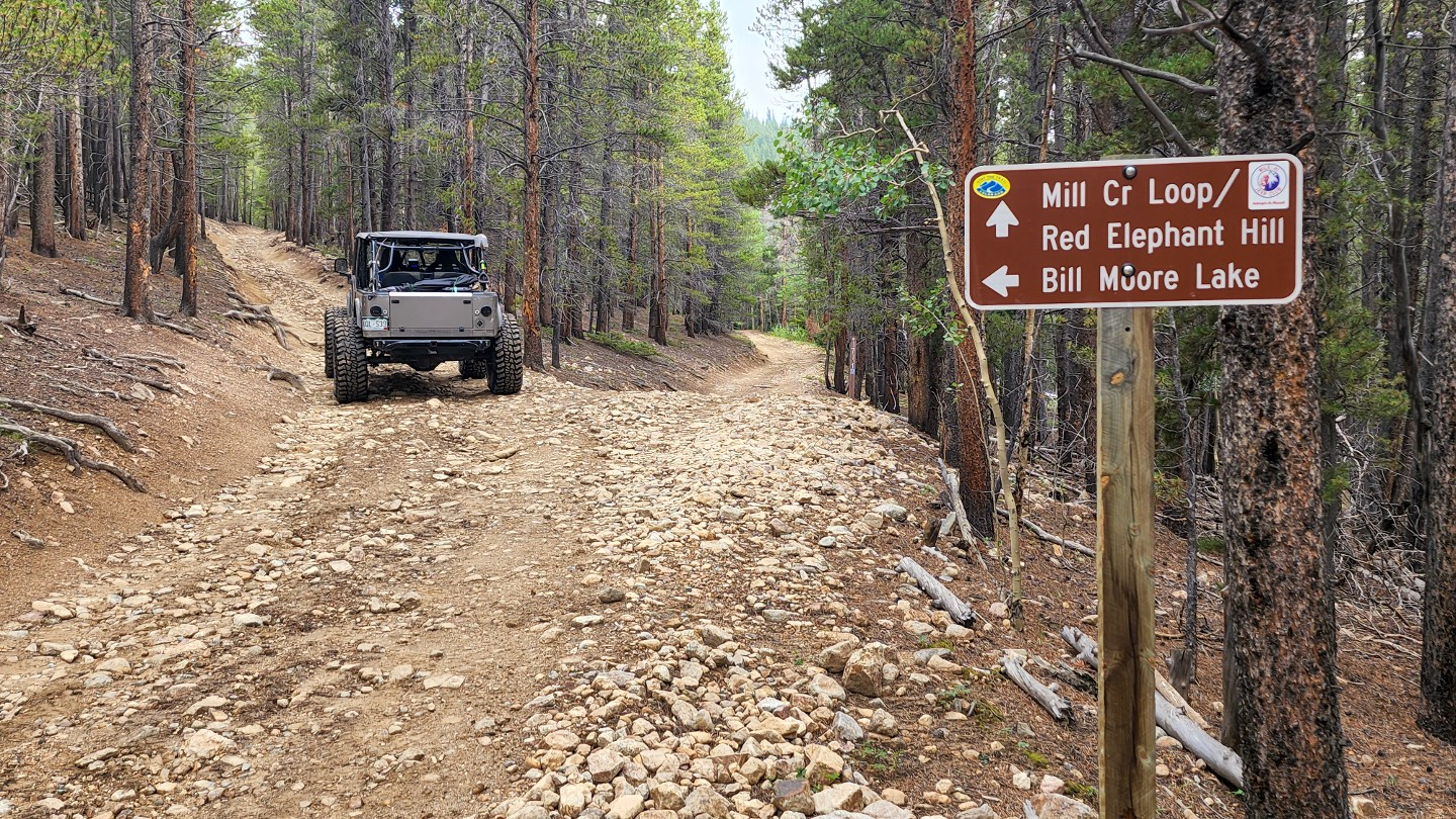
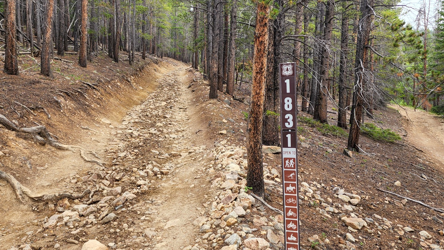
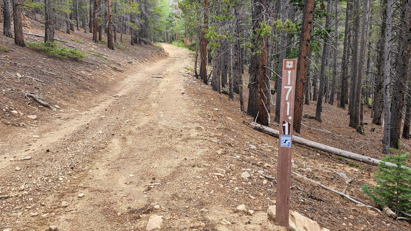
Stay left again on 183.1. Taking a right takes you to Red Elephant Hill and Mill Creek trails.
10. 171.3C - Stay Left (2.96 mi)
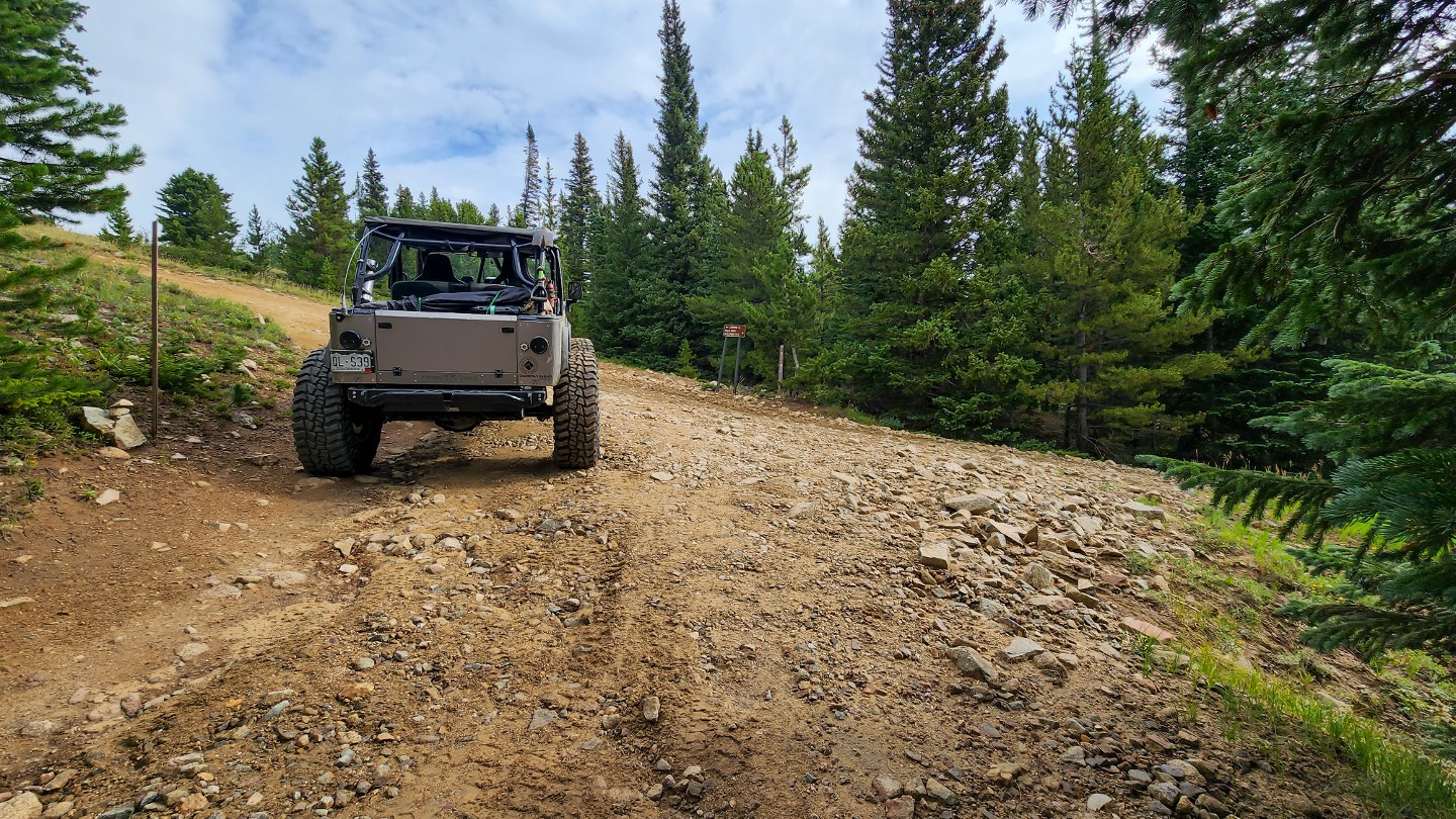
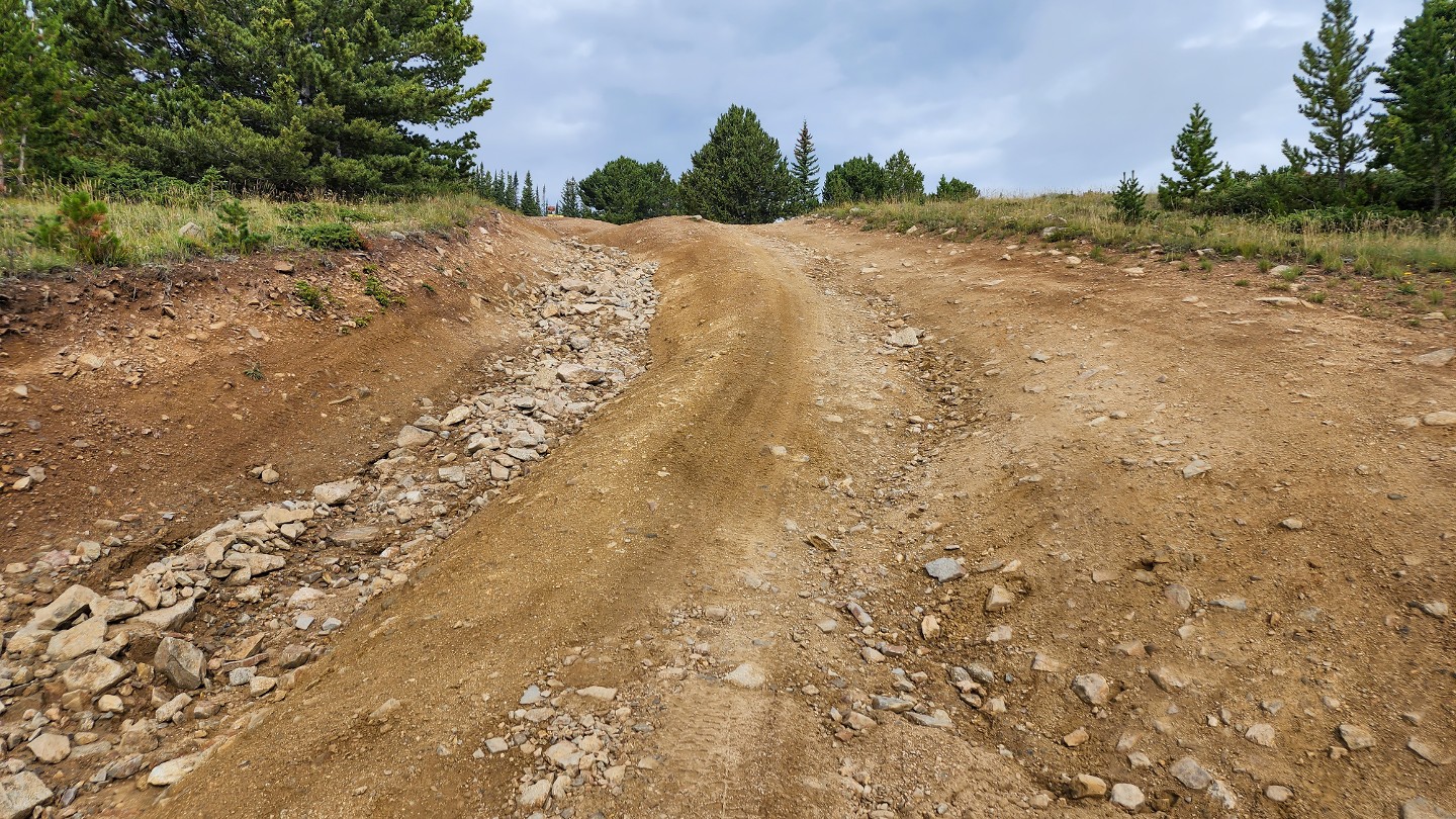
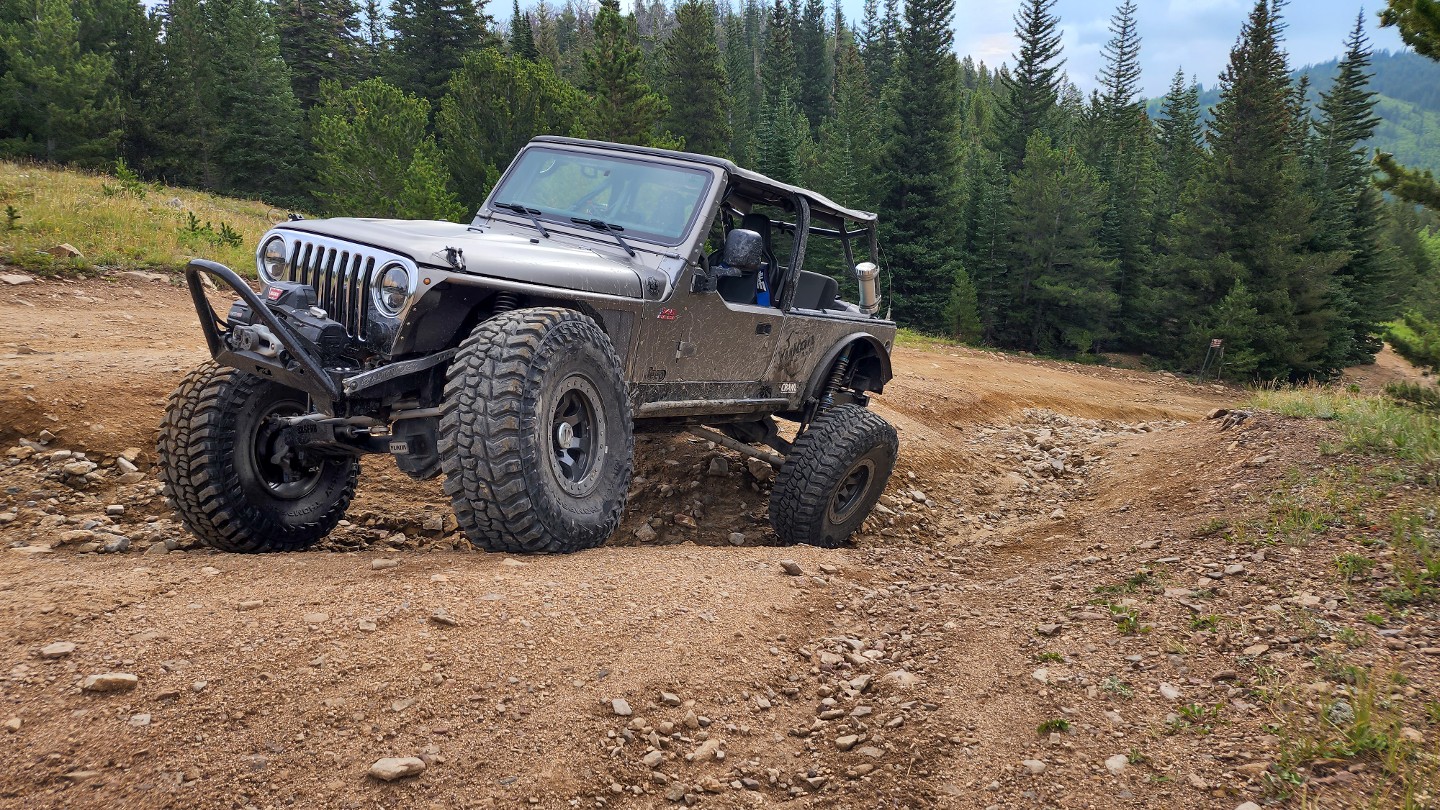
At the t-intersection, stay left and travel uphill through a deep erosion rut with multiple lines. 171.3C to the right will take you to Red Elephant Hill and Mill Creek.
11. 183.1A - Stay Left (3.01 mi)
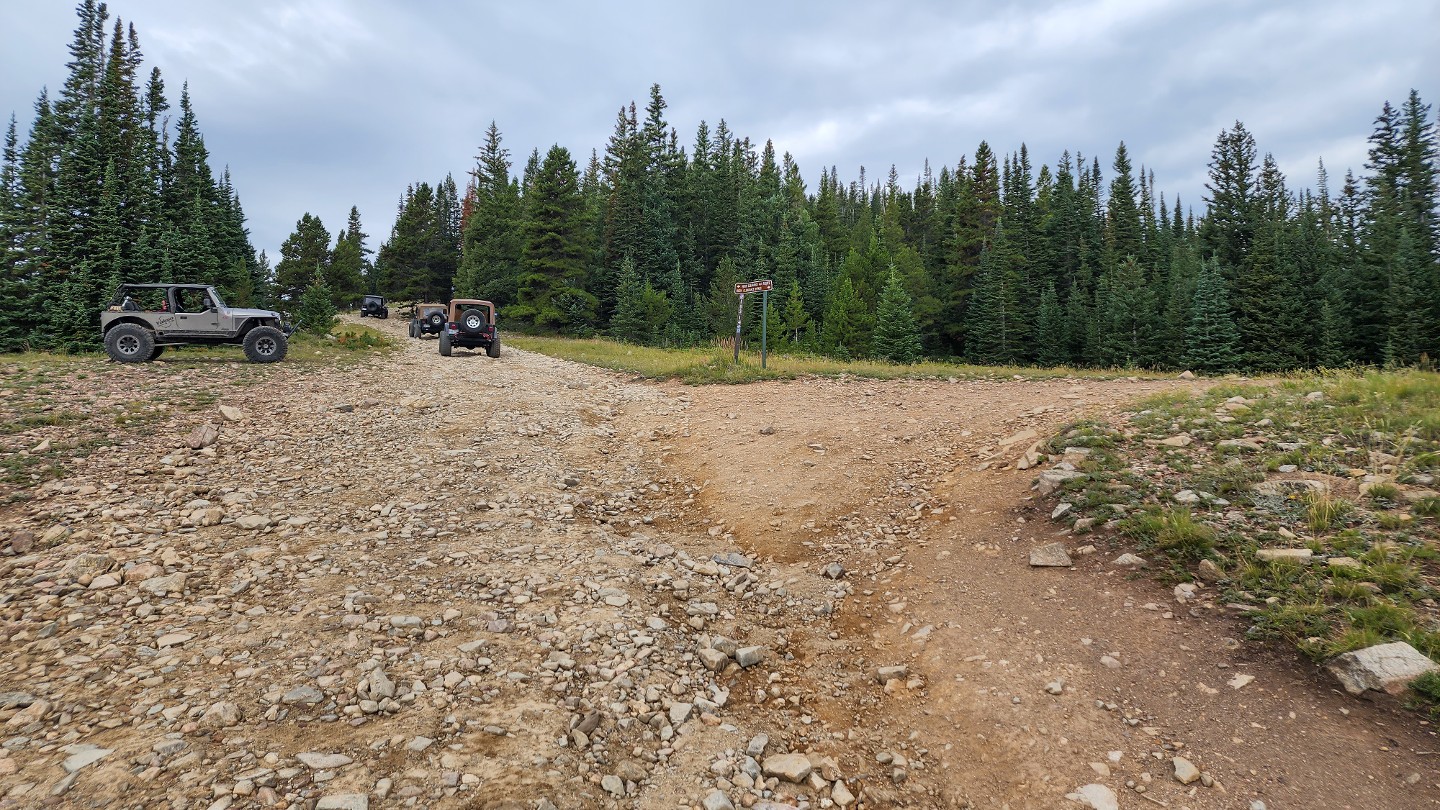
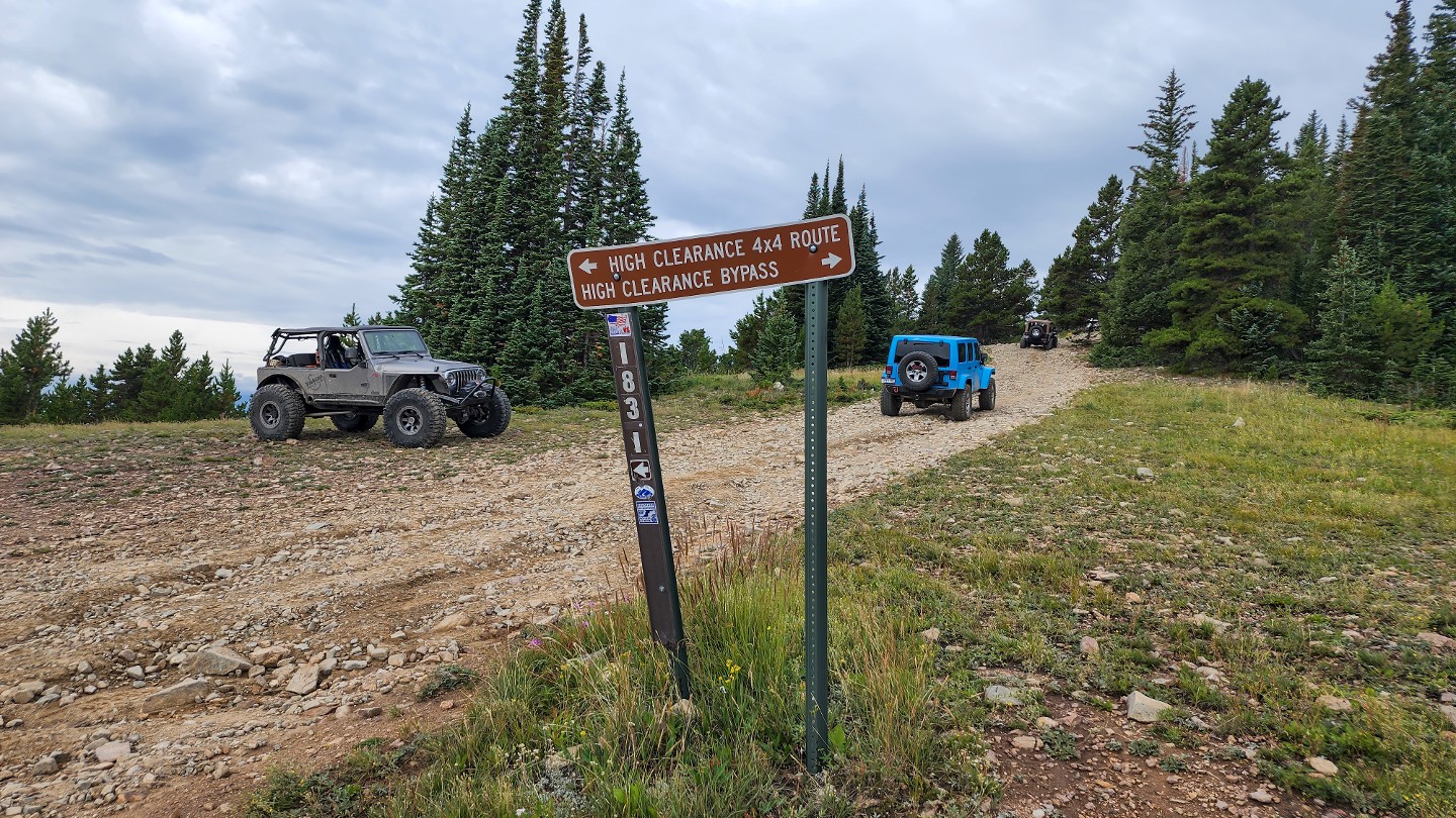
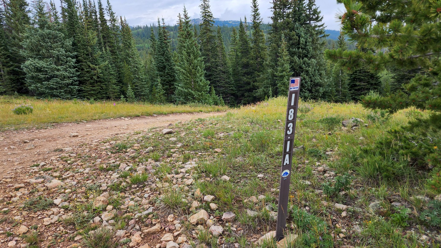
Stay left up the rocky hill. 183.1A is a short loop around the bottom of the hill ahead and reconnects at Waypoint 12. On the south side of the road is a small, rocky campsite good for a couple of vehicles and ground tents.
12. 183.1A Reconnect - Stay Left (3.22 mi)
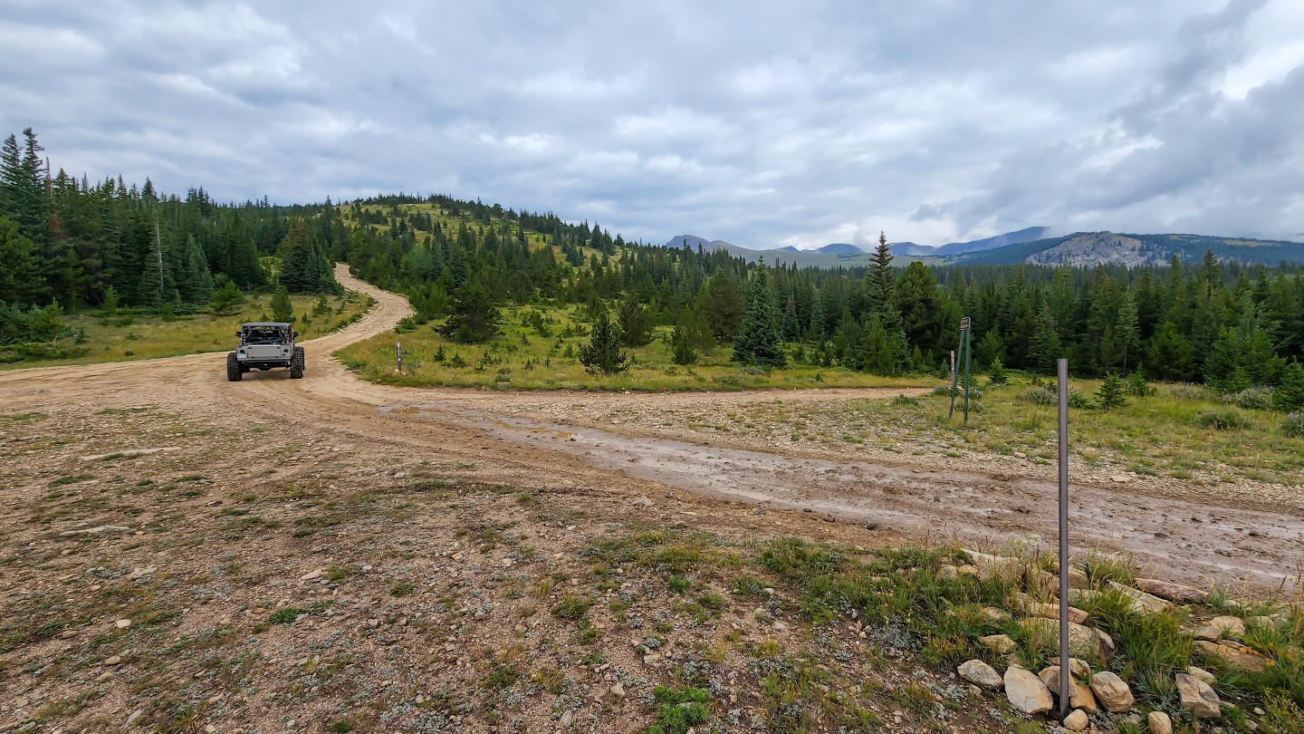
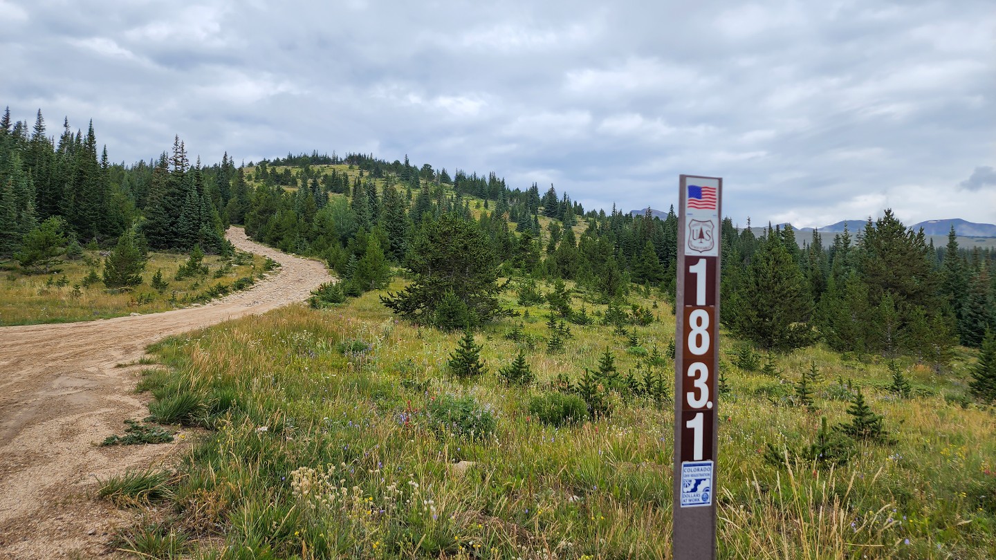
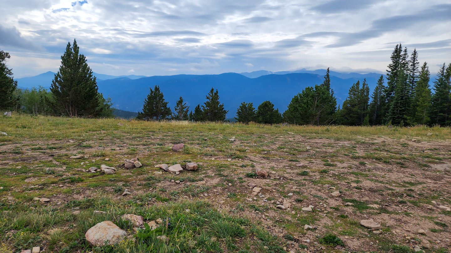
Stay straight as 183.1A reconnects from the north. The trail generally gets rougher and more challenging from this point forward, with several loose, rocky hill climbs. On the south side of the road is a large, open campsite with level but rocky ground, good for vehicle camping or ground tents.
13. 183.1C - Stay Left (3.57 mi)
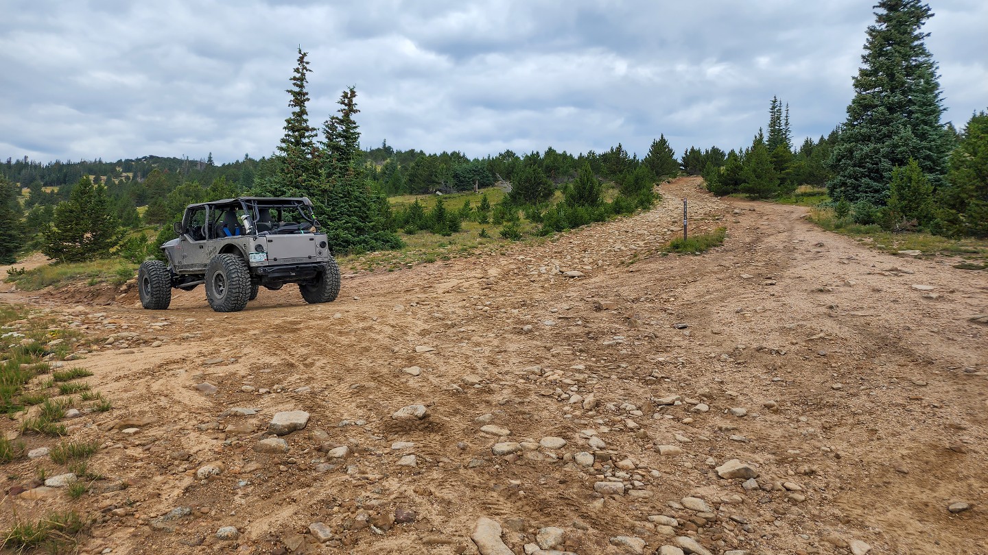
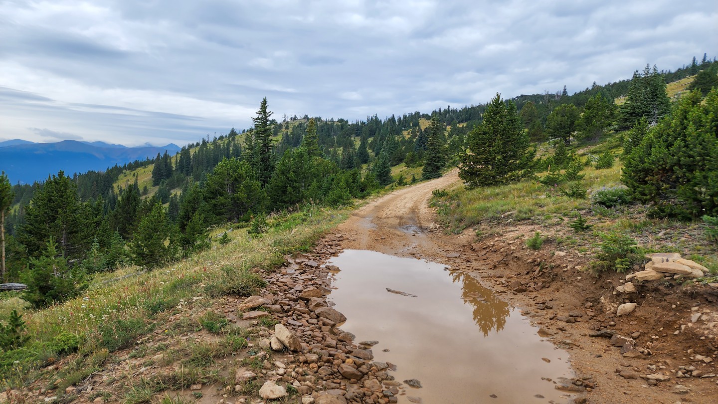
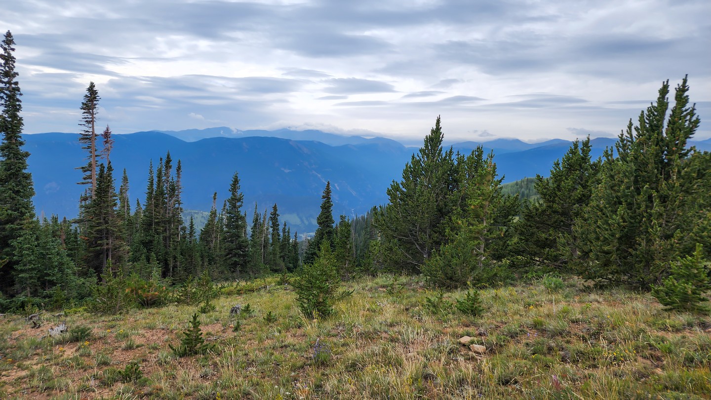
Stay left at 183.1C along the lower road. 183.1C goes to some campsites and dead ends.
14. Rocky Hill (3.81 mi)
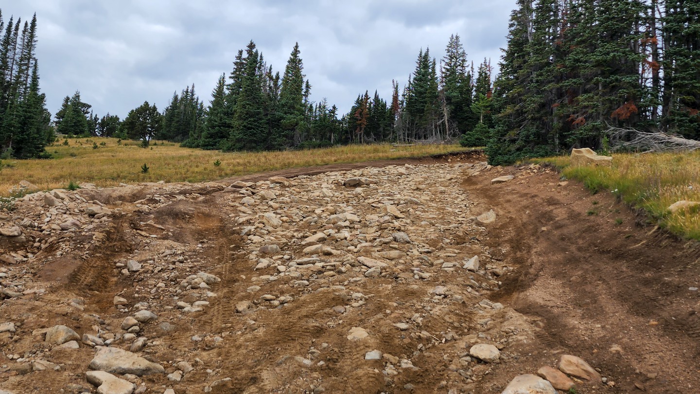
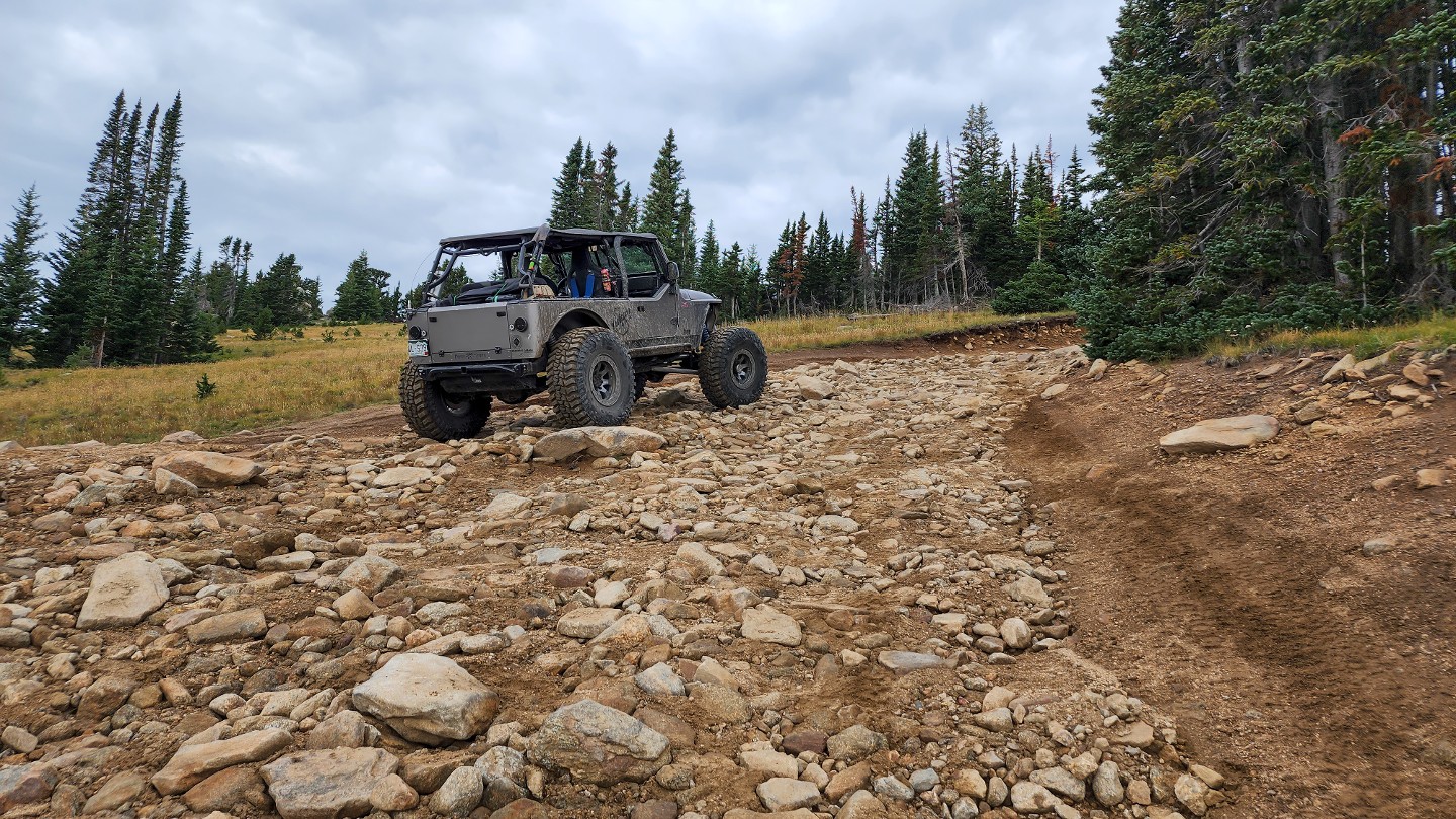
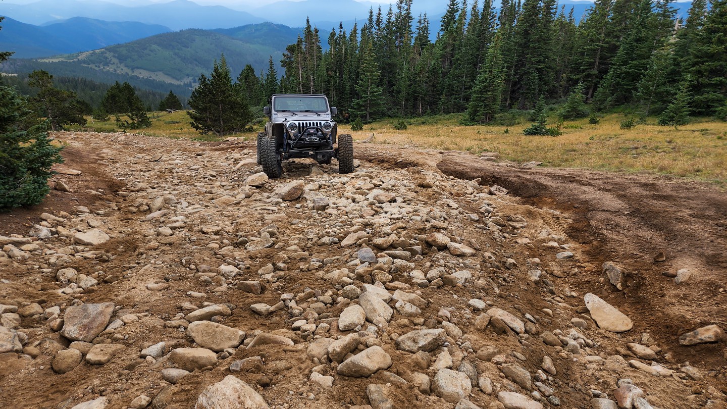
Climb this rocky, loose hill with multiple lines. Do your best to stay in the middle of the trail on the rocks and avoid riding the edges of the trail, as doing so widens the trail and creates trail braiding and resource damage.
15. 183.1L - Stay Right (4.25 mi)
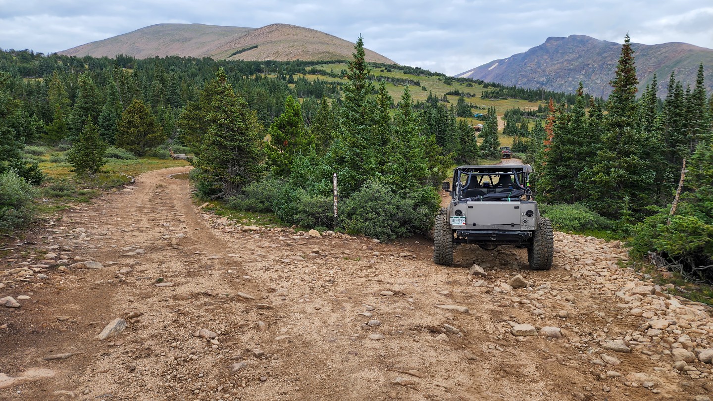
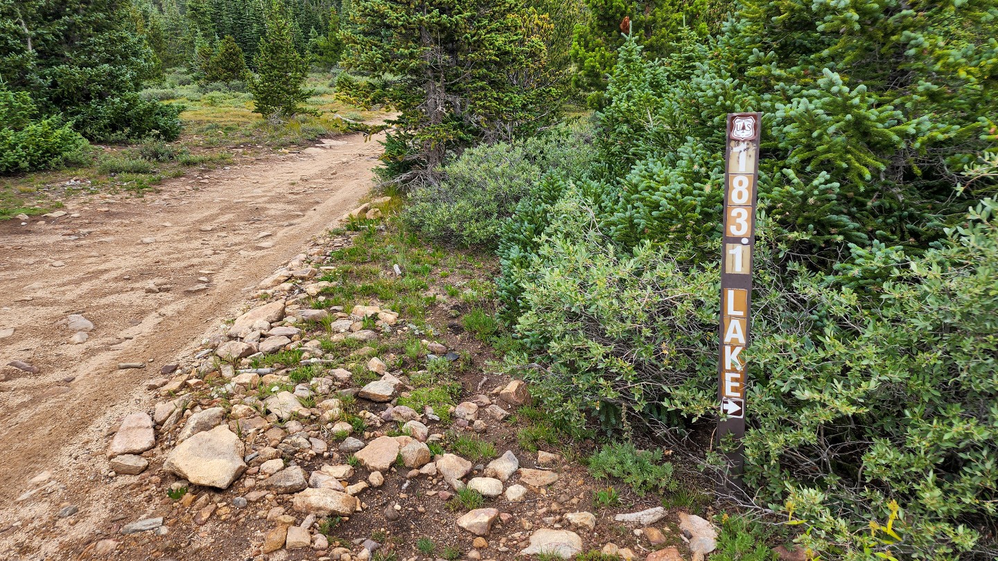
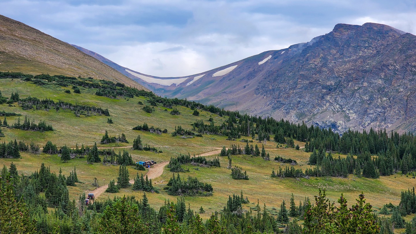
Stay right, dropping down the hill. To the left, USFS MVUM maps show the road as 183.1D, but signage shows it as 183.1L. It loops around past some dispersed campsites and reconnects at Waypoint 16.
16. 183.1L Reconnect - Stay Right (4.46 mi)
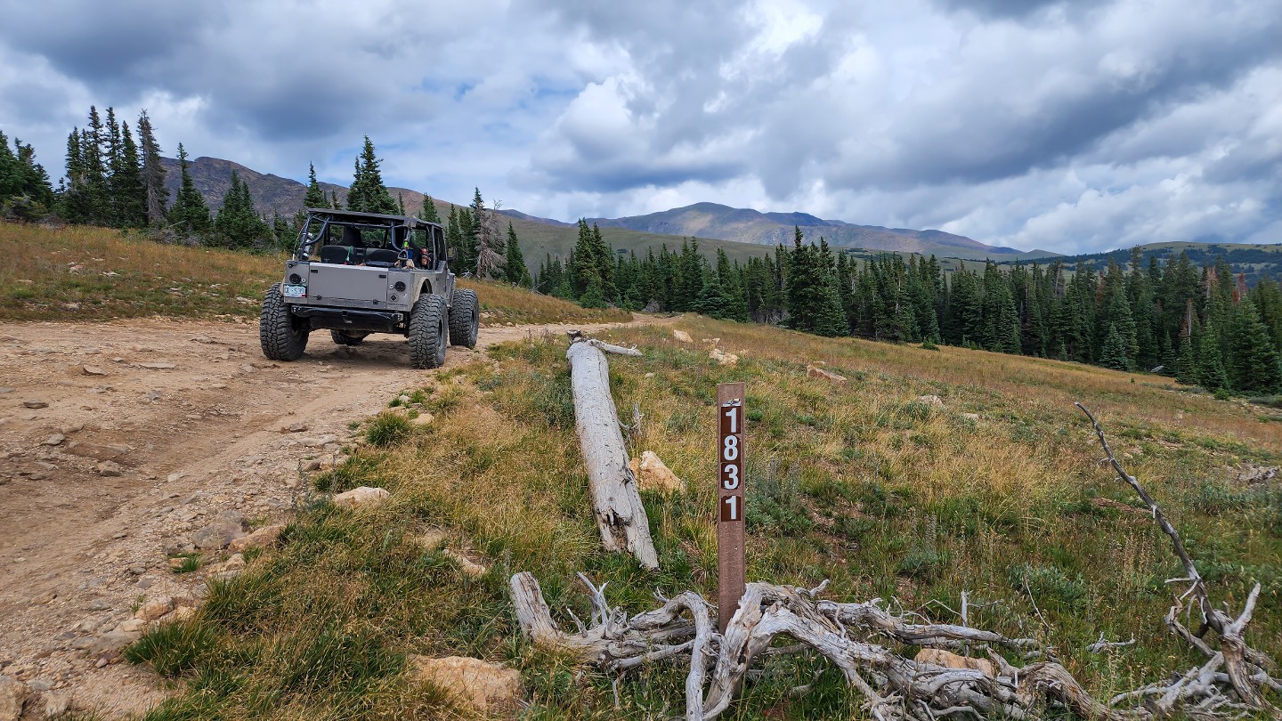
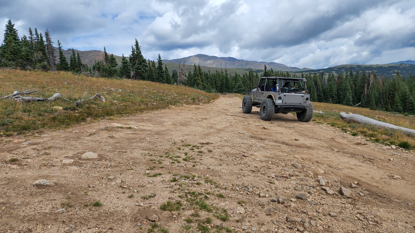
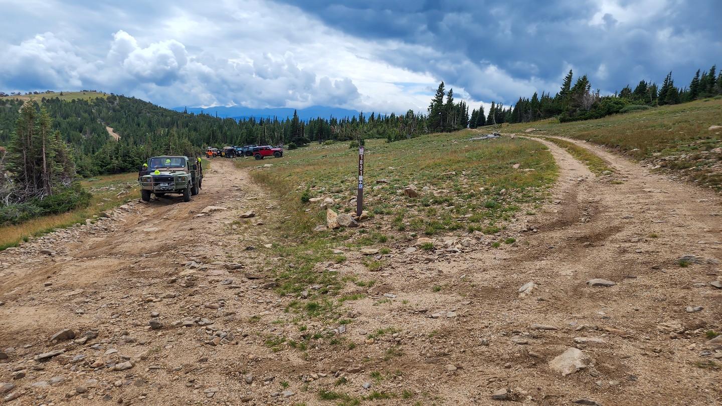
Stay right and travel into the trees. 183.1L reconnects on the left. Shortly after this intersection, the trail will descend into the Bill Moore Lake area. It will get narrow and slightly more challenging with few passing spots. Take caution to mind oncoming uphill trail traffic, which would have the right of way.
17. Mud Bog Repair / Lingering Snow (5.03 mi)
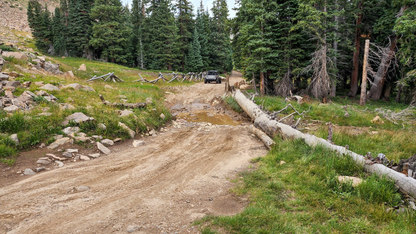
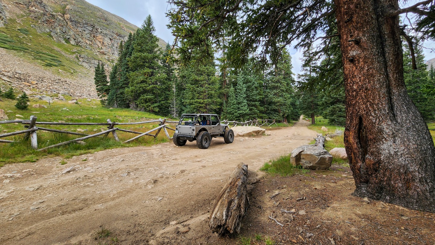
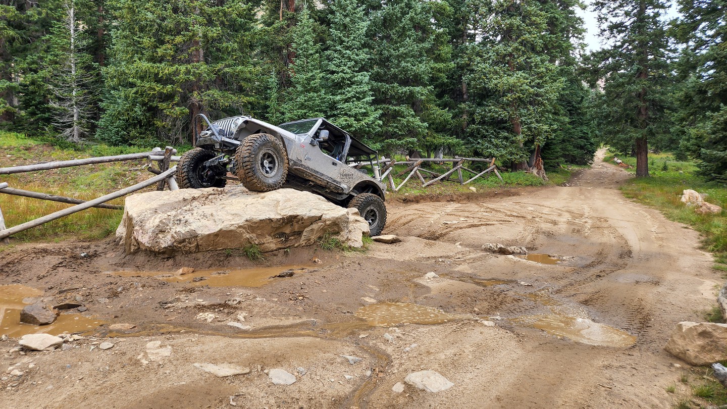
At the bottom of a steep descent, the trail levels out and comes to a brief clearing as you pass an old mud bog repair area. Snow can linger in this low point until mid-June keeping the ground soggy and making lake access impossible. Do not bypass any snow drifts blocking the trail. If you cannot drive through the drift, winch, or turn around. On the opposite side of the clearing is a large boulder that can be used as a winch point or as a fun "poser" obstacle.
18. Trail Ends - Bill Moore Lake (5.28 mi)
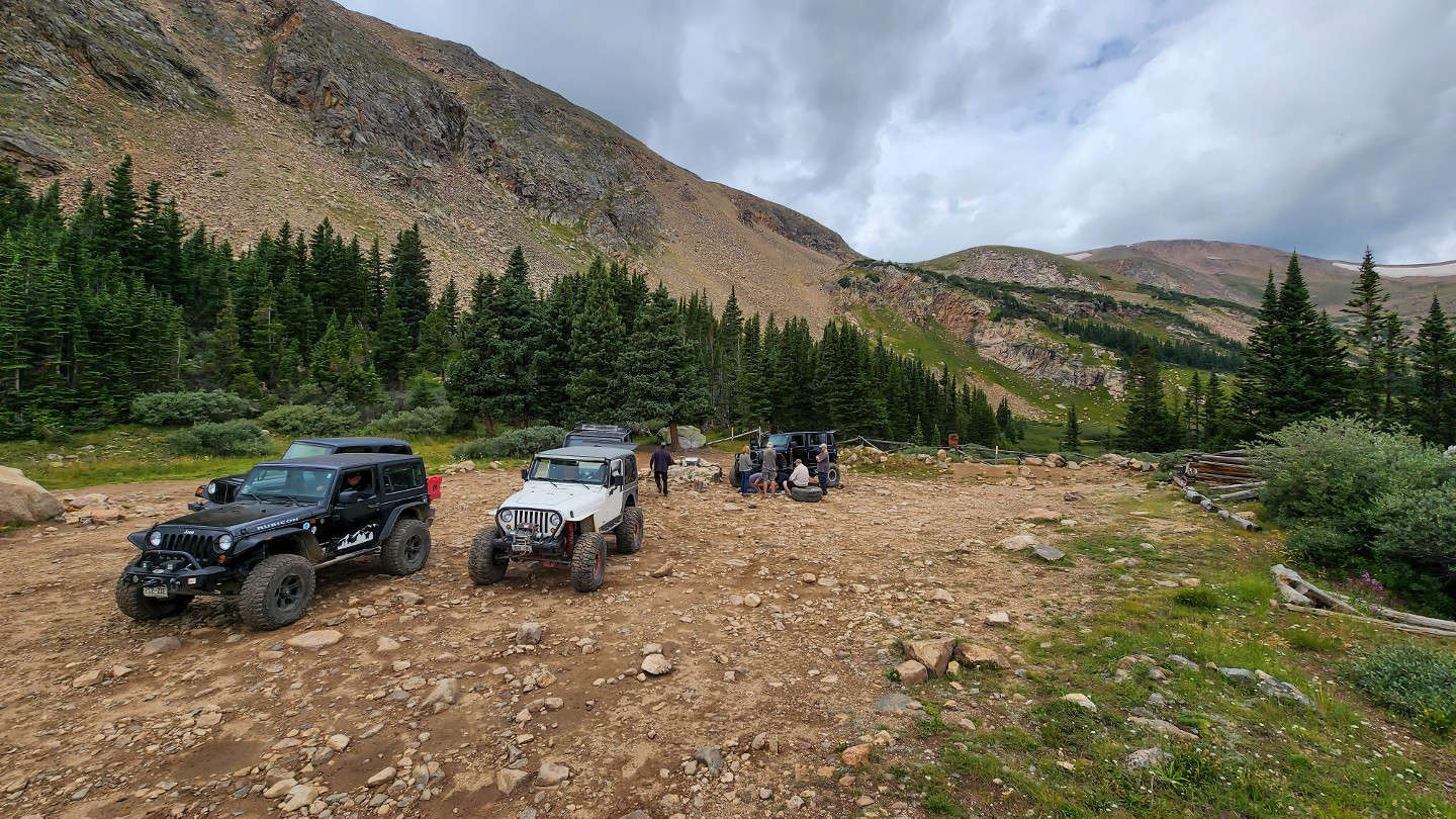
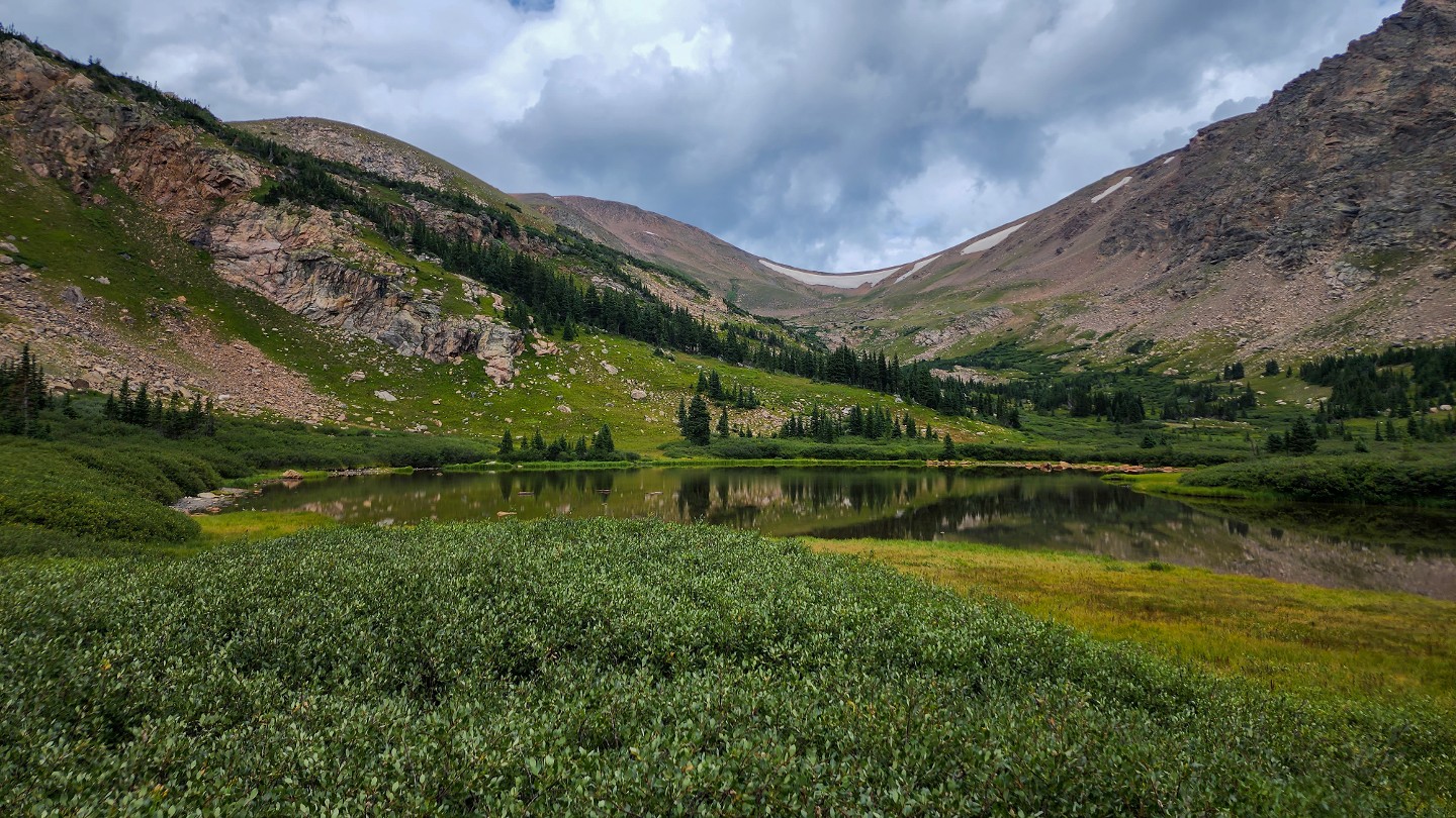
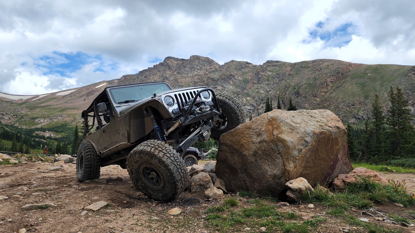
The trail ends at a large parking area a few hundred yards from Bill Moore Lake. A few small dispersed camping spots can be found around the parking area ideal for a vehicle, ground, or hammock camping. Surrounded on three sides by nearly sheer cliffs, Bill Moore Lake is framed by Breckenridge Peak to the southwest at 12,889 feet and Witter Peak to the north at 12,884 feet. There are remains of an old cabin within the parking area. Be courteous and leave everything cleaner than when you found it. Don't forget to grab a picture on the extremely popular posing rock.
Dispersed
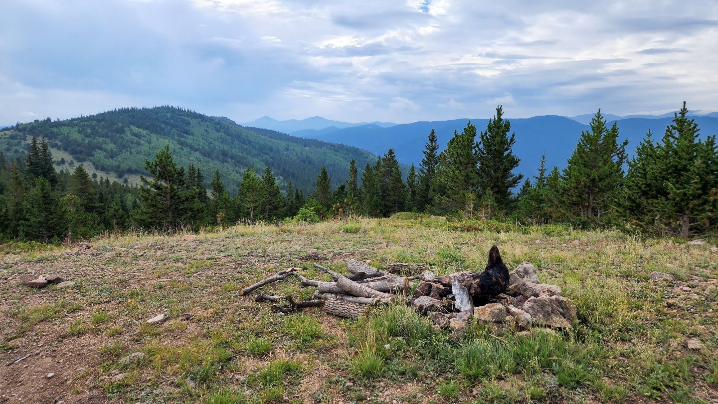
There is dispersed camping along the trail after waypoint 10 along the trail. There is also one or two secluded areas at the end of 183.1C and a couple at Bill Moore Lake.
Starting Point
Denver
Take I-70 west to Highway 40. Go north to the town of Empire. Turn right on Main (this intersection does not have a street light). Travel approximately 1 mile just after turning on Main to the air down area.
Trail Reviews
4.6/5 (95)
Open
Rated
5/5
Visited: 10/23/2022
Difficulty Accuracy:
Harder
Amazing trail but much closer to a 5 at this point. Super gnarly and off camber now. Didn't run it all the way to the lake because the snow was starting to pile up. You'd probably be fine with lockers but my TJ and friends XJ was struggling.
Open
Rated
5/5
Visited: 10/12/2022
Difficulty Accuracy:
Spot On
It's been ten years since we last ran this trail-until today. The conditions sure have changed since then, with some spots a bit rougher than I remember. Still a great trail with beauty all around. And no one else was up there!!!!!! Awesome.
Open
Rated
4/5
Visited: 09/21/2022
Difficulty Accuracy:
Spot On
Tried this last year as a novice in a stock Xterra, turned around between 5-6 as I was alone and concerned about clearance. Returned this year with a lift, 33’s and more experienced, no issues. It is a rock pile of trail, you should have solid off road tires. Also I didn’t see anyone all day, it could be long hike if you need help. Nice views and the lake is beautiful. I would say the current 4-5 rating is accurate, if you have smallish tires like me be prepared for a long bumpy ride.
Open
Visited: 09/17/2022
Difficulty Accuracy:
Harder
The trail rating for this felt like a solid 5 overall. As noted by other reviews the Whoopdie Doo #2 is getting pretty beat up. From checkpoint 17 onto the lake, it is narrow with steep sections. Traffic was light for us and we found one of the only spots to pull to the side to let 6 side-by-side go by heading uphill. Which were the most vehicles we had passed all day. This was my first time running this trail and I found it was just what we needed for a day out on a trail.
Open
Rated
5/5
Visited: 09/17/2022
Difficulty Accuracy:
Spot On
The more difficult rating for Bill Moore is most certainly justified. Whoopdie Doo #2 is a much bigger challenge than in the past. The switch back just afterwards is also a challenge. Be careful and choose your line carefully. A new Frontier Pro 4 was able to make it in and out without issue, so it can be done by most 4x4s with good tires.
Once you get to the lake, boy oh boy are you in for a treat. The lake is absolutely beautiful. Fun times!
Open
Rated
5/5
Visited: 09/04/2022
Difficulty Accuracy:
Harder
First time running the trail, found it harder than description and ratings from a intermediate driver point of view. In regards to the rating, this is in comparison to other ratings in the area (i.e., McClellan at a 4, though I get the point about the off-camber switchbacks). I would not enjoy doing this in a stock vehicle, unless I did not own it and was not responsible for any damage! I believe it is possible for the right driver (experienced or intermediate with confidence) and the right "stock" vehicle (Toyota, Jeep, Nissan with upgraded packages).
Notable rutting and erosion requires good knowledge of how to choose your line, where to place your tires, and awareness of your clearance. These are my primary reasons for feeling this is a bit under-rated when considering novice to intermediate drivers reading these reviews. Limited off-camber sections. Experience and confidence does mentally smooth out this trail. Definite air down trail, though I air down on most trails to smooth the ride for the passengers and to get that additional traction when needed. Trail is constantly rocky with limited smooth areas, so expect bouncing the whole way. Limited stops gets you uphill to the lake in 1.5 hours, downhill roughly 1 hour 15 minutes to the trailhead.
I run an 07 4 Runner Sport (V8), 2.5" lift, with 285/70/17 Wrangler DuraTrac's, and Billstein 5100's. I did not necessarily need the locker, but was glad to have the option as well as the minor upgrades to my clearance and travel. The stock low gearing was also nice to have.
SIDE NOTE: Fishing appeared to be limited and lake filled with sediment limiting the depth and creating the inability to float any craft (tried paddle boarding, no-go).
This trail guide's difficulty was changed on
07/04/2022
Open
Rated
4/5
Visited: 07/04/2022
Difficulty Accuracy:
Harder
The route up was quite harder than expected. Not a problem for me but the Cherokee trailhawk was probably near its limit though with some good spotting was fine.
Got really busy around noon and a broken Jeep caused about an hour delay trying to organize 15 rigs to pass or move. We started around 9:30 and didn’t see anyone else until around 11.
Mosquitoes are relentless up top.
Very pretty though.
Open
Rated
5/5
Visited: 07/03/2022
Difficulty Accuracy:
Spot On
Awesome trail! Some beautiful scenery!
Nice trip up and back. Sun on the way up and rain coming down, but trail rode great.
Not a lot of congestion on the trail either. Fellow trailgoers we're respectful and knew trail etiquette. Huge bonus.
FYI: If you plan to go to the lake, make sure you have bug spray or clothes to cover your arms and legs. The mosquitos are brutal.
Open
Rated
5/5
Visited: 06/29/2022
Difficulty Accuracy:
Harder
I have done this trail many times in my Jeeps, over many different builds from stock to highly modified. Because of that, I think I underestimated this trail. ANd I possibly overestimated the offroad capabilities of my stock ram. I tried heading up Bill Moore yesterday and the washouts and exposed rocks up through the switchbacks worked the truck over bad. The switchback at wp5 is super dug out and had the truck just spinning two tires on the way up. I made it through, but had to use momentum and really scrapped the running boards. I made it just past The Chute where I continued to bang the running boards. Rather than risk rocker damage, I opted to turn around. When I had to negotiate the switchback again at wp5, the truck was teeter tottering on 2 wheels. Wish I has someone else there to take photos. I am sure a taller stock truck could negotiate the trail, but for mine, I'm gonna have to stick to smoother roads.
Partially Open
Rated
5/5
Visited: 12/08/2021
Difficulty Accuracy:
Spot On
This trail has degraded over the last year with a few more small obstacles that weren't there before, especially on the first part before you get to the Miller split. The trail is clear of snow / ice until about waypoint 11, where it turns into quite a lot of ice. It wasn't bad during the day but at night it turned into a sheet of ice. Turned around mid-way between WP 13 and WP 14 due to ice.
Partially Open
Visited: 12/06/2021
Difficulty Accuracy:
Spot On
Ran this on Saturday, made it to waypoint 17 before getting stuck in a snow drift and digging/winching out. Minimal snow but only got worse from there, impassable beyond that point.
* I lost a single black Maxtrax in the snow if someone happens to find it
Open
Rated
4/5
Visited: 10/25/2021
Difficulty Accuracy:
Harder
Ran today. Snow and ice melting, so really until there's another good storm it should be doable. The only tough spot in regards to snow was the hill on the way out.... If you don't have great tires/locker/winch you should think twice before heading down on the way to the lake. In just 4 low (no lockers on) and 35" m/t I spun on the way out. Had to back down (an icy hill) and lock and hit with more speed. Honestly more speed prolly would have been enough.
Anyhow, some of the washouts and switchback washouts on this trail are ferocious. Either other trails like Argentine and mount mcclellan aren't rated low enough or this one isn't high enough, in my opinion. The washouts are enough to have wheels in the air multiple times. That being said, the worst of them are at the beginning so if you make it past the switchbacks in the beginning you can make the whole thing.
Overall a good trail! Def a must do, just enough excitement!
Open
Visited: 10/23/2021
Difficulty Accuracy:
Spot On
Can confirm what Kyle below me has said. The last half mile or so is getting just icy enough that if you do not have a locker you will have trouble getting back up. The north to southeast aspects in the area are starting to hold snow/ice so caution is advised. I'm guessing this may have been the last weekend that last bit is manageable for stock and lightly built vehicles.
2nd Gen Xterra 2.5" lift/33's
Open
Visited: 10/17/2021
Difficulty Accuracy:
Spot On
There is ice on the trail about 0.5 mi out from the lake (after waypoint 16, see 2nd pic below) that apparently caused some problems for a group of 6 well-built rigs in front of me. After their warning, I turned around just before that area. Prior to that point, the recent snow(s) have just added some surface snow and mud on the trail, that didn't really cause problems other than a bit of slippage here and there.
Otherwise, the trail is a nice mix of whoops and rocks, just bummed I couldn't make it all the way to the lake.
2011 Nissan Frontier 4x4 SV w/ 2" lift.
Open
Visited: 10/14/2021
Difficulty Accuracy:
Spot On
19 4x4 Tundra w/rear"LSD", 2" spacer lift, 34" BFG ko2 aired down to 25psi. Trail was a lot of fun it had some challenging spots for a beginner like myself but overall, if you place your wheels right, you won't have any issues. We only made it to the 13th marker at the bypass. It was snowing pretty good and made the climb very slippery and it is very narrow. Did not want to risk damage from slipping. Ended up backing out of the bypass and turning around. Will be back in the summer!
Open
Rated
4/5
Visited: 09/12/2021
Difficulty Accuracy:
Spot On
Leaves are just starting to change along the trail! If you want to see some spectacular fall colors I’d do it soon!
As far as the trail goes, it was a very nice and decently easy trail (loose rocky patches in spots) that was surprisingly not busy for a Sunday!
Open
Rated
3/5
Visited: 08/07/2021
Ran trail out and back on 8/7/21. Trail had several small obstacles (washouts, boulder fields, standing water, and a couple 12" steps). Trail was not to busy early, but on way down we had lots of oncoming traffic. A few part of the trail are tight and tough to pass. The lake is a nice place to take a break and enjoy the views. If you are up to a hike, the CDT crosses the road near the end of the trail by lake and you can get a good hike to a 13er Mt. Flora Summit. Nice hike, but limited views because of smoke. DId not run any of the other nearby tails on way down because was alone by then. Will be back to play on the other trails.
Open
Rated
5/5
Visited: 07/17/2021
Ran this trail in my '14 JK, 2" lift came in handy in a few places, but didn't need my rock sliders or skid plates.
With all the rain recently, trail was slick and standing water in some places, but definitely passable with good line choices and patience! Really great trail start to end, was tough enough to keep me engaged, but also sections where passengers who are less experienced could drive without too much anxiety! Lake at the top is a great spot for lunch on the trail as well.
Open
Visited: 07/17/2021
Heads up about waypoint 1/air down-n-up area... there are numerous new 'No Parking' signs in this area. The only "legal" spot to park is between two signs on the right side (when driving in); you'll see them before you make the 90 degree right turn to start the trail. There is a local/downhill resident who harrassed our group because we weren't parked in the allowed area (there wasn't enough room available) while we aired up. He was taking pictures of license plates in his fit of anger. A matter of minutes after the harrasser left, an Empire city police officer showed up but only out of coincidence. He acknowledged we were not blocking the private driveway (on the far left where there is a gate), and we were being courteous by not clogging up the road (which is county and not city). He was there educating folks.
Impassable
Rated
4/5
Visited: 05/29/2021
Made it just past WP #11, to 39.786095,-105.678299. Impassible snow drifts. I busted through 4-5 of them solo on a stock quad before giving up since they stretched as far up the trail as I could see. The initial "gatekeeping" parts of the trail have gotten rougher in the last couple of years from erosion. I used to take my long bed F-150 up without incident, but I don't think I'd risk anything with a lengthy wheelbase with the current conditions of deep off-camber washouts. There was a convoy of Jeeps on 40-42"s unloading when I got back to my truck that likely could've plowed through with caution, so there may be ruts all the way up now. There were some wide single tracks (adventure bike/enduro, narrower than a Rokon) on the downhill exposed side that got quite a bit further than I did. I'm speculating with some snow coming in tomorrow night that it'll be a couple more weeks before it's feasible to make it all the way to the lake.
Open
Visited: 11/10/2020
Stage 3 fire restrictions have been lifted as of 6am, 11/10/20. The forest is no longer fully closed. Areas within fire perimeters remain closed. See closure maps here: https://www.fs.usda.gov/detail/arp/news-events/?cid=FSEPRD844558
Expect winter conditions on trails. Some trails may be impassable due to snow.
Open
Rated
5/5
Visited: 09/06/2020
Awesome drive! Sad to see the lake seem to be so low. Beautiful area to go and drive to. Some tricky obstacles that rain seems to have increased near the start. But not too bad for a Nissan Frontier on a 2" lift with a bigger tire! Would definitely camp near the end and totally would bring some friends!!
Open
Visited: 08/30/2020
Awesome trail! Quite a few great spots to test your flex! Locking rear diff helped a lot but may not be absolutely necessary with the right line. The hill back up out from the lake is loose and steep.
We took our inflatable kayaks but it was way too cold and windy. What were we thinking!
Nissan Xterra PRO-4X with 3" lift.
Open
Rated
5/5
Visited: 08/01/2020
Great trail! Some good terrain challenges in the beginning (checkpoint 2) and after the bypass (checkpoint 13). Went on a weekend and it wasn't that busy, with a fair share of stock Jeeps and Tacoma's making it through. Could tell there were some who were new to 4x4 taking the trail, so be on the lookout for those who may need an assist in navigating some of the tighter places to pass.Will definitely do again and probably get on some of that dispersed camping up there.
Open
Rated
5/5
Visited: 07/18/2020
Fun trail. Not to difficult and a spectacular destination. It was much much cooler at the lake than lower down. I would recommend bringing warmer clothes if you intend to stay at the lake for an extended amount of time.
We kept right at (7) The Chutes on the way up as about a dozen jeeps were heading down it. On the way back we took the steeper route. I would not recommend it if you do not have higher clearance and sliders. It was pretty chewed up and there were some large boulders knocked loose that were pretty hard to avoid.
It was pretty busy but it was a Saturday in mid summer, so that's to be expected.
Open
Rated
4/5
Visited: 07/11/2020
Fully clear and dry, albeit w/ snowpack at the top. Pretty heavily trafficked, so be aware of folks coming and going. Beautiful views on top as always, have run the trail in a stock pickup and in 4-wheelers. Just have to be careful with your approaches at times. Currently Stage II fire ban, so not much camping appeal, though fun for a day trip. Lake was tepid and refreshing to wade in.
Open
Rated
5/5
Visited: 07/03/2020
did it in a stock 2012 wrangler, over all pretty bumpy but nothing to bad. the only part I had to backtrack was on waypoint 13 where it divides. the rocks were thin, loose, and slippery if you go the 4x4 route to the left with a pretty good upgrade. got about half way up and couldnt get traction. i even got out of the jeep to check out the ground, and I was slipping just in shoes. had to reverse back down and take the right path, the high clearance bypass one. other than that, nice views and went up and down ok.
Open
Visited: 07/03/2020
Open all the way to the lake, no issues, but there is a rutted out water crossing near the lake from a snow bank that is draining into it. No issues crossing the water. It started to rain when we were coming up on the lake so the last half of the trail was wet when we went back home, even then we had no trouble. Vehicles taken: 2015 Tacoma TRD Sport with a 3” lift and 33s and a stock 2006 Tacoma TRD Sport, with 31” KO2s. Stock truck did great, just pick your line well. I did do some precautionary spotting for the stock Tacoma in a couple areas on the way up since it was the owners first real off road trail.
Open
Visited: 06/29/2020
Open beautiful and clear. Trail has got a little more rough but fun as always. The spot the last review mentioned is even worse it has been rutted out by razors and ATVs which has made it difficult and a little dangerous. We all made it through and back out fine just pick your lines carefully and have a buddy for when you get stuck.
Open
Rated
5/5
Visited: 06/28/2020
This a fun track with amazing views and tons of camping options. Given the status of some of washouts, I'd rate this as a 4 in difficulty. There is also a snow drift as you get close to the lake that required lockers to pass. It's pretty dug out and muddy, but passable. Some vehicles were getting stuck and required winching. The snow should be gone relatively soon.
Open
Rated
5/5
Visited: 06/22/2020
Did Red Elephant and then up to Bill Moore Lake. The snow drifts have either melted enough off the road or are small enough to drive through without issue. As of the time I write this review, however, be cautious after way point 17 when it descends downhill to the lake. There is a pile of snow over the road but has been packed down by other vehicles. It is doable, but be careful, take you’re time, and don’t be afraid to scope it a little. The photo is the view driving out from the lake.
Impassable
Rated
5/5
Visited: 03/28/2020
Deep, dense, off-camper snowpack right after you get to the end of private property. I went maybe 50-100' beyond the last tracks/ruts, and the uphill pack nearly 3' deep was pushing me to the downhill edge of the road. Took some work to get turned around without sliding off. Definitely need another month or so of melt to make any real gains up towards Bill Moore. Have done the trail in the summer, short wheelbase stock body on frames should be fine carefully. I went very cautious but still dragged a non-lifted crew cab extended bed f-150 on just a level kit on the running boards both ways.
Impassable
Rated
4/5
Visited: 03/22/2020
Knew the trail would be impassable, but wanted to check it out anyway and see what the snow conditions were like. This latest storm dumped a good amount of fresh snow on the trail. Only made it to waypoint 5. The uphill switchback there was extremely icy and difficult. One rig made it around that corner, but immediately the snow becomes very off camber leaning you off the trail. We opted to turn around instead of attempting to continue.
Open
Rated
5/5
Visited: 09/28/2019
Fun trail! My first time off-roading since moving to CO. I was able to scale this trail with a stock Geo Tracker. A few difficult spots, but nothing too crazy. Definitely recommend this trail to anyone, but perfect for beginners who still want a challenge or testing the limits of their stock vehicle.
Open
Rated
5/5
Visited: 09/21/2019
I definitely would recommend this trail. I did it in my stock 4Runner SR5, which handled everything fine, although there were definitely some spots where I had to be careful to take a good line, and I always took the easier bypasses when available. Be careful about heading onto some of the other trails in the area though - I decided to explore a bit on my way back from the lake and quickly regretted it. The most difficult section is very close to the start where some of the road has been washed out. If you make it through that, there's nothing to worry about if you stay on the path to the lake. The lake is great with fall colors, which were pretty well started when I went up in late September.
Open
Rated
4/5
Visited: 08/24/2019
Traffic wasn't bad; trail was almost 100% dry at this point. Very windy up top (camped over night) with 20-30mph winds consistent except for about 8-10pm. Dry, sunny, wind kept the bugs away. Moderately crowded, but only a couple times ran into opposing traffic on the trail.
Ran it in a crew cab extended bed F-150 (3" level on front and Bilstein 5100s since factory suspension was soggy, otherwise all stock albeit with slightly larger than factory tires) the entire way, got some light gouges/scratches on running boards, but no issues snagging underneath with slow and careful approaches. Not bad for a 22-23' bumper to bumper long truck.
Open
Rated
5/5
Visited: 07/27/2019
Chose this trail as my first outing in my new Rubicon and it was a great introduction to the vehicle’s impressive abilities. There are a few challenging sections that can be bypassed, but were very doable even for a novice (but require a pretty capable vehicle). Trail is in great shape. I camped at the lake in a dispersed site that was beautiful but very buggy. Bring serious bug spray! The network of trails above Empire is large and will be fun to explore this summer. Of note, there’s a gas station in Empire at the access road entrance with easy access to air if you choose to air down and don’t have a compressor.
Open
Visited: 07/26/2019
Great trail! We were told about a quiet camping spot not too close to the lake (too many mosquitoes) and it was great. Got to drive up to the lake during the day and take pictures in the huge rocks. Beautiful lake and nice hike just a little bit down from the lake that follows the timber line. Moderate rocks and some difficult spots if you don’t have a little bit higher clearance. Overall we had a great time. That was the second time we’ve gone up. On Sunday there were a ton of people coming up. Popular place!
Open
Visited: 07/17/2019
Knew this would be a bit tricky with our basically stock 2007 Jeep Liberty, but we took our bumps and scrapes, still making it in one piece. Awesome trail to convince the wife that we need a lift and some sweet tires. Great views though! (Except for the bullet casings, seriously...Police your brass).
Open
Rated
5/5
Visited: 07/14/2019
The trail conditions are about the same from previous years. Perhaps the whoop-de-do section is a little smoother with the final section descending to the lake being a little rougher. Noticed a bunch of shell casings around the lake, please pack out what you pack in and pack out more than you pack in! Tread Lightly!
Open
Rated
4/5
Visited: 07/08/2019
For anyone with a full-size truck wondering if this trail is wide enough - it is! There are several loose rocky climbs on FS 183 but the most difficult routes can be bypassed. As of now there are snow drifts close to the trail near the descent to the lake, but none that prevent travel. Note that access from FS 261/Columbine Dr is restricted by a locked USFS gate, but FS 251 is open.
I suspect that record rain/snow fall this year has washed out the road quite a bit...locking rear dif highly recommended, although I imagine any rig with decent clearance and low-range could make it with enough patience and careful line choice.
Silverado 1500 Z71, 2in lift, Toyo At2's
Partially Open
Rated
4/5
Visited: 05/18/2019
Trail is dry through the switchbacks and the chute. At the top of the chute you encountered snow and a lot of it. Was able to make it pass the Miller Creek cutoff and up to a nice camp spot at which the trail turns right and goes up hill. Snow was to deep to go any farther for us total 2.5 miles into the trail. On the way back we turned up the split to Miller Creek and again deep snow and was only able to go about a mile up the trial before turning around. Just a note there are many places where there are snow drifts on the trail but clear on the side of the trail, please stay on the trail and do not go around the snow drifts. This was before all the snow they received this week.
Impassable
Visited: 10/22/2018
Tried posting a review last night, but not sure it took so just making this gets out there. Just wanted to let people know that this trail is dry to the final hill that drops you down to the lake. That hill is snow covered, and can get icy would advise to not head down to the lake unless you've got chains to get back up that hill.
Open
Rated
5/5
Visited: 09/03/2018
Spent the day exploring the Empire trails starting with this one (the Bill Moore Lake trail) and had a thoroughly good time with the family. We run a stock 2015 Jeep Unlimited Altitude, and it handled the trail quite well. As others have stated, there are a few spots where you will need to pick your lines smartly, and a few spots with some decent washout...but nothing too extreme. There is a stunning vista view on the climb up (past the chutes, if I recall) and was a prime picture spot. My son said it was his favorite part of the trail. The aspens are just starting to take on their yellow hue. We will plan to go back in a few weeks to see more color. Great trail!
Open
Rated
5/5
Visited: 08/12/2018
It's BML... so that means great views, a pretty lake at the end, and a bumpy road. Conditions were dusty, as is typical this time of year. There were about 6-8 other rigs along the way, which is also typical as this area is popular. Be prepared that some folks don't know or care to follow right-of-way rules on hills, and some of the hills on this trail are not conductive to stopping if you're the uphill vehicle as the surface is loose and rocky. If you have an opportunity to kindly educate, it may go a long way.
Partially Open
Visited: 03/18/2018
Headed up the trail on March 18th before the most recent winter storm rolled through. The day started really nice and sunny with warm temps. There was practically no snow until you got to the mine at waypoint 5. When we got to the chutes, there wasn't much snow at the bottom, but there was a thick layer of ice. When you get to the turn in the chute, that is where the snow was drifted pretty deep. The snow was a very soft, light, and icy snow that didn't compact at all. Once you broke the crust, you sunk to the bottom and then hit solid ice before the dirt so there was no traction. We had to winch the corner but we're able to drive the rest of the way.
Above the chute the trail is covered in nothing but deep snow. We only made it 1.6 miles which isn't even to the split with Miller Creek. This was before the storm that rolled in, so it's going to be quite awhile before the trail is even doable beyond the Chutes.
Open
Visited: 09/09/2017
We did Bill Moore Lake Trail over the Sept 9th & 10th weekend. I found people listing it as a 3/4 or 5/6 rating. Depending on what you're driving, they are correct. 4wd is definitely needed with (my opinion) at least 9" of clearance. It's a fun trail with tight switchbacks, big, loose rocks. Some spots need a locker but there is a designated bypass as well. The views are amazing, most of the trail there is plenty of room to pass. The decent to the lake is the only place where passing may be difficult or not possible.
Campsites are beautiful as you are surrounded by towering mountain views.
Open
Visited: 08/13/2017
Took the SxS up Bill Moore and Mill Creek. The parking area was FULL at 8:30 am. Loads of ATV and SxS trailers. Surprisingly we didn't see many folks on the trails. When we first pulled up to the lake, there were only two trucks there. When we left the lake 20 minutes later, different story. (See pic.)
The trail conditions were PERFECT!! Not muddy, but just wet enough to keep the dust down and provide a few splashes in the low spots.
Open
Visited: 07/20/2017
One of my favorite trails and one of the first trails I've ever done when introduced to the 4wheeling life, I went to this trail known as Bill Moore Lake on mid-July of 2017. I attempted this trail not too long ago back in November of 2016 and I can say that this trail is always changing every year. Back in November of 2016, the trail was pretty much flat with less rocks than usual. However, when I returned this July of 2017, the trail was surprisingly more rockier, more rutted out, and the washouts increased! Not to say that I didn't like the challenge, but the Bill Moore I saw in July 2017, though very familiar, was NOT the same Bill Moore that I first encountered back in November 2016. Even with my stock Jeep WK Grand Cherokee named Rocky though (who by the way only has 8" of ground clearance and no 4 low), we had a great time and encountered no issues at all except for some minor hits against the gas tank skid plate, but even they weren't an issue at all. If you're running a low clearance vehicle, I definitely believe that 8" of ground clearance is plenty so long as you pick your lines properly. In fact, the hits my Jeep took all could've been prevented even through the miniature rock gardens; I barely stepped outside to spot for myself. Compared to last year, it seems as if more and more rocks slid down the hills of the trail and onto the actual trail itself, creating a somewhat rock garden-like area around 2/5ths of the trail and onwards. The weather was dry at first when we went up around 11 AM in the morning. By the time we got near the end of the trail, it began to rain and thunder, forcing us to retreat. We had a great time and this trail was definitely worth it! There's some really beautiful scenery to see if you really look for it in some places. You can literally see an entire town from up above the mountains after climbing the 21 degree hill after Waypoint 13 at the High Clearance 4x4 Area. Too bad lightning was taking place :( That being said, since we were so high up in the mountains, we could literally see some lightning so close that it turned purple
Open
Rated
5/5
Visited: 07/08/2017
Drove Bill Moore Lake along with Red Elephant Hill and Mill Creek as part of a full-day loop. Our group was the trailsoffroad.com Meetup group from Denver. Wider and more open than either Red Elephant Hill or Mill Creek, Bill Moore Lake was the most pleasurable segment of the trek. There is still snow at the highest elevations, but none obstructing the road. Arriving at the lake was the highlight of the day.
Open
Visited: 07/04/2017
I try to run a trail every 4th of July. This year the choice was to run Red Elephant to Bill Moore Lake, then Miller Creek and exit via Bill Moore. We arrived on the trail at about 11:15 PM the sun was shining and the trail was dusty. Red Elephant proved to be a little challenging.
I had to use my rear locker multiple times, and had a few very close calls. We made our way up to the lake where there were about 5 other rigs up there. Talked to a few people, ate lunch with our feet in the lake and then headed down to run Miller Creek. This trail was fun, not as challenging as Red Elephant, but overall it seemed to be more narrow than the other trails. Came out the lower end and wrapped back to Bill Moore Lake trail and went down the chutes. Ended the day after airing up at just after 3:30 PM. Made it home in time to catch a concert followed by fireworks.
Open
Visited: 07/04/2016
Went up to Bill Moore for the first time on the 4th, traffic was surprisingly light. We took the stock Rubicon so we took all of the 'easy' bypasses to get to through the trail. The trail is open all the way to the lake with only a few bits of snow. One of them pictured here, both cut/plowed out. The larger of these two snow melts has caused a little mud and rutting to occur near the tree there. Be careful on that line and be aware of momentum. I was mildly concerned that I hadn't turned on my lockers when we came across this little obstacle. The lake is in melt and standing water, soooo, mosquitoes! Bring the Deet and put it on before you reach the end of the trail to spare your bloodstream.
Partially Open
Visited: 06/25/2016
Most of the trail to Bill Moore is in its near summer time condition. There were a few small snow drifts that were less than 6" deep left and some parts of the trail were wet from snow melt. Earlier in the day we met with a Forest Service Ranger who had told us that someone had winched through some of the snow drifts that were on the downhill road into the lake, so we investigated after running Miller Creek. As the ranger had stated the snow drifts had been opened up and with the warm temperature there was almost no snow left on the trail. At the bottom near the Buck Fence a large 3+ foot snow drift was still present along with a good amount of water. We shoveled for about 20 minutes and were easily able to get past the drift. Note: that there is quite a bit of water from melting snow so be cautious not to dig any ruts. We monitored it closely. We were able to make it all the way to the lake. With the warmer temperatures the remaining snow drift should melt quickly.
Partially Open
Visited: 04/30/2016
It was the last day of April and we were on the hunt for some semi open terrain. What we found, was extremely deep, rig swallowing snow. I was in the LJ on 37s, the CJ was on 42s, and the Bronco was on 35s with tire chains. All three rigs are locked front and rear and have winches.
Several fresh inches of snow had fallen the night before and we were making the only tracks from the parking area up the trail. With only several inches under our tires, we made good progress up till the chutes at waypoint 7. The CJ went first and only made it 30 yards before progress stopped and the uphill climb was nothing but an ice sheet under the fresh snow. As he attempted to power through the chute with his big V8, Ryan decided to check out the main route to the right of the chutes. Quickly it became apparent that direction was not a possibility as I was greeted with some extremely off camber drifts towards the downhill side of the trail. While attempting to backup, the LJ slide sideways and dropped a tire of the trail. Out came the winch for a quick self correction to pull it back on the trail, and back to the chutes I went.
The CJ had made it up to the left hand turn in the chutes, but had decided it was more productive to use the winch now instead of trying to throttle out. Once past the turn, he was able to get enough traction again to continue without the winch. As for the Bronco and I, we also had to winch at the same turn spot.
Once we were out of the chute and met back up with the main trail at waypoint 9, the snow became pretty daunting. The CJ plowed the way while the Bronco had to winch a couple times. We reached waypoint 10 at the split for Miller Creek, and found the snow completely impassable to continue. This was the ample opportunity to turn around. Ahead of us, the snow had to have been 7 feet deep with extreme camber into the trees. We turned around and made our way back down the trail to check out some other nearby routes.
The trail received several inches of fresh snow just while we were on it. With the amount of snow we saw, I wouldn't be surprised if the trail is only passable this far till at least the end of May.
Partially Open
Visited: 11/08/2015
It was the 8th of November and I ran up to Bill Moore Lake with another buddy. I was in my LJ that is locked front and rear, on 37'' tires. My buddy was in a 2dr JK on 37s with only a rear locker.
We started the trail around noon and it was a gorgeous day. Close to 60 degrees all day, and no wind to speak of, even at the top. We didn't encounter any snow till about waypoint 7, and even at that point it was just an inch or so and very spotty. The trail was fairly clear and easy till we got above tree line. Once above tree line the snow got several feet deep in some place. It was a struggle to get to waypoint 15, but we did it without winching, just a lot of back and forth snow busting.
We were able to continue through about 8'' or so of snow past waypoint 16 just before the trail drops back down into the trees and has a couple steep downhill sections. The snow was easily 2 feet deep at that point and even if we made it down the hill, coming back up would have proved very very difficult. We opted to turn around at this point. This was 4.8 miles into the trail.
Overall, super fun day and I was actually surprised how far we were able to make it considering the snow we have had lately. Won't be open this far for too much longer as another storm is coming in on Wednesday.
From the Community
Be the first to ask a question!
Ryan Boudreau
Mapping Crew - Colorado
Hi, I'm Ryan!
I am a Colorado native and I've been wheeling since I was 16 years old. I grew up with a relentless passion for all things Jeep and off road related, and that passion has never died out. I am a member of the Mile-Hi Jeep Club, and currently own a customized '05 Jeep Wrangler Unlimited (LJ) with a 5.7 Hemi swap.
I am a huge supporter of Stay the Trail and Tread Lightly, and have participated and even been in charge of many trail restoration projects. I have been a trail leader several times for events such as All-4-Fun, ColoradoFest, Set Them Free, 14er Fest, and others. I am also the creator of the Unlimited LJ Adventure.
My rig is built for extreme offroading, but I love to get my tires dirty on any kind of trail whether it's rock crawling or just scenic high Alpine drives. I've wheeled all over the country and love a great adventure, especially if I get to share those adventures with others.
Visit Profile
Start a free trial and get this level of detail on every trail
guide
Start Free Trial
Print Trail Guide
Purchase
Company
Community
Recent Updates
By clicking "ACCEPT", you agree to be the terms and conditions of each policy linked to above. You also agree to the storing of cookies on your device to facilitate the operation and functionality of our site, enhance and customize your user experience, and to analyze how our site is used.

