Please wait - Uploading to Gaia GPS
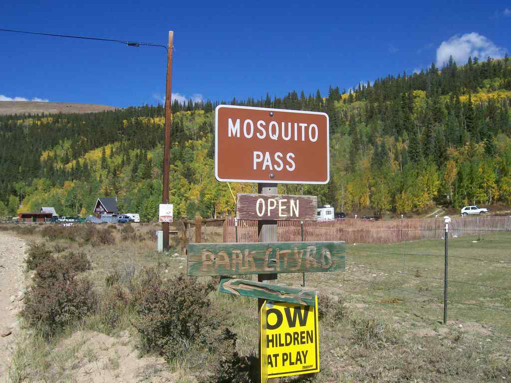
Mosquito Pass

Trail Information
Difficulty - Mandatory
3 -
MODERATE
Difficulty - Optional
4 -
MODERATE
Status
Impassable
Distance
10.63 mi
Duration (one-way)
About 3 hours
Highest Elevation
13185 ft
Shape of Trail
Straight Through
Typically Open
07/01 - 12/01
Best Direction
West
Official Road Name
Park County Road 12/Lake County Road 3
Nearest Town
Leadville
Nearest Services
Leadville
Management Agency
Pike and San Isabel National Forest
District
Leadville Ranger District
Highlights
 Altitude
 Camping
 Iconic
 Mine
Mine Overland
 Rock
Rock Scenic
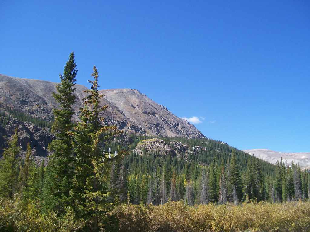
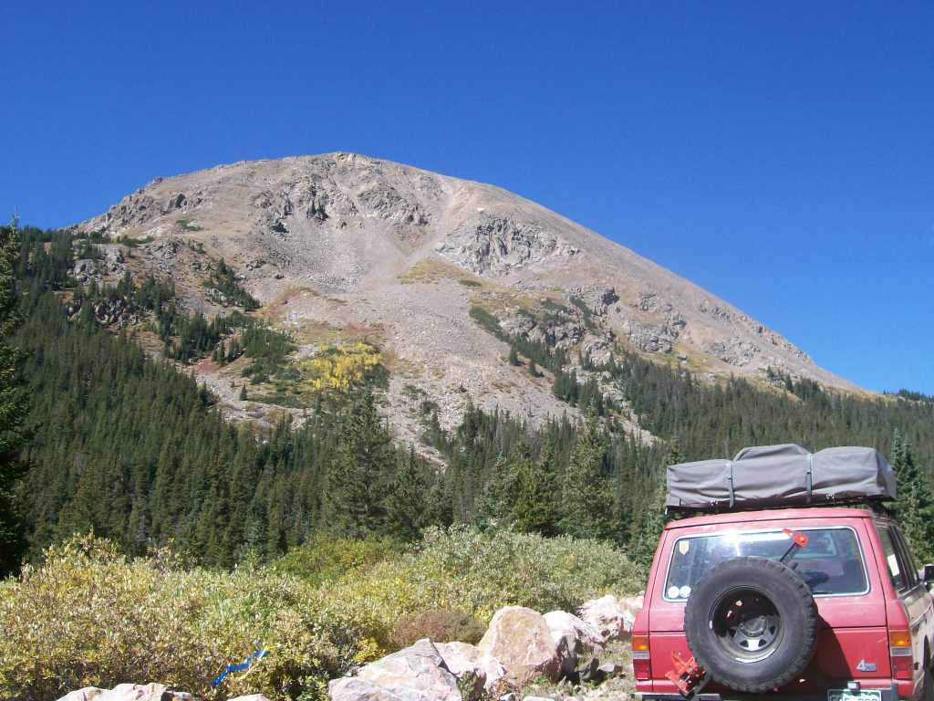
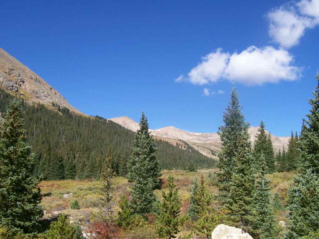
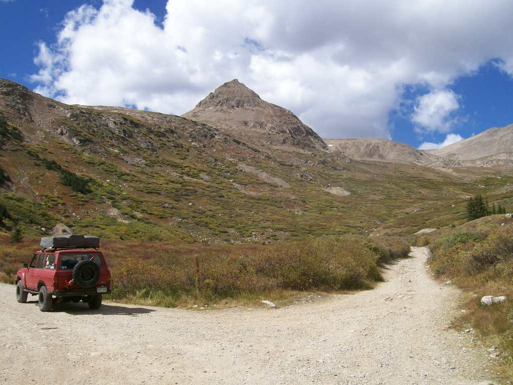
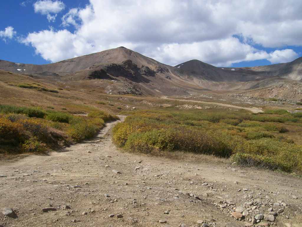
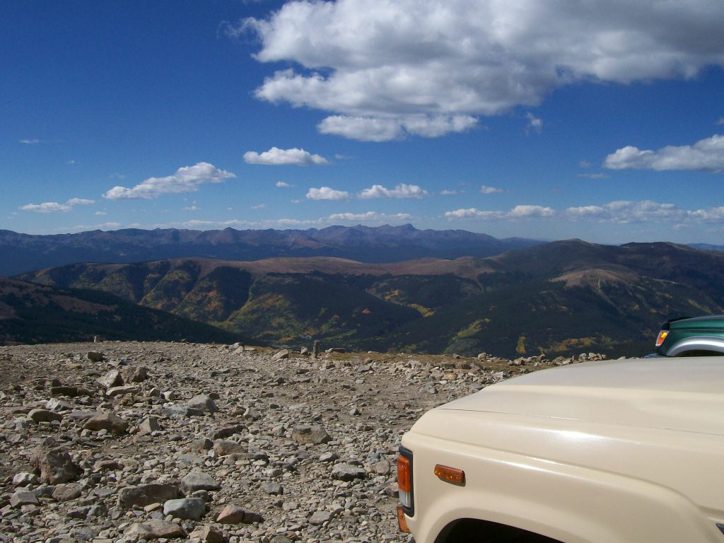
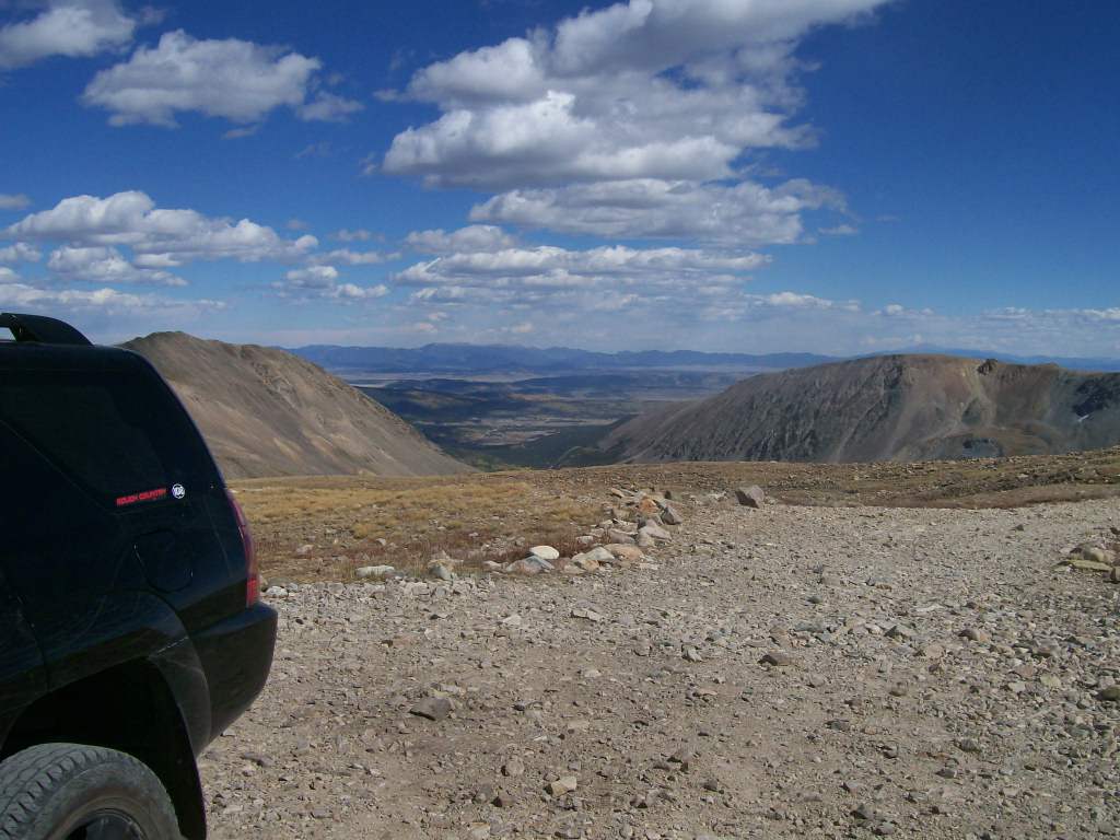
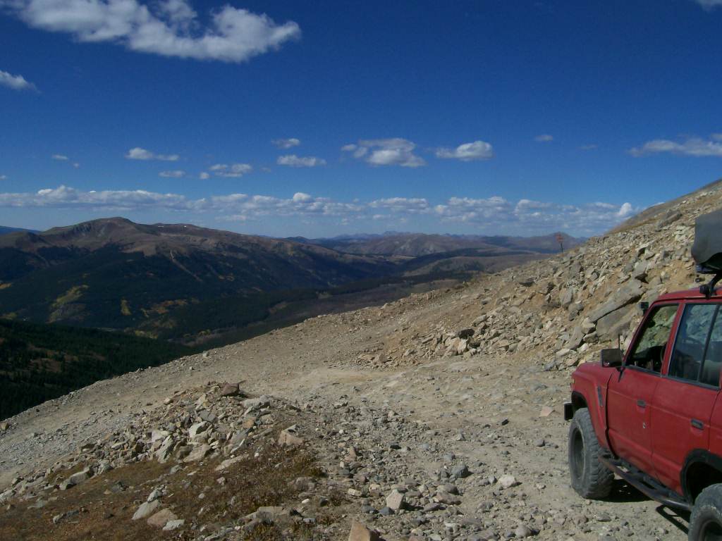
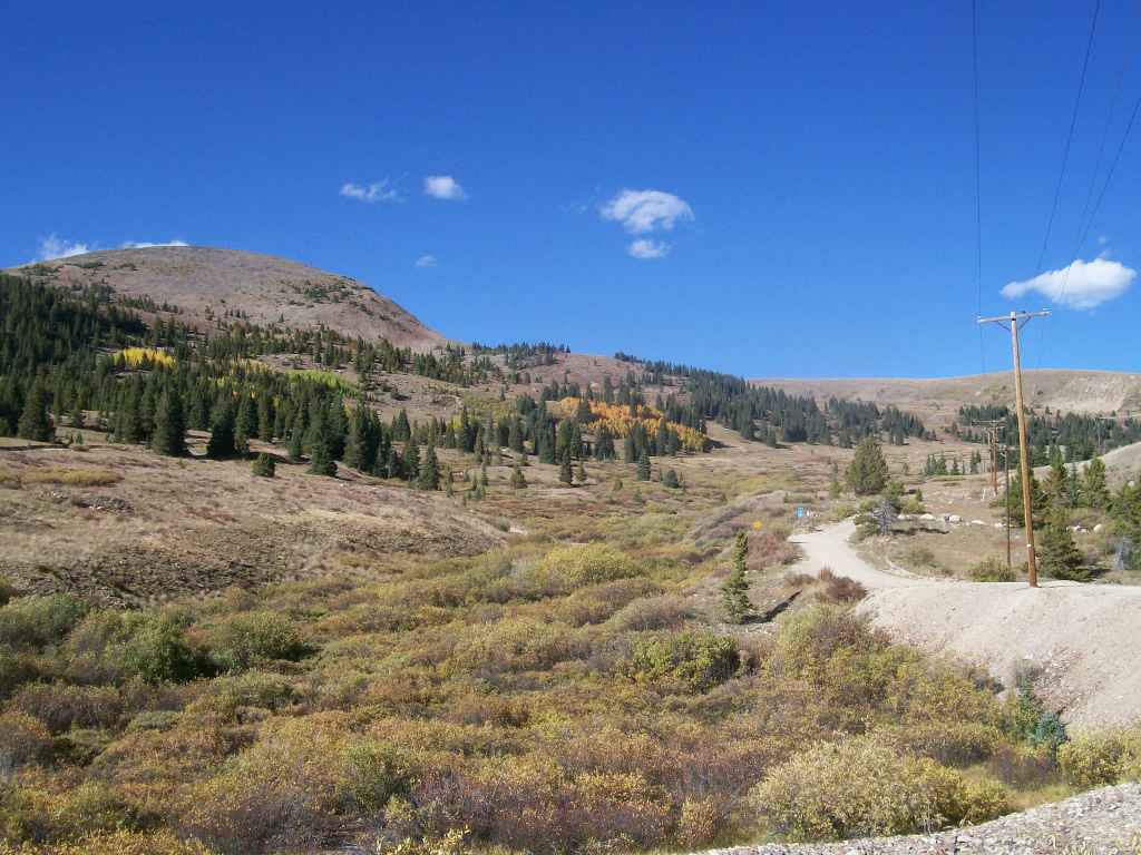
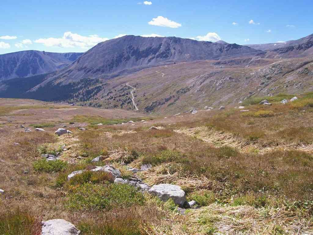
Mosquito Pass (elevation 13,185'), between Alma and Leadville, Colorado, is among the highest Colorado passes accessible to 4WD vehicles. The views from here are spectacular, especially in early autumn when the valley’s foliage begins to change color. The vibrant gold, amber, and green colors provide a stark contrast to the drab brown stone and paled grasses covering the high treeless ridges.
Earlier in the summer, the alpine grasses and wildflowers are spectacular. However, check with the Forest Service District Offices because Mosquito Pass opens late due to snow blocking the road.
Pike National Forest/South Park Ranger District (719) 836-2031
San Isabel National Forest/Leadville Ranger District (719) 486-0749
Trail Difficulty and Assessment
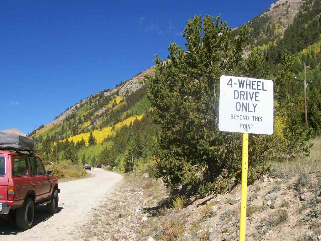
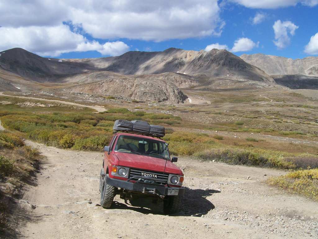
Recommended Vehicle:
Stock SUV with High Clearance and 4 Low
Concerns:
Summary:
The turn and climb/descent on the rocky ledges at Waypoint 6 (Coomey Lake Spur) plus the switchback at Waypoint 10 give Mosquito Pass its difficulty rating.
Community Consensus
0 votes
20 votes
5 votes
Easier
Spot On
Harder
The weighted average of your fellow members agreement of our trail rating. As trail conditions change this helps us keep the community aware of changes.
Mandatory
3 -
MODERATE
The hardest part of the trail that you
cannot bypass - you have to drive it.
Optional
4 -
MODERATE
The hardest part of the trail that is
purely optional - you can bypass it.
Typically, more rock or undulated road surface. Potential rocks and/or tree stumps less than 12" tall and/or vertical ledges less than 12" tall and/or near vertical ledges or waterfalls less than 24" inches. Tire placement becomes more difficult. Can be steep. Read More about our Rating System
Start your next adventure on Mosquito Pass

Upgrade your Membership
Unlock all of the details on every Trail Guide and Scout Route.
Start a 7-day Free TrialUploading to Gaia GPS
Share Trail
Trail Navigation
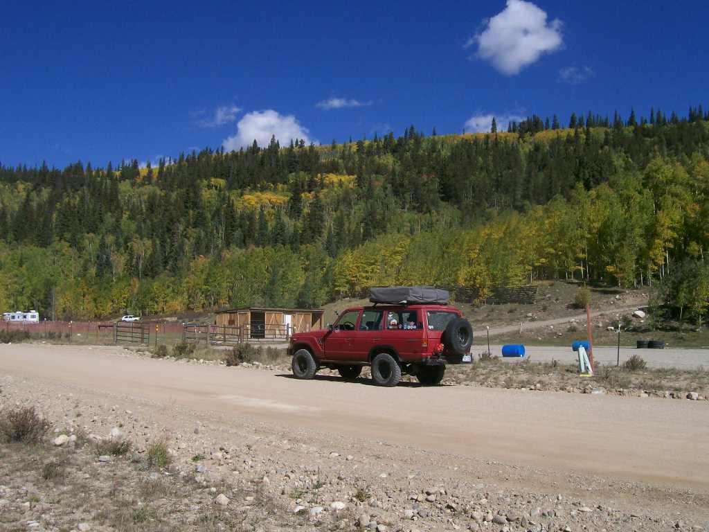
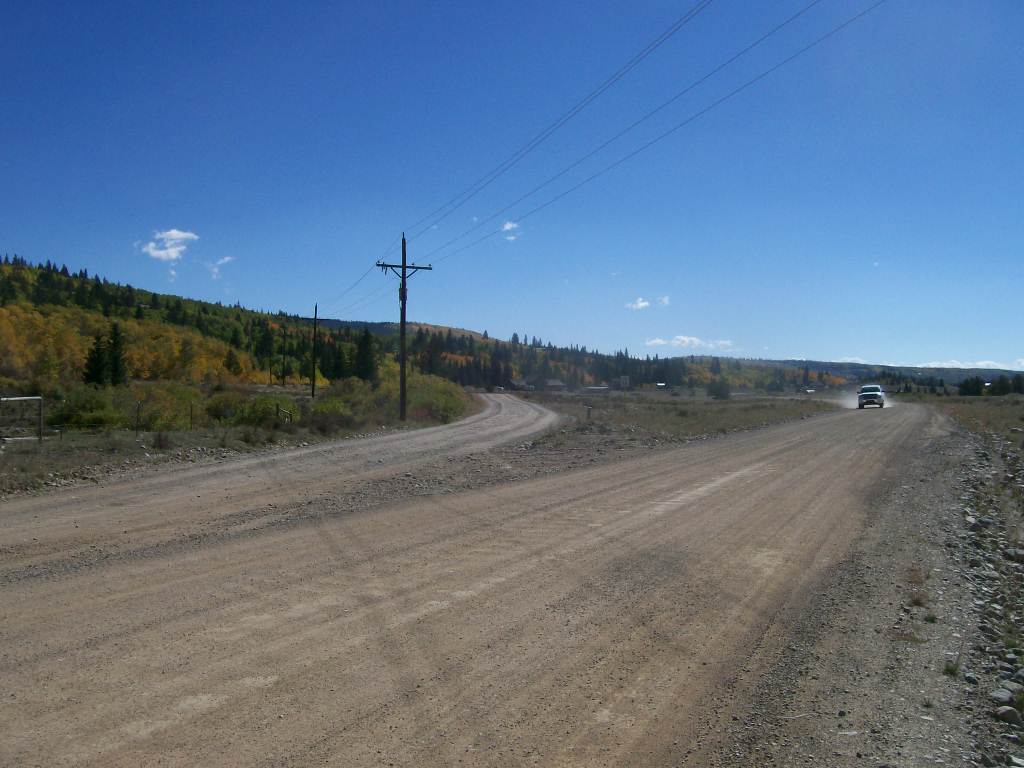
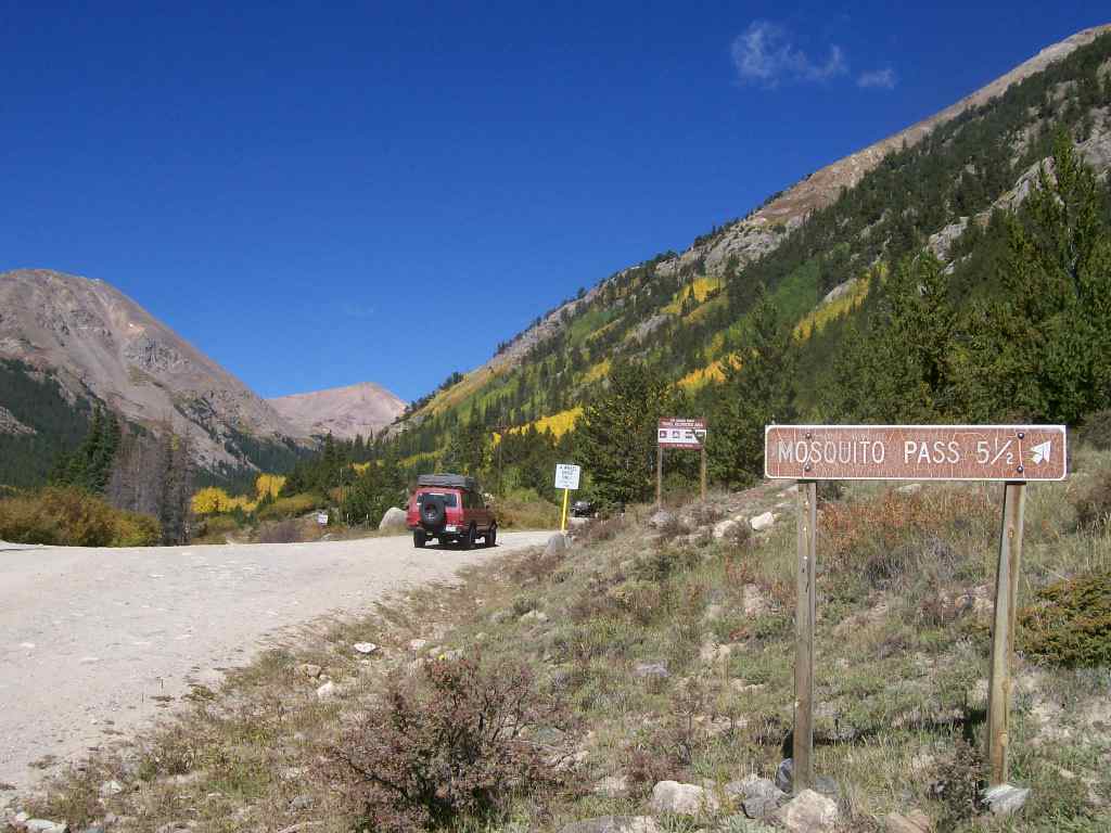
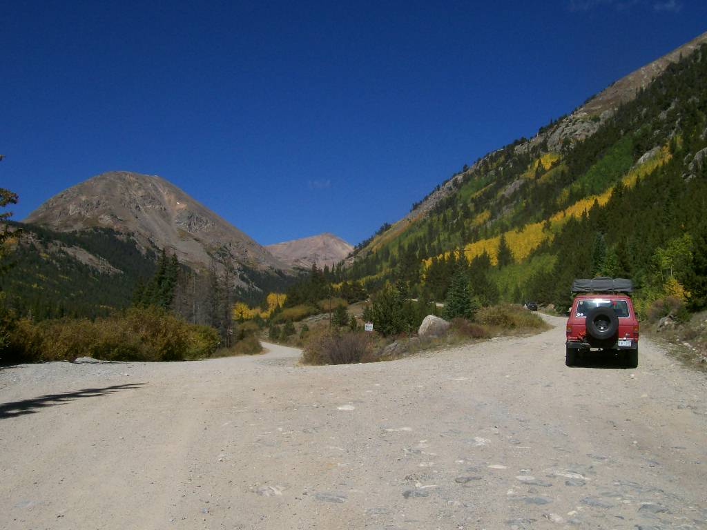
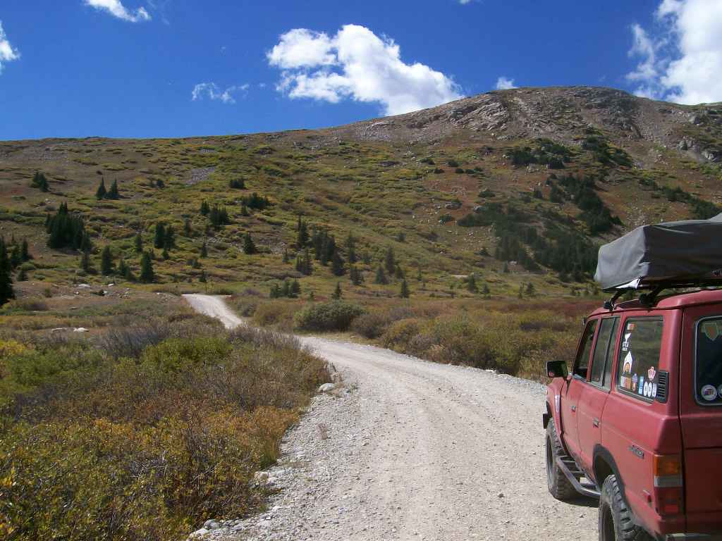
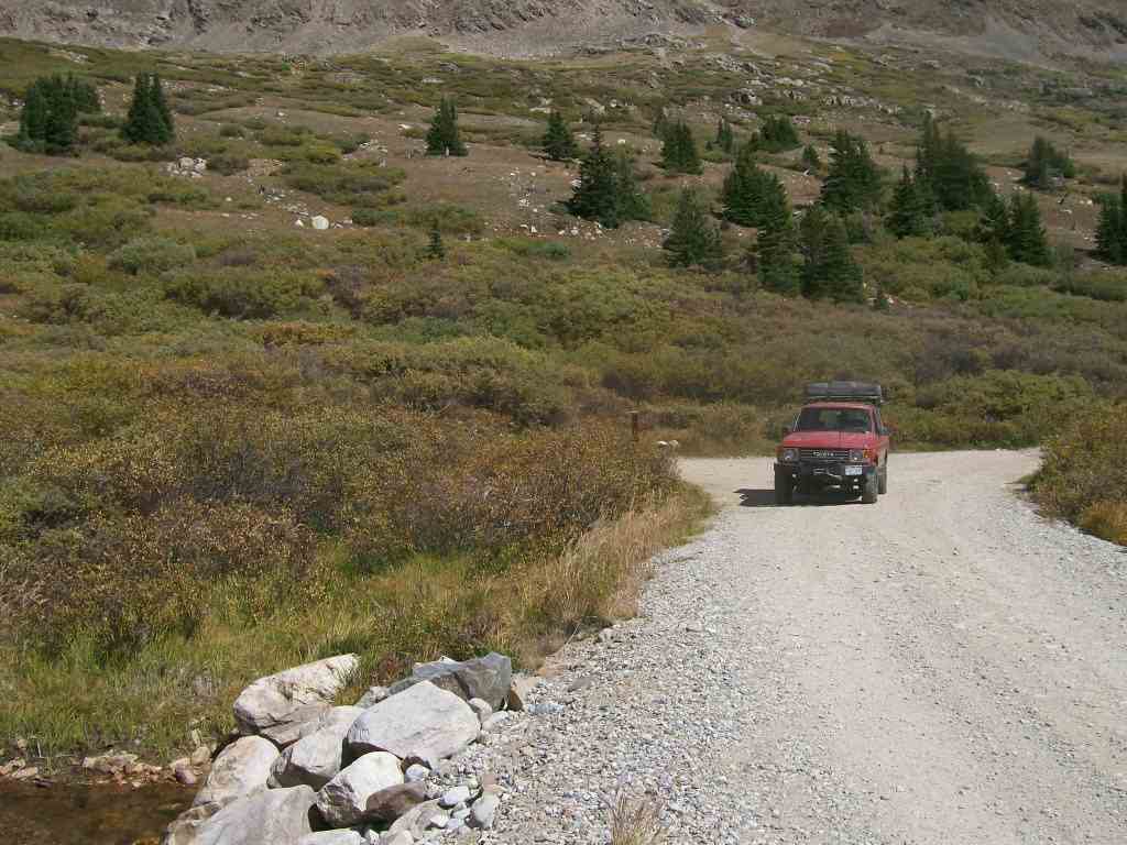
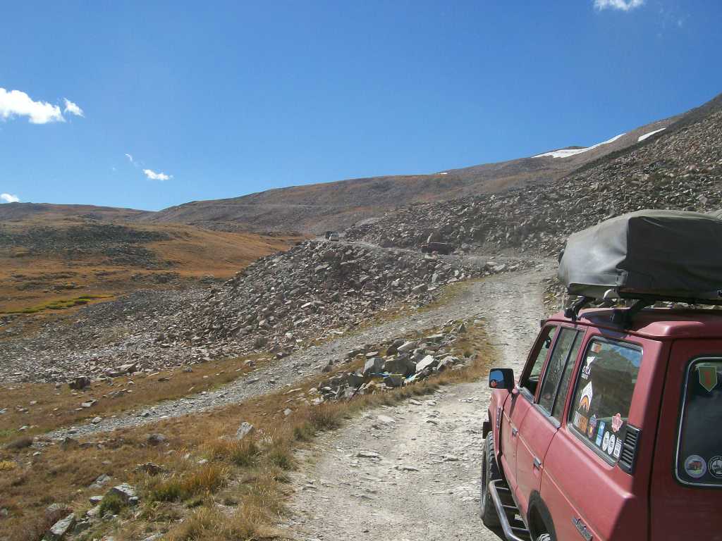
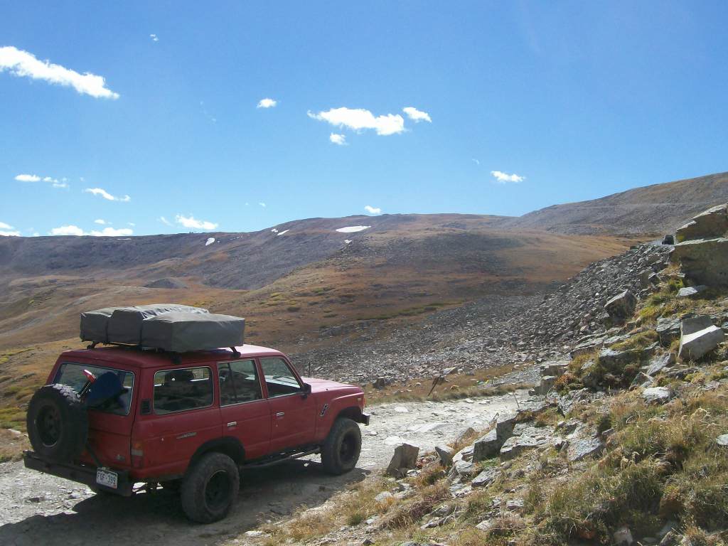
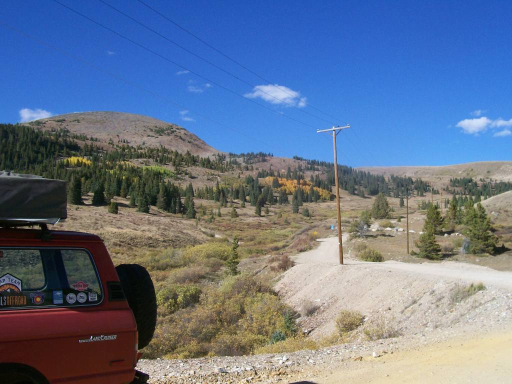
Mosquito Pass is a very rocky road. From east or west, the lower portions are mostly dirt and gravel. As you gain elevation, the rocks become larger (6" to 8" diameter). Several segments of the road are entirely covered in loose stones up to 10" diameter, giving the sensation of driving on bowling balls. At the highest elevations, there are numerous switchbacks, but all are sufficiently wide so as not to require three-point turns. At these locations, trail surface is exposed bedrock. Mosquito Pass also includes a few shelf road portions that preclude passing.
1. Trailhead (0 mi)
The trailhead is at the intersection of County Road 12 and County Road 10, on the east side of Park City.
2. Intersection FS Road 696 (2.3 mi)
Keep right (east) at the intersection where the brown Forest Service sign indicates Mosquito Pass to the right.
3. Scenic Pullout (3.5 mi)
Continue straight past the pullout. This area is wide enough for five or six vehicles to make a pit stop.
4. London Mill Marker (4.5 mi)
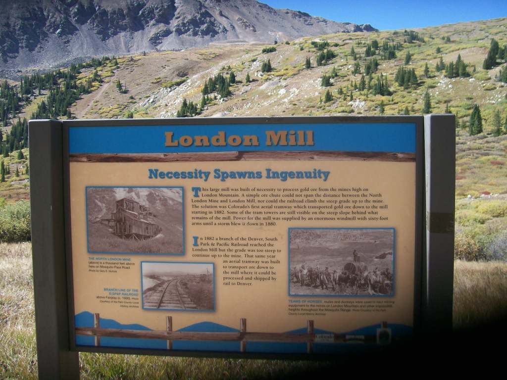
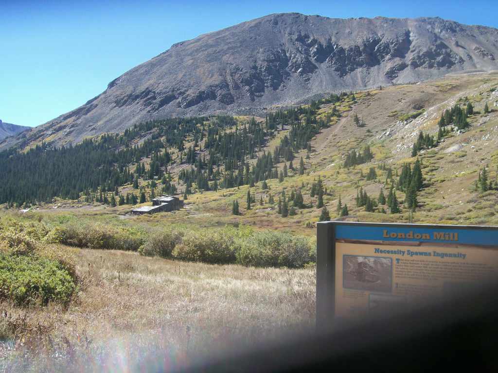
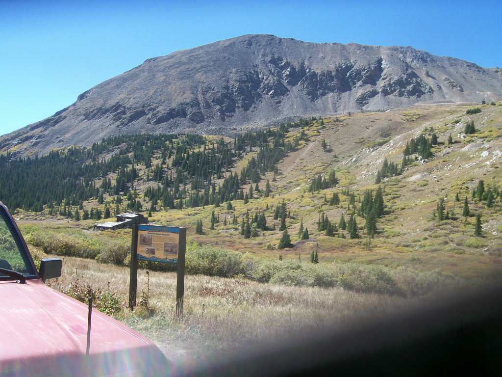
Continue straight past the historic marker. You will see the remains of the mill structure to the west well before approaching the marker.
5. Intersection Champagne Mine Trail (4.7 mi)
Turn left (west) to follow Mosquito Pass Road.
Alternatively, you can proceed straight (north) on the narrow trail which continues for approximately two miles. It is a rocky and winding diversion trail that terminates at the near-vertical base of a ridge between Mt. Tweto and Mt. Buckskin. There is an abandoned mine and a small collapsed structure here.
6. Coomey Lake Spur (5.8 mi)
Follow the broad Mosquito Pass Road. The spur heads north one-half mile and arrives at Coomey Lake. The turn and exposed bedrock makes this one of the more difficult points on the Mosquito Pass Road.
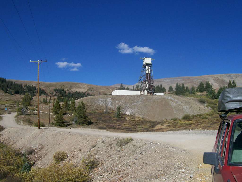
7. North London Mine (5.9 mi)
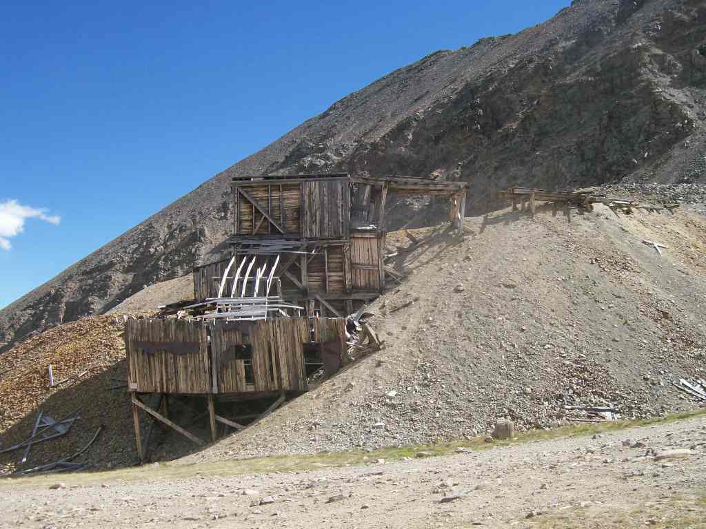
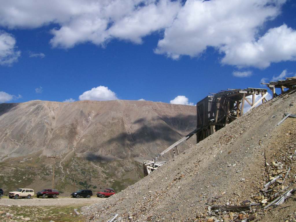
Continue straight at the North London Mine. There is adequate space here for a dozen vehicles to park, if desired, to view the remaining structure (Do Not enter or climb on the structure).
8. False Top (6.5 mi)
Proceed straight on the shelf road past the false summit.
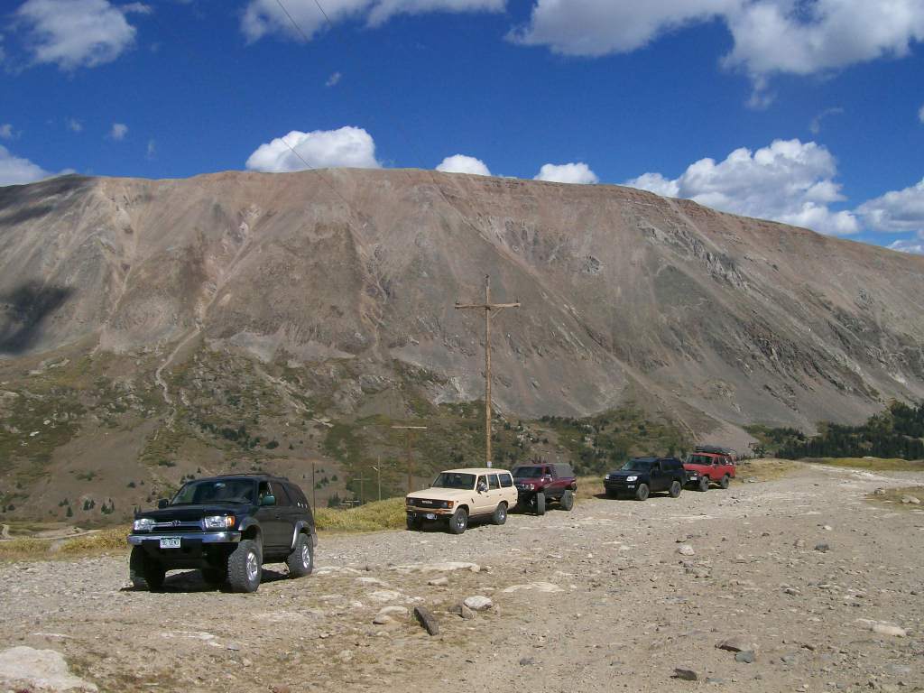
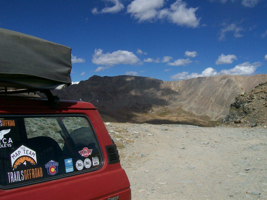
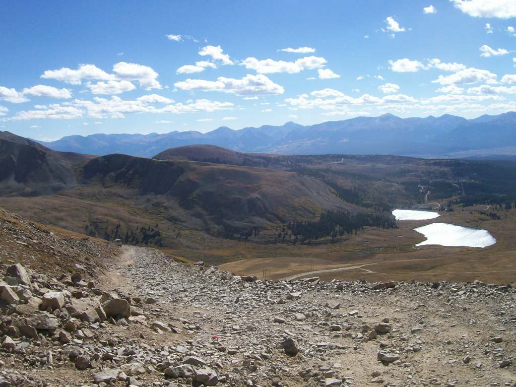
9. Mosquito Pass (7.5 mi)
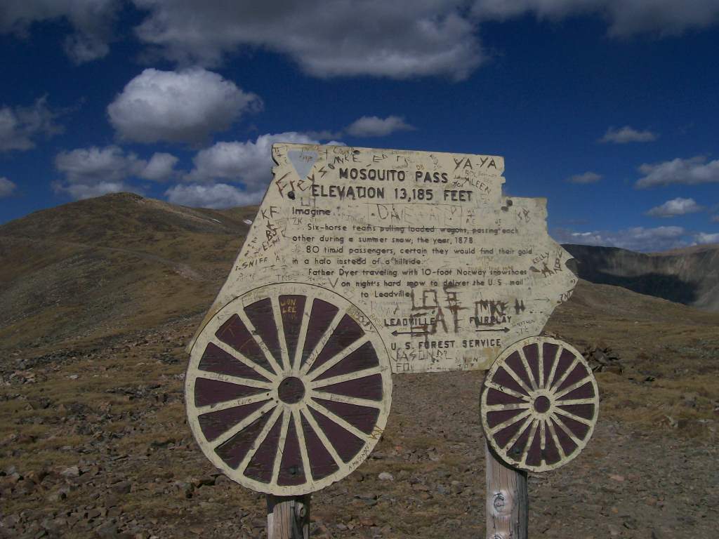
Arrive at Mosquito Pass. There is a historical marker with details about the site. The pass is broad enough for eight to ten vehicles to park temporarily.
10. Switchback (8.4 mi)
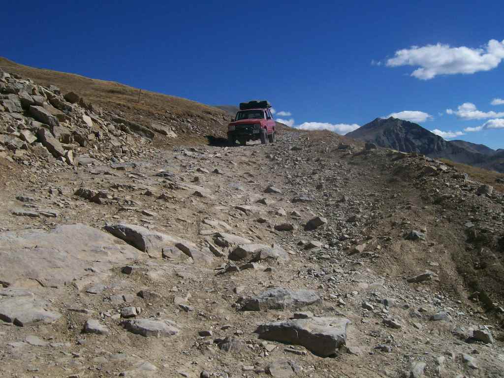
Proceed through the switchback. This point is one of the more significant obstacles on the road. It is a tight turn but wide enough that it doesn’t require backing. Before arriving at Waypoint 11 (Lakes), the road to the north is Birdseye Gulch.
11. Lakes (9.6 mi)

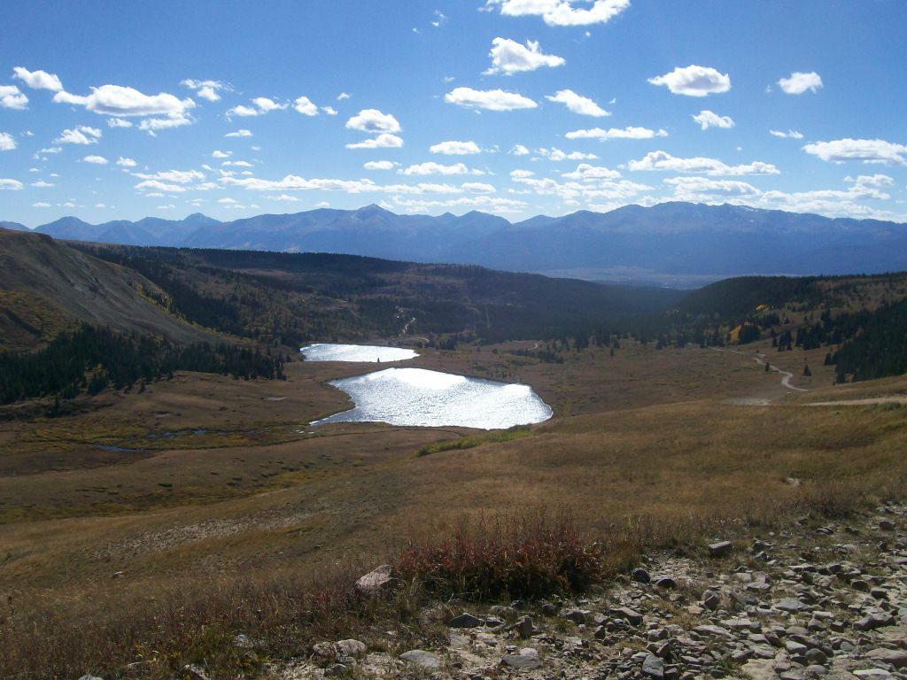
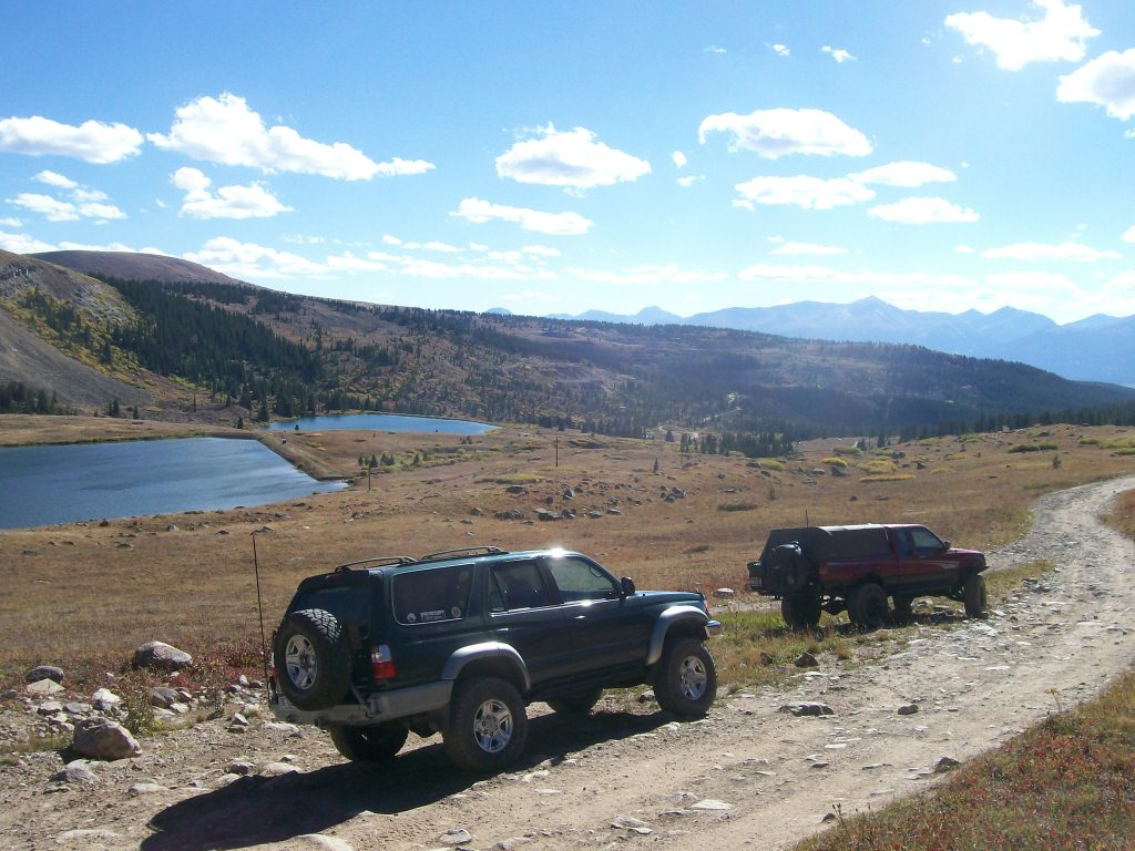
Continue past this wide spot in the road, where the lakes are to your south.
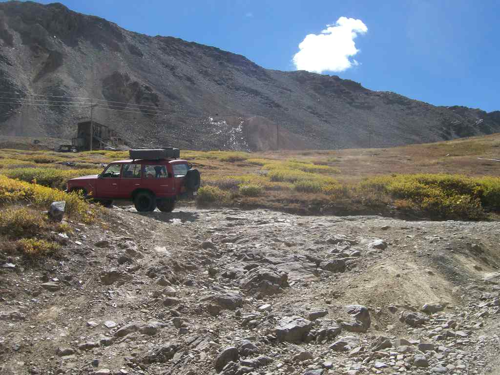
12. End at Diamond Mine (10.7 mi)
The Diamond Mine is an active/operating mine. The road here is wide and there is a pullout with space for 10-12 vehicles.
Dispersed
Dispersed camping is allowed however many segments of Mosquito Pass are not suitable for camping due to grades/inclines. Suggested places to camp include Waypoint 6 and the broad gulch south of the False Top (Waypoint 8). One connecting road, Birdseye Gulch (between Waypoints 10 and 11), also permits dispersed camping.
The US Forest Service maintains Kite Lake Campground about five miles north of Alma. There are additional US Forest Service facilities on the Leadville (west) side.
Starting Point
Leadville
Mosquito Pass is a straight-through trail with start/end points in Leadville and Alma, Colorado.
From Leadville, travel east on 7th Avenue which becomes Lake County Road (CR) 3 for approximately four miles to the base of Diamond Mine and a wide pullout. This is the western trailhead.
From Alma, turn west off Colorado Highway 9 onto either Park County Road 10 or Park County Road 12.. These County Roads converge a few miles west of Highway 9 at the town of Park City. The point of intersection is the eastern trailhead.
Trail Reviews
4.7/5 (105)
Open
Rated
5/5
Visited: 09/27/2022
Difficulty Accuracy:
Spot On
Went from the Alma-side to Leadville. Waypoint 5 to 6 is not bad if you choose the right lines. Between 7 and 8 there is a nice tricky spot where I was balancing on two wheels. Between 10 and 11 there are some switchbacks that are very angled, take your time in your approach as these can be tricky to maneuver downhill.
Once I reached the top it was flurrying. Some other mountain tops nearby had a bit of snow on them.
Vehicle: 4Runner with skid plates, still waiting on suspension upgrades, so at the moment I probably having less clearance than stock.
Open
Rated
5/5
Visited: 09/17/2022
Difficulty Accuracy:
Spot On
Took a stock Tacoma with ATs, a stock Tundra with ATs, 2 stock 4Runners with ATs. They scraped a little bit, but nothing serious - just small polishing of their engine skid plates.
Trail is rocky/bumpy. Those without lifts and bigger tires will need to take their time, but this trail is by no means difficult. Ran it with my 4Runner with a lift and 285s ATs and another 4Runner with a very similar build. No scraping, no close calls, and the trail was smooth for us.
Air down for a smoother ride. Large boulder that sits near the middle of the road is easily passable. Tundra made it with no problems. Puddles at the beginning of the Alma side are deceivingly deep but easily manageable.
Open
Rated
5/5
Visited: 09/09/2022
Difficulty Accuracy:
Spot On
Took my Tacoma through the pass Solo. It's definitely doable with low range 4x4. Lockers are not needed. The climb from Alma/Fairplay got challenging about half way up. If you don't have high clearance then picking lines will be important.
Open
Rated
5/5
Visited: 08/29/2022
Difficulty Accuracy:
Spot On
Really amazing views all along the trail, but I don’t advise taking your eyes off the trail as a driver. Trail is very narrow in a couple places, do to boulders occupying space on the side of the road, forcing vehicles to creep dangerously close to the edge, my Ram had roughly 6–8” on the left side before a steep and long drop in a couple places. Don’t attempt in a stock vehicle, you’ll probably regret it, however possible it is to “make it”. Completed in 2017 Ram Rebel on 35” KO2
Open
Rated
5/5
Visited: 08/21/2022
Difficulty Accuracy:
Harder
It was drizzling on and off so the rocks were wet, there were several large boulders in the road that we had to squeeze past, and there were pretty steep dropoffs along a lot of sections. Squeezing past one of the boulders put us pretty close to the edge. We saw one motorcycle, one Wrangler, and one Nisson Pathfinder that was clearly struggling. He needed more articulation and lockers. I don't know how far he was planning to go, but he had much harder obstacles ahead. If he was planning to go over the pass, I doubt he made it. My Bronco never had any issues, but I did hear metal on rock about 3 times. I haven't crawled underneath yet to see if I can tell what touched and if there is any minor damage. Overall an awesome trail that I will probably do again.
Open
Rated
5/5
Visited: 08/20/2022
Difficulty Accuracy:
Spot On
I drove Mosquito Pass from east to west on Saturday, 8-20-2022. Conditions were low clouds, intermittent rain, and wind. The road is wet in most places (likely due to intermittent rain). The road has been "braided" (widened) in several places due to SXS and 4x4 trying to "find an easier path". Please stay on the road and drive OVER the rocks!
Open
Visited: 07/17/2022
Difficulty Accuracy:
Spot On
Left Alma and went over Mosquito Pass and then down to Red Cliff and ran Shrine Pass to I-70 and back to Alma through Breck. Toughest part in my opinion is picking the right line up the hill just after waypoint 5 - not that hard, just have to choose tire placement. Wildflowers are in bloom and it is beautiful all along the trail right now.
Open
Rated
5/5
Visited: 07/09/2022
Difficulty Accuracy:
Spot On
Open, BUT take a shovel and recovery gear (traction boards, strap, D-ring or soft shackle) to be prepared! I drove Mosquito Pass on Saturday, July 9th. I started on the Alma side (drove east to west). There are large water pools in the vicinity of the London Mill. The rocky climb to North London Mine is bumpy and braided in spots due to vehicles attempting to find a "smoother path"--please don't widen the road, drive over the rocks! There is a large snow bank at the North London Mine, likely to endure into August. This snow bank does not block the road. The snow bank which has kept the road "impassible" is above WP 8. As I approached it, another vehicle was coming down. We both stopped at the snowbank and walked across it to assess depth, consistency, etc. He offered to stay uphill in order to pull me if necessary. I made it 2/3 the distance before getting stuck. I backed up and we shoveled to reduce the snow where my front axle was plowing/piling snow. Next attempt I made it over the "hump" and stalled 8-10 feet from the uphill side. We shoveled again, hooked the strap, and he pulled me through. He went down and continued downhill, and the Tacoma behind me came up, and stalled at the same spot I did. I hooked the strap and pulled him through. A side-by-side came next and cleared the snow bank. Finally, a Wrangler JKU came up and stalled at the same "hump"; he backed out and made it on his second attempt.
Partially Open
Rated
5/5
Visited: 07/03/2022
Difficulty Accuracy:
Spot On
Went up to the pass from Leadville in my Tacoma TRD OR on 32’s and stock suspension. Near the summit, a dude in a beefy 4Runner told me he came up the Alma side and had to get winched through a snowfield. We decided to turn back and go explore the Prospector Mountain trails, which were absolutely awesome and I would rate as a 3 in terms of difficulty. Awesome day on the trails.
Impassable
Rated
5/5
Visited: 01/17/2022
Difficulty Accuracy:
Spot On
Currently impassable. Wanted to get to Waypoint 5 for a hike, but didn’t make it further than Waypoint 3. Encountered 4ft of snow – got stuck and had to take the shovel and traction boards out. Took 3 hours to get free again (kept on sliding into the ditch due to ice), but overall had a fun day! I’ll come back again when there’s a bit less snow and be a bit better prepared with more recovery gear. (Stock 4Runner TRD-Off-road with some Wildpeaks, upgrades are coming soon.)
Impassable
Rated
5/5
Visited: 10/29/2021
Difficulty Accuracy:
Harder
I went up on mosquito pass trail today to see if it was possible to cross over to Leadville. We got up to the North London mine but above was 5 to 6 feet of drifted snow. I have a lifted F-150 offroad on 35 m/t aired down to 12 psi for the snow. The shelf road above the mine was drifted in. Getting to the north London mine was a challenge in its self. The Lower road was solid ice in one place with a few rocks for traction and above we went through 3 to 4 feet of drifted snow.
Just the kind of off-roading i like !!
We got high centered on a deep drift but some shoveling got us out and upward.
It was sunny and very warm up there.
Open
Rated
5/5
Visited: 09/26/2021
Difficulty Accuracy:
Spot On
This is a great summer/fall trail for just about everyone. The shelf roads will make it seem harder than it is. The rocks you need to drive over will beat you up if you don't air down first. We did this at 14 psi to get a comfortable ride and help protect the tires. After the end of October, it will become impassable due to snow.
Open
Rated
4/5
Visited: 09/26/2021
Difficulty Accuracy:
Harder
This trail is probably a 3 if you carefully selected the easiest lines in the handful of technical spots, but I’d agree with other reviewers that said it feels harder than other 3s. I’d vote for rating it a solid 4. That said I ran it from Leadville to Alma in less than 2 hours with no problems other than long periods of waiting on other traffic with the right of way. I feel like more people probably start from Alma but I would recommend starting in Leadville because the Leadville side is the most technical and it’s narrow of course so backing up would be awful. I chose to go up the switchbacks so I would have the right of way and I’m glad I did. It just made going down the other side annoying because everyone else was coming from that side today. Oh and did I mention this trail is very bumpy?
Open
Visited: 09/18/2021
Difficulty Accuracy:
Harder
We drove this trail 40 years ago when there wasn't much information like there is today. We just knew it was there and went and did it in our stock '81 Bronco.
I'd say the trail is a little rougher now, but we have a 4Runner with a 2" lift and stout off road tires so it was a moderate challenge at best. I would say it pushes more toward a 4 in many spots rather than a solid 3 all the way. There are a few spots where careful tire placement becomes pretty important if you don't want to catch a skid plate or running board. If your vehicle doesn't have a fair amount of clearance I'd think twice about heading up Mosquito. It is rocks of varying sizes all the way up and down.
We started out from Leadville early on a Saturday morning with the goal of getting up the switchbacks and to the top before traffic from the other side would be coming down. There is really nowhere to pass on the Leadville side switchbacks. We didn't see another vehicle until well down the other side toward Alma. It was a beautiful day without a cloud in the sky and provided some phenomenal views. All in all a great day.
Open
Visited: 09/18/2021
Difficulty Accuracy:
Spot On
Trail is open and easily passable. Nothing super off camber but the shelf does get tight when passing, not as tight or steep as other pass roads. Depending on vehicle and driver capabilities this might be more difficult or easier, for us it is easier but we have a heavily modified rig and spend a lot of time on shelf roads.
Open
Rated
5/5
Visited: 09/12/2021
Difficulty Accuracy:
Spot On
2010 Rubicon JKU with 2.5 lift and 35's handled the trail easily.
Beautiful views...great time to drive the area. The aspens are changing color in the high country and there's still time to get up there and appreciate the foliage. As others have said, this is generally an easy but bumpy (literally a road composed entirely of rocks in places). There are a couple of technical spots with the most challenging being the switchback (waypoint 10) on the Leadville side. Rating of a 3/4 seems about right.
Not busy at all in the morning. I think we passed 5 vehicles and 5 four wheelers the entire trip. A hidden plus for this trail is you can see all the shelf sections in advance and avoid having to do the shelf shuffle with an oncoming 4x4. I caught up to stock JK running 35's who managed it fine (albeit a bit slower than my pace), but I was happy to have the extra clearance on that switchback.
Open
Rated
4/5
Visited: 09/07/2021
Just ran Mosquito Pass. 2014 Rubicon with 2.5 inch lift and 35s. Agree - overall easy trail. Ran with an old Jeep Cherokee, new Ram Power Wagon, Raptor, and a stock Yukon (both with A/T tires). Nothing technical - very bumpy from Alma to the pass. Not a lot of room to pass on the short shelf road but you can see the whole way and easily avoid a situation. Great old gold mines along the way. Ran in 4 high the whole way. Ran Alma to Leadville - then over Cottenwood to Tin Cup Pass. I give it a 3/6 difficulty. Great long day. Great beginner trail for someone wanting to get off forrest roads.
Open
Rated
5/5
Visited: 08/18/2021
Difficulty Accuracy:
Spot On
Awesome trail. Did Alma to Leadville. Don't have much mountain off road experience coming from the gulf coast but my Gen 1 Raptor had no issues with the trail; was a bit concerned about the width but the switchbacks were fine and plenty of visibility on the shelf to plan if someone is passing. Only saw 3 other vehicles the whole trail. Would love to do again
Open
Rated
3/5
Visited: 08/15/2021
2018 4runner TRD Off Road w 3 inch lift and sliders. I think this should be rated a solid 4. It is much harder than other 3's. We went from Alma to Leadville. The shelf roads with rock obstacles are scary enough that I may not do this one again. We were lucky to follow another Jeep down to Leadville and not encounter any traffic. But hitting oncoming traffic on the shelf roads would have ruined the experience. It is not crazy, but I was glad to have some upgrades on the truck plus a few years of experience before running this one. Also note there are a few places where the trail in not clearly marked. Be sure to plan. One other note as others have mentioned: The Alma side had a closed sign - which was not true. As we approached the start of the trail, it was open.
Open
Rated
5/5
Visited: 08/14/2021
Fun trail. Rocky. Fantastic views. The weather was terrific today. We went from east to west. Busy trail with lots of folks out today.
Daughter did trail in her stock 4Runner with careful tire placement. Photo of jeep is at climb starting at waypoint 6--this is the toughest part of the trail.
Open
Rated
5/5
Visited: 08/10/2021
Difficulty Accuracy:
Spot On
Really enoyed this trail from Leadville to Alma. No on coming traffic made it pretty easy not needing to squeeze by vehicles on soe of the real narrow sections and the trail was dry so no Snow or slippery sections to deal with. in 2022 going to start on Birdseye Gulch lead up to Mosquito Pass for something a little different
Open
Rated
5/5
Visited: 08/08/2021
Difficulty Accuracy:
Spot On
I ran mosquito pass on Sunday. It was my 3rd time running it. I went from Alma side to Leadville. It was super smoky up there. You could barely see the mountains heading into the
start of the trail.
After I got to the pass I ran kuss peak to the top 13,500 feet. I descended to Leadville and went onto Mt. Antero and camped. The next day went to the top 13,850 feet then hiked to the summit. The highest pass to the highest point offroad. 💪😊
Open
Rated
5/5
Visited: 07/25/2021
Ran Mosquito Pass on 7/25 in my Ram 1500 with 33s and sliders from Alma to Leadville with only a couple other rigs on the trail. Though the trail isn't that hard, in my opinion it might be closer to a 3.5 than a true 3. I can think of many trails around this one that are rated a 3 that I would consider a bit easier than this "3". The hardest part for me was unmarked as a waypoint and was between waypoint 5 and 6 right after the switchback where things start to get rocky. This hard spot had a bunch of embedded rocks on the left side of the trail that would take swipes at rocker panels and skid plates, and the right side was a big rut with embedded rocks and a small stream of water running through it making it a bit slippery, I made it up the right line barely scraping my skids after a few attempts. Other than this spot I made it through all of the other marked waypoints with flying colors besides a couple more minor scrapes on my sliders and skid plates. I also ran the trail with a newer 4runner TRD with a 2inch lift and 33s and he had no clearance issues but did need to turn his differential locks on once or twice.
Open
Rated
4/5
Visited: 07/18/2021
Ran the trail from Alma to Leadville. Decent amount of 2-way traffic including SxS, Motorcycles and Jeeps/Trucks with a good crowd at the top. Wildflowers were pretty strong on the Leadville side and the wind was surprisingly calm on top. Nothing technical or too challenging on the trail. Enjoyable drive with great views.
Open
Rated
4/5
Visited: 07/17/2021
Unable to make the summit from the Alma side in a 2017 Jeep Cherokee Trailhawk. The steep part past the Coomey Lake spur is really rough, and after about 100-150 yards I ran into some 13-17" rocks I couldn't find a way around. I had to back down to the tight turn before I could turn around. You will need pretty high clearance to get through here.
Open
Rated
5/5
Visited: 07/11/2021
Ran from Alma to Leadville and back over Weston Pass. Wildflowers were in full glory. Area coming up the hill past the North London Mill and area near the lakes were absolutely stunning with the purples, reds and yellows. Weston Pass was pretty but not as many flowers.
Impassable
Visited: 07/03/2021
We went from Birdseye Gulch up to the top of Mosquito Pass and then tried to go down into Alma / Fairplay area, but the road was impassable due to snow between the 7th & 8th way point, about a mile from the top towards Alma. There was a Jeep trying to get through but the snow was too deep and the angle made it very likely of sliding down into a bunch of rocks. I'd guess that give it a month or so and it could be clear. Too bad we weren't able to make it down and see the rest of the trail.
Open
Visited: 06/20/2021
Went from Leadville to Mosquito Pass and back. We were staying in Leadville that night and a storm was brewing in the distance, so we decided to head back after reaching the pass. The trail was really rocky in the flat sections and I had to 3 point turn one of the switchbacks near the top due to a snowfield being in my line. Also it was extremely windy at the pass. Like too windy to close the truck door. Awesome and quick ride though!
Open
Visited: 10/16/2020
Trail was open and passible without issue, completed from Leadville to Alma. Had really high winds at the summit, almost couldn't open the doors to take a picture. Rest of the trip was pretty uneventful. There was a bit of ice at the bottom of the climb on the eastern side. Had no sliding issues, just rolled on down. Wasn't the most challenging trail but had some areas that needed a little more attention and the London Mine was really interesting. Sign at the east side stated the pass was closed but no issues crossing. Completed in Stock JLU Rubicon, 35 inch tires, 18 PSI.
Open
Rated
5/5
Visited: 10/03/2020
Did this Saturday from Alma to Leadville. The Jeep mentioned in the review below has apparently been moved. Clear all the way across -- definitely no snow anymore. Rocky as advertised, but great views, and no issues in a stock Xterra Pro-4X with Duratracs. Great way to spend an afternoon!
Temporary Closure
Rated
3/5
Visited: 09/29/2020
Currently on Mosquito Pass coming from Leadville. At 2.8 miles there is a Jeep on its side blocking the road. Might be able to pass but "might" isn't very comforting. Backed up to a fork and trying to determine if this road is an alternate route to the pass. Rolled Jeep has temp. tags so driver probably didn't know what they were doing. I'll update again soon (10:40am Tues.).
Alternate route leads to cell phone towers and deadends. We are turning back to Leadville (11:35am).
Open
Rated
4/5
Visited: 09/25/2020
Ran the trail on Friday from Leadville to Alta. Barely any snow is left on the trail and it's definitely doable in a stock vehicle. Not my favorite, but a good one to try out if you haven't before. It's a bumpy trail with sharp rocks - the vehicle ahead of me punctured the sidewall of their tire and had to put on their spare at the top of the pass. Definitely air down on this one!
Open
Rated
5/5
Visited: 09/05/2020
Drove from east to west on Saturday, September 5, 2020. The road is in good condition overall, but the west side upper switchbacks are eroded showing more rock. This is not a problem for even a stock rig, just pick your line to avoid dragging the undercarriage. The State Historical Fund was hosting an open house at the London Mill (Waypoint 4) so I stopped to visit; glad that I did because I got to see a large bull moose in the creek about 100yds from the site! For info on the restoration/renovation project see: https://www.historycolorado.org/location/north-london-mine-field-office
Open
Rated
5/5
Visited: 08/30/2020
Pretty cool trail, starting from Alma, we were above tree line before we knew it, didn’t even put it in 4 wheel drive until then. Just past the mine it gets a little interesting, lots of rocks and some offset holes that will challenge open diffs without a traction aid. The mines are cool and the scenery is amazing.
Open
Rated
4/5
Visited: 08/21/2020
Did the trip from Alma to Leadville with Team Hyke. Although the haze from the fires was present, it wasn't too bad. The rest of the day was great. Why do people insist on climbing on the old structures? Other than that, a good day all around. Not too many vehicles on this day. Awesome beauty anywhere you look...
Open
Rated
4/5
Visited: 08/09/2020
We took the trail from Alma to Leadville. There was a Burro race from Leadville to Alma so there were several stops to wait for the groups of racers and burros to pass and we chatted with the "Last Ass". Andrea was a bit woozy on the downhill past the summit, but she doesn't like the big drop offs. I really liked the trail and no problem with a stock jeep.
Open
Rated
5/5
Visited: 08/06/2020
Mosquito Pass is never disappointing. Did the trail from Alma to Leadville. Road was very good up to London mine, after which it narrows a bit, and gets bumpy. Traffic was moderately heavy. Views are incredible at the top! We had a bit of a time with Razor/ ATV group coming up on the West side just past the summit. The only really narrow portion of the road of course, but we pulled out as far as possible and allowed them to pass on the mountain side. Saw lots of wildlife (deer, fox and Moose) and flowers. The road is rough and bumpy but otherwise pretty easy. I have always found Mosquito Pass interesting because you will see lots of noob drivers looking nervous, with many spouses looking quite angry. Its a great road for newer drivers, but they need to be warned, and aware of traffic sometimes putting them in a bit more uncomfortable situations. Some of the heights and drop-offs can also be a little intimidating for the inexperienced. For Beginners, I prefer West to East.
Impassable
Rated
4/5
Visited: 07/17/2020
Impassible at waypoint 8, false top. Nobody appears to have attempted it. Should be clear by next weekend I would think. Pretty trail, just enough technical parts to make it interesting but nearly all of it is bypassable. Nice rolling hills and steep basin walls. Started going down the South London Mine side and realized there is some new industry activity going on down there. Private property will probably start to be enforced soon : (
Open
Visited: 10/16/2019
We did Mosquito Pass from Alma to Leadville. The sign outside Alma said 'CLOSED' but we continued waiting for a barrier or impassable condition (snow) and never encountered anything, so we made it over to Leadville without issue. A few stretches on the Alma side were rough, no joke, more than I expected even after watching several videos of the pass. The Leadville side was a little dicey since the road was covered with snow drifts for the top 1000' +/-....not too deep (less than 12 inches) but the snow certainly added another wrinkle going down the upper shelf road.
We spent a couple days in Buena Vista, then heading back on 10/18/19 the peaks around Fairplay/Alma were covered with snow, so I'm not sure how passable the road is now.
Open
Rated
5/5
Visited: 09/29/2019
Did the trail from Alma to Leadville in a stock JLUR. Very rocky but not really technical. Shouldn’t be a problem for any high clearance 4wd low vehicles. Nice views on top and always fun to see old mining ruins. Sign at the top is unique and hard to believe horse drawn wagons did that path way back when.
Open
Rated
5/5
Visited: 09/22/2019
Drove Mosquito Pass to Birdseye Gulch today. Mosquito Pass itself is not an overly challenging trail, but has amazing views. One of my first trails featuring steep cliffs on the trail edge and felt a good introduction as there was never a time you were right on the edge or super off-camber towards an edge.
Note: I’d been looking beforehand for a recommendation on whether to run Birdseye to Mosquito or Mosquito to Birdseye (like we did). I would heavily recommend Birdseye to Mosquito as Birdseye was much more challenging and contained several technical/rocky sections I would have much preferred going up on instead of down.
Open
Rated
4/5
Visited: 09/22/2019
This was my first time driving this and I started on the Leadville side. The whole way up to the summit was very rocky and bumpy the whole way up, and same for part of the way down the other side. I found it to be a little annoying after a while, but the views made up for it. Not sure I would drive this every year because of how rough the road was. Not a really tough drive but definitely rough. As a side note it was disappointing to see a couple dirt bikes driving around off trail on the alpine tundra, goofing off and popping wheelies. People like that either don’t care or don’t realize their behavior causes trails to get closed for all of us.
Open
Rated
5/5
Visited: 09/11/2019
I drove Mosquito Pass with a group of eight Land Cruisers from back east (Keystone Cruisers, Capital City Land Cruiser Club) as part of their Colorado Expedition. We had done Red Cone and Webster Pass the prior day, and used Mosquito Pass to cross over to Leadville where we'd then drive the highway south to access Tincup Pass.
Mosquito Pass doesn't disappoint; it has neat mining history and provides fantastic panoramic mountain views. We had clear weather, so the trip was especially good. The road is in good condition, and there were relatively few others present, maybe three other vehicles and one group of hikers.
Open
Visited: 08/31/2019
Drove this trail from Alma to Leadville in a stock 4Runner TRD PRO. This was our first real off road trip, so it was definitely a learning experience (rig capabilities, choosing lines, etc.)
There were a few stretches where I questioned proceeding (because I'm new to this), but i tried to pick the easiest line, and the 4Runner did great. Hit the skid plate a couple times (barely grazed it, no dents/scratches), but that was 100% driver error: I guarantee a better driver would have avoided the obstacles. That being said, as a beginner, I wouldn't want a vehicle with any less clearance on this Trail.
I'm pretty scared of heights, but with the trail being fairly wide, I was never too worried. We did get way too tippy for comfort on the second switchback heading down the leadville side (left hander), but again, I chose a poor line: 100% driver error.
The views on this trail are gorgeous, and my wife and I definitely enjoyed the excursion. Lots of Pika and Marmots around at higher altitude.
Open
Rated
4/5
Visited: 08/24/2019
Great day to run the pass. Ran it from East to West and only saw one m/c, three hikers, and two mt. bikes so we basically had the trail to ourselves. Very windy at the top so we didn’t hang around too long. Came back to 285 via Weston pass which, as expected, was much more crowded. It has been graded to be not much more than a rough two wheel drive road, but is scenic just the same.
Open
Rated
5/5
Visited: 08/17/2019
The sign at CR 12/CR 10 (east side trailhead near Park City) said "closed" but the road is OPEN. Just a little bit of snow remaining on the side of the road at the false top (WP 8). The road is rocky and bumpy, but totally within the capability of a stock 4x4. Get out and see it before the snow flies again in late September or October!
Open
Rated
5/5
Visited: 08/07/2019
Always a favorite of mine because of the scenery and elevation. Very rocky, and would be a challenge for some stock vehicles. 2000 Frontier (3" lift) and 2001 4Runner (3" lift) on 32s din't have any problems with clearance or articulation, for reference. As mentioned, what little snow is left was easily passable. The switchback at WP10 seems to be getting a bit more tippy on some lines in the last couple years. Pick your line carefully.
Lots of wildlife, so keep your eyes open. We saw lots of marmots, pikas, ptarmigans, and even a yellow fox.
Partially Open
Rated
5/5
Visited: 07/22/2019
Open up to the North London Mine. Still too much snow to get pass that point.
Temporary Closure
Visited: 06/19/2019
Officials announced today that the pass is closed until further notice on account of avalanche debris. Check back here for updates.
"Park County Road 12 (Mosquito Pass) is closed due to avalanche debris along with snow still at the higher elevations. This is a very popular 4-wheel drive road from Fairplay to Leadville. The public is asked to seek an alternate route."
Open
Rated
5/5
Visited: 09/22/2018
We ran this trail in a 2000 Frontier (3" lift) and 2006 4Runner (2" lift), both with 32" tires. We had a pretty easy time making it all the way through. The trail is rough but not challenging and there is a lot of room for passing vehicles for most of the trail. There is only 1 switchback corner on the west side of the pass that could get a bit tippy if you take it wrong.
Overall very enjoyable. Good scenery. We did the whole pass in about and hour and a half.
Open
Rated
4/5
Visited: 09/15/2018
Highly recommend this trail during the fall. We didn't air down until after first ascent, but we did air down after the first ascent making the rest of the drive more enjoyable. Fun drive and lunch in Leadville made for a great day on the trail. We drove our Willy's with a 3 inch lift on 34 in. Nitto Ridge Grapplers.
Ben & Lindsey
Open
Rated
5/5
Visited: 08/31/2018
Breathtaking. the single word my wife used to describe this route. we made this trip using our 1999 stock wrangler TJ sport. We traveled from Fairplay, over Mosquito Pass, and down into Leadville,
This was an incredible route. Road was chunky and bumpy but not un-doable or too hard by any means. Generously wide road with plenty of passing areas throughout. Mining buildings and other implements are littered throughout the landscape. The view at the top of Mosquito Pass is just beyond words. Breathtaking, as my wife declared. This route is one of America's National Scenic By-ways. It is worth it, if you have a solid and sturdy rig, to make this trip.
As it was suggested to us, at the top of Mosquito Pass, by a Leadville local, we suggest the Leadville Grille at the end of your journey for a well earned drink and hearty Colo-Mex meal. Keep your rubber to the road & stay safe
Open
Rated
5/5
Visited: 08/18/2018
Calvary 4-Wheelers gathered for our Back-to-School Special run on Saturday, August 18, 2018. Along for the trip were me in my lifted XJ; my wife, Missy, in her stock TJ; my daughter, Leona, in her newly-lifted late ‘70s Plymouth Trailduster; Jon and his friend David in Jon’s red, lifted Cherokee; and John and his two boys in their blue JKU Rubicon. We had originally planned on going up to Wheeler Lake but found out there was going to be a major trail maintenance project going on there so we switched to Mosquito Pass.
We met in Jefferson on the west/south side of Kenosha Pass. It was cold, overcast and windy feeling more like late September than mid August. We drove into rain on the way to Fairplay which got steadily heavier until it was raining pretty hard. I was beginning to wonder if we might find snow at 13,000 feet on the top of the pass.
We took a back way in from Alma, heading up CR 10 (Park Hill Road) and then across FSR 449 (Narrow Gauge) along the old railroad bed. Along the way we saw a large bull moose and a pretty good-sized muley buck. We took a wrong turn at an unexpected fork and ended up coming down Orphan Boy Mine Road to CR 12 before the end of 449.
By this time the rain had started to let up and was down to off and on sprinkles. We made a brief stop at the information Kiosk for the North London Mill to take some pictures and, for those that wanted to, to air down. When we reached the left hand turn that starts the pass in earnest, we shifted into 4wd and began the climb.
After bouncing our way up the rocky road, pausing occasionally to admire the view and take a picture or two, we stopped for lunch at the North London Mine. The rain had completely stopped by now and the sun was intermittently peeking through the clouds. When the sun was out, it was quite pleasant. When it went behind a cloud it was still a little cool. We ate our lunch at a leisurely pace, enjoying the day and each other’s company.
After lunch and a little time to explore the mine ruins, we headed on up the pass. We only stopped at the top long enough to take a quick picture of the sign and then headed down the other side. The weather continued to improve and, by the time we got to Leadville, we were able to shed our jackets. We stopped at a gas station for a bathroom and some snacks before hitting the highway and heading home.
The trail was clear and passable the entire way. The views were as impressive as ever. This classic trail is definitely worth it.Partially Open
Rated
4/5
Visited: 06/29/2018
From Leadville, the road/trail to the summit is open but a bit challenging on the switchbacks due to large rocks protruding in the trail. A good line will keep you moving, otherwise one could reasonably expect undercarriage damage on a stock, unlifted vehicle. Low range gears, soft tires, and high clearance will be helpful. Approximately 1/2 mile from the summit towards Alma, the trail in impassable due to six foot snow drifts covering the road. This is a shelf road and any attempt to traverse the snow could result in a catastrophic event. Don't go alone!
Seasonal Closure
Rated
4/5
Visited: 06/23/2018
The trail is still closed due to a few snow drifts across the trail. Between waypoints 8 and 9 are where the drifts are. They are passable with a motorcycle if you dont mind hiking a bike through at least two of the drifts. It will likely be another two weeks before they are open unless it heats up soon.
Still a great trail to explore from either side. It is completely clear on both sides other than those drifts.
Partially Open
Visited: 05/11/2018
Snow drifts at just under timberline were passable. By the time we got to one we couldn't pass, we could see London Mill, probably only 1/4 mile away. This was about halfway between waypoints 3 and 4. So we camped in the sites near the intersection with 696.
Big note here, I guess Mine Water bought up most of Mosquito Pass and the are to fix it up. You can search and find articles about it if you search 'London Mine' on google. I had permission to camp and explore up 696 from the guy running security here. Be advised that the current MVUM maps aren't be updated for the change in ownership. There are sheets stapled to trees about the mine claims that were bought.
Seasonal Closure
Visited: 02/17/2018
Attempted to drive up to the London Mine site but the trail has snow drifts a few hundred feet after waypoint 2. Could be passable with more than one rig or a great starting point for a hike up to the mine.
There are areas for parking at waypoint 2 as well as where the snow drift is.
Partially Open
Visited: 09/29/2017
Recent storms have delivered early snow to the high country, particularly routes above 12,000ft elevation. While Mosquito Pass technically remains "open", there is approximately 4" of snow accumulation towards the summit. Use caution during this transition of seasons--don't travel alone (single vehicle).
Open
Visited: 09/11/2017
I ran Mosquito Pass from west to east (Leadville to Alma) with friends visiting from Virginia, on Monday, September 11, 2017. Weather was stormy but we made it to the summit before rain began to fall. By the time we reached North London Mine, the rain had stopped but the ground was wet. There are two spots where the road is deeply rutted, one above and one below North London Mine. Careful line selection made it a non-issue, even in a stock '88 Trooper on 29" All-Terrains.
Open
Visited: 08/26/2017
Despite a sign on the Alma side indicating that the pass was closed due to snow, it was wide open. There were a few gnarly sections that required careful wheel placement for my stock LX470, but otherwise it was a nice, bumpy trip. Beautiful views the whole way. Chilly up top.
Open
Visited: 08/19/2017
Road was clear (no snow). Wet in only a few places. Beautiful day.
We started off from Alma. The posted sign noted the pass was closed. However, a member in the group had checked the website the night before and it noted the pass was open.
We had one flat just up the first climb before North London Mine on the trip but he gave it a shot using 2wd most of the way. 4-low was only necessary in a couple of spots. The first just as you start the climb up from North London Mine.
It was chilly at the top so make sure you bring a jacket.
Last note. if you are into Geocaching, there is a location at the top of Mosquito pass. 😉
Not Reported
Rated
5/5
Visited: 07/08/2017
Love this area, but make sure to go in mid to late summer as the top can be snowed in till then. One year we were up there, it took a few tries to get through the last snow drift to get to the top. Still worth a day or two to explore the area. Have done this trail in a stock 98' Tacoma, stock 07' FJ Cruiser and stock 11' 4runner. All had BFG Allterrain tires and experience driver/s.
From the Community
Be the first to ask a question!
Tracy Barker
Mapping Crew - Colorado
Tracy is an outdoor enthusiast originally from north Alabama. His family moved to central Utah when Tracy was a child, and subsequently to southern Utah, where he fell in love with the Rocky Mountains. His favorite activities are family trail rides and camping with small groups. He started many years ago in his dad's F-150 pickup truck, and subsequently his own 4x4 acquisition, a 1975 Ford Bronco (in 1991).
Visit Profile
Start a free trial and get this level of detail on every trail
guide
Start Free Trial
Print Trail Guide
Purchase
Company
Community
Recent Updates
By clicking "ACCEPT", you agree to be the terms and conditions of each policy linked to above. You also agree to the storing of cookies on your device to facilitate the operation and functionality of our site, enhance and customize your user experience, and to analyze how our site is used.