Please wait - Uploading to Gaia GPS
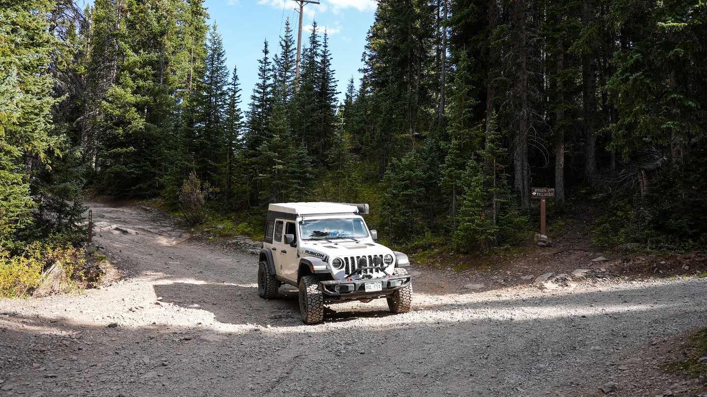
Imogene Pass

Trail Information
Difficulty - Mandatory
3 -
MODERATE
Difficulty - Optional
6 -
DIFFICULT
Status
Impassable
Distance
12.04 mi
Duration (one-way)
About 3 hours
Highest Elevation
13162 ft
Shape of Trail
Straight Through
Typically Open
07/01 - 11/01
Best Direction
East
Official Road Name
869
Nearest Town
Telluride
Nearest Services
Telluride
Management Agency
Uncompahgre National Forest
District
Norwood Ranger District, Ouray Ranger District
Highlights
 Altitude
 Forest
 Ghost Town
 Iconic
 Mine
Mine Overland
 Scenic
 Water
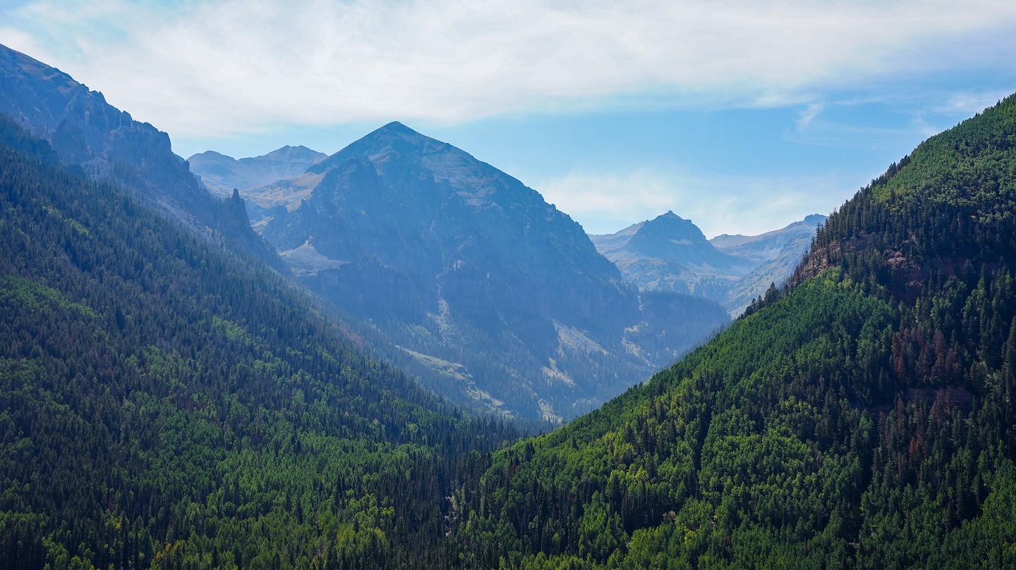
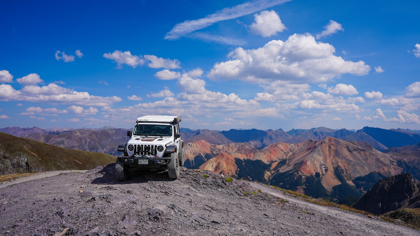
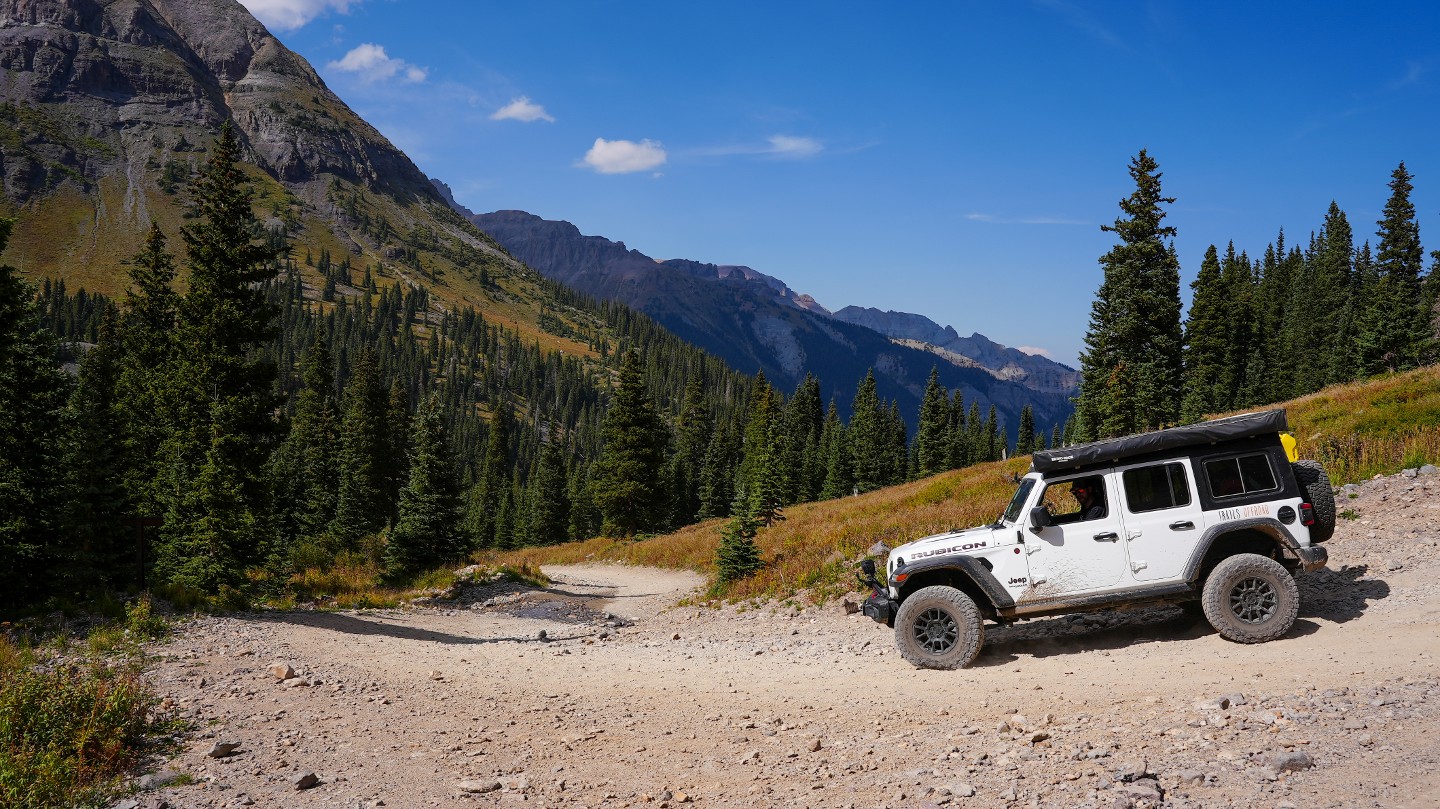
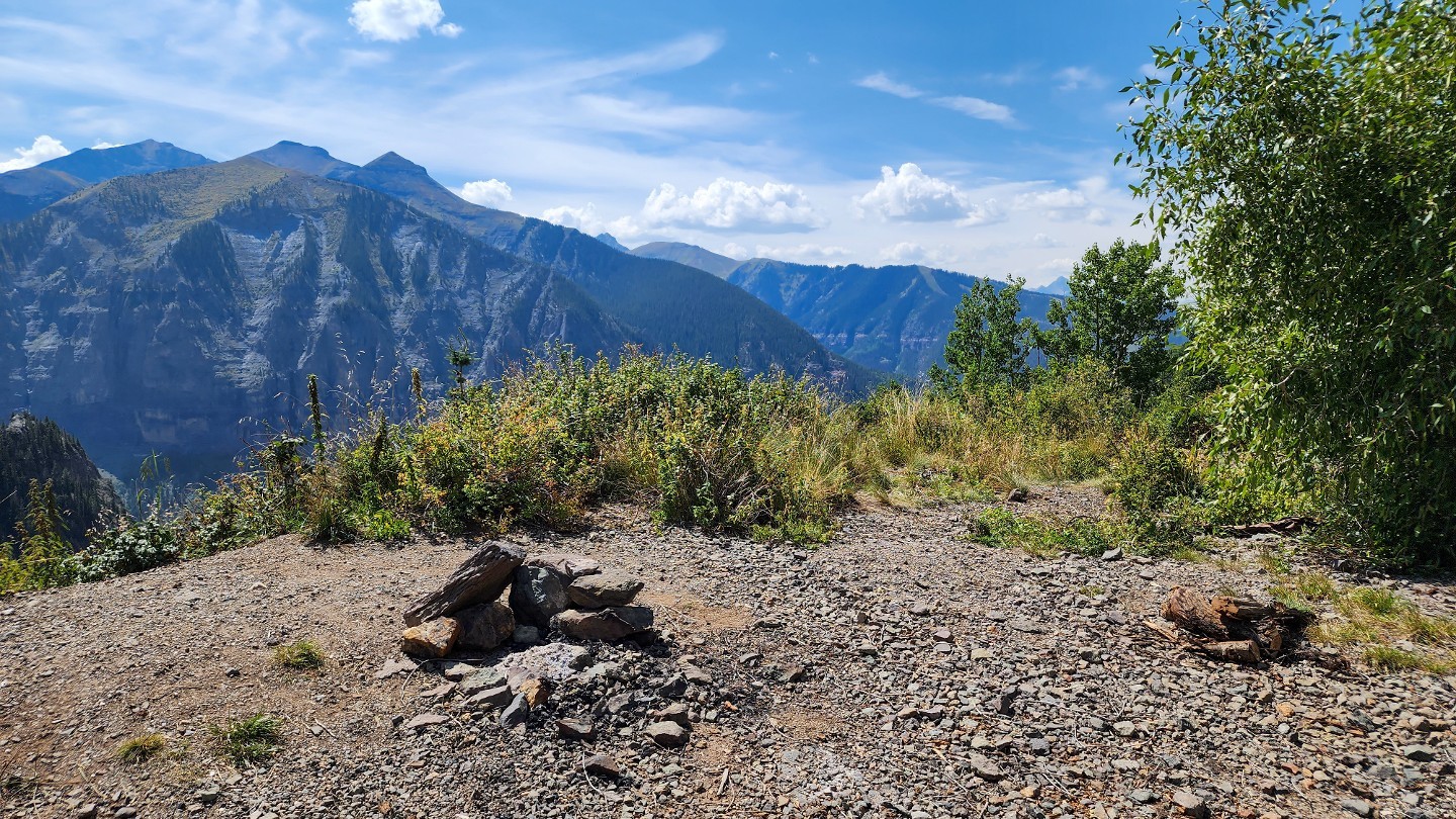
WaterImogene Pass offers gorgeous scenery and traversing backcountry rich in mining history, offering an opportunity to look back into time and relive what it would have been like to live and work in harsh alpine mining environments. Huge mining structures and machines are plentiful along what was once the richest gold and silver mining area in Colorado. Book-ended by the beautiful towns of Telluride and Ouray at either end of the trail, it is no wonder this is a Jeep Badge of Honor Trail.
Trail Difficulty and Assessment
Recommended Vehicle:
Stock SUV with High Clearance and 4 Low
Concerns:
Summary:
Easily traversed by a stock 4x4 with low range. Expect narrow shelf roads, steep climbs, and slight off-camber camber terrain above the treeline. The high-end rating comes from optional lines near Waypoints 8 and 12.
Community Consensus
2 votes
23 votes
4 votes
Easier
Spot On
Harder
The weighted average of your fellow members agreement of our trail rating. As trail conditions change this helps us keep the community aware of changes.
Mandatory
3 -
MODERATE
The hardest part of the trail that you
cannot bypass - you have to drive it.
Optional
6 -
DIFFICULT
The hardest part of the trail that is
purely optional - you can bypass it.
Typically, more rock or undulated road surface. Potential rocks and/or tree stumps less than 12" tall and/or vertical ledges less than 12" tall and/or near vertical ledges or waterfalls less than 24" inches. Tire placement becomes more difficult. Can be steep. Read More about our Rating System
Start your next adventure on Imogene Pass

Upgrade your Membership
Unlock all of the details on every Trail Guide and Scout Route.
Start a 7-day Free TrialUploading to Gaia GPS
Share Trail
Trail Navigation
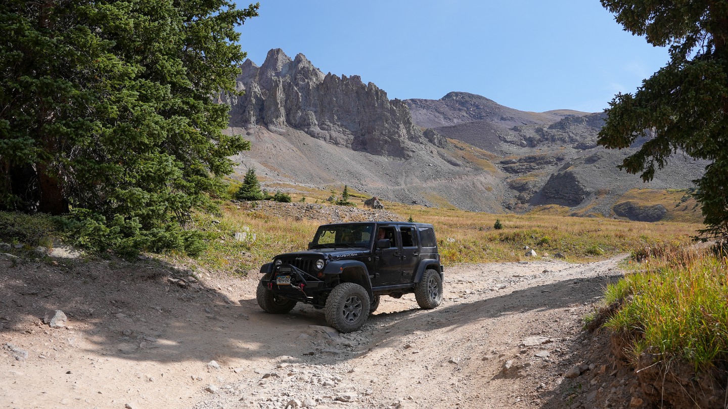
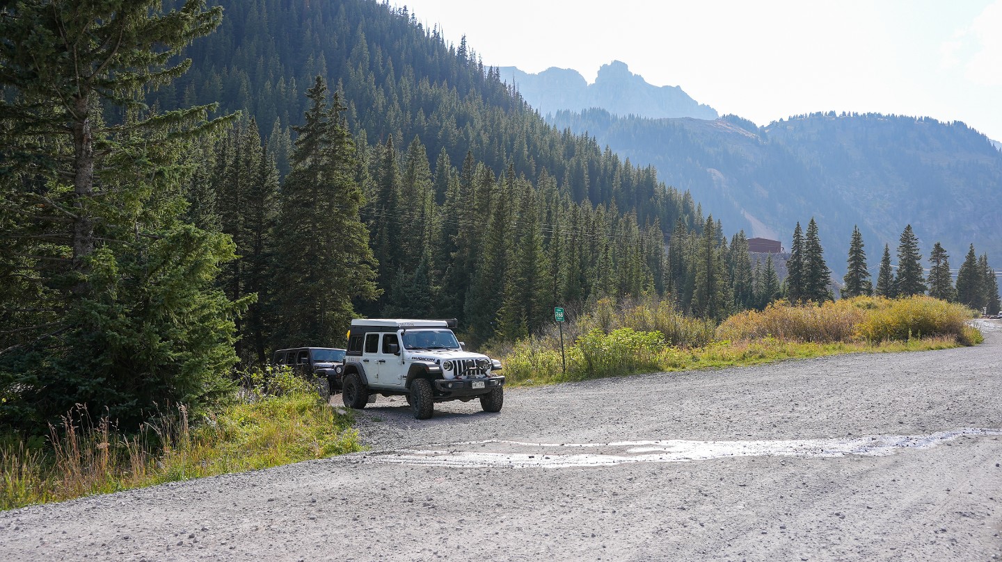
Imogene Pass is a straight-through route connecting San Miguel County and Ouray County, crossing an elevation of 13,114 feet.
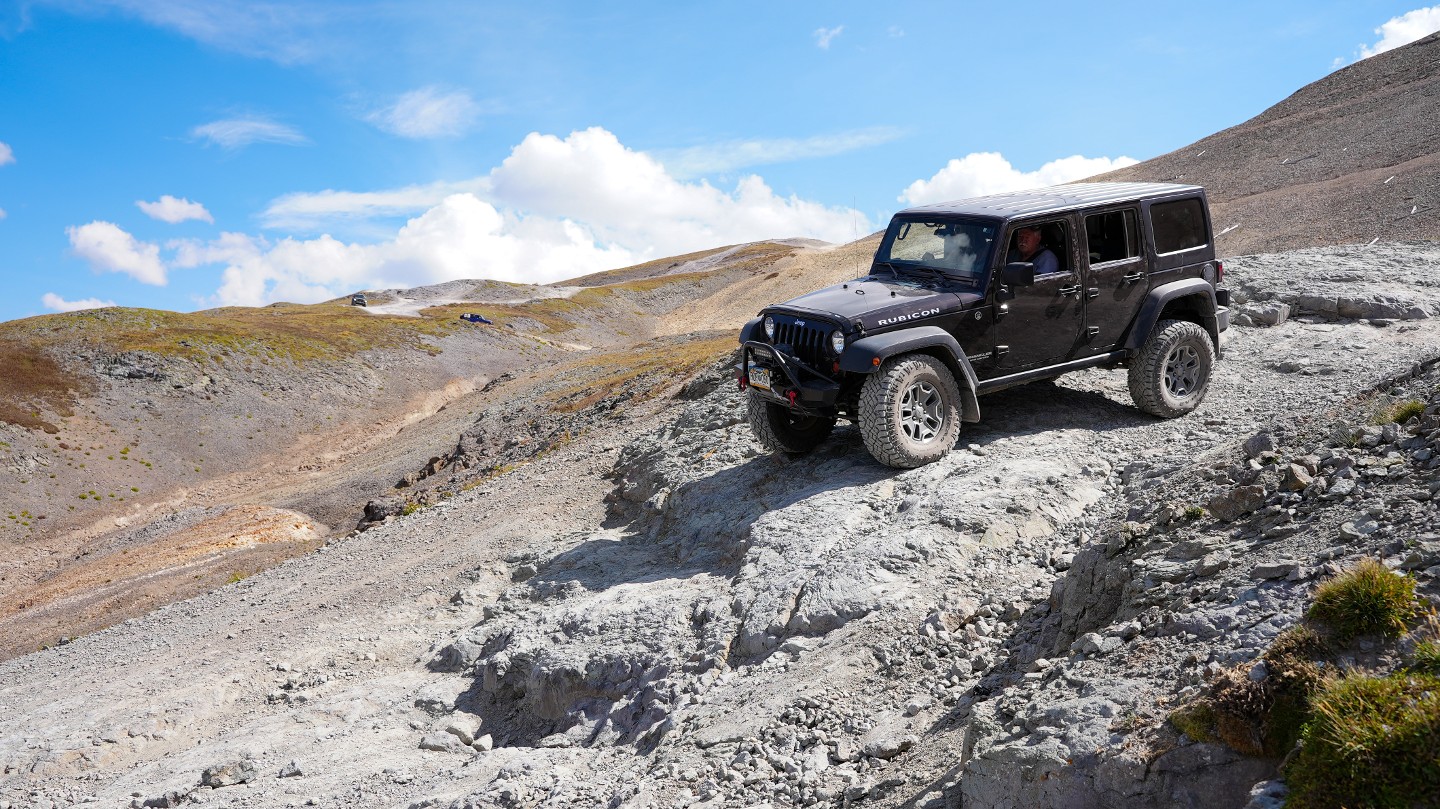
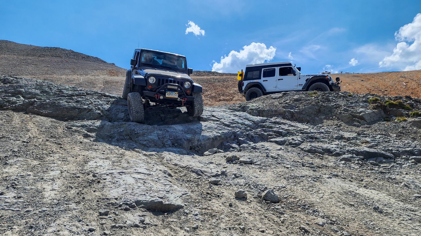
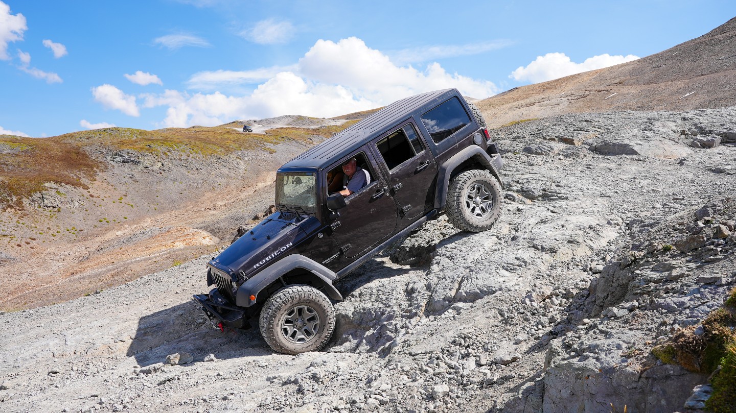
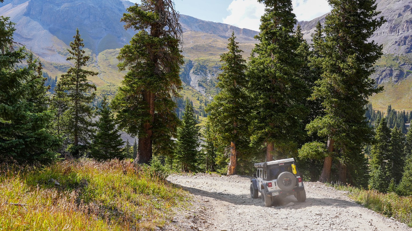
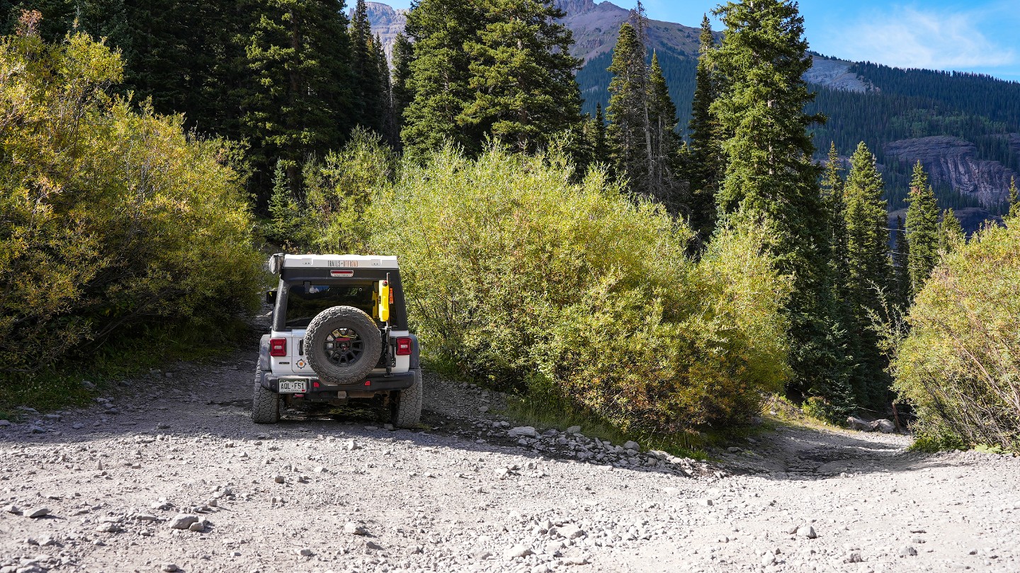
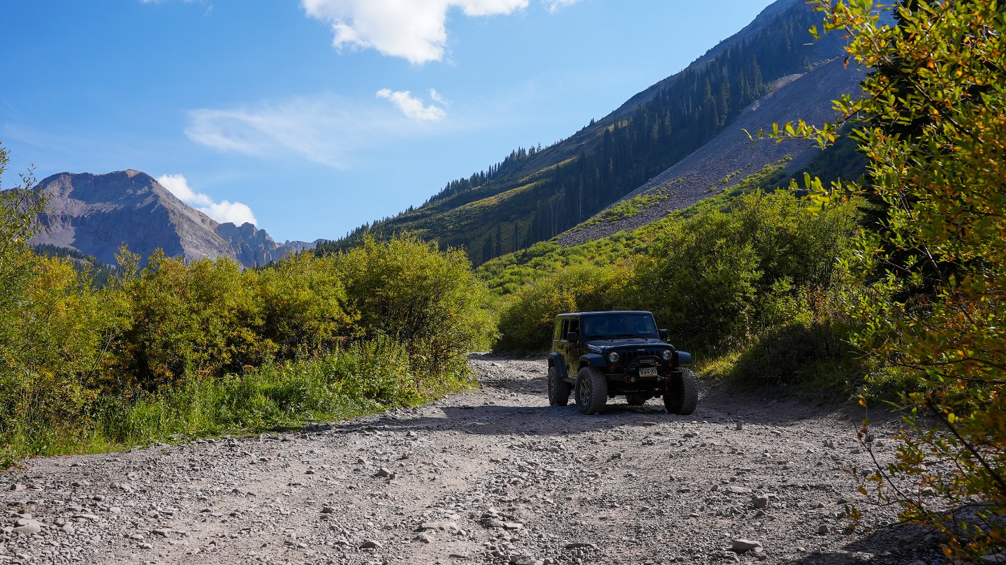
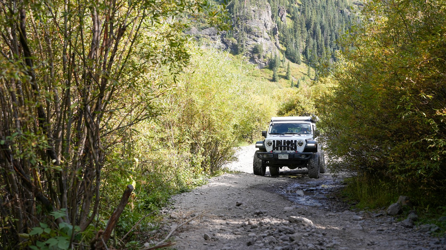
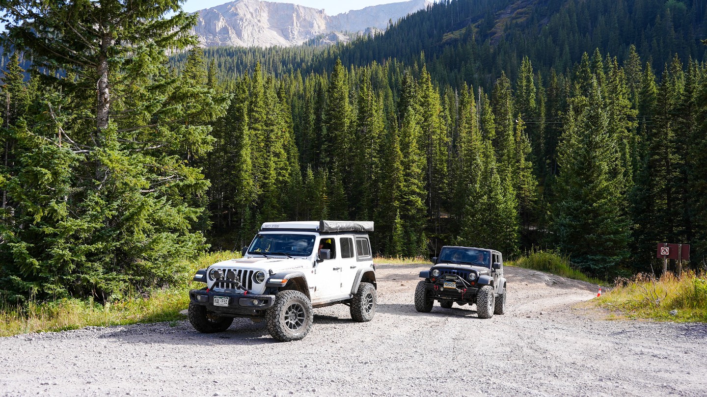
Ascending from the quaint little town of Telluride, aspen trees surround the rocky dirt road. The road is narrow, but there are a number of places to get past oncoming traffic. On the way to Tom Boy Mine and the summit, the trail becomes a narrow and intimidating shelf road.
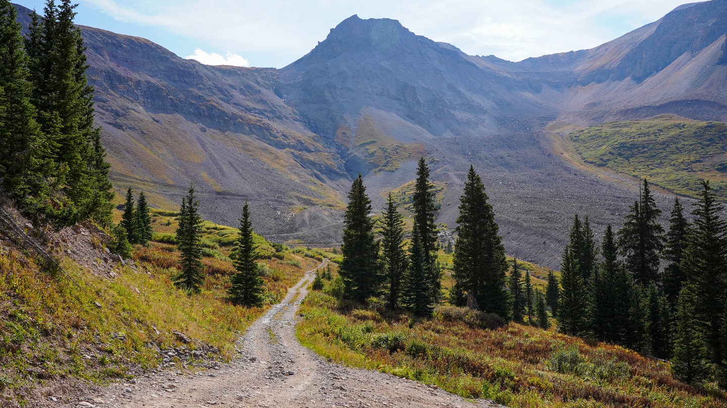
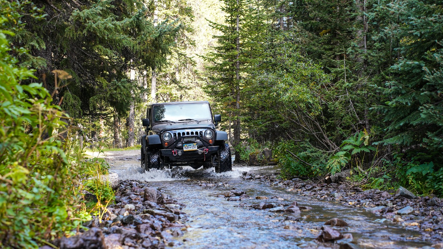
The trail is rocky and bumpy downhill from the summit, with a few optional obstacles. This portion of the trail is the most challenging for those driving from Ouray to Telluride, east to west. The views in this area are beautiful. The trail has a few water crossings as it descends into the valley. The trail passes through a dense forest before intersecting with Camp Bird Road.
The trail is extremely narrow in sections with limited passing opportunities.
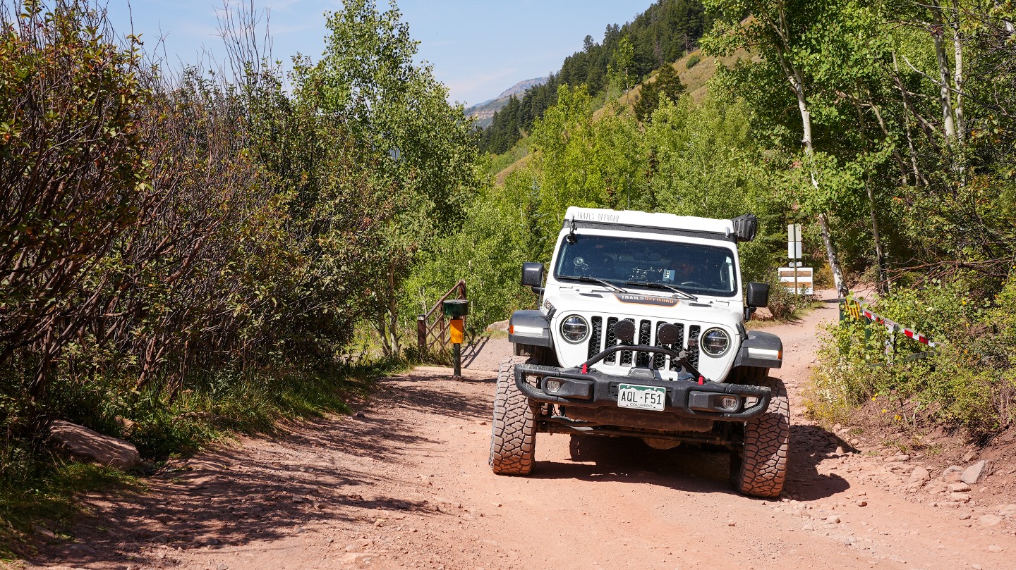
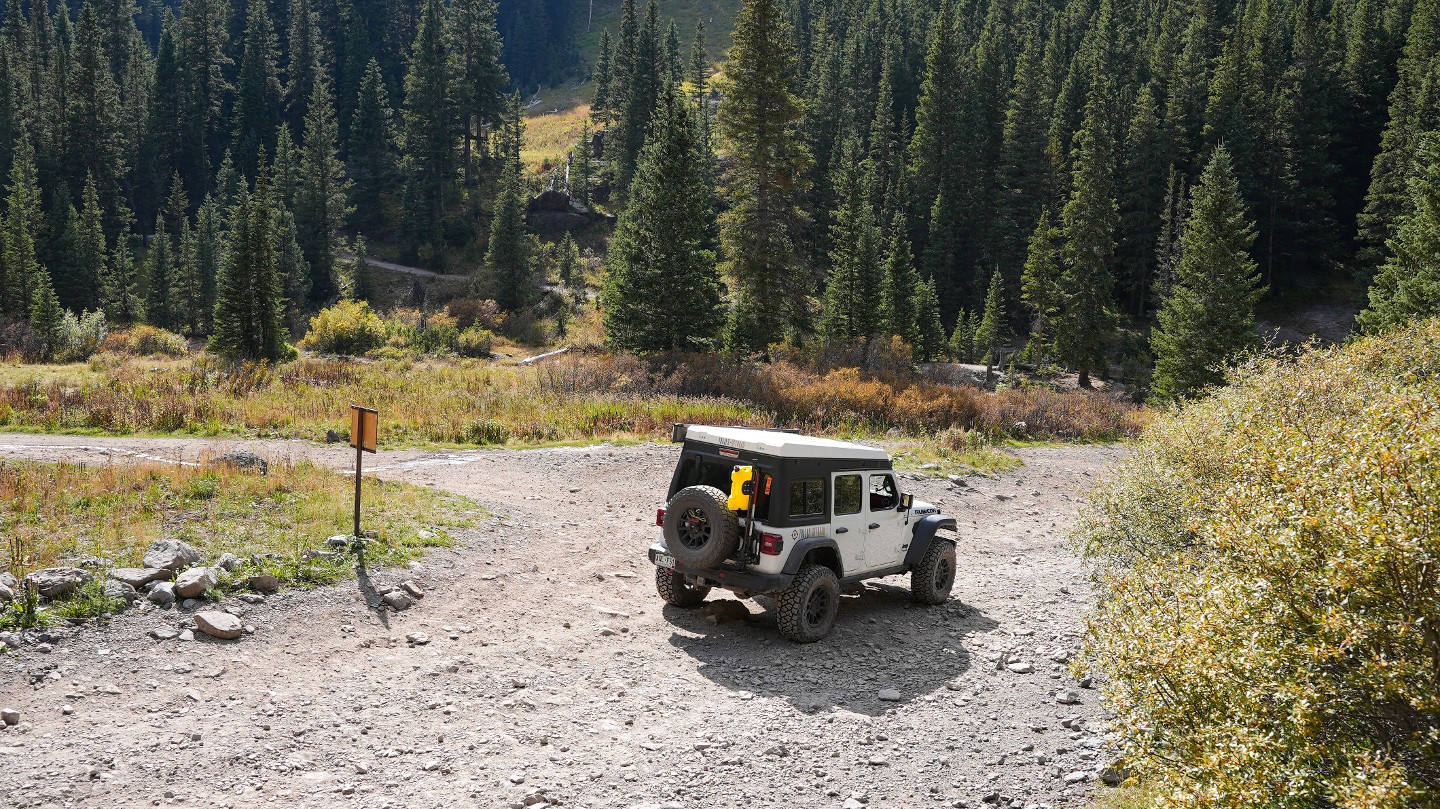
1. Southern Trailhead (0 mi)
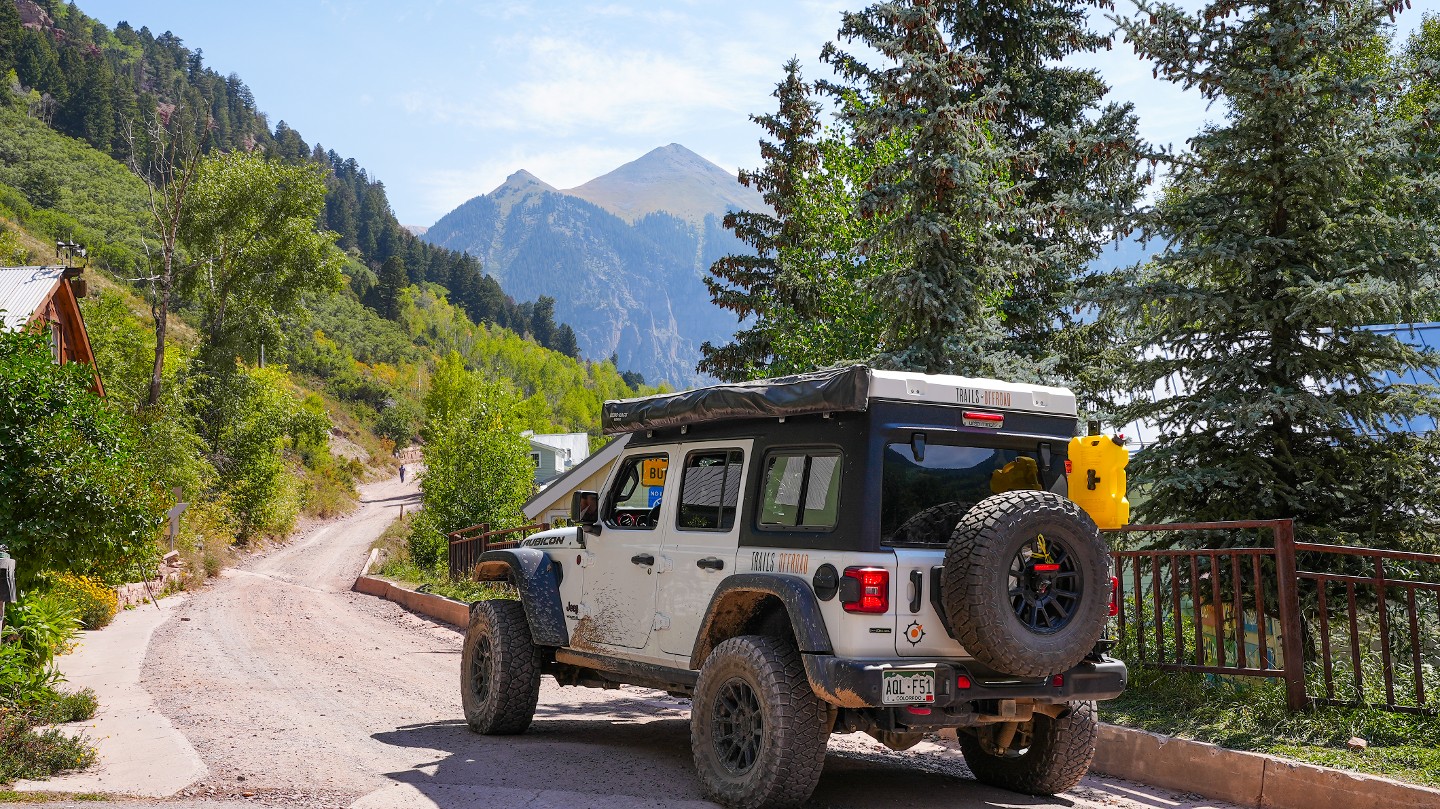
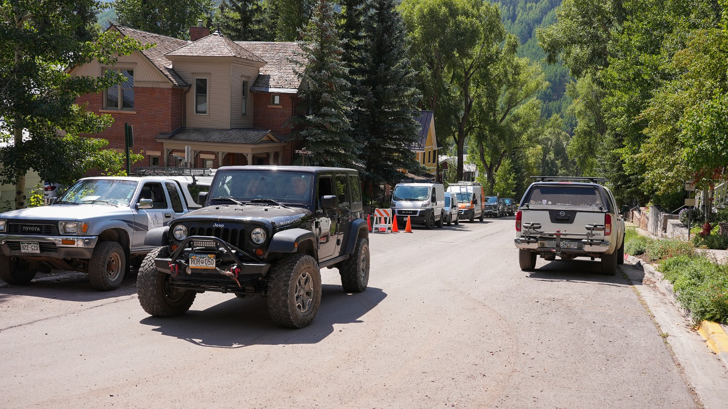
The southern trailhead looks like an alley behind neighborhood homes in the area. However, the trail is well-marked with Forest Service signs. Since this first stretch of trail is a residential area, please keep noise levels and speed to a minimum.
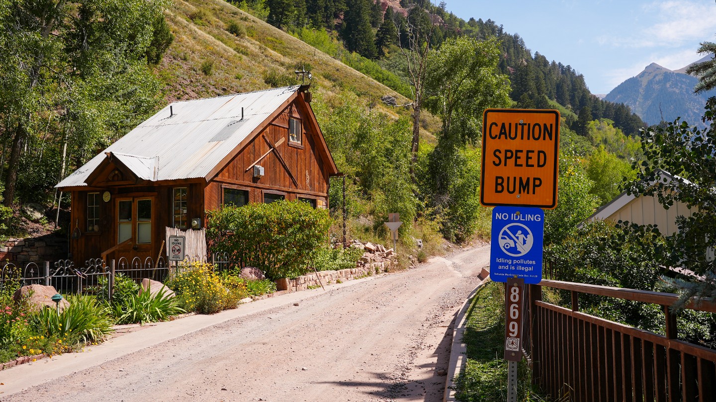
2. Seasonal Gate (0.32 mi)
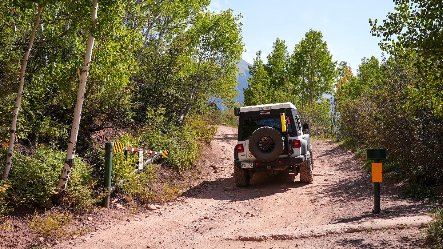
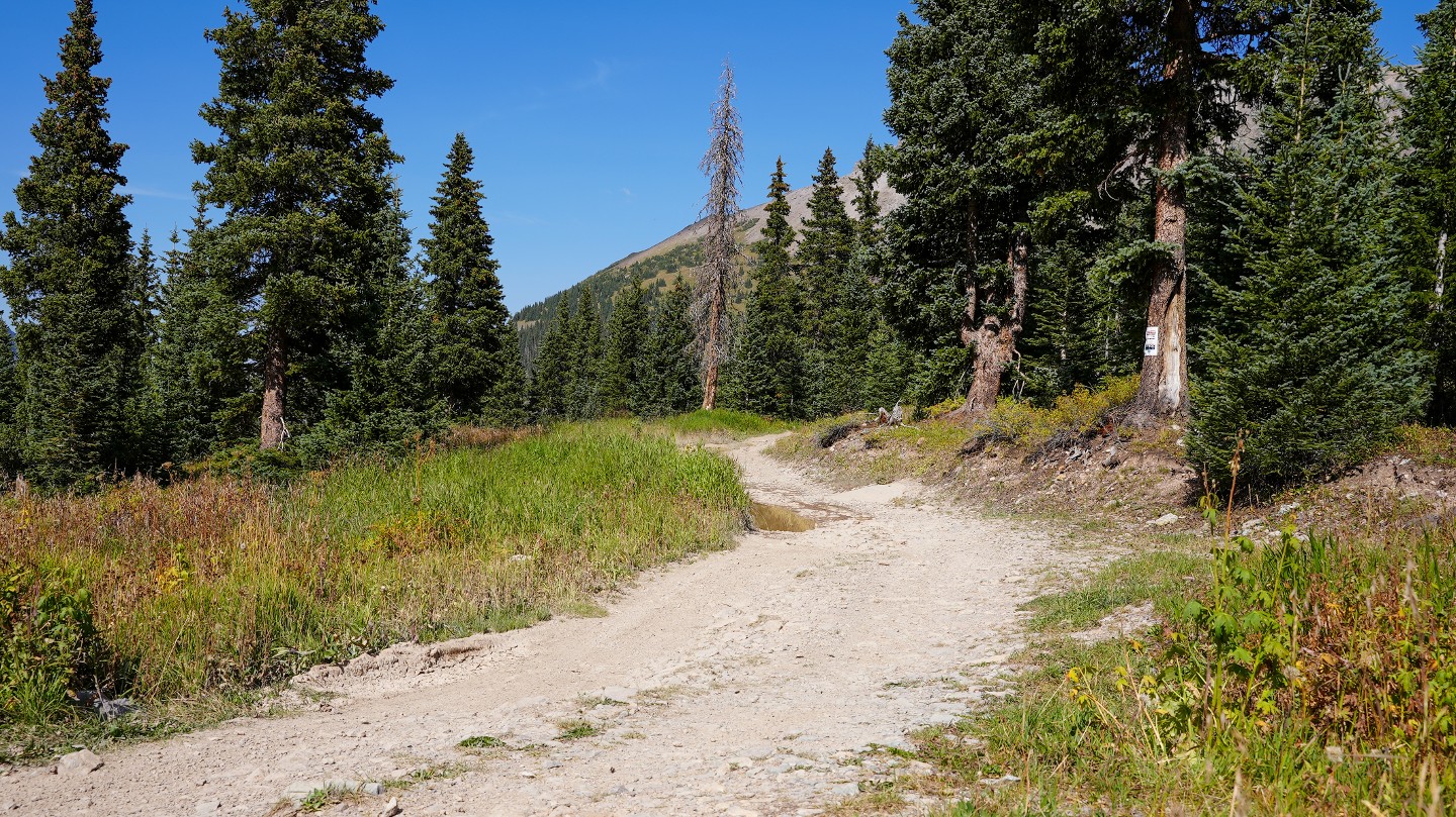
A short distance from the trailhead is the boundary for Uncompahgre National Forest. A seasonal closure gate will be open if the trail is passable. The major trails in the San Juan mountains are bulldozed to clear snow and rockfall off the trails in hopes of making them passable sooner. Imogene is usually clear by the July fourth weekend.
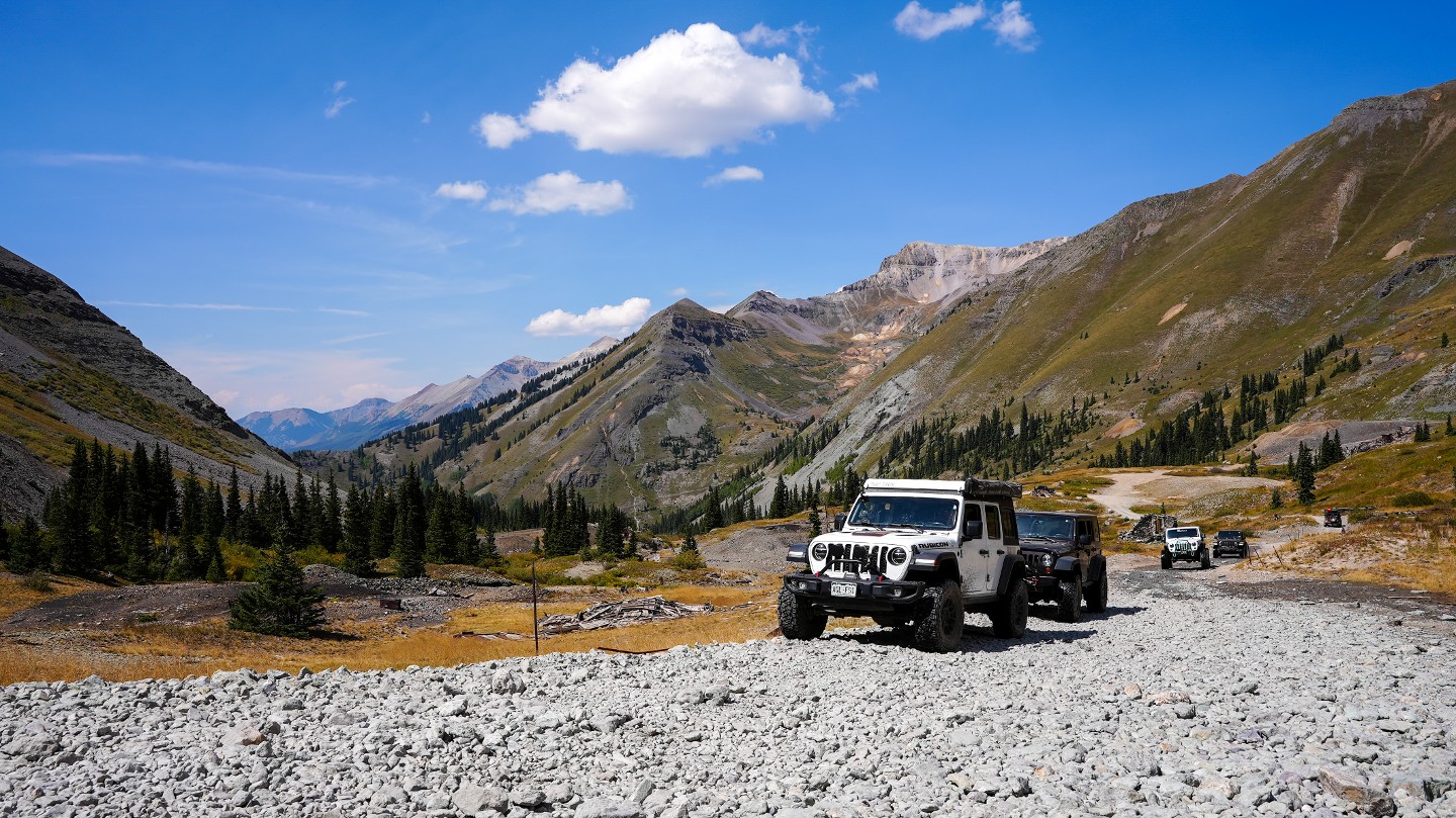
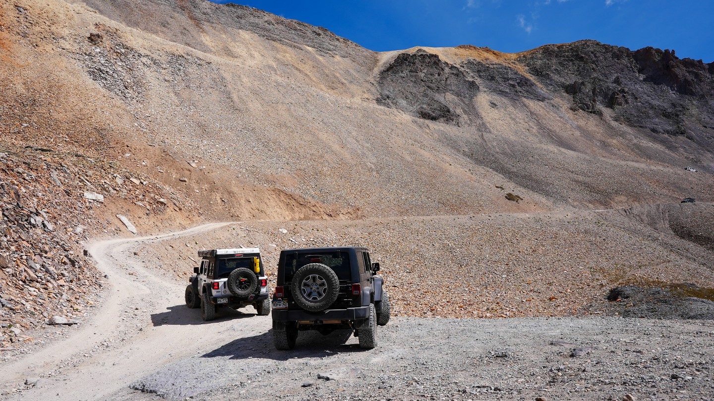
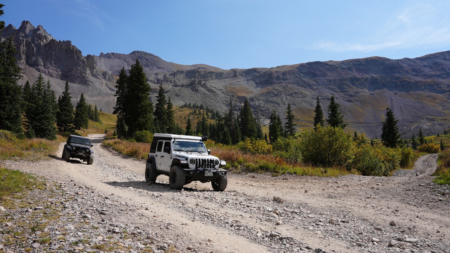
3. Scenic (2.15 mi)
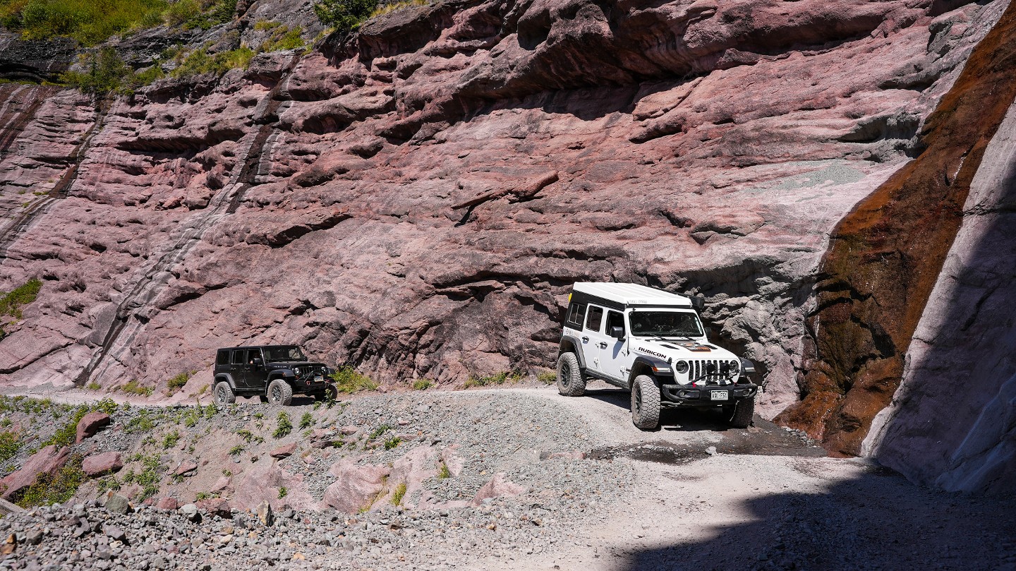
The trail quickly becomes a narrow shelf road with towering cliff faces to one side and sheer drop-offs on the other. There is excellent visibility ahead to spot oncoming traffic, but pull-offs and passing areas are limited. Generally, uphill traffic has right-of-way unless it is safer for uphill traffic to pull off to let others pass.
4. Social Tunnel (2.6 mi)
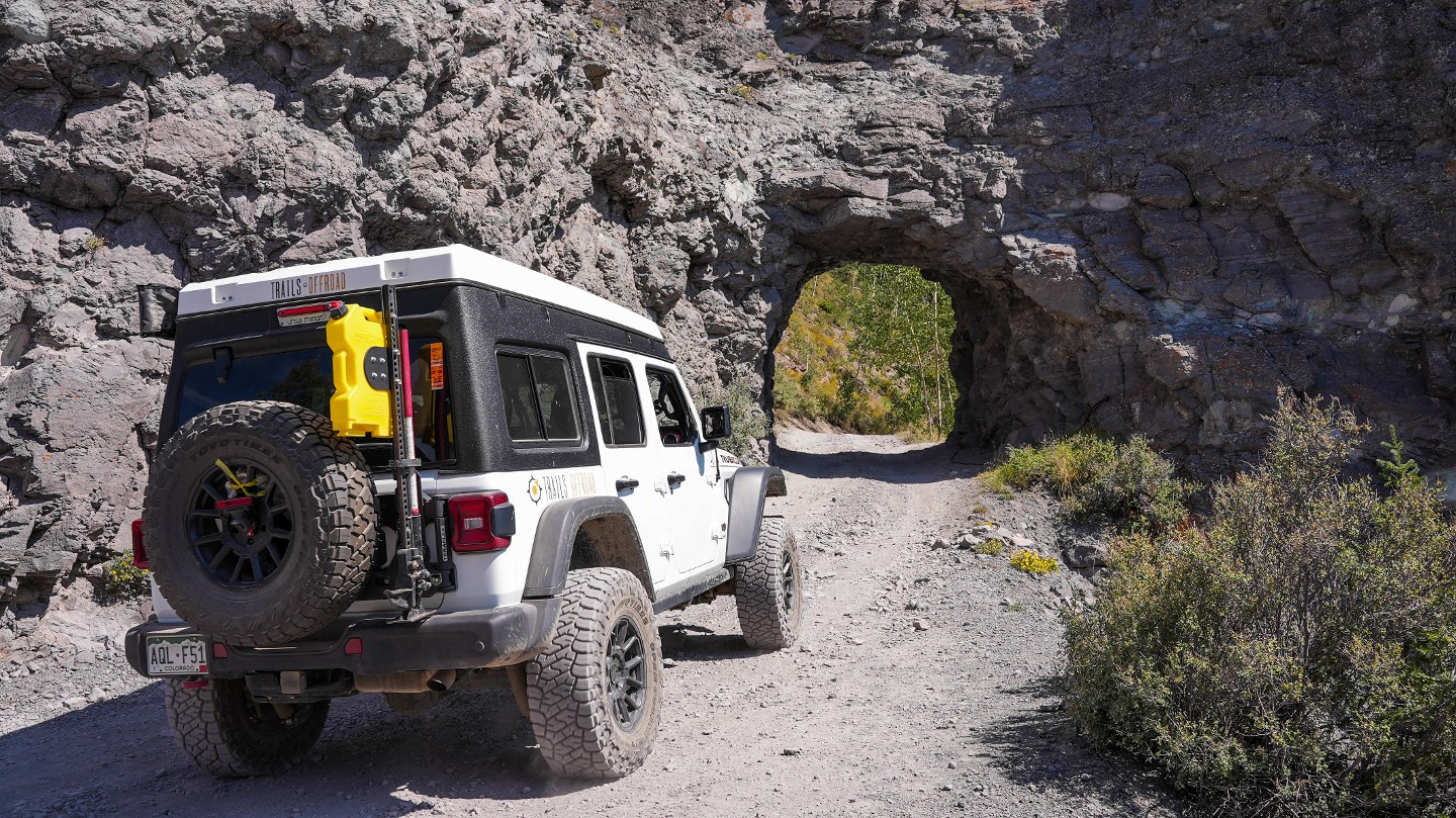
The Social Tunnel was blasted through the stone cliffs. This tunnel has seen horses, wagons, and vehicles pass through it for over 130 years. Spectacular views abound in every direction. There is room at this point for one or two vehicles to pull off to the side to let traffic through or take in the views. More information on why this is named Social Tunnel can be found in this article from Denver Channel 7.
5. Smuggler Union Mine (3.52 mi)
Nearing the timberline sits Smuggler Union Mine. Gold and silver were first discovered in the Smuggler's vein in 1875, and the Smuggler Union Mine quickly became one of the most lucrative mines in the area. The Bullion Tunnel is now gated off but used to transport ore from Ouray to Telluride for processing. Many mine shafts are still present, and there are signs advising travelers of the unstable nature of the structures and open mines in the area.
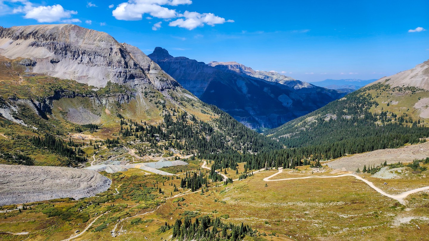
6. Tomboy Townsite (4.53 mi)
The trail enters the Savage Basin, where the massive Tomboy Townsite once stood. Constructed in the 1880s and active until 1927, Tomboy was once home to more than 2,000 residents. Many people lived here year-round, utilizing tunnels dug out of the snowpack to travel between buildings during winter. Once you leave the mine on your way toward the summit, you'll see more of the shacks and various other structures of the Tomboy Complex. Signs are posted in various places around Tomboy, notifying visitors that the structures in this area are unstable and are private property. Please stay on the road and do not attempt to enter any buildings.
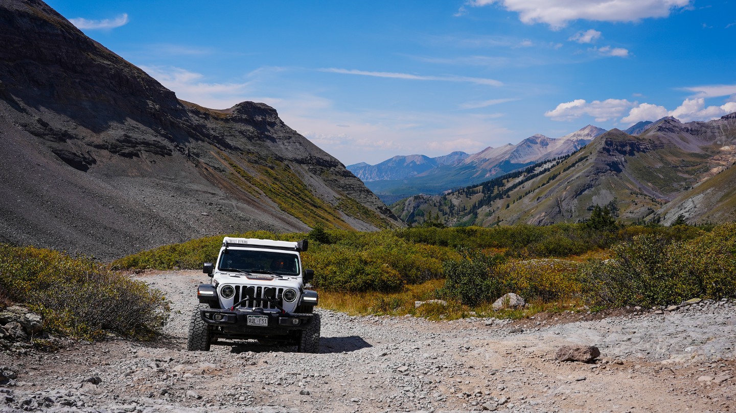
7. Columbia Mine (5.01 mi)
Numerous mine sites continue to dot the landscape with an epic view back towards Telluride.
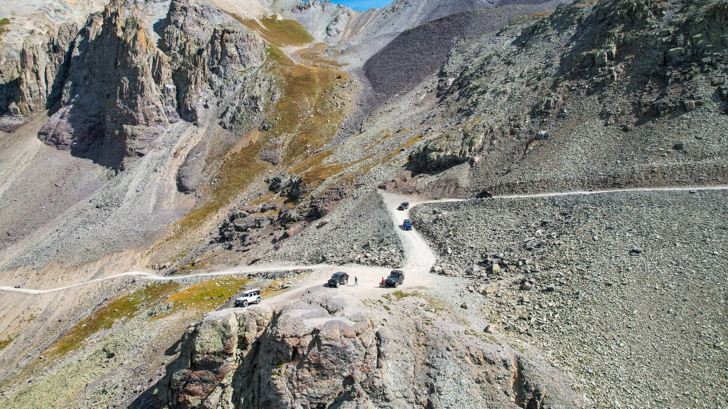
8. Confusing Intersection - Stay Right (5.29 mi)
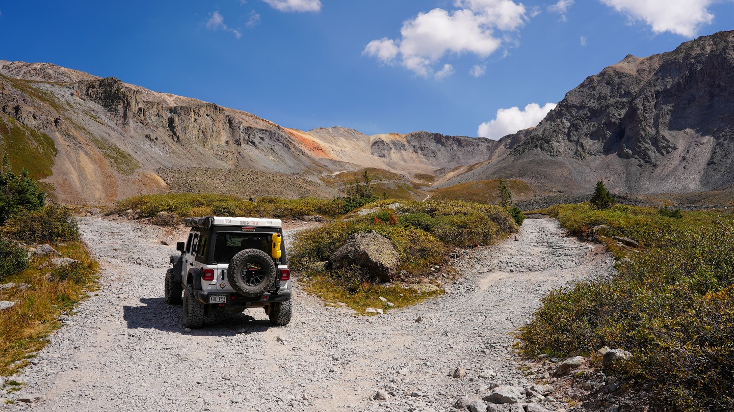
The trail splinters into three different routes. Although the main road appears to lead to the left, that route only takes you to another former mine site. Stay right, following either the first or second route up the hill as they reconnect in a short distance.
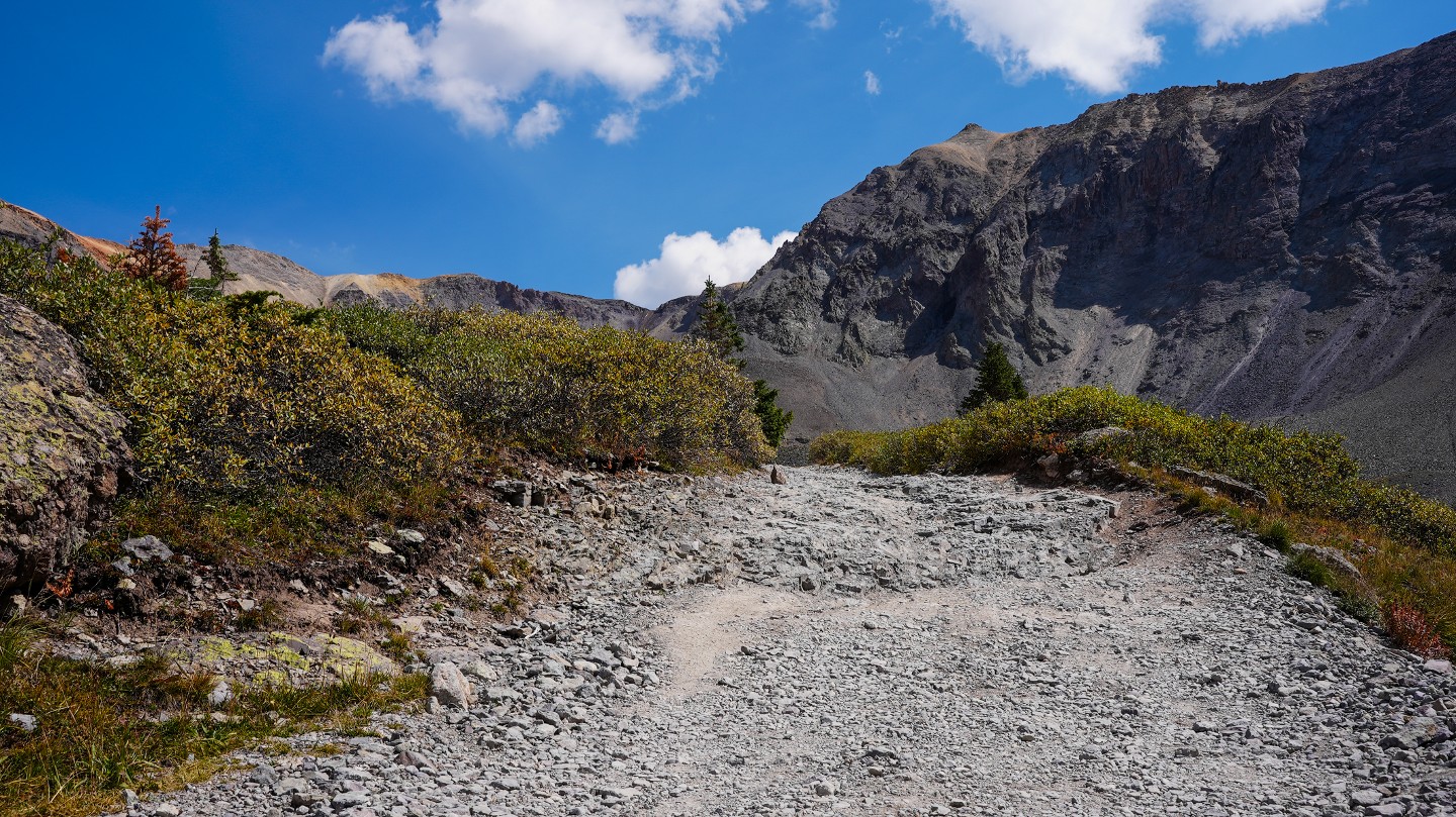
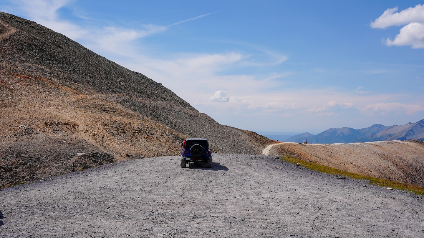
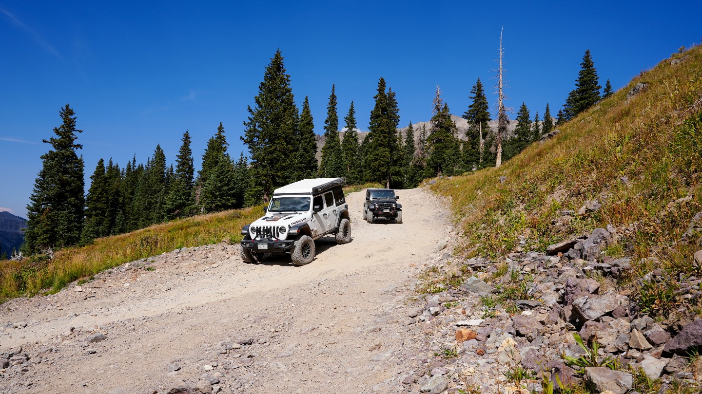
9. Begin Shelf Portion (6.13 mi)
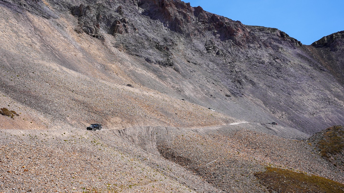
Nearing the final climb to the summit, the trail narrows substantially with few pull-out opportunities. This situation is exacerbated early in the summer when dozers cut single-lane roads through snow drifts with 20-foot walls on both sides, making it impossible to see oncoming traffic. Be sure to look far ahead and use available pullouts when necessary.
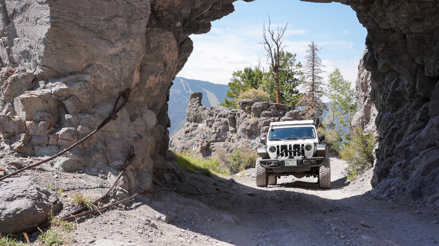
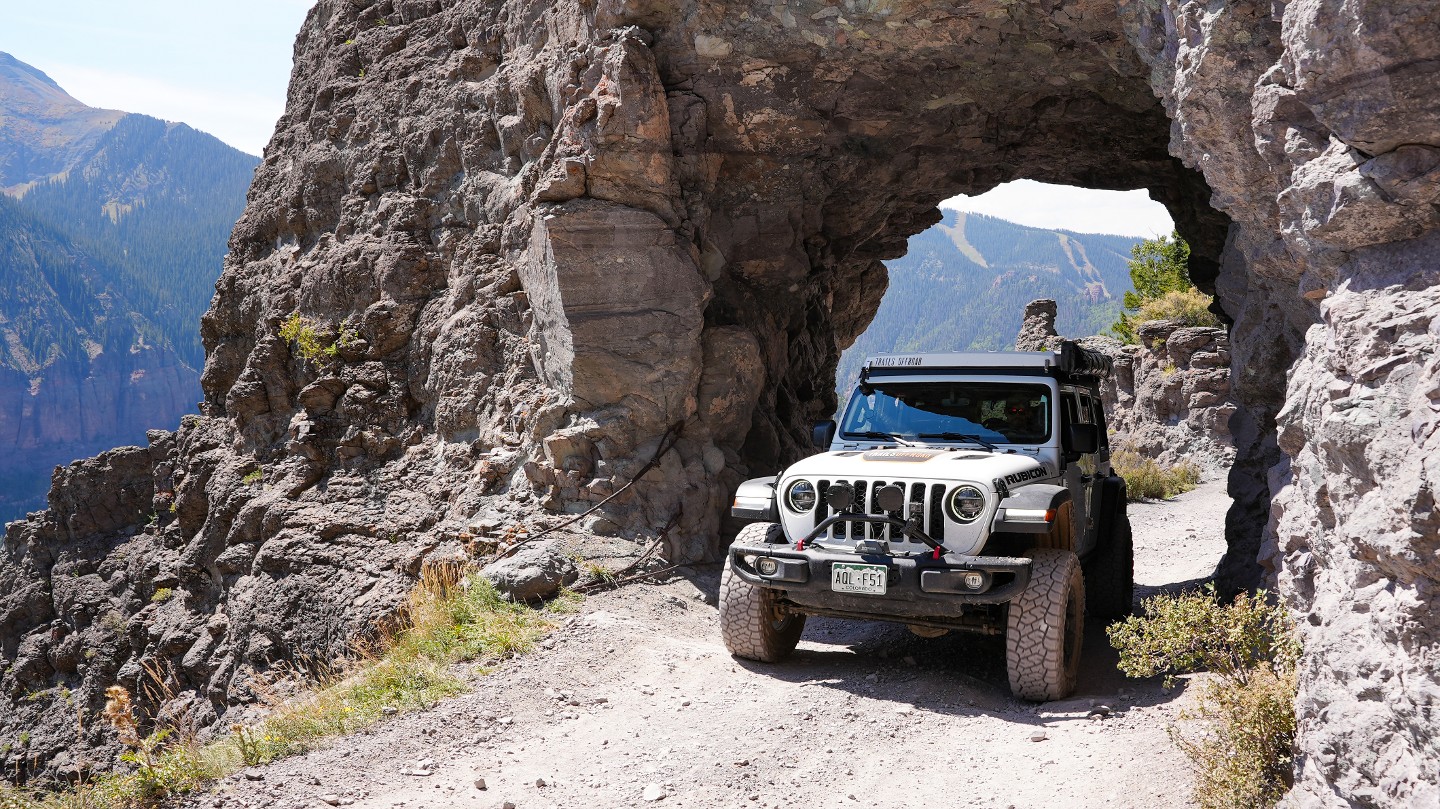
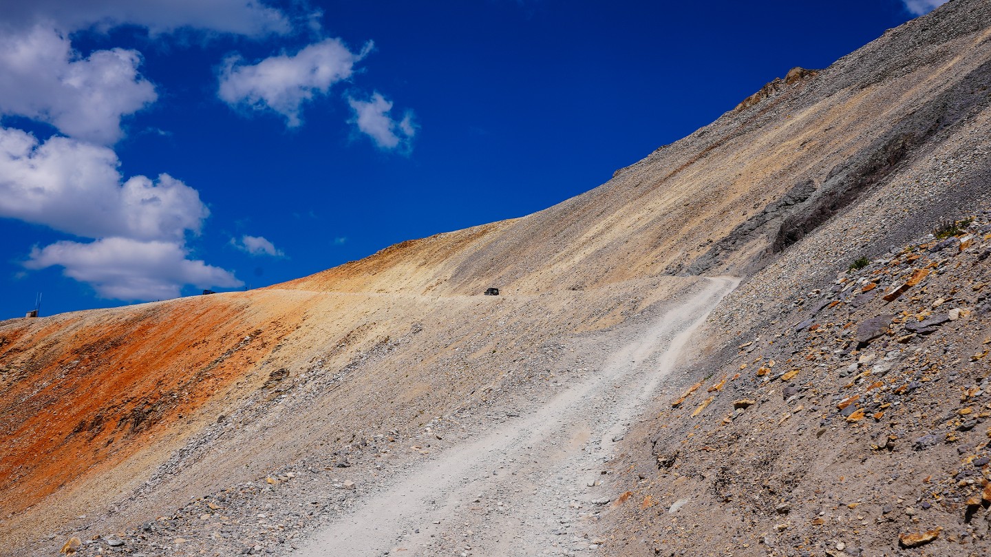
10. Imogene Pass Summit (6.58 mi)
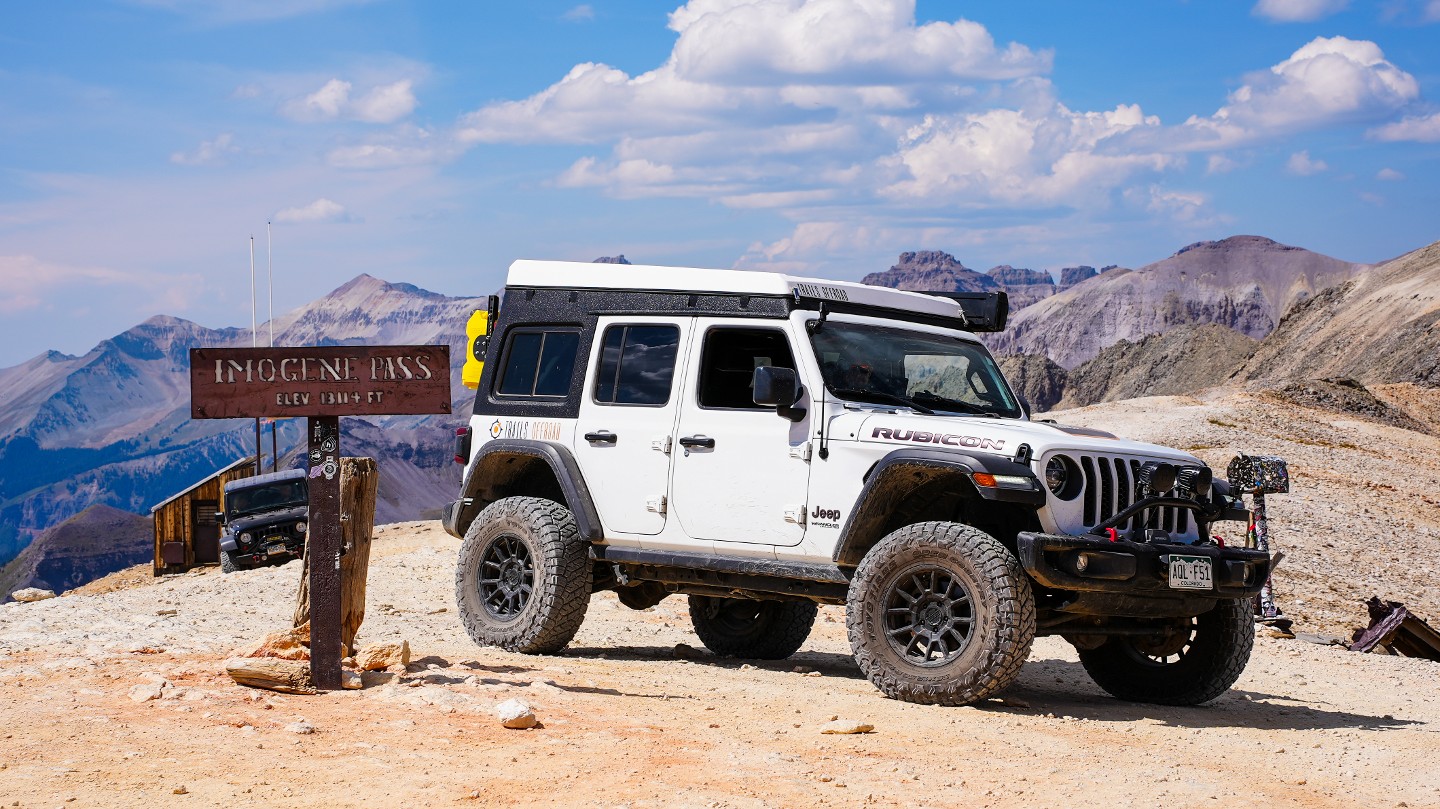
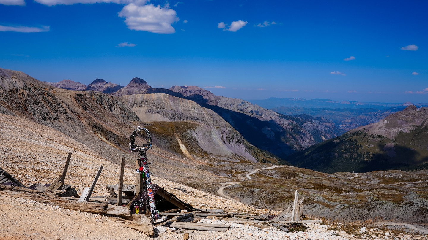
After a steep climb out of Savage Basin, the trail tops out on Imogene Pass,13,114 feet. There is a small parking area at the summit for travelers to stop and enjoy the 360-degree views. A short steep hike up to the east from the summit leads to the remnants of Fort Peabody, a sentry post for Colorado National Guard soldiers, constructed in 1904 to prevent union miners or their sympathizers from entering San Miguel County during the height of statewide labor disturbances. More information on Fort Peabody can be found here courtesy of the US Forest Service.
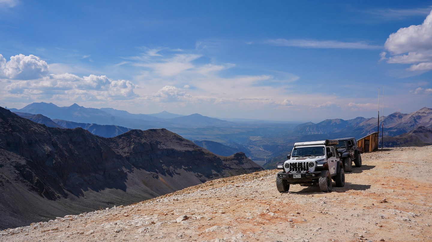
11. Viewpoint (6.88 mi)
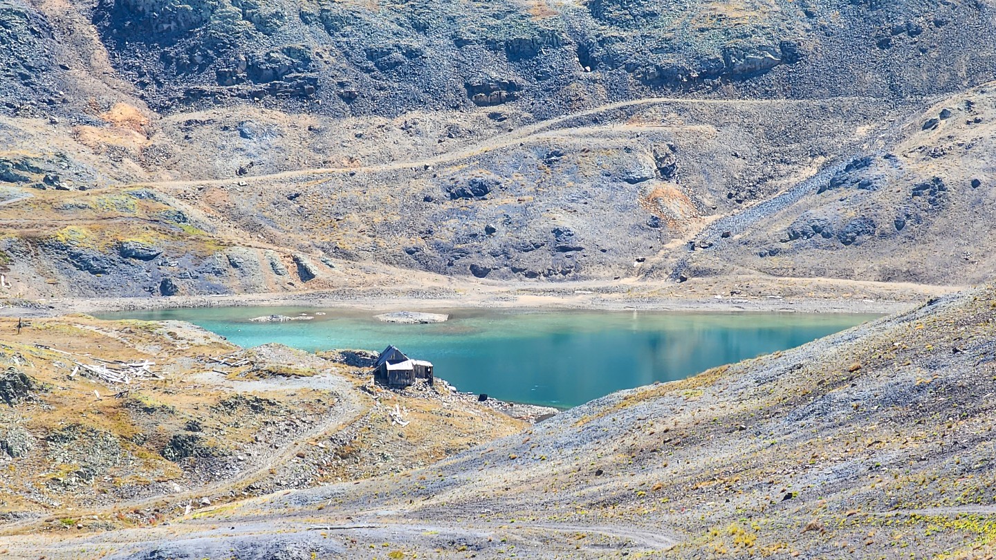
This viewpoint is the highest drivable elevation along Imogene Pass, at 13,217 feet. There is a large parking area here for numerous vehicles where you can look out to the east, past US 550, and gaze down upon Red Mountain and several other 4x4 trails like Corkscrew Gulch and Minnehaha Basin. Ptarmigan Lake and a few old structures can also be seen to the south of this viewpoint.
12. Optional Obstacle (7.21 mi)
As the trail begins its descent, there are a series of stone shelves. All of these obstacles have an obvious bypass if travelers do not wish to attempt these optional obstacles.
13. Poser Rock Viewpoint (8.31 mi)
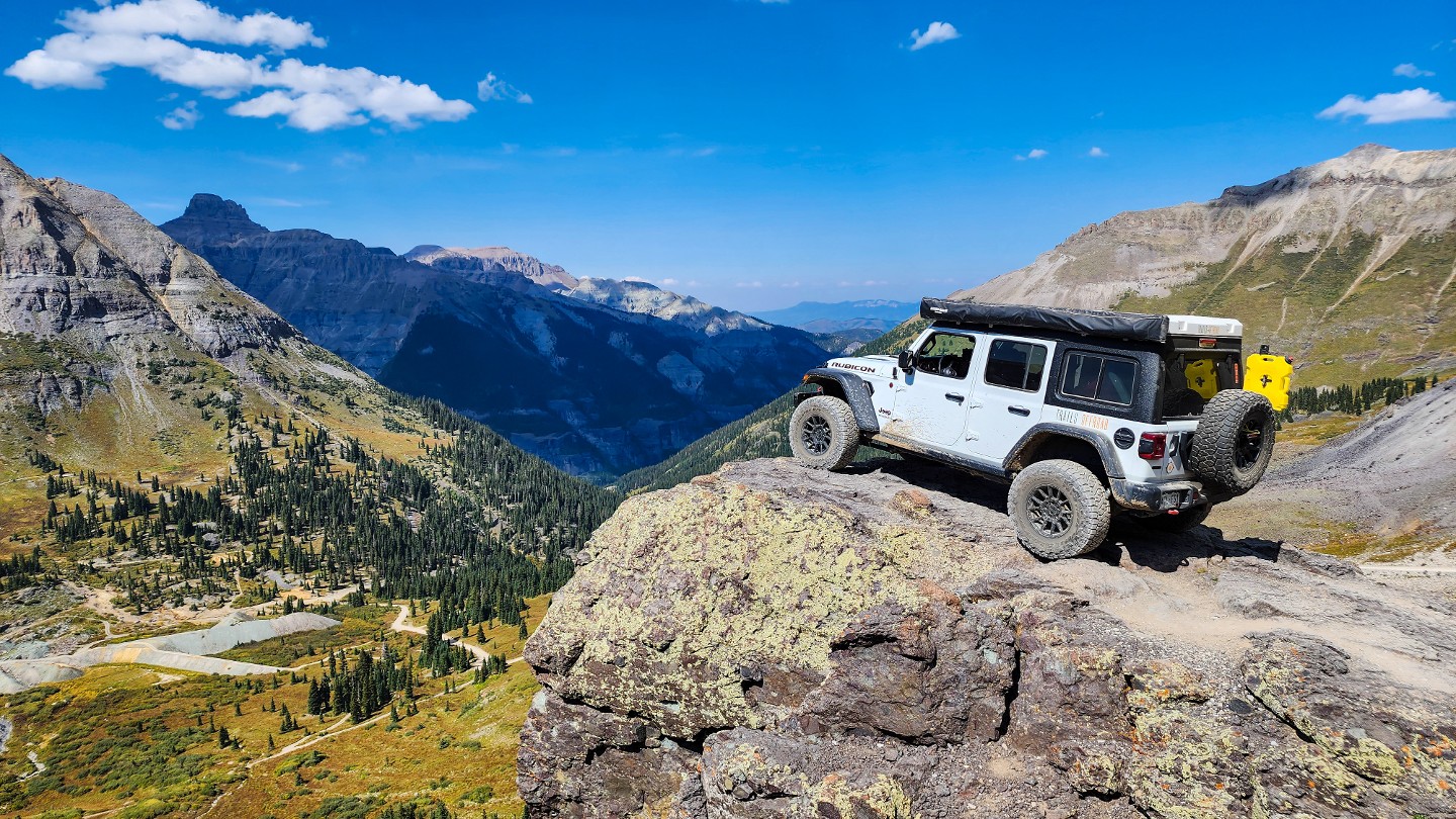
A prominent rock outcropping is the perfect setting for a great "hero shot". There's ample parking and breathtaking scenery. A large geologic landform known as a Rock Glacier is visible in the basin below. This is a living glacier, typically only moving a few centimeters a year.
14. Campsite (9.02 mi)

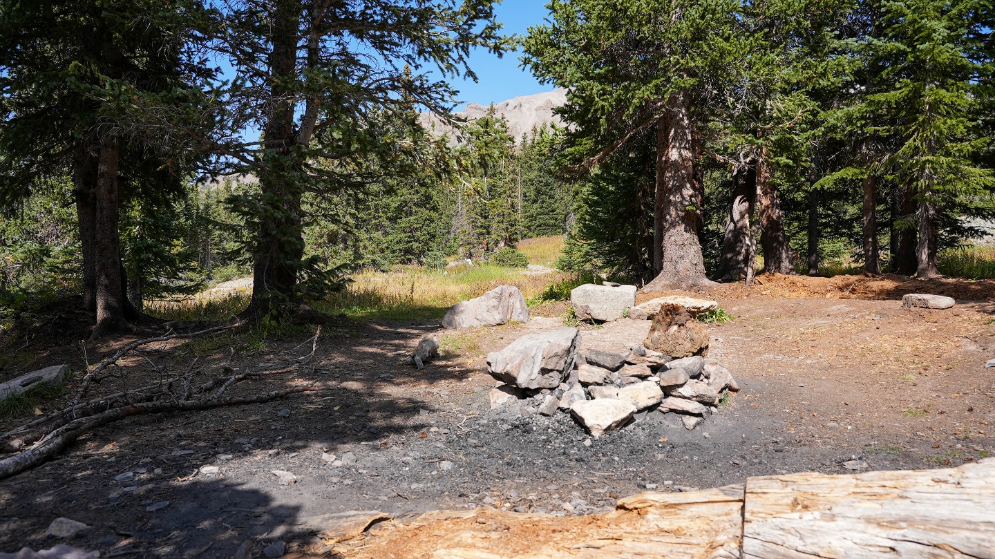
Follow the trail through the curve to the left. The short spur to the north leads to a small campsite best for ground tents and small offroad-type trailers.
15. Camp Bird Mine - Stay Right (9.09 mi)
Follow the trail downhill to the right. The spur road ahead leads to Camp Bird Mine #2 and Imogene Basin.
16. Campsite and Camp Bird Mine (9.22 mi)
Another small campsite exists to the north, good for small offroad trailers and ground tents. The road taking off to the south into the brush leads to Camp Bird Mine #3 and the Hidden Treasure Mine.
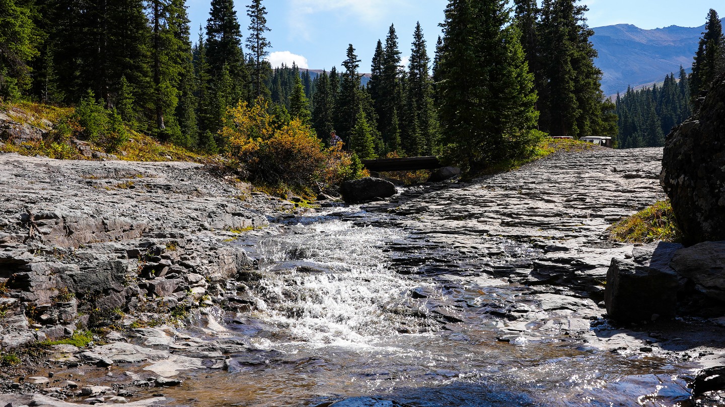
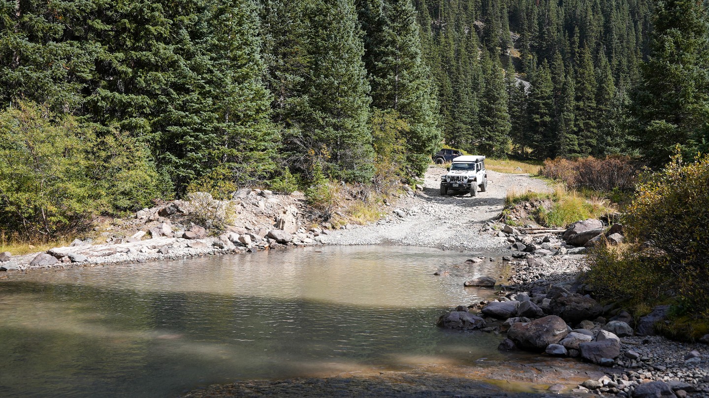
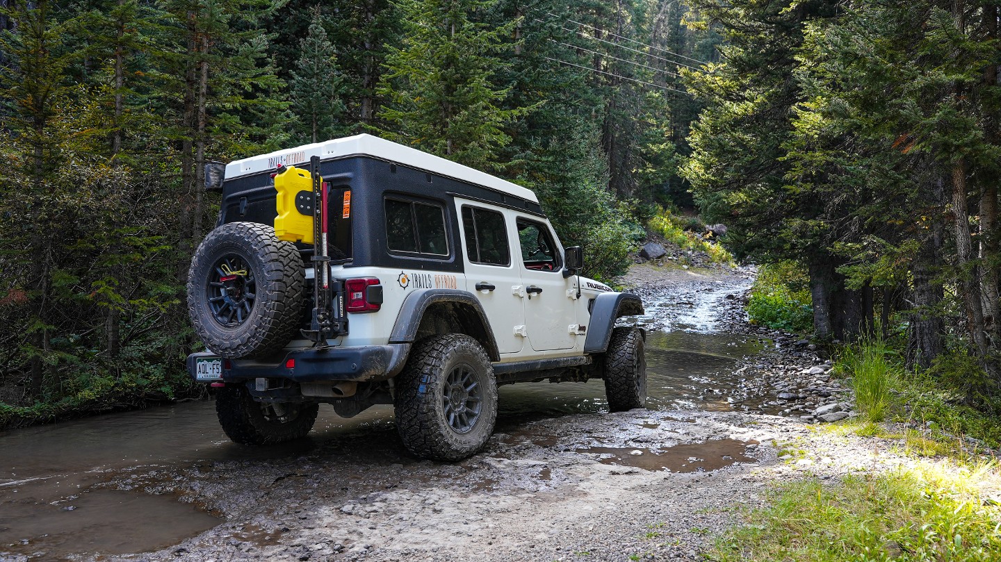
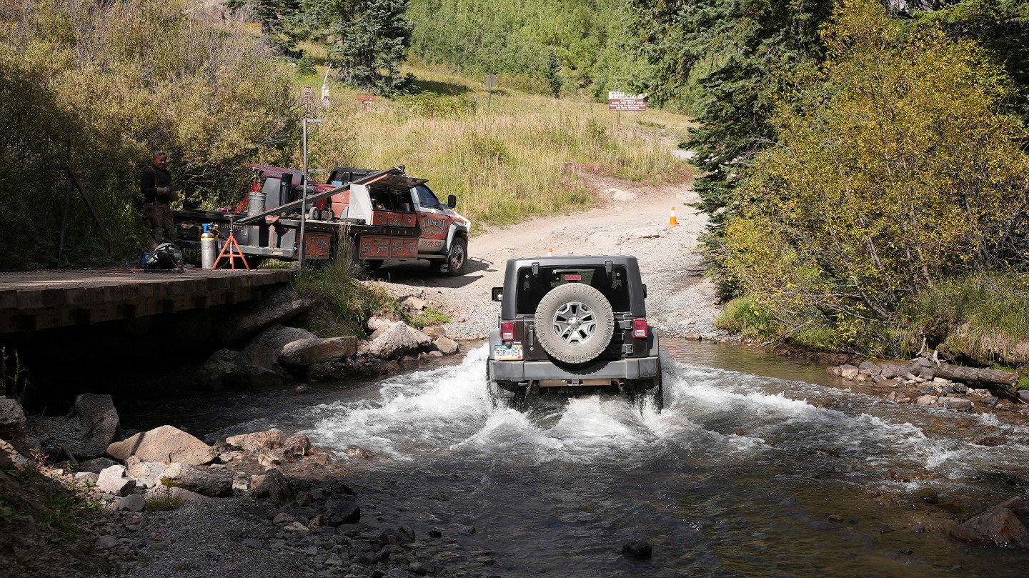
17. Water Crossing (9.32 mi)
The trail crosses Imogene Creek several times. The water could be moving swiftly. However, the bottom is hard-packed gravel, and the water is shallow enough for a stock high clearance vehicle to pass with ease.
18. Water Crossing/Richmond Basin - Stay Left (9.75 mi)
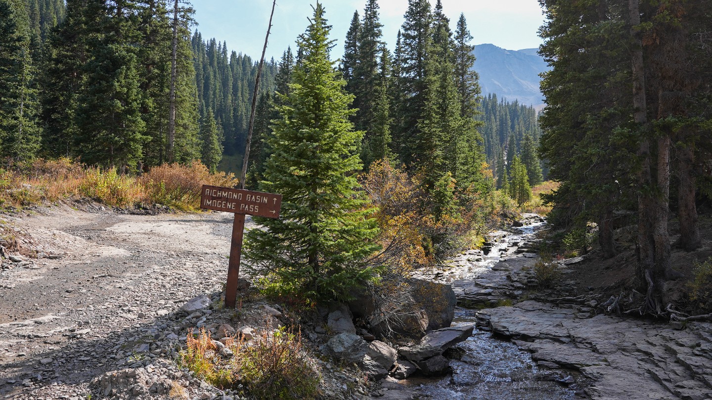
At this point, vehicles can cross Imogene Creek again by either a small bridge or water crossing. After the creek, the Richmond Basin trail intersects here, heading south and offering a few dispersed campsites not far from the bridge. Continue north to finish Imogene Pass.
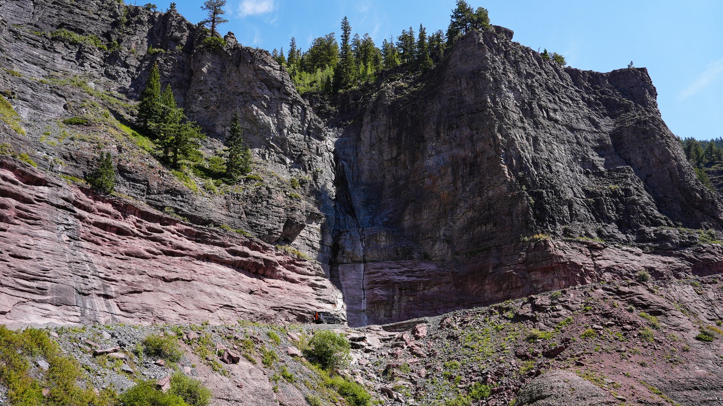
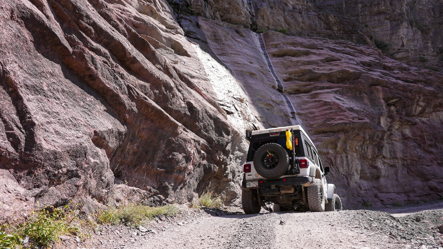
19. Waterfalls (10.04 mi)
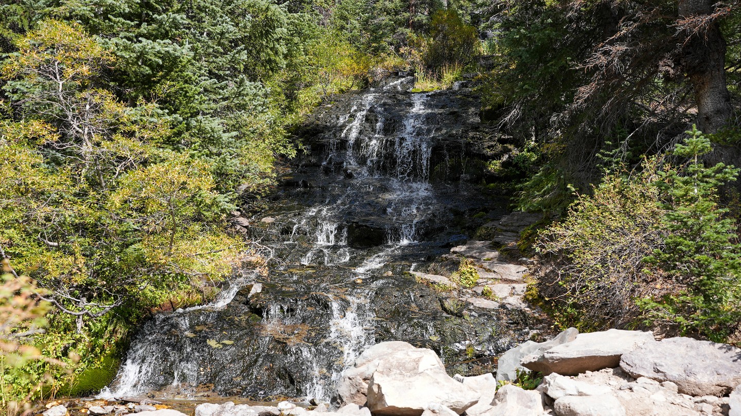
The trail crosses Imogene Creek one last time with waterfalls on both sides of the trail. A short spur road to the north leads to a larger waterfall that is visible from the main road.
20. Trail Split - Stay Left (10.79 mi)
Stay left at this y-intersection. The trail to the right leads down Camp Bird Road and through the Camp Bird Mine.
21. Old Cabin/Mine Tailings (11.24 mi)
Pass by an old mining cabin and a blocked-off mine shaft.
22. Water Crossing (11.63 mi)
The trail briefly travels through a long stretch of creek. This creek crossing has a solid bottom lined with small stones.
23. Silver Basin/Water Crossing (12 mi)
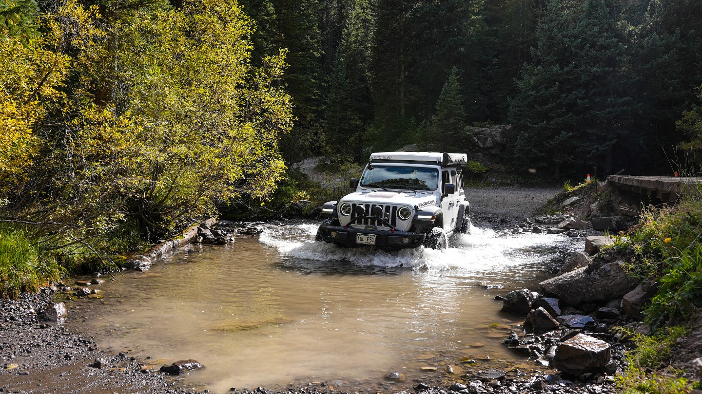
The trail crosses Sneffles Creek either by bridge or by fording the creek. The crossing here can be 1 to 2 feet deep and has a solid bottom. The trail heading north just before the crossing leads down Silver Basin.
24. Northern Trailhead (12.05 mi)
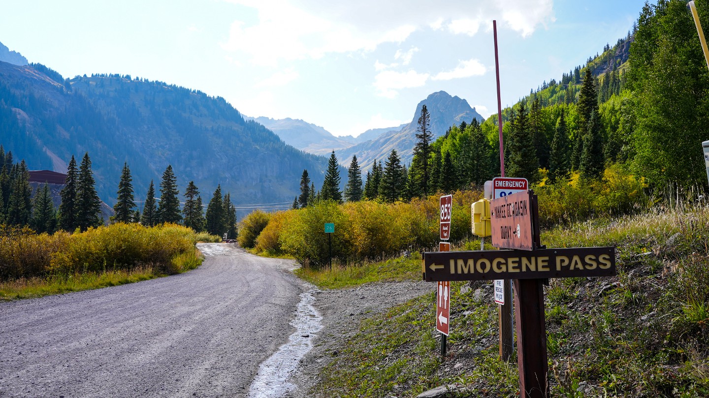
The trail intersects with Ouray County Road 26. A left heading west will take you up Yankee Boy Basin. A right heading downhill to the east will lead to Camp Bird Road and the town of Ouray after 6 miles.
Dispersed
Along the trail, there are very limited dispersed camping options on both sides of Imogene Pass. On the Ouray side of the pass, free dispersed camping is available near the intersection of Imogene Pass and the trail into Richmond Basin.
Starting Point
Telluride, CO
This trail can be run from west to east (Telluride to Ouray) or from east to west (Ouray to Telluride).
**Telluride to Ouray:**
As you come into Telluride on Main Street, Turn north on Fir Street, make the second left on Columbia Avenue, and then take the first right onto North Oak Street. You'll be headed uphill on Oak Street in a residential area. At the very end of the street, turn right. You'll feel like you're driving in an alley behind people's houses, but this is the trailhead.
**Ouray to Telluride:**
From Highway 550 on the south end of Ouray, turn south at the entrance to Box Canyon Falls. This is Camp Bird Mine Road which leads to Imogene Pass, Yankee Boy Basin, and Governor Basin. It is a fairly well-maintained dirt road but has potholes and a lot of washboard due to heavy usage by offroaders and miners from the active Camp Bird Mine and Virginius-Revenue Mine. Follow Camp Bird Mine Road approximately 6.1 miles to the trailhead on the left. The entrance to Imogene Pass is well-marked.
Trail Reviews
4.9/5 (134)
Open
Rated
5/5
Visited: 10/21/2022
Difficulty Accuracy:
Harder
As beautiful the scenery is the danger also is equal. Made it to the top on a stock 4Runner with a tent on top ( high center of gravity) and KO2s using 4low most of the way up. Witnessed a suv roll off the mountain pass the summit … the driver jumped out before it did. Pass the summit, if you want to continue the trail you should consider the following; compacted ice on the road , no traction to go down on the trail - pretty much a slide off the cliff . Passed the guide and he told me that they will close the trail on Saturday.
Open
Rated
5/5
Visited: 09/29/2022
Difficulty Accuracy:
Spot On
One of the most scenic trails in the area with tons of old mining stuff to check out. probably best starting from the Telluride side and watch out for the jeep tour outfits, they drive a bit crazy. Since its a pretty long and rocky trip airing down is pretty much mandatory in order to save the kidneys and not shake up the cold adult beverages. Using your low range gearing for the major climbs and descents will save your brakes and your coolant temps. There is usually a traffic jam at the tunnel for the gram but just stay right since it is a two way trail. The back side can be said to be the toughest part of the trail for stock rigs once you get down into the timber as there arent many bypasses for some of the off camber obstacles so just be squared up to your obstacle before hitting them.
Open
Rated
5/5
Visited: 09/19/2022
Difficulty Accuracy:
Spot On
Imogene is one of my all time favorite trails and it didn't disappoint! The views are always amazing and I was impressed to see the work that has been done on the bridges! Definitely less sketchy than they were the last time I ran this trail!
Temporary Closure
Visited: 09/13/2022
Per Ouray County Road and Bridge:
Ouray County is closing. Camp Bird Road for vehicle recovery on 9/13/22 from 6am-4pm This will impact travel on Imogene Pass. Vehicles on the Telluride side will be required to turn around at the Ouray County line. Updates will be posted if conditions change.
Open
Rated
5/5
Visited: 09/12/2022
Difficulty Accuracy:
Spot On
Imogene is a must-do trail - it just is. No words will sum up the experience you will have along this trail. It doesn't matter what kind of trails you enjoy, how long you've been doing it, how built your rig is - Imogene is one of those trails that needs to be done at least once in your lifetime.
Open
Rated
5/5
Visited: 08/29/2022
Difficulty Accuracy:
Spot On
Hands-down my favorite trail in the state. I've visited the San Juans in August for the last three years in a row and this trail hasn't changed much. I prefer to run it starting from Ouray/Yankee Boy as I think climbing the obstacles on the Ouray side is a lot more enjoyable than descending them. Once you start nearing the summit, there are some spots (Waypoint 11 specifically) where you can test your rig a little bit and take challenging lines if you'd like (the pictures don't really do this spot justice). My current tires (285/70's) are super worn so they didn't perform that great but next year I should be able to take any line without issue. Amazing trail that I always look forward to doing.
Open
Rated
5/5
Visited: 08/29/2022
Difficulty Accuracy:
Spot On
Finally got to do the entire trail starting from Telluride. Last time I came with a SxS and didnt do the entire trail because of having to make it an out and back. The Telluride side certainly has some narrow spots and would not be good for wide vehicles or people afraid of heights. Also can be a pain to pass on the Telluride shelf road. Overall a much better experience on this trail compared to last time I was here when this was extremely crowded. I’d say 90% of the traffic I saw was running east to west but I liked going west to east.
Open
Rated
5/5
Visited: 08/24/2022
Difficulty Accuracy:
Spot On
Great trail! If you’re debating between a few of the ‘iconic’ trails in the area I would say that this is easier than Engineer and Black Bear. If you’re traveling as a group I’d send someone ahead on the telluride side to scout traffic and radio back to the rest of the group due to few pull sways. Other than that, most of the obstacles have bypasses so this is great for medium to high experience levels. As with all of the trails in the San Juana, make sure you check weather beforehand.
Open
Rated
5/5
Visited: 08/18/2022
Difficulty Accuracy:
Spot On
We ran Imogene today from Ouray to Telluride. This is the second time for me and I love this trail !!
It was very wet in the area and that was great to keep the dust down. Lots of traffic but people were friendly. We ran it in a F-150 2.5 lift on 35 m/t aired down to 14 psi. We ran lots of obstacles with no issues. Thanks for the 3 new bridges on the Telluride side.
Open
Rated
5/5
Visited: 08/17/2022
Difficulty Accuracy:
Spot On
Absolutely loved this trail. Ran it from Telluride to Ouray. Though ranked moderate I thought it was considerably easier than the Mineral Creek portion of Engineer Pass we did the following day which had a similar rating. We camped at waypoint 16 listed in the description. Single campsite just about 50 yards up from the wood bridge after crossing Imogene Creek. Great campsite at 11,000ft. We had rain all afternoon / evening and put walls up on our awning. Walk up the Richmond Basin Road to the first sharp turn to get a good view of waterfalls on Imogene Creek in the distance.
Open
Rated
4/5
Visited: 08/11/2022
Difficulty Accuracy:
Easier
I ran this trail from Telluride to Ouray, early in the morning before much traffic on the trail (thanks for getting it open). Enjoyed it and it might be one of the most scenic trails I have been on. It is an easy trail if you avoid almost all the technical stuff (you kind of have to go looking for it).
Open
Visited: 08/04/2022
Per Ouray County Road and Bridge:
Good news! Camp Bird Road, Yankee Boy Basin and Imogene Pass are OPEN! We thank everyone for their patience and understanding while we closed the roads to clean-up and repair them after the mudslides on July 27. Please be safe out there and ENJOY!
U.S. Forest Service-Grand Mesa, Uncompahgre & Gunnison National Forests
Open
Visited: 07/29/2022
From Ouray County Road and Bridge
‼️ CR361 UPDATE: 7/28 3:50PM
Much progress was made today in the clearing of debris from County Road 361, specifically in the Senator Gulch area where a critical Hilfiker wall and culvert were significantly damaged in yesterday’s mudslide. After consulting with the contractor of the Hilfiker wall, it was determined that this area would not suffer from a catastrophic failure if we receive more rains this weekend. Water flow has been restored through the culvert at Senator Gulch and along with the progress made in clearing multiple debris fields, Road and Bridge has decided to RE-OPEN County Road 361 / Camp Bird Road / Yankee Boy Basin / Imogene Pass for the weekend. The road will re-open in the next couple hours and there will be two bulldozers continuing to work into the early evening. There is approximately 1000 cubic yards of rock that needs to be moved and cleared so please be patient with crews if you encounter them. Please note, County Road 361 / Camp Bird Road / Yankee Boy Basin / Imogene Pass (on Ouray County side) will be CLOSED on Monday, August 1, for repairs to the damaged road. Please continue to follow us for more updates. We appreciate your patience while we have worked through this today.
Open
Rated
5/5
Visited: 07/22/2022
Difficulty Accuracy:
Easier
Was escorted from T-Ride to Ouray by a local in his Land Rover and made the trip in just under 2 hours (1:40 mins). He just kept moving, and we only stopped at the summit for a pic. He's done it "more times than I can count" and knew every line to take. My mostly stock '22 Land Rover Defender did it without a single slip and no damage. I must admit my fear of heights, so I didn't look to the sides, just straight ahead.
Glad I did it!
Open
Visited: 07/22/2022
Difficulty Accuracy:
Spot On
I completed Imogene on Fri morning in a mostly stock Nissan Frontier Pro 4x. I have a 2 1/2in lift and rock sliders added on. It was a fairly easy trail although it did require some spotting to find the right lines. The wildflowers and views we're amazing. I also did Yankee Boy basin afterwards. I started on the trail from Telluride st 6am which was awesome. We had the trail mostly to ourselves until the end when a few tour groups started to clog up the trail. The ATV's were surprised to see my truck could make it, the narrow shelf road by Telluride is a bit nerve wrecking, smaller vehicles will do better there
Open
Rated
5/5
Visited: 07/21/2022
Difficulty Accuracy:
Spot On
Fantastic. With just enough of the "I'm about to die" factor to keep it interesting. The shelf roads out of Telluride are only difficult due to oncoming traffic--some of which shouldn't have been doing a trail this difficult in stock vehicles with all-season radials. This is really the most awe inspiring trail I've done to date with lots of bonus side areas to earn the Difficult rating.
Open
Rated
5/5
Visited: 07/20/2022
Difficulty Accuracy:
Spot On
Completed Imogene with a T4R with a 3inch lift with no trouble going from Telluride to Ouray. However, if you are a cautious off-roader like me then be prepared to get out of your vehicle multiple times to assess your path and/or direction as there are options with some being more technical. The shelf road near the top when heading from Telluride isn’t difficult but look ahead for drivers and plan accordingly as not everyone remembers trail etiquette for uphill drivers. The view at the top is hard to beat when comparing against Engineer, Cinnamon, and Ophir. I found the decent towards Ouray to be steep and with a couple of drops so watch your lines if riding in a stock vehicle. My advice is to take your time on the decent while scouting your lines and enjoy the wild flowers and water crossings. If you are wanting to compare against Engineer and Cinnamon, in my opinion this is harder given the shelf roads and scouting required for lines.
Open
Rated
4/5
Visited: 07/19/2022
Difficulty Accuracy:
Harder
Can confirm that it's open all the way through, and based on older photos and videos the new bridges seem to be an improvement. I did Imogene after doing Ophir in the morning and due to that and a later start than intended, ran into the peak travel time on Imogene, I think. As for the difficulty rating, I'm saying it's harder due to the traffic and the fear factor. These shelf roads are no joke, you're going to be a foot or less from your great reward, so take this seriously. I don't consider myself afraid of heights, but I do have a natural aversion to plummeting to my death, and there were spots that were really scary. There was a good amount of oncoming traffic (including the tours that use full size Chevy trucks) and I did get into a couple of traffic jams that took a bit to sort out.
With all that said, everyone I encountered was friendly, courteous and everybody helped and spotted when it was necessary. I definitely recommend starting from Telluride. Doing so, you get the more severe shelf roads out of the way prior to the summit and then you can descend down the much steeper and more technical north side. I saw plenty of stock looking vehicles that came up that way, so it's doable, just my preference.
I don't mean to scare anyone away, just want to help anyone not familiar with it know what to expect. It's completely doable if you go slow and think about your lines. When you finish, you'll feel like you really accomplished something!
Open
Rated
5/5
Visited: 07/12/2022
Difficulty Accuracy:
Spot On
One of the most Beautiful Trails I've ever driven on
We did this route from the Ouray Side July of last year and most recently 7/12/2022. The Ouray side has moderately technical parts, and the Telluride side is smooth, but a little steeper in some sections. When we went, the Telluride side was closed so that repairs on the wooden bridges could be made, but luckily the entire trail had just opened up for us. On this most recent trip, we tried to get a 2014 Subaru outback with a CVT transmission, cut front bumper, rear lunch box locker and a transmission cooler through the trail, but at the 12,950 foot mark it eventually succumbed to the high altitudes. So, I know that my video has two Honda midsized AWDs, but not many people know that these are the more capable AWDs. They have the ZF9 transmission just like a Jeep Compass trailhawk (just no fake 4LO button). While this trail was fairly easy for our Hondas, it appears this trail won't be reasonably possible by the more "popular" AWDs, not without assistance.
THE BIGGEST CHALLENGE
The most dangerous thing on this trail is the head on traffic you will come across. At times, the trail will be too narrow to pass. People have been falling off the trail while attempting to pass or while backing up. This is the single biggest challenge of this trail. Jeep tours/rentals and side by sides frequent this trail for it's immaculate beauty. So expect a challenge.
TRAIL HACK
My advice is to get a single vehicle to scout ahead on the tight sections and blind turns. That vehicle can coordinate with oncoming traffic to hold while everyone drives through. It makes everyone's life easier.
Open
Rated
5/5
Visited: 10/05/2021
Difficulty Accuracy:
Harder
Telluride to Ouray. I drive a 2nd gen tacoma with a 2" lift. Truly awesome trail! Narrow shelf roads with off-camber toward the edge. Mild-mod rock obstacles. There was a good amount of snow on the last few switchbacks up to the summit and down the other side which was a bit hair raising. It's rated the same as Cinnamon pass but I think it's a bit harder because it requires almost constant focus. I do better with technical rock obstacles than narrow off-camber shelf roads though so I suppose its all subjective. I'd say its closer to Engineer pass difficulty than Cinnamon pass.
Partially Open
Rated
5/5
Visited: 09/16/2021
Per San Miguel County Road and Bridge: Imogene Pass is still closed from the Smuggler Ruins to the Town of Tomboy while work is continuing on the Marshall Creek Bridge. Crews will work late tonight and tomorrow morning - hoping to have the road open by the weekend. WATCH FOR UPDATES!
Temporary Closure
Rated
5/5
Visited: 09/15/2021
Difficulty Accuracy:
Spot On
Found out too late that the trail is closed at Marshall creek, about 3.5 mi in from Telluride :-(. Sights we did get to see were great. Fun going through Social tunnel. Disappointed we didn't get to do the rest, maybe tomorrow!
Open
Rated
5/5
Visited: 09/07/2021
Difficulty Accuracy:
Spot On
A "MUST DO" if you're in the San Juans!
Perfect day for this run, temps in the mid 70's very few vehicles on the pass, and just a gorgeous trail! Views are epic, and enough variation in the trail that it keeps you on your toes most of the time.
Running Ophir first then Imogene is a good plan if you're new to shelf roads, Ophir is the "bunny slope" that gets you on the hill and Imogene is about perfect!
Open
Rated
5/5
Visited: 09/06/2021
Pass 3 of 3 for Labor day 2021. After camping past mountain village, we took Imogene from Telluride to Ouray. This was probably my favorite trail of the long weekend (1 and 2 were Engineer and Black Bear). I really enjoyed the obstacles above Tomboy (WP 8-9). Stopped a lot to check out waterfalls and the mine ruins on the Ouray side. Honestly the hardest part of the trail was the traffic. We came across a individual backing down at WP 4 because they got freaked out by the shelf road. Side note, I had full cell service from Telluride to the summit (ATT).
Open
Rated
5/5
Visited: 08/12/2021
Difficulty Accuracy:
Spot On
Did Imogene Pass during a big 2 week Overland / Camping trip this past summer and documented the highlights from our trip in the video attached here!
Overall, I think the rating was accurate. Nothing TOO terribly difficult in terms of obstacles, but it's more the narrow shelf roads that add to the pucker factor in a few places. Throw in the fact that the summit was fogged in and we couldn't see if vehicles were coming in the opposite direction, and it made things a bit more tense.
With that said though, this was an INCREDIBLE trail ... one of the most beautiful I've ever done without a doubt1
Open
Rated
4/5
Visited: 08/01/2021
Absolutely stunning scenery but the one thing for me personally that drops the rating down from 5 stars is the never-ending shelf roads. I don't mind them in short sections, but trail had me gripping the steering wheel for a majority of it, taking away some of the enjoyment of the trail. Back to the good, this is seriously one of the most scenic trails I have ever done in my life. It also has a ton of history with mine shafts littered along the way. Crazy to see the Tomboy area as it is massive! Do this trail once in your life for sure but don't if you either don't like shelf roads or the people you're with don't like them.
Open
Rated
5/5
Visited: 07/28/2021
Amazing views on a very fun trail. My only complaint is the amount of traffic. I really wish that these passes would join Black Bear and designate a one-way direction. There are just too many people and vehicles on these trails. The gorgeous views make it worth it but having to deal with all of the opposing traffic on the shelf roads was a bit terrifying. I know that one-way directions are inconvenient and require more planning but it would make these trails infinitely more fun...at least for me!
Open
Visited: 07/24/2021
Did this trail a few years ago, and was excited to come back and do it again. Imogene did not disappoint, and am already planning a return trip.
The shelf rode was more rutted coming out of Telluride, which made it feel narrower and more intimidating. This continued the rest of the trail. While I wouldn’t say it increased the difficulty, it did make for slower going. Additionally, the area around waypoint 11, as well as some of the shelf obstacles in the forest as you descend from the summit to Ouray took a bit more time to check lines before descending.
There were far more tour vehicles (trucks with seats in the bed) and UTV’s on the trail compared to a few years ago, and the vast majority were heading east to west. While uphill traffic has the right of way, in practice we usually stopped for the UTV’s to go around and half the time had to give way for the tour trucks. Because of this, I would recommend going east to west to go with the flow.
Open
Rated
5/5
Visited: 07/18/2021
Ran this one after Black Bear so took it from Telluride to Ouray. Not a dramatic as Black bear but the view from the saddle is amazing. A 360 degree view of the whole area. Truly amazing. Trail has some tight areas for passing which is where this would get a little tight, the rest of the time it wasn't bad and a lit of fun. Just a good driving trail. Aired up at the end of Yankee Boy and checked another badge trail off the list.
Open
Rated
5/5
Visited: 07/15/2021
This trail was amazing. It was long, scenic and offered a good amount of challenge. We ran it from Ouray to Telluride, as most people do. Next time I'd like to run it the other direction as the fun obstacles are on the Telluride side. I went down some of the fun obstacles, but I did skip some that I would have definitely gone up, had I run it the other direction. We were there right before a bunch of the trails got closed down by mud slides so we lucked out. I'll definitely be going back next year.
Open
Visited: 07/12/2021
Was my first trail in CO. After doing a few easy scenic trails in Moab, I came home through this trail back to Texas. This trail was insane! Beautiful. Semi-stock '17 Tacoma. There were a few times, as a newbie, I didnt think I could make it, but I pressed on and my Taco didnt have an issue, I followed a heavy modified jeep and didnt take any bypasses and never had any issues. Its a must-do trail.
Open
Visited: 07/03/2021
Ran West to East after taking Ophir over from HW 550. It was a Holiday weekend, so I expected it to be busy, and it sure was, but didn't detract from the experience. And what an experience! Has to be in the top 5 of any trail in the country for scenery, from the ascent and views of black bear and Telluride Valley, to the extensive abandoned mining towns, the summit, and then views of the Basin on the other side and the camp bird mine area. Awesome rock overlook just below the summit on the north side which presents a great photo op, just be mindful. A few spots could be tricky in a stock jeep but is still passable for sure. Amazing ride, will definitely be back in future years!
Partially Open
Rated
5/5
Visited: 06/08/2021
We ran Imogene from the Ouray side until we started up toward the summit. There is a lot of of snow and it is evident that crews have been working hard to get things cleared. The section we visited did not disappoint. The snow melt is making for some amazing white water run off. The aspens are leafing out and are a vibrant green. The trail itself was challenging but we loved it. We do not know what the Telluride side looks like but if you are coming from Ouray, take the time to check out this trail.
Open
Visited: 10/04/2020
Ran the trail today in a rented stock Rubicon and it went great! With a bit of careful tire placement we didn't even bump the skid plate. Saw several near stock looking Tacomas and 4-runners out on the trail as well. They might have had slightly oversize tires and skid plates but no crazy mods. Trail was beautiful and fall colors were at peak on the telluride side! Highly recommend!
Open
Rated
4/5
Visited: 09/28/2020
Ran Imogene from Telluride to Ouray today. Over 4.5 hours to the Camp Bird Intersection via the Northern Access. And that was with zero stops on the Ouray side, except for 4 checks for lines to take around obstacles in the first half mile after the summit.
Road is incredibly battered, technical. Looks like a sharp rock moonscape for at least 10 of the 11+miles. Had to run a 25psi to prevent punctures. Didn't prevent me from losing my mind on the unending carpet-bombed road surface.
Also, downhill traffic on my uphill portion was abhorrent. Which, normally is what it is, except rarely does anyone default to uphill traffic having the right of way.
That all said, with as bad as the rest was, the views on the way up, with the aspens in full explosion this week made it worth it, but it's not a trail I'll ever choose to run again... I don't have the mental bandwidth... Which is a shame for a truly gorgeous trail that I expected to love and came out so frustrated with.
Open
Visited: 09/21/2020
The views are amazing with this trail. We are novice offroaders and ran this in an 07 sahara wrangler with 35s but did it with no real problems. Towards to summit, the trail gets difficult and we needed to stop a few times to check lines. We definitely picked the wrong line a few times and had to back down and pick a new one. It was pretty heavily trafficked, so we were able to follow a trail of vehicles for most of the way. It was roughly 4 hours all the way through. I would probably do this trail again.
Open
Rated
5/5
Visited: 09/19/2020
This trail was amazing! I stopped every couple minutes because there were more pictures I had to take. I was in a 4Runner with a 2” lift and that was helpful. The trail was moderately technical and a decent challenge, it would have definitely been more challenging at stock height.
Open
Rated
5/5
Visited: 09/14/2020
We drove this trail East to West from the connection at Yankee Boy Basin. Beautiful views at the Summit! When we began driving the trail was still closed due to bridge repairs on the West/Telluride side. But, luckily we learned the bridge was repaired around 2 PM and made it down to Telluride. Would recommend!
Open
Visited: 09/07/2020
Ran this trail on Sunday 9/6/2020 from Telluride to Uray. I was able to make it over the broken bridge (which I didn't know was broken until I drove up to it.) Climbed under it and there was still (8) 8x8 beams. My tacoma was narrow enough to make it over with additional room. I wouldn't suggest a full size truck until repaired.
Temporary Closure
Rated
5/5
Visited: 09/03/2020
Per San Miguel County Road & Bridge: Attention:
Effective immediately CR K68, Tomboy Road, FSR 869, Imogene Pass will be closed to through traffic until repair to a damaged bridge can be made.
The closure will impact the portion of road between the Smuggler Tram Ruins to the Town of Tomboy.
Motorists or visitors planning on traveling CR K68 between Telluride and Ouray will be required to turn around at the following locations:
Vehicles traveling from the Town of Telluride vehicles will have to turn around at the Smuggler Tramp Ruins.
Vehicles traveling from Ouray County will have to turn around at the Town of Tomboy.
We estimate repairs to be completed by the middle of next week.
We apologize for any inconvenience and appreciate your patience while we make the necessary repairs.
Open
Rated
5/5
Visited: 08/29/2020
Wow. I watched YouTube videos and looked at pictures before my trip and being there in person was incredible. The trail itself is pretty easy on the Telluride side but the Ouray side is where things can get a little sketchy. On top of the already challenging terrain, I did Imogene in the pouring rain so all of the rock faces were slick as snot. Luckily, I started in Ouray so I was able to go UP the rock rather than down (idk about you guys but I prefer ascending obstacles, not descending haha). Sadly, I didn’t get to see any views at the top because I was up in the clouds but the scenery before and after reaching the top was awesome! The Ouray side is a lot of fun at the bottom of the mountain as the rock obstacles are challenging enough to be fun but no so challenging that they’re sketchy. Will definitely do again!
Seasonal Closure
Visited: 08/22/2020
Great trail was a bit rainy when we did it so that made for a little mud and slippery rock. I think this trail is harder going Ouray to Telluride but i think alot of people do this trail in both directions in one day. We did this as a follow up to Ophir and Black Bear. Nothing to difficult here some technical stair steps and shelf roads. Beautiful views especially from the summit.
Open
Rated
5/5
Visited: 08/20/2020
This is my favorite trail of all time. I'm already planning a return trip next summer. Black Bear Pass gets all the glory, but in my opinion, this is a much more demanding trail. There are more challenges, more narrow shelf road, two-way traffic (YIKES!), and more distracting scenery. This is an absolutely iconic trail that I am looking forward to seeing again.
Open
Rated
5/5
Visited: 07/30/2020
Ran Yankee Boy and Imogene Pass in my 2019 4Runner TRD Pro on 7/30. Imogene was great for the most part. Some off-camber stuff which always makes me nervous. Came too close to rolling it at one point - biggest scare I've had to date. Definitely on the high side of "Moderate" and into the "Difficult" range a few times. The payoff is big, though. The view from the top are incredible!
Open
Visited: 07/25/2020
Ran this Saturday afternoon and we only saw a couple vehicles the entire way. Raining most of the time but the stock ZR2 pretty much just auto-piloted the entire trail with no slipping or anything. I've seen all the pictures on nice days but have to admit the clouds and rain were pretty awesome.
Open
Rated
5/5
Visited: 07/24/2020
Ran the trail in a Tundra on 35's, no issues whatsoever. Ran from the Yankee Boy Basin side, no issues with off-camber portions either. Just pick your line carefully and you'll be golden. I will say it is VERY busy, lots of the typical instagram-ers stopping for pictures which really slows down trail traffic both ways, so be prepared. Good thing the scenery is beautiful!
Open
Visited: 07/23/2020
Beautiful views as always and trail was full of people! Amazed by some of the vehicles making their way up this trail. Full-sized trucks, a Grand Cherokee and a Chevy Tahoe for starters. Didn't see any issues and with careful placement of tires there really shouldn't be. It's raining most afternoons this time of the year and that gave us some issues making some of the rocks slick and mud around the corners causing some people to slide. Nothing major but if you're coming up in anything less than AT tires I'd take that into consideration.
Open
Rated
5/5
Visited: 07/03/2020
Great trail that actually lives up to the hype. There are good obstacles, really steep sections, and killer views.
2000 Frontier, 33's, 2" lift, no lockers, and a 2004 4Runner, 32's, 2" lift, no lockers. No real clearance issues. There are generally easier lines if you can't make a bigger obstacle. That said, there are definitely some spots where you have no other options and you have to commit to a slightly technical line.
Ran from Ouray to Telluride.
Open
Visited: 06/26/2020
Geat Trail. Awesome views. No snow on the road. Crowded. Saw 4 tour trucks and at least 6-8 other vehicles during our 4 hour run of the trail. Moderate to Difficult rating was accurate. A ton of fun. Some narrow sections might be an understatement, if heights bother you or a member of your party consider this trail carefully before setting out.
Seasonal Closure
Rated
5/5
Visited: 05/13/2020
High Country Roads Opening Priority
May 12, 2020 Update
Crews will begin work May 18, 2020 with the goal to have all High Country Roads open by the July 4th weekend.
Please note: some services may be unavailable or slow to respond due to the COVID-19 pandemic. Please be respectful of local Public Health Orders and restrictions. Visit https://ouraycountyco.gov/396/Coronavirus-COVID-19-Updates-and-Resourc to check current orders and for more information.
(Note – Crew 1 and Crew 2 work concurrently)
Crew 1: Yankee Boy (Depending on snowfall, anticipated time to reach the Outhouses is 4 days.)
Crew 2: Red Mountain Town – Open the Main Loop
Crew 1: Corkscrew
Crew 2: Engineer
Crew 1: Imogene
Crew 2: Crews will move to help open Imogene after the completion of Engineer
Updates will be posted periodically on the Ouray County Website (www.ouraycountyco.gov) and on the Road and Bridge Facebook page.
***Subject to change due to weather and emergencies***
Open
Rated
5/5
Visited: 10/21/2019
I have not been to Imogene to verify, but according to San Miguel County Imogene is open. Be cautious with changing weather conditions as this could change at a moments notice but I will do my best to update the trail guides in this area as soon as the county announces their closures for the season.
https://www.sanmiguelcountyco.gov/406/Road-Conditions
Seasonal Closure
Visited: 10/19/2019
I attempted to cross the pass this morning in my Rubicon with 37” tires and 4” lift. Aired down to 10psi, I was foiled by 2’ snow drifts about 800 feet from the summit, traveling from Telluride. I suppose it is possible that someone traveling from Ouray might have made it today. More snow predicted for tomorrow.
Open
Rated
5/5
Visited: 10/11/2019
Fair bit of ice and snow on the east side of the pass coming from Ouray to Telluride. Went up on Friday morning and just a single set of UTV tracks ahead of us. Dead other than that. Started in Ouray at 8 and was drinking a beer in Telluride by 12:30 with a 20 min summit stop to take in the views and let a family in a rental Suburban climb the last push from the Telluride side. I expect the trail to be closed in a week or two because of the weather. Not super hard, just pick the right lines if you have no spotter.
Open
Rated
5/5
Visited: 10/03/2019
Ran this pass from Ouray to Telluride started out in Ouray on the trail to Yankee boy basin then turned off into Imogene pass. This pass was moderate with some shelf road before you get to the top of the pass at 13,114 ft. Going on the back side down to telluride, was amazing, we saw black bear pass before entering into telluride
Open
Rated
4/5
Visited: 09/14/2019
Difficulty Accuracy:
Spot On
Extremely busy road. I got caught behind several large groups of anywhere from 5 to 20 Jeeps at a time. This road was a complete zoo at times. Also, because I had to make this an out and back type of drive, I had to cut off the last portion of my drive towards the bottom on the Telluride side due to the next group of almost 20 Jeeps coming up. Sure wasnt going to risk getting stuck behind that (again). Also tried a few times to get my picture with the Imogene Pass Summit sign and that wasn't happening. Way too many people at the summit trying to do the same thing both times I summited. The old mine ruins and awesome views were worth it though. A special shout out to all the wonderful drivers who did allow others to pass, and who did know the right of way rules. Thanks!
Open
Rated
5/5
Visited: 09/03/2019
Took the pass starting from Telluride and ending in Ouray. By far the most scenic trail that I have ever done. Very dangerous shelf roads along the pass. Did not need any traction control, but did have it in 4-low for a lot of the pass. Pay attention to the road, but plan the time to stop and take in the views!
Open
Rated
5/5
Visited: 09/01/2019
Best trail I've ever been on. I've wanted to do this trail ever since my dad did it in a rental Kia Sorento. Was able to easily complete this trail in a stock 2019 Tacoma Off-Road. We started in Ouray and did the trail backwards according to the way points. This trail is less likely to cause body damage but you have a higher chance of flipping. Just take your time and spot out obstacles. Going on labor day weekend meant there would be a lot of traffic. The cliffs on the Telluride side were a little sketchy. Make sure you know where your tires are and take it slow. Absolutely amazing trail. Nothing else like it. Highly recommend.
Open
Rated
5/5
Visited: 08/19/2019
Amazing views! Imogene Pass has a little bit of everything for each type of vehicle. Was a busy trail but nothing to complain about really. There's plenty of places to pull off and take in the beautiful views. We ran the trail in both directions and both ways offer different obstacles and scenic views. I highly recommend Imogene Pass, you can make it in a stock Wrangler. But take extra care on some of the narrow parts of the road. The few days we were in the area there was a couple accidents on the trail from people sliding off the side.
Open
Rated
5/5
Visited: 08/07/2019
Imogene was great fun and scenic as always maybe even more than usual because of the interesting year we've had. It was open all the way despite there still being a small sign on the Telluride end saying it was closed. Ran in my stock full size Chevy with no issues.
Open
Rated
5/5
Visited: 08/03/2019
Great trail, probably the highlight of our Ouray/Telluride trip. So much cool mining history, great views, varied terrain. Snow banks still exist up high, saw some fresh new dustings of overnight snow - thank you to the road crews for the insurmountable task of opening this trail this year. For a group of slightly modified rigs it was perfect, a challenge here or there but nothing that made me feel uncomfortable having a 2-yr old in tow. Took about 5 hours to soak in all the sights, absolutely recommend making a loop with Ophir (or Black Bear if it's open and you are more adventurous) .
Partially Open
Rated
5/5
Visited: 07/25/2019
Imogene Pass Update
Ouray County has their side open - the San Miguel County side is to remain closed until mid-week. There is a section of road that slid off that needs repaired before it can be opened.
There will be a dozer parked at the top so that jeepers coming up from the Ouray side cannot try to go down and not be able to get back over the ice to return.
Open
Visited: 07/16/2019
Wow! If you are new to trail riding, this trail is doable but will certainly take you to the fringe of your comfort zone. The scenery is literally and figuratively breathtaking. Recommend taking the trail from Ouray to Telluride. This will give you the option to take Ophir Pass trail or the highway back to Ouray. Getting an early start will ensure you can stop in Telluride for lunch.
Impassable
Visited: 07/09/2019
(Note – Crew 1 and Crew 2 work concurrently)
Crew 1: Yankee Boy -- OPEN
Crew 2: Red Mountain Town Open the Main Loop-- OPEN
Crew 1: Corkscrew -- OPEN
Crew 2: Engineer Pass (in progress)
Crew 1 & 2: Imogene (in progress, began 7/9)
Updates will be posted periodically on the Ouray County Website (www.ouraycountyco.gov) and on the Road and Bridge Facebook page.
Impassable
Rated
5/5
Visited: 06/02/2019
Due to the heavy, late snows San Miguel County is not going to be able to start clearing the high mountain passes as early as usual. Plans are to begin Ophir Pass mid-June, followed by Imogene and then Black Bear. Updates will be posted on the County Web Page www.sanmiguelcountyco.gov
Impassable
Visited: 05/06/2019
Ouray County has announced that plowing operations have begun for these trails. From the county:
High Country Roads Opening Priority
May 6, 2019 Update
Crews will begin work May 6, 2019 with the goal to have all High Country Roads open by the July 4th weekend.
***Please be aware: Southwestern Colorado received an exceptional amount of snow during the 2018-2019 winter. Roads may be cleared later than usual, and dangers like avalanches may still exist into the summer months. Please use caution when venturing into these areas.***
(Note – Crew 1 and Crew 2 work concurrently)
Crew 1: Yankee Boy (Depending on snowfall, anticipated time to reach the Outhouses is 4 days.)
Crew 2: Red Mountain Town – Open the Main Loop
Crew 1: Corkscrew
Crew 2: Engineer
Crew 1: Imogene
Crew 2: Crews will move to help open Imogene after the completion of Engineer
Open
Rated
5/5
Visited: 10/06/2018
Did the trail from telluride to ouray in a 2015 Ford f150 2.7l EcoBoost. While it's not truly built for off roading it adds a challenge to the trail. The top of the pass was snowy and slippery on the way down to ouray (there was some uncomfortable times sliding). The trees were beautiful and there was a large shelf towards the end of the trail that scraped my undercarriage a little (long vehicle problems). Over all I'd do it again but in a jeep or shorter vehicle earlier in the season.
Open
Rated
5/5
Visited: 10/06/2018
Beautiful Trail and is in great condition other than the last 100 or so feet near the summit of Imogene Pass. The summit was very slick with snow starting to accumulate (1-2 inches) and tracks icing over. Coming down was very sketchy and slow but doable. We ended up sliding about 20-30 feet when descending the Ouray side. Be aware and cautious this time of year. I would recommend chains or waiting till next year.
Open
Rated
5/5
Visited: 09/27/2018
Ran the trail from Telluride to Ouray in a 2005 Xterra with 2" lift and 33's. The trail never felt too difficult and I imagine a skilled driver in a stock high clearance vehicle should have no problem. A few obstacles bypasses were still somewhat technical so don't run this expecting to have an easy way around difficult terrain.
Open
Rated
5/5
Visited: 09/04/2018
I drove Imogene from Tellluride to Ouray on Tuesday (September 4th). The weather became stormy (mixed rain and hail) before reaching the summit, so conditions were cold and wet. Our small group of three included all stock rigs--me in an '88 Isuzu Trooper, Kyle in a '70 Land Cruiser FJ40, and Chera in a '17 Wrangler JK Sport. We had no problems, but I think the road is rougher than it was one year ago--the ledges and ruts seem to be eroded more--so choose your line over/through them with care.
Open
Rated
5/5
Visited: 09/03/2018
Ran it from Ouray to Telluride in my 80 series, it was rainy and slick on the Ouray side but overall the conditions were decent. We had beautiful views and had a great time!
I'm not sure if its because we're at the end of season and things are a little rougher or we just missed the bypasses, but the "3" rating is a little misleading (maybe its easier going Telluride -> Ouray). There were definitely a few obstacles that required retries and even hit sliders and diff cover (probably user error) on the trail. If you're new to wheeling, I'd recommend going with someone experienced, the pucker factor is still pretty high on this trail.
Open
Rated
5/5
Visited: 08/21/2018
Started in the Morning from Ouray.
Stunning views, great water crossings. The day was nice and clear. During the weekday there was still light to moderate traffic in some places
maybe a quarter way into it was big rock feature. Ive seen the photo online with vehicles up on it. It was dry so I didn't think I would have much of a problem. Some parts can be longer and tedious. With breaks and snack stops with pets expect 4-6 hours, maybe longer with pictures
A must when you visit the area and don't forget poser point
Open
Rated
5/5
Visited: 08/01/2018
Had a blast! Great weather, water levels were low crossing streams. Completed in a stock 2006 Land Rover LR3 and a lifted Toyota FJ62. We went from Ouray to Telluride and I believe that direction is more adventurous (fun!!), as all the technical terrain is on the Ouray side of the pass, while going uphill.
Partially Open
Rated
5/5
Visited: 09/28/2017
Per San Miguel County, CO, Imogene Pass is not recommended for travel from the Telluride side:
Imogene Pass- Telluride to Tomboy is passable, a few small patches of snow in shady areas. Tomboy to the countyline, travel not recommended. Road is extremely snow packed and icy.
http://www.sanmiguelcountyco.gov/AlertCenter.aspx?AID=44
Open
Visited: 08/17/2017
Came over Imogene from Telluride after starting the day on Black Bear Pass. We had fantastic weather all day and by the time we started the trail about 3pm, most of the traffic was on its way down the hill, including the tour jeeps. The first 3 miles of the drive are narrow and definitely make it hard to squeeze by vehicles. Yes there are spots, but it's just a pain with the amount of traffic both ways. Luckily the traffic didn't last too long and we were on the trail pretty much all alone after a little while.
On the north side of the pass, between waypoints 10 & 11, don't miss the opportunity to drive up the short spur to an awesome overlook of Ptarmigan Lake. At the top of the ridge, the road to the lake is blocked off, but there is a very large parking area and views from there are gorgeous. You can also see highway 550 from that vantage point.
If waterfalls are your thing, just before waypoint 17 you will see a sign that reads, "Recommended. High clearance four wheel drive short wheel base". Across the road from that sign you will see a small waterfall. You can also take the spur road to the south of this sign parallel to the main trail where you will quickly find another awesome waterfall on Imogene Creek.
Open
Rated
5/5
Visited: 08/13/2017
Imogene Pass is a stunning 4WD route from Telluride to Ouray, or visa versa. The cliffs do create a lot of exposure where there is little room for error, so it's not for the squeamish. Just ensure you're vehicle is in good working order before heading up and that you're aware of your surroundings at all times. Along the way, keep an eye out for traffic coming from the other direction, as the trail is a two-way road.
The juice is certainly worth the squeeze. - At over 12,000' at the pass, the view is tremendous in every direction. Pictures below are in chronological order, but are in reverse. The last picture is the very beginning of the trail in Telluride. You can drive it in either direction though.
Instagram: @overland_pajero
Open
Visited: 08/02/2017
This trip was done in an original Swiss Army Pinzgeuar. 6 wheel drive and 3 locking diffs (see pics). Roughest ride I have had in my life. I had to ride in the back so the wife got the front seat. The trip went up Yankee Boy basin, then to Imogene pass trail and then up a more rugged road to a ski in/out being built on a peak. Couldn't see a lot out of the back, even with the side open, but the stops were beautiful. This vehicle climbs hills like a cat.
From the Community
Be the first to ask a question!
Greg Stokes
Mapping Crew - Colorado
Greg Stokes Is a Colorado native, born and raised in Colorado Springs. He has been off-roading since childhood, his parents say his first trip was a Jeep run over Medano Pass when he was only 14 Months old. Greg has been at the wheel of everything from dirtbikes, ATV's, early Jeep CJ5's that he has restored, Wranglers, and presently explores in a 1997 80 Series Toyota Land Cruiser and a 2015 BMW R1200GS Adventure motorcycle. Greg is a proud Husband and Father of 3. His passion in the off road world is the vehicle-reliant world of Overlanding. He hopes to one day make it to Canada to Explore the Yukon and Northwest territories.
Visit Profile
Start a free trial and get this level of detail on every trail
guide
Start Free Trial
Print Trail Guide
Purchase
Company
Community
Recent Updates
By clicking "ACCEPT", you agree to be the terms and conditions of each policy linked to above. You also agree to the storing of cookies on your device to facilitate the operation and functionality of our site, enhance and customize your user experience, and to analyze how our site is used.