Please wait - Uploading to Gaia GPS
Kingston Peak

Trail Information
Difficulty - Mandatory
4 -
MODERATE
Difficulty - Optional
4 -
MODERATE
Status
Seasonal Closure
Distance
8.01 mi
Duration (one-way)
About 2 hours, 30 minutes
Highest Elevation
12038 ft
Shape of Trail
Straight Through
Typically Open
07/15 - 10/30
Best Direction
South
Official Road Name
353
Nearest Town
Rollinsville
Nearest Services
Nederland
Management Agency
Roosevelt National Forest
District
Boulder Ranger District
Highlights
Situated about an hour from the Denver and Boulder Metro areas, this is a high-altitude trail that is a must-do for anyone in the area as it is the gem of the immediate surround off-road trails in the area. Although they call this the Kingston Peak Trail, the real beauty and focal point are the amazing views you get of James Peak for almost the entire route. James Peak is 13,294 feet and named in honor of Dr. Edwin James, an early explorer, historian, and botanist who was a member of the famous Stephen H. Long expedition to Colorado in 1820.
Trail Difficulty and Assessment
Recommended Vehicle:
Lightly Modified 4X4 (Small Lift and Larger Tires)
Concerns:
Summary:
Waypoint 8 is the most difficult spot of the trail. It can change from year to year. Throughout the trail are small boulders to drive over requiring extra clearance.
Community Consensus
1 votes
19 votes
0 votes
Easier
Spot On
Harder
The weighted average of your fellow members agreement of our trail rating. As trail conditions change this helps us keep the community aware of changes.
Mandatory
4 -
MODERATE
The hardest part of the trail that you
cannot bypass - you have to drive it.
Optional
4 -
MODERATE
The hardest part of the trail that is
purely optional - you can bypass it.
Typically, more rock or undulated road surface. Potential rocks and/or tree stumps less than 18" tall and/or vertical ledges less than 18" tall and/or near vertical ledges or waterfalls less than 36" inches. Tire placement becomes more difficult. Can be steep and off-camber. Read More about our Rating System
Start your next adventure on Kingston Peak

Upgrade your Membership
Unlock all of the details on every Trail Guide and Scout Route.
Start a 7-day Free TrialUploading to Gaia GPS
Share Trail
Trail Navigation
The road up Kingston peak is approximately 8 miles long and can take 2 to 4 hours depending on your rig and is generally very rocky with some steep climbs and descents. From this road you can also access the Yankee Hill Network via Forest Service Road 271.1. As described here, starting from the north and running south, the trail quickly climbs out of timberline where it follows a narrow section of road with limited passing, but with plenty of visibility of oncoming vehicles. It first reaches the parking area for the James Peak Lake hiking trailhead just prior to climbing to the highest point. You then descend into a flat area before making a steep climb up to a knob just prior to the final descent into Alice and St. Mary's Glacier.
1. Forest Service Road 353 - Apex and Mammoth Gulch Road Trailhead ( mi)
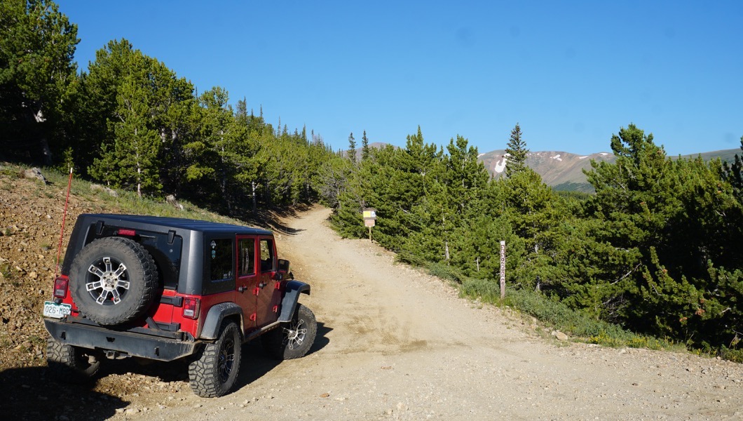
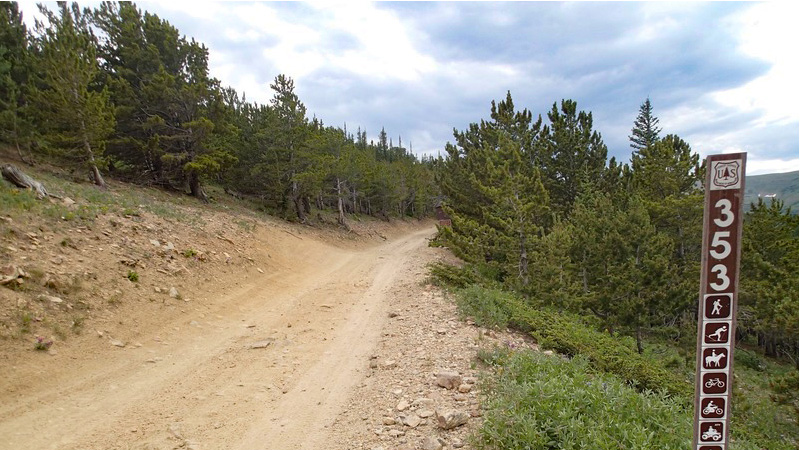
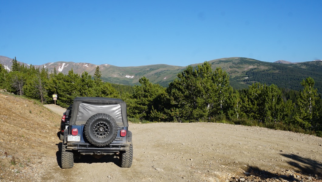
Head uphill on Forest Service Road 353. Though it looks narrow there are plenty of passing spots. Dispersed camping can be found once the road levels out.
2. Stay on Main Road (0.99 mi)
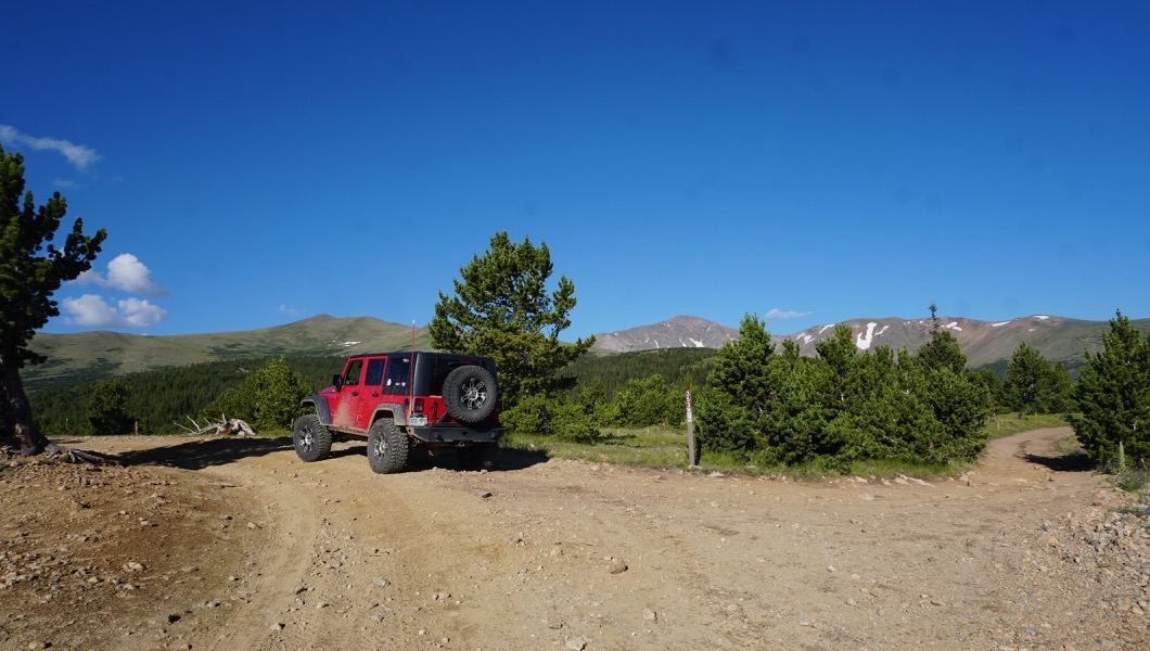
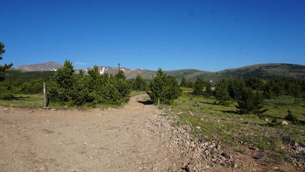
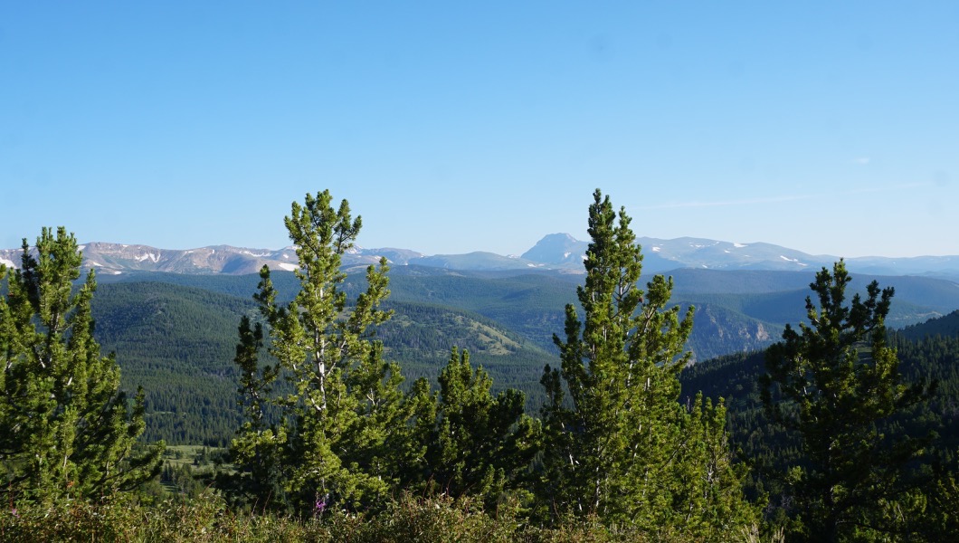
Continue on the main road. There are dispersed camping areas located on the spur road.
3. Forest Service 187 Dead End Trailhead (1.13 mi)
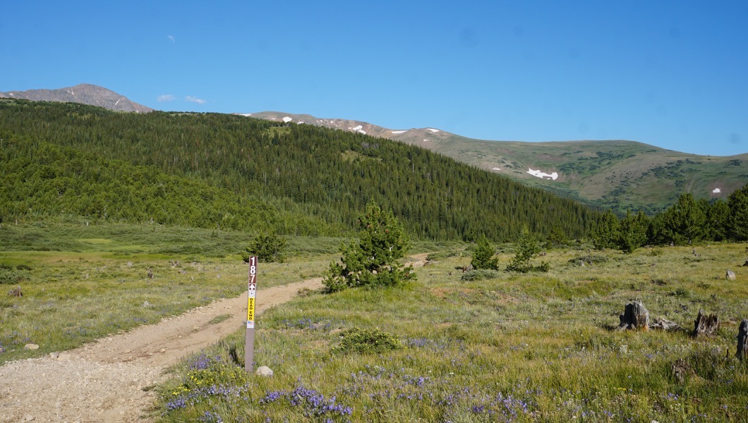
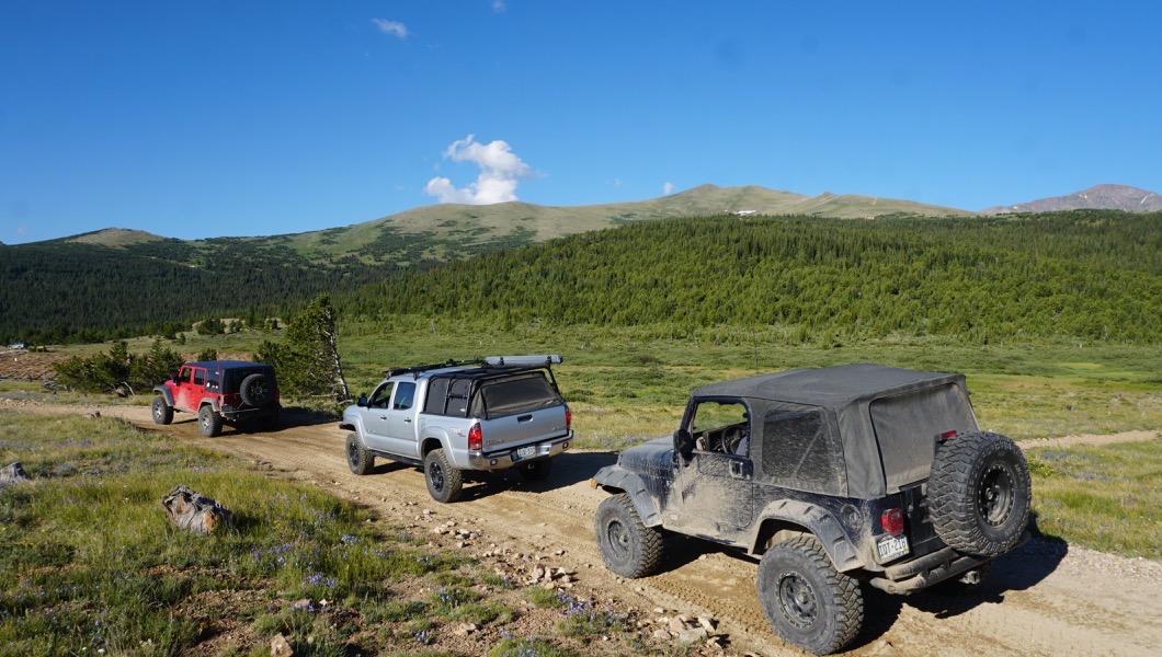
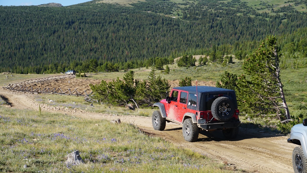
Continue on main road towards the mud pits.
4. Forest Service 772.1 Pigsah Lake Trailhead (1.29 mi)
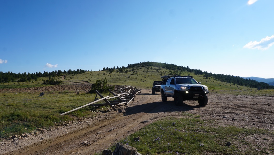
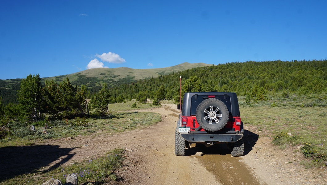
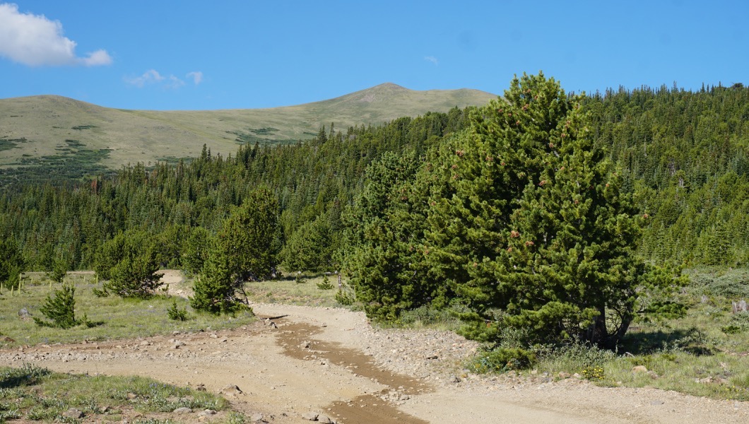
Continue straight. Turning down Forest Service Road 772.1 will connect you to the Yankee Hill Network of trails. http://www.trailsoffroad.com/trails/502-yankee-hill-to-central-city
5. North Side Seasonal Gate (1.6 mi)
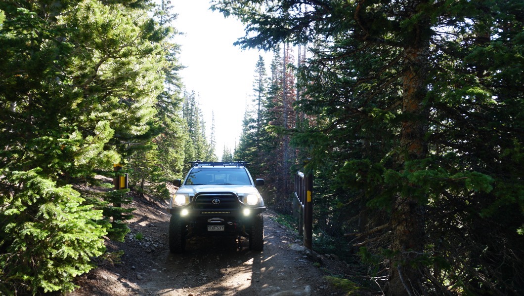
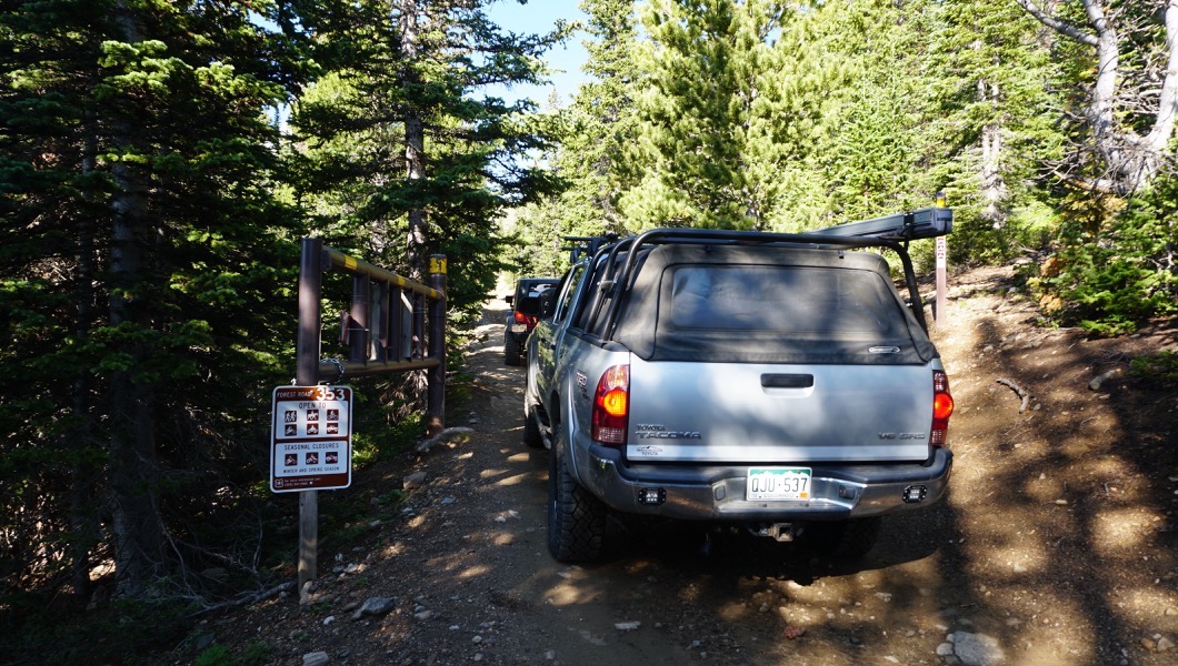
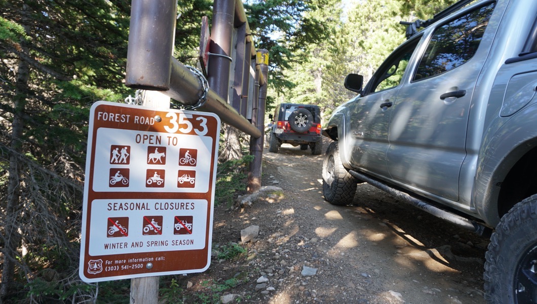
Continue straight. The gates are usually open from Mid July through Mid September.
6. Narrow Stretch - Pull Off (2.62 mi)
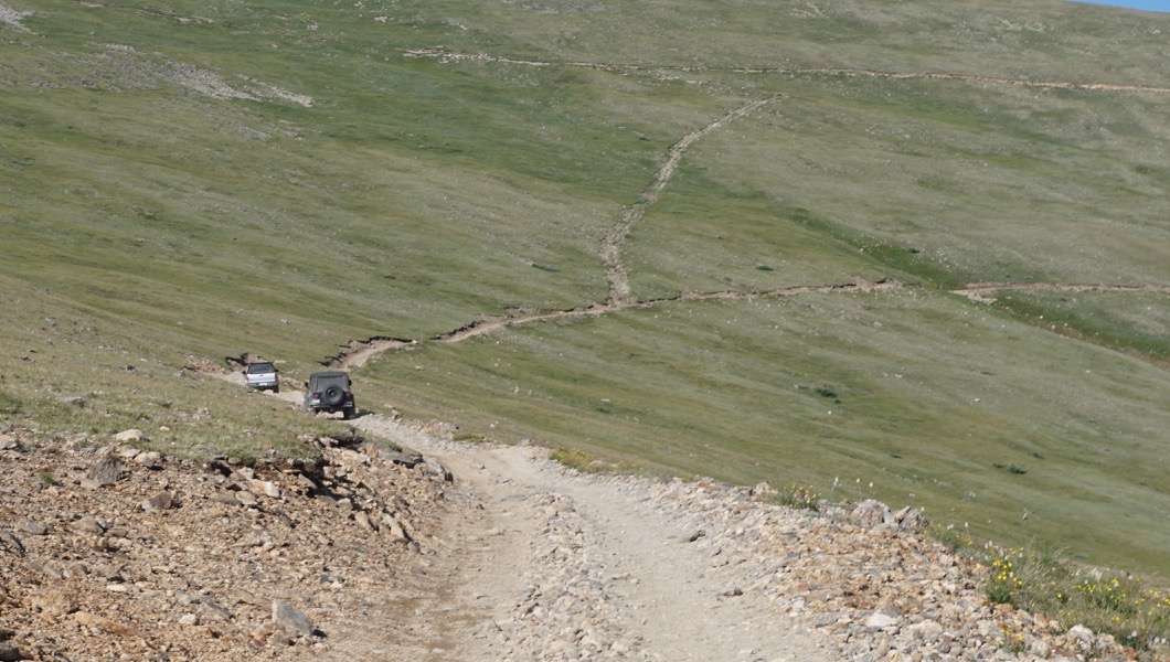
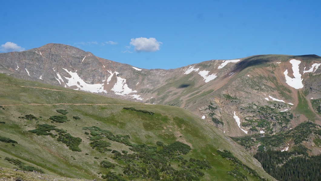
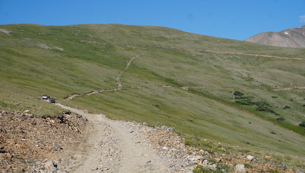
Continue up the main road. After you enter above timberline the road wraps around to the west with little passing space. You can clearly see the road and most oncoming vehicles. There are a few pull outs along the way. Uphill has the right of way.
7. Hiking Trailhead (3.34 mi)
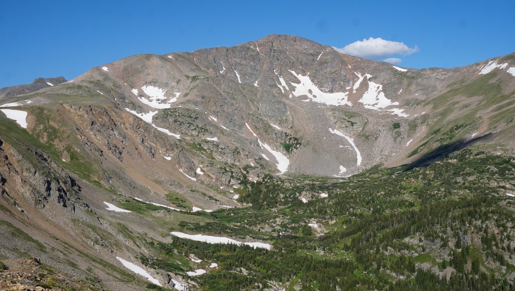
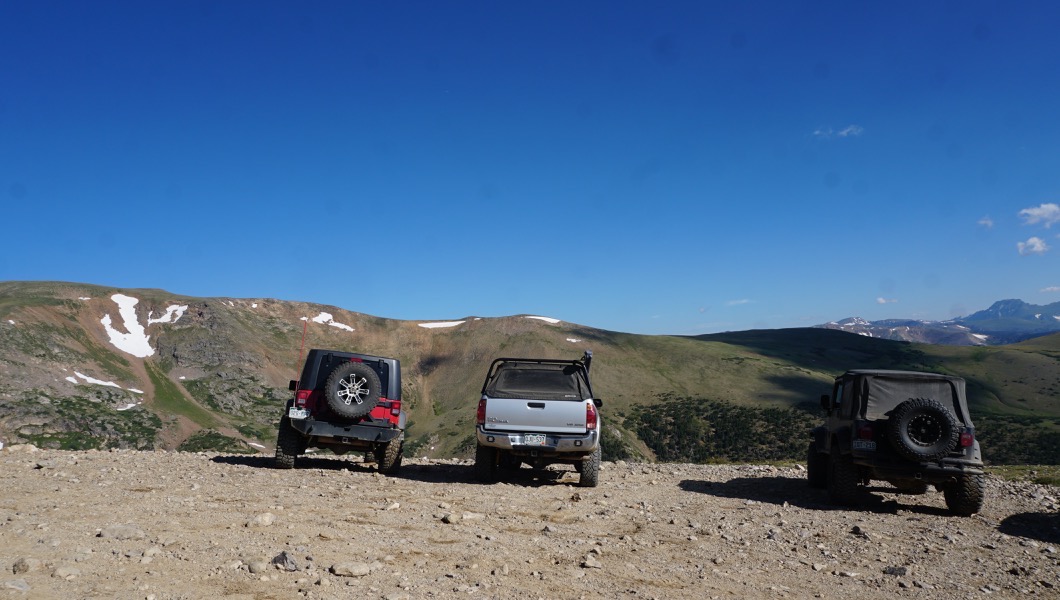
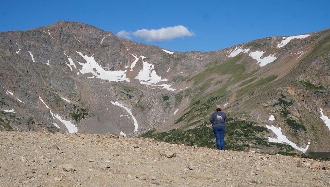
From this location is the hiking trailhead to James Peak Lake and an amazing view of James Peak. There is plenty of parking here for day hiking.
8. Hill Climb (3.34 mi)
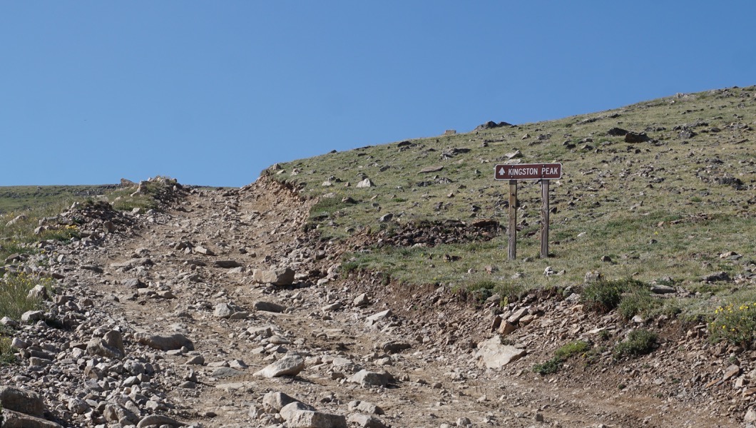
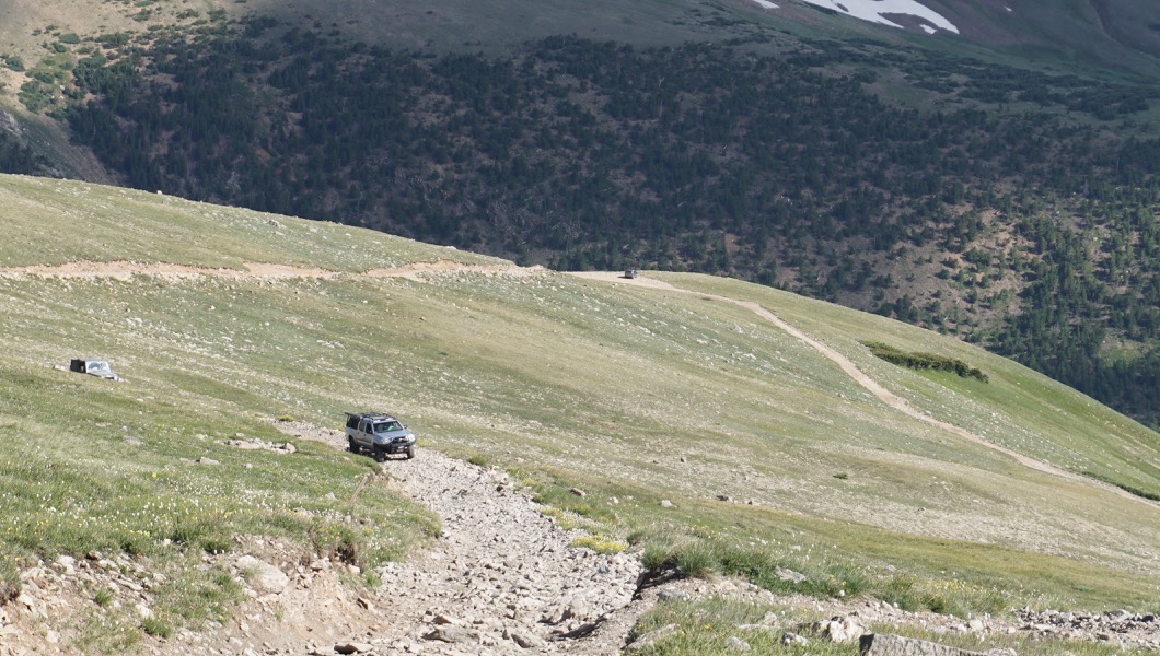
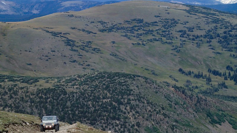
Continue uphill. This is a moderately steep uphill to the highest portion of the trail. Every year this section of the trail changes due to shifting boulders. There is one spot where careful tire placement will be required. There is only one pull out for passing and that is more towards the top.
9. High Point (3.85 mi)
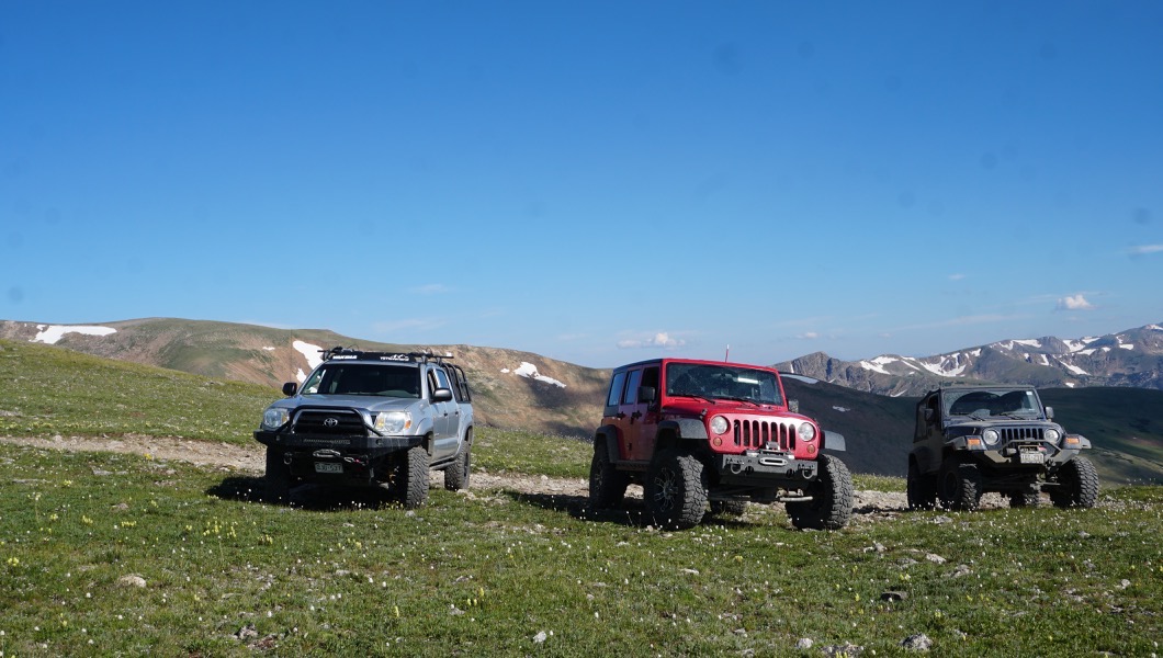
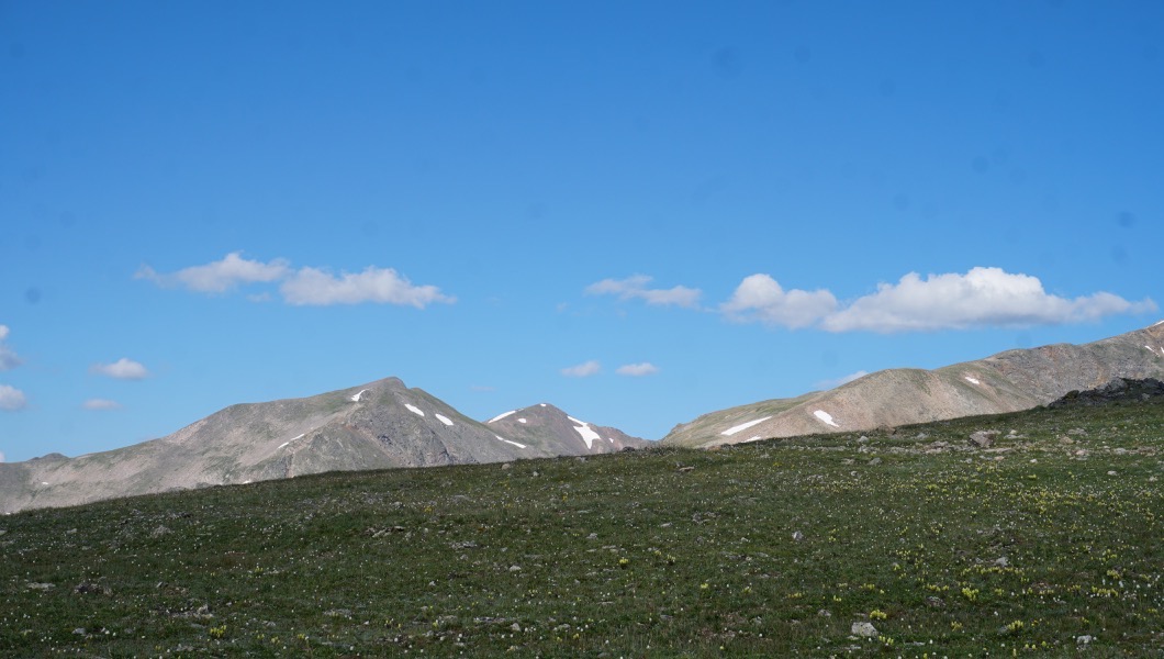
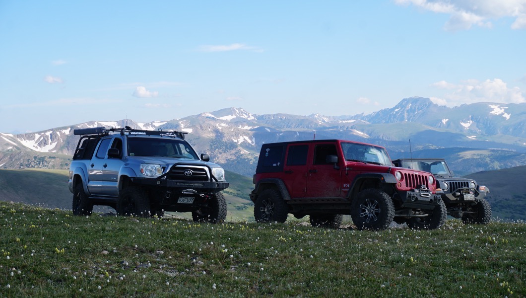
Continue straight on the main route. Do not be tempted to take the roads that were once spurs off the main trail. When you reach the top you are the highest point of the trail. There is a small area to park a few vehicles just down hill from here if you wish to hike either James Peak to the west, or Kingston to the east.
From the parking lot just below you will continue to follow the clearly visible road through flat area which consists of a series of boulders and washouts all the way to Mailbox Hill. The washouts can become 3' deep, so keep a long distance view of the road and plot your way though.
The views of the trail system to the east as you drive along the road is the Yankee Hill Route. http://www.trailsoffroad.com/trails/502-yankee-hill-to-central-city
10. Straight - James Peak Hiking Trailhead (4.12 mi)
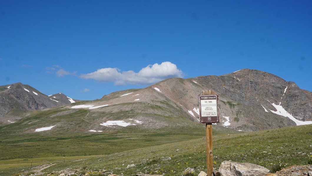
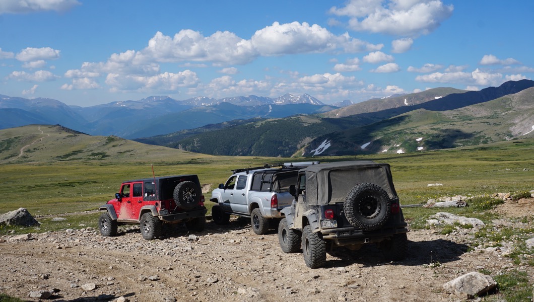
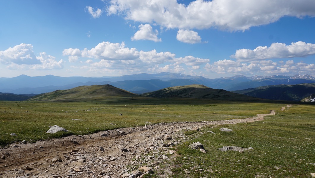
11. Bottom Mailbox Hill (5.18 mi)
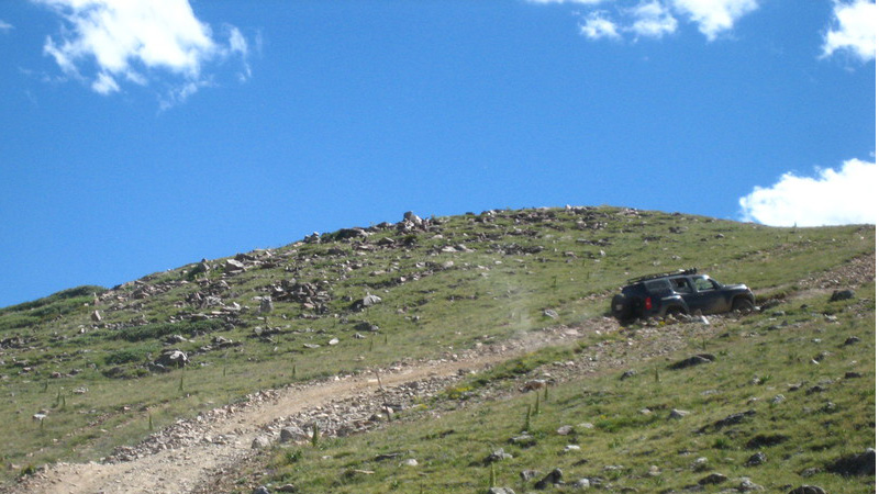
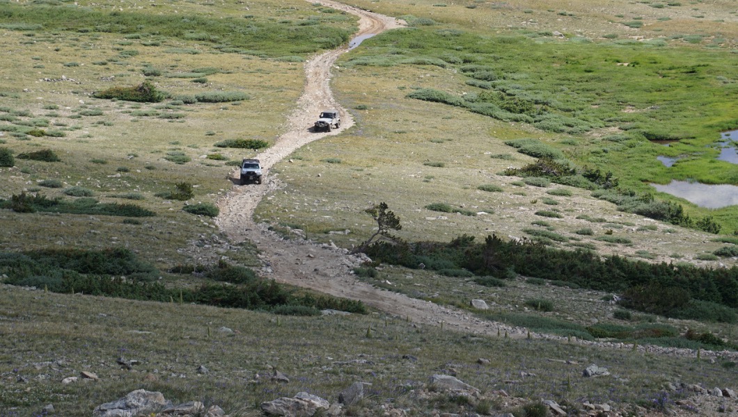
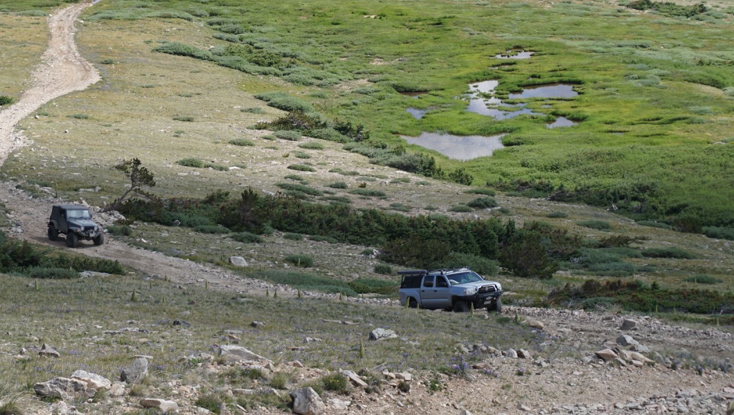
Continue uphill. This hill is not as daunting as it looks. 4 low will crawl you right up it. ATV and UTV riders have cut two different trails through this. You want to take the spur to the west to stay on the actual trail.
Off to the east you can clearly see the Yankee Hill Network.
12. Mailbox (5.67 mi)
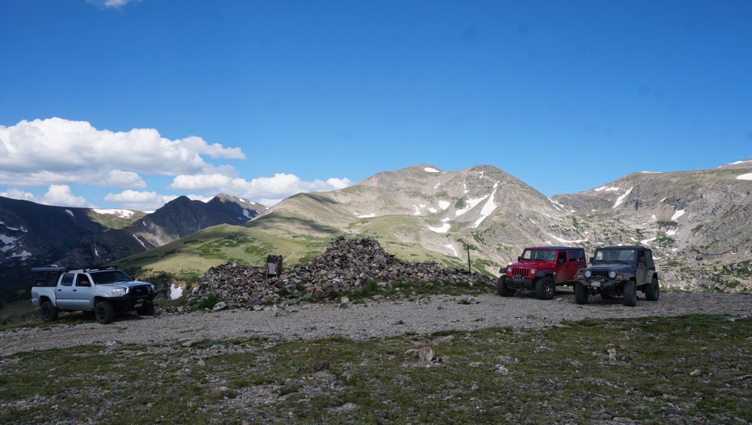
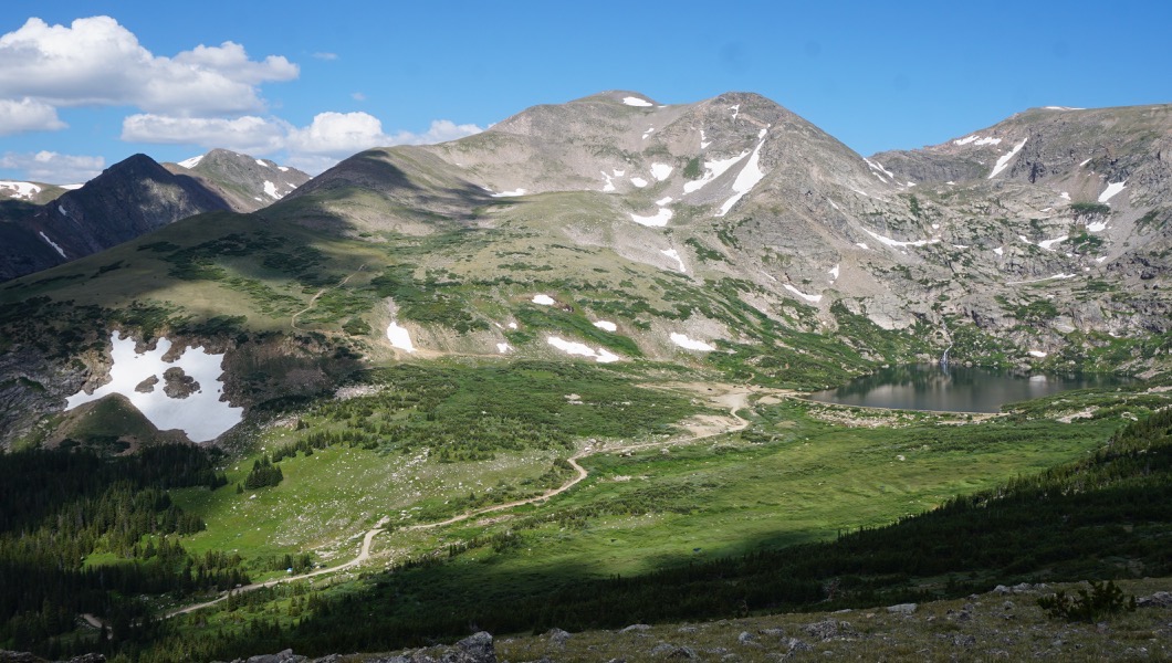
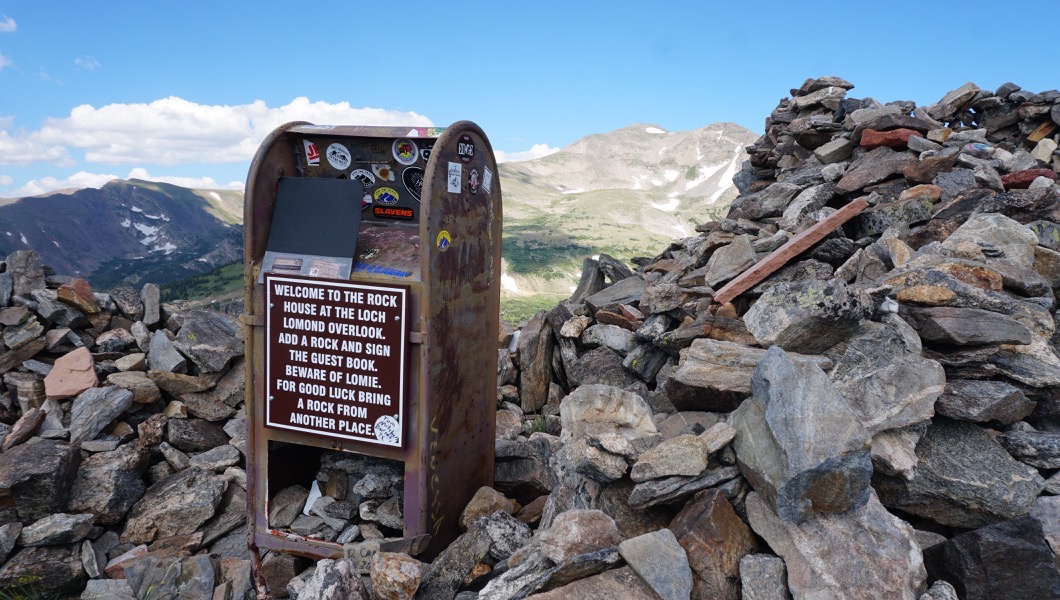
Continue straight. The mailbox is considered hallowed ground after the attacks of 9/11. There is a registry book to sign and the cover tells the tale that many books have been destroyed over the years by fire, guns, and all sorts of things, but that they keep the ones that survive and only ask that people respect the site and guest book. Legend states that if you place a rock or move a rock in the pile it brings you good luck.
The views looking down below and to the west is of Loch Lomond. Loch Lomond is certainly worth adding to your trip itinerary if you are doing Kingston.
13. South Gate (5.97 mi)
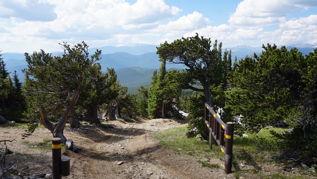
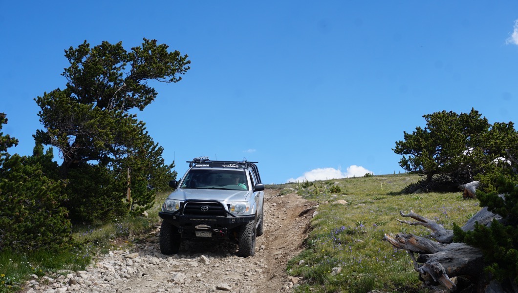
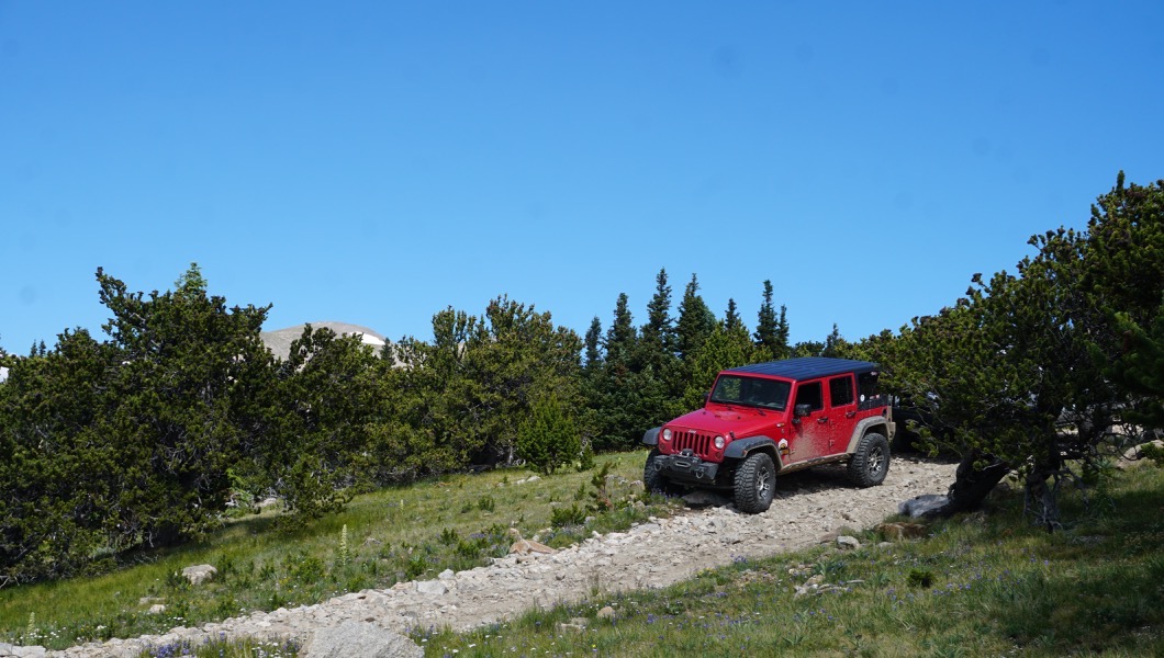
Continue on the main trail. From here you will continue downhill into a windswept pine forest. There are a few areas to pull over and enjoy the interesting landscape. This gate is usually open from mid July to mid September.
14. St. Mary's Trailhead (7.74 mi)
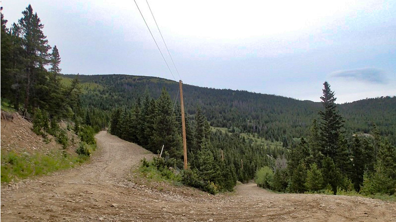
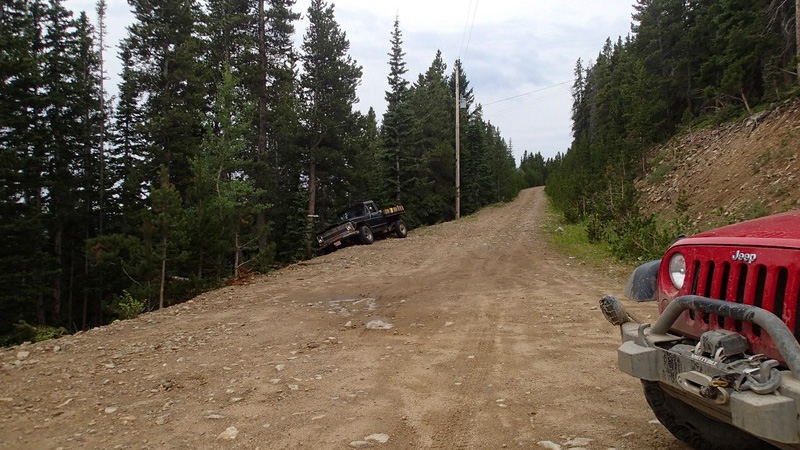
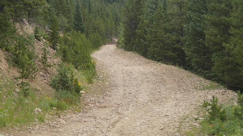
The trail starts to turn into a residential development. At your first turn go left down Hill Side Road, then right down Nebraska, finally turn right onto Harris to Alice Road. Turn left to either get to Yankee Hill Network, Rainbow Road, or I-70. If you wish to head over to Loch Lomond, turn right onto Alice Road. If any of the road signage is missing, just keep going downhill.
Dispersed
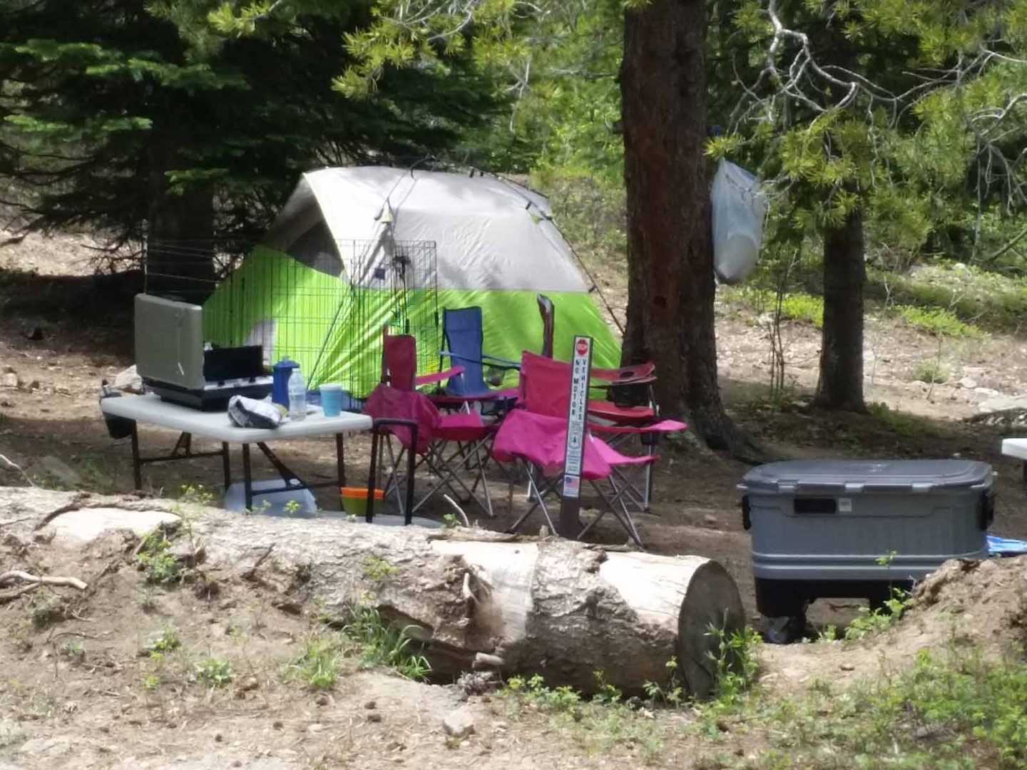
Some dispersed camping spots are on the north side, particularly in the Mammoth Gulch area or on the south side near Loch Lomond. There are several private property owners nearby, so always be mindful of watching the signs. Look to the Loch Lomond and Chinns Lake trails for additional dispersed camping locations.
Starting Point
Idaho Springs, Colorado
There are a few different ways the Rollinsville side trailhead can be accessed:
Option A. From Rollinsville take Moffat Tunnel Road (http://www.trailsoffroad.com/trails/384-moffat-tunnell-road) to just after Tolland and turn left up Mammoth Gulch, continue on the main road until it intersects with Forest Service Road 353 and head right and uphill.
Option B. From Blackhawk head north on State Highway 119 and turn left onto Apex Valley Road. Follow Apex Valley Road until you reach the ghost town of Apex. Turn left at the first intersection and follow this road out of timberline for a few miles until it joins with Forest Service Road 353, the Kingston Peak Road.
Trail Reviews
4.8/5 (79)
Open
Rated
4/5
Visited: 10/30/2022
Difficulty Accuracy:
Spot On
Tired to make it up the trail from the north spade today, but there was too much snow for me to get to the top. 4Runner with 3” lift and 285’s, but without any lockers. We made it up to waypoint 6, but had to back down not to long afterwards, the trail was shaded and had 10-12” of snow on it from last weeks storm. If I wasn’t alone, or had lockers, I probably would have press on.
Open
Visited: 10/01/2022
Difficulty Accuracy:
Spot On
We 4 wheeled over the James Peak trail starting on the St Mary's glacier side and connecting to another trail to end in Black hawk. I have a Nissan Frontier Pro 4x with 2 1/2in extra lift and rock sliders. The truck handled it great, I just bumped the skid plate and rock rails a couple of times. Gate is still open and we beat out a rain storm. Amazing views of Long's peak, James Peak, and Loch Lomond lake.
Open
Rated
5/5
Visited: 09/04/2022
Difficulty Accuracy:
Spot On
This is a beautiful trail but it is certainly a moderate trail! I got stuck behind someone that didn't have the proper vehicle for the trail which caused me to have to stop on a big uphill and get momentarily stuck but I was able to change gears and get myself out. The road does get very narrow in spots and so you may have to wait awhile for cars to pass before continuing. We did bypass the highpoint instead of stopping because there were a lot of cars congregated there but it was still beautuiful. I plan on doing this trail again in order to hike some of the trails there.
Open
Visited: 09/03/2022
Difficulty Accuracy:
Spot On
What a great day! Not a a cloud in the sky and very little traffic for a Saturday, especially for Labor Day weekend. Ran the trail from Central City (Upper Apex Valley to County Road 4N) to Alice. The views are absolutely amazing and the trail will remind you why these mountains are called the ROCKY Mountains. 2021 4Runner TRD Off Road, 2 inch lift, Cooper STT Pro tires. Good clearance is required in many spots and good tires are even more important. The trail is pretty much all rocks of varying sizes from the trailhead all the way to just outside of Alice.
This is one of the very best off road trails near the Denver area.
Open
Rated
4/5
Visited: 08/24/2022
Difficulty Accuracy:
Spot On
Nice trail, nice views. Pretty bumpy.
Open
Rated
5/5
Visited: 08/06/2022
Difficulty Accuracy:
Spot On
First time on this trail. Thought the views were great and the trail itself was easy but extra bumpy, even for Colorado standards, which made it pretty slow going. The hill climbs were pretty steep in places (18 degrees) but not a problem at all. I noticed on the Saint Mary’s side there is a rock that’s just big enough to be a gatekeeper for this trail. As I passed through I saw one car that shouldn’t be attempting the trail reluctantly turning around here and another car seemingly not paying attention and drive right into the rock. Don’t think they knew this was a trail and not another Saint Mary’s dirt road. Hopefully this rock can continue deterring drivers and vehicles that shouldn’t be attempting this trail.
Open
Rated
4/5
Visited: 07/18/2022
Difficulty Accuracy:
Spot On
Great trail but definitely very rocky. Don't bring your wife who gets car sick easy that's for sure! Won't make that mistake again :p.
Other than it being slow going, it was fun for me. Somewhat challenging part just after waypoint 7 headed up to the rock house. The last switchbacks near waypoint 14 are pretty sharp and one of them needs good navigating.
All in all I had fun but the wife definitely didn't 😆😆
Seasonal Closure
Visited: 06/17/2022
I just called the ranger district. They are still working on opening up this trail, and say it might be next week before this trail opens but told me to check the website as they are going to update it as soon as they verify it is safely passable. The ranger I talked to was very nice and apologized for the delay. Apparently, they are understaffed and are working as fast as they can to ensure these trails get opened in a safe manner. We will also update Trails Offroad as soon as we see the status change to OPEN.
https://www.fs.usda.gov/detail/arp/recreation/?cid=stelprdb5339508
Open
Visited: 09/05/2021
This was an extremely fun trail. Most of the trail was easy however the incline was intense and very fun. Tire placement is very important on this section. I would not suggest this trail for the novice driver, the incline has very real consequences if mistakes are made. I ran this in the suggested direction and glad I did. I would not run this trail without a lift and good off road tires, again most of it is very easy however the incline parts can be deadly if a novice driver or an ill-equipped vehicle tried something out of their league. Overall this trail was amazing and I cant wait to go back!
Open
Visited: 08/29/2021
Made it up in a stock '17 TRD OR 4runner. Went the route listed in this guide. Was fairly easy and simple until the last uphill to the high point of this trail, that part was a lot of fun, tire placement important. From there, most of the way down and up from there was also pretty Rocky and bumpy, but very awesome and interesting! Hit my skids and rock sliders quite a few times, but no dents in my skids.
Open
Rated
5/5
Visited: 08/21/2021
This is definitely one of my favorite trails in the area. It showcases the high alpine beauty just 45 minutes outside of Denver. There is an amazing hike to James Peak lake which makes this trail that much better. If you are in the Denver area and you are looking for a scenic day trip, this trail is not to miss!
Open
Rated
5/5
Visited: 08/15/2021
Beautiful scenery all the way through. Liked going in the same direction as the track as you have some great views as you approach the mailbox.
We were on Rollins Pass the day before and was cool to see this road and James peak from a distance.
Without the 2in lift I would have probably tagged the skid plates a couple of times.
Open
Rated
5/5
Visited: 07/23/2021
Great day on the trail, with minimal traffic. Wildflowers are still going strong at the 10k-11k foot range. The only callout is please, please stay on the trail and do not drive on the tundra! I, unfortunately, witnessed multiple SxS wandering off the trail and onto the tundra.
Open
Rated
5/5
Visited: 07/16/2021
Conditions seemed similar to prior years, only saw two parked trucks (James Peak & mailbox) otherwise had the trail to myself on Friday evening. Smoke didn't impact view as much as I expected. Good challenge for a stock 4x4, easy going with a little lift and protection, great views close to Denver.
Open
Visited: 10/16/2020
Ran this trail in my 99 F150 and my buddies stock Chevy 1500 from Alice and had several people warn us between Waypoint 6 and 8 would be impassable due to snow. Since it was downhill we decided to ignore this advice and continue. Buddy was running 33" KO2s and I was running 33" Maxxis Razr MTs, and we ran the trail all the way through. Attempting to go uphill through this section would be extremely difficult however we cut a good trail downhill which my buddy had no problem following. He did find a good rock which gave his skid plate its first scar and when we were almost out of the snow we ended up utilizing recovery boards to get the rear tires of my truck back on the trail but ultimately had a really good time playing in the mountains. If running downhill make sure to have adequate tires and recovery gear just in case. Make sure to bring heavy gear as well, the wind was ferocious. We also did end up taking some time at waypoint 9 to test some suspension flex.
Open
Visited: 09/19/2020
We "stumbled" onto this trail not knowing anything. We always keep the truck off-road ready so we aired down early and fired up Gaia. We used it to do a hike to James Peak. The trail is rocky but pretty wide. My stock Tacoma did great but having a good tire to air down helps. I goosed a few rocks and scraped the bottom but that's what frame rails are for, right? Great views the whole way. The elevation is awesome and the landscape is epic. Around the trailhead parking was a pretty steep section off the side of the trail.
Open
Rated
5/5
Visited: 09/06/2020
Super windy and busy on labor day weekend! Lost a front turn indicator lens trying to pass another vehicle at a narrow point near WP 5. Stock 98 XJ made it over with careful tire placement between WPs8-10.
Open
Rated
5/5
Visited: 08/28/2020
Done this trail a few times in a stock FJ Cruiser. Always during the week, so it is never crowded. Rocky, Steep, all the things we love. Some mildly technical tire placement, but overall a pretty easy trip no matter which wat you run it. I prefer funning from Alice to Rollinsville, just because I-70 traffic gets worse as the day progresses. Great views and you have to stop at the Rock House to sign the book.
Open
Rated
5/5
Visited: 08/20/2020
Ran this trail today with my Land Cruiser and our sons 4Runner. Only aired down to 25psi would definitely recommend going at minimum 20psi. The views are amazing. No problems other than testing out the skids and sliders a few times. This trail is rough from start to finish along with narrow shelf road most of the way. Just take your time, you will mainly be running 4Lo and first or second gear most of the way. The steep hill climbs need some good tire placement in places, but nothing serious. Long day, but a lot of fun!
Open
Rated
4/5
Visited: 08/16/2020
Great trail, typical for Colorado loose and rocky. I ran this backwards from how it is shown and would advise you do the same if you doubt the capability of your vehicle. if you run it as shown there are a few steep, loose, rocky ascents that could easily stop you. I give this trail 4/5 because there are very few places to allow others to pass without pushing one of you uncomfortably close to the edge of a steep hill. I'm sure the views are great but current fires didn't give me the chance to see it.
Open
Rated
4/5
Visited: 08/08/2020
Had a lot of fun on this trail today. I did it in my decently-modified 4Runner and had no issues. I talked to one guy who said he didn’t air down and I’m surprised he didn’t blow a tire. There were a lot of spots where airing down was a necessity (in my opinion at least) and my tires at 17psi seemed to do well. Nothing was washed out or slick; overall, the trail was in great condition. I plan on going back earlier in the day to hike James Peak as it looked awesome perched above everything up there!
Open
Rated
5/5
Visited: 08/08/2020
Ran Kingston from North to South, then up Loch Lamond. Kingston was an awesome trail that my 4runner with 6112/5160 and my brothers stock JL handled with ease. There was one point on the Hill Climb section where we had to wait for a few trucks that were getting stuck. When they either got through or backed down, our trucks went right up. The truck that got stock and couldn't make it up was a bone stock Taco TRD, though I feel pretty confident he could have made it with a better line. Overall this was a great moderate trail with amazing views/stopping points and enough difficulty to make it interesting.
Open
Visited: 07/16/2020
Trail is open all the way. We ran it from Alice to Rollinsville on 07/16/2020. My buddy talked to the Forest Service Ranger and they opened the gates on 07/15/2020. Trail is in pristine condition and we scored some killer views. It took us exactly 2 hours including a couple stops.
Open
Rated
5/5
Visited: 09/26/2019
Drove this the opposite direction of the waypoints in a lifted T4R on a Thursday. Overall easy to moderate trail that most stock 4WDs can handle. I would recommend driving the direction in the waypoints as the direction I drove has one or two steep descents. The "hill climb" from James Peak stopped one stock nissan frontier as it has some clearance issues the driver did not want to risk. I ended up on yankee hill road after a few narrow FS trails for a good loop.
The views over lock lomond and james peak are incredible. Will have to come back and hike James Peak. The Lakes look pristine.
Open
Rated
5/5
Visited: 09/14/2019
Always a good trail with GREAT views. We camped near Loch Lomond on a Friday night and found a great spot for the (small) offload trailer. Ran over Kingston Saturday morning to Mammoth Gulch. It was a fairly busy day up there with about 8 rigs parked at the James Peak trailhead, but no drama with pulling our small trailer over. I've done Kingston Peak 3 times this Summer and while it's a pretty easy run, it never gets old!
Open
Rated
5/5
Visited: 09/14/2019
Tacoma 3” lift, 32” BFG ATs
Grand Cherokee -Summit, stock
I think the rating is perfect for the trail. Easy spots, but definitely some more tricky areas requiring some experience and proper tire placement. No scraping on either vehicle. 1 flat tire.
I’ve always come too early in the season and it’s been closed.. finally got to do this trail! The views are awesome!
Open
Rated
5/5
Visited: 09/07/2019
Great views on what I’d call an easy to moderate trail. There are a couple steep climbs and a few tricky spots. I drive a stock 2011 4Runner SR5 and I believe I scraped my back bumper once on one of the obstacles. Bonus points for being able to skip I-70 traffic to get to the trailhead.
Open
Rated
5/5
Visited: 09/02/2019
It was my first time on this trail. Drove my stock 2019 Tacoma TRD Off Road. The views were gorgeous! Only had one scary encounter at a narrow rocky point on the trail coming down a hill with three 4Runners coming up the trail. Had to get real friendly with trees so they could pass. We drove up to the peak and turned around. I recommend stopping at Pile Hill to take in the view. I want to go back up there and camp.
Open
Rated
5/5
Visited: 08/24/2019
Beautiful views! Saw a stock 5th gen SR5 4Runner with highway tires still on make it through with no problems so definitely not too difficult a trail!
Open
Rated
5/5
Visited: 08/18/2019
I only ran the backside this time (St Mary's to Loch Lomond) and then turned around. There are some holes (WP 14-13) that I struggled with before but wanted to try again after my locker install. I do enjoy this area and trail. Most people run it according to the guide so expect traffic if you go backwards.
Open
Visited: 08/18/2019
This is a must do! Stock 2008 FJ made it fine, touched bottom a couple times. Went from Rollinsville to St Mary’s. St. Mary’s side is a tougher climb. James Peak is legit, mt Evans, mt Bierstadt, Grays and Torrey’s all in view. The sun sets at one of the best angles you can get. Beautiful!
Open
Rated
5/5
Visited: 07/27/2019
Great views. Gates are open and the trail is free and clear of snow.
Seasonal Closure
Visited: 07/14/2019
Drove up to the seasonal gate on the Alice side, still closed. Hiked up past rock house and down the hill to the flexy two track through the meadow and trail is dry and in good shape. There must be snow drifts coming from the other side that is keeping this from being opened.
Open
Rated
4/5
Visited: 09/25/2018
I did Kingston this year while the wife was out of town. I like this trail but it wasn't as spectacular as I remember. I noticed the rutting and washouts on the tundra part of the trail seemed worse this year. It looks like the Forest Service is closing some bypasses but leaving many 'new tracks' for people to follow an easier path.
Open
Rated
5/5
Visited: 09/08/2018
Great day, beautiful views that the pictures don't do justice at all. Ran it North to South in a 2000 Land Rover Disco 2 with a 3" lift. No issues. There was a stock Subaru Outback in front of us for part of the way that we were very surprised made it all the way up (although did grind their undercarriage a bit). There were some pretty rutted out parts with big dips coming back down past the South gate (waypoint 13). Might've been a bit tricky trying to come up that way, so I probably wouldn't recommend running it South to North.
Open
Rated
5/5
Visited: 08/25/2018
This was a really fun trip. Ran the trail with our bone stock 99 TJ sport. We ran it north from near Apex to south ending up in Alice. Bumpy, bumpy, bumpy. The hill climb up to the peak looks sketch and steep but once you are on it rides well and it is not nearly as steep as it appears. Road is super chunky and bumpy. But slow going and some nimble tire placement are key. Kick-ass view of Loch Lomand from the Mailbox located at the Rock House Overlook. Not a terribly difficult trail, all in all, lot of fun, spectacular views, just technical enough to make it a bit of a challenge . . . I mentioned it was really bumpy, right?
Open
Rated
5/5
Visited: 08/12/2018
Ran with a buddy over the weekend from central city to st marys with our sons. Great views and good weather. Kids found it too bumpy :). That hint at waypoint eight is true. There is a hole on that hill that needs some speed to get over if you don't have lockers.
Vehicles: 96 XJ 2" lift on 29" street tires
91 XJ 5" lift on 33" ATs
Seasonal Closure
Visited: 04/11/2018
Road starting to melt out, but definitely still closed - large drift across first shelf from Tolland side with continued large drifts several feet deep further up the road. Will not be open for at least another month or so.
There are many long stretches of exposed road surface, so snow sports on this road are done for the season.
Partially Open
Visited: 10/15/2017
There is a significant amount of snow reported (and seen) above the treeline on this trail. At this time it is NOT recommended that you proceed above the treeline. There is already one vehicle there that a rescue group has had to abandon until the spring (the driver is safe) due to the snow and weather. Use caution when going out and be aware the local Rescue and Recovery group has annouced that they will rescue people above timberline, but they will not recover vehicles until spring. That means a stuck rig may be crushed by the winter show or worse. Use your best judgement.
Open
Visited: 08/15/2017
We ran the trail from north to south. A really nice, long trail with spectacular views. Please take an American Flag up with you as the one at the Rock House is very tattered and in need of replacing. An all weather 3'x5' will do. I suggest that we keep the flag up there in good condition!
Open
Visited: 08/06/2017
Continued on Kingston Peak after running Moon Gulch and ran from North to South. Hadn't been South of the James Peak overlook before, and was a little surprised how rocky parts of the trail were, though no problem for a lifted 4Runner. Had to spot a stock GX through a few sections, but no issues. Incredibly windy as a brief storm blew through near the overlook, but cleared soon after. Great views when the clouds break, both of James Peak and Loch Lomond near the mailbox. Really cool trees, practically ripped out of the ground, yet still growing on the descent towards Alice. Several areas still with wildflowers as well!
Open
Rated
5/5
Visited: 07/30/2017
Our annual trip up Kingston this year and we took the north to south route. I will say that the north route is a little rougher in my opinion, but I prefer descending to ascending on a trail. The nice part was that we dumped out near the lakes at the bottom and just make a day of running to Chinn's and trying to run up Loch Lomand. We had to stop due to weather and a CJ that needed some gas and a dead tow.
Despite the weather, it was a beautiful day on the trail with the clouds playing all day with the sun. Having a cloud pass through our Jeep was pretty cool.
From the Community
Be the first to ask a question!
Todd
Founder
Todd is an avid wheeler who loves to explore new trails whenever and wherever possible. They say necessity is the mother of all invention, which is true for Todd. His want and desire to find passable trails and new nooks and crannies of the Great American west to explore were his reasons behind starting Trails Offroad. On any given day, you can find Todd on an obscure 4x4 trail, curating Trails Offroad guides, or using his legs to hike to an alpine lake.
Visit Profile
Start a free trial and get this level of detail on every trail
guide
Start Free Trial
Print Trail Guide
Purchase
Company
Community
Recent Updates
By clicking "ACCEPT", you agree to be the terms and conditions of each policy linked to above. You also agree to the storing of cookies on your device to facilitate the operation and functionality of our site, enhance and customize your user experience, and to analyze how our site is used.

