Please wait - Uploading to Gaia GPS
Ophir Pass

Trail Information
Difficulty - Mandatory
3 -
MODERATE
Difficulty - Optional
3 -
MODERATE
Status
Impassable
Distance
9.98 mi
Duration (one-way)
About 1 hour, 30 minutes
Highest Elevation
11771 ft
Shape of Trail
Straight Through
Typically Open
Year Round
Best Direction
East
Official Road Name
630, 679
Nearest Town
Ophir
Nearest Services
Telluride
Management Agency
Uncompahgre National Forest / San Juan National Forest
District
Norwood Ranger District / Columbine Ranger District
Highlights
 Altitude
 Forest
 Iconic
 Overland
 Scenic
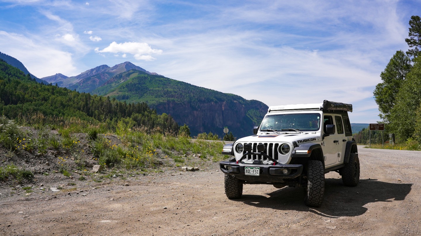
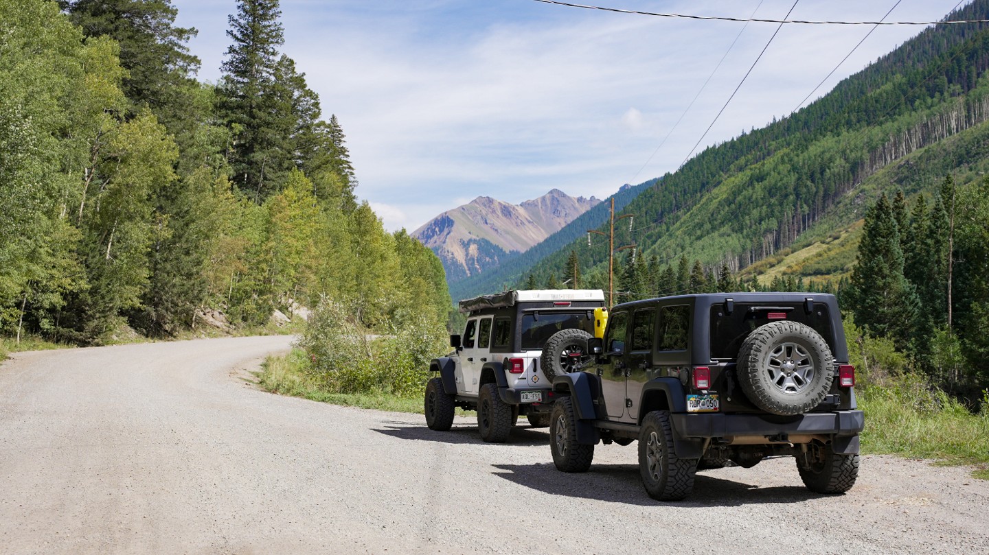
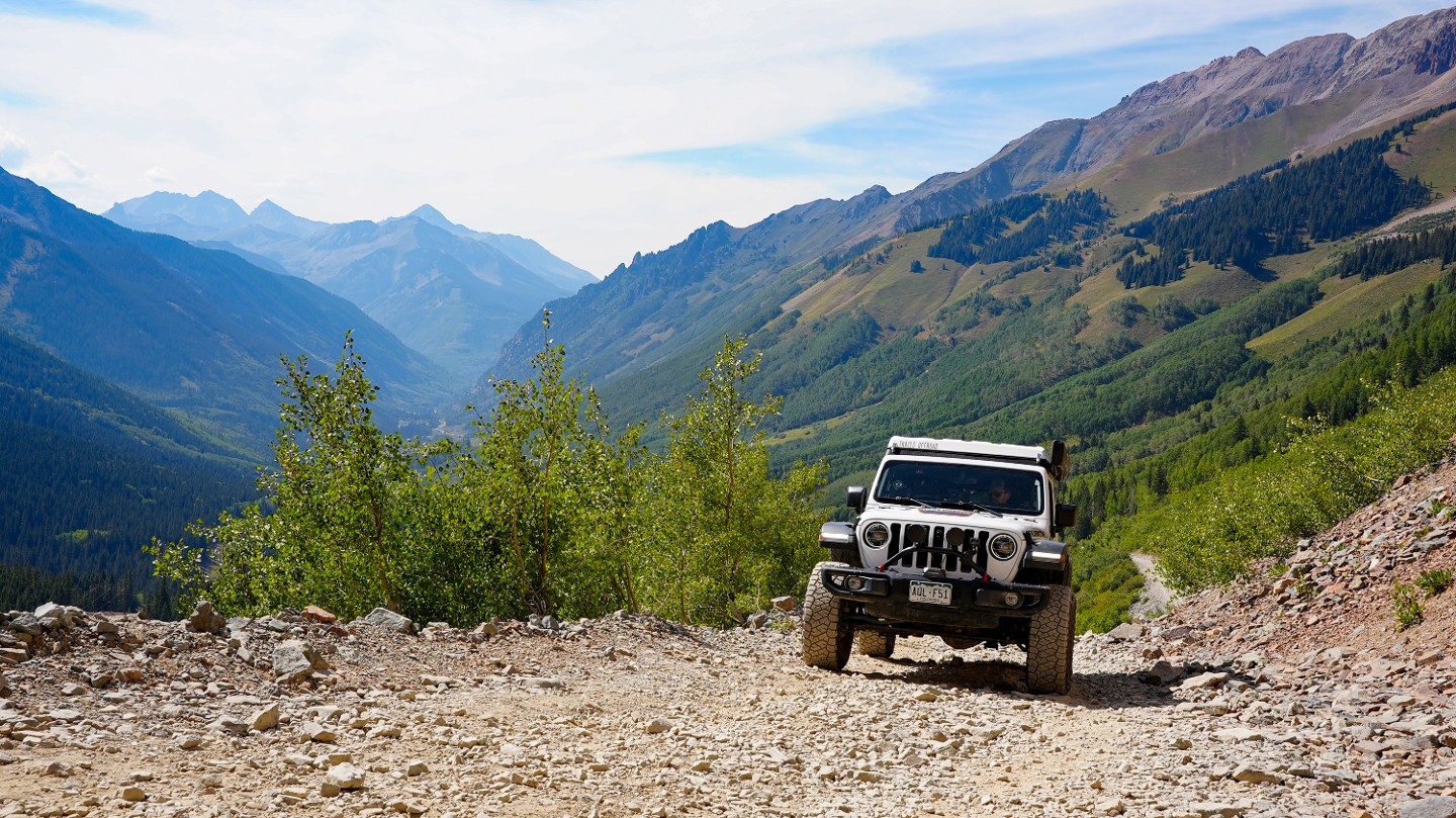
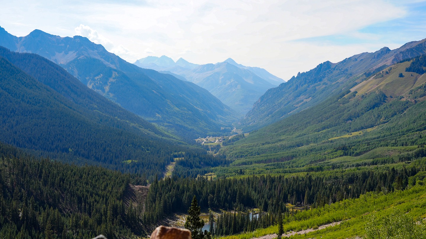
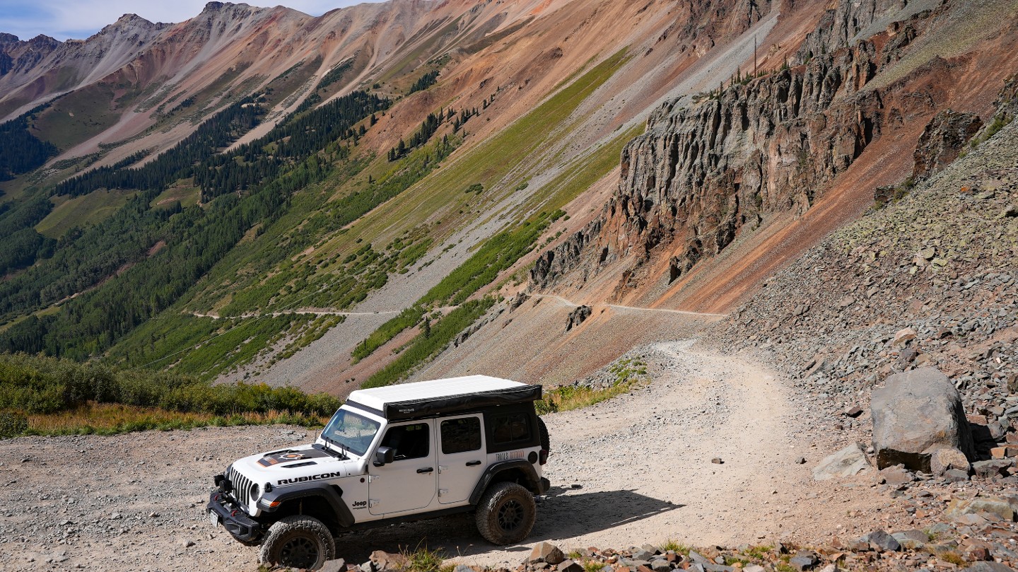
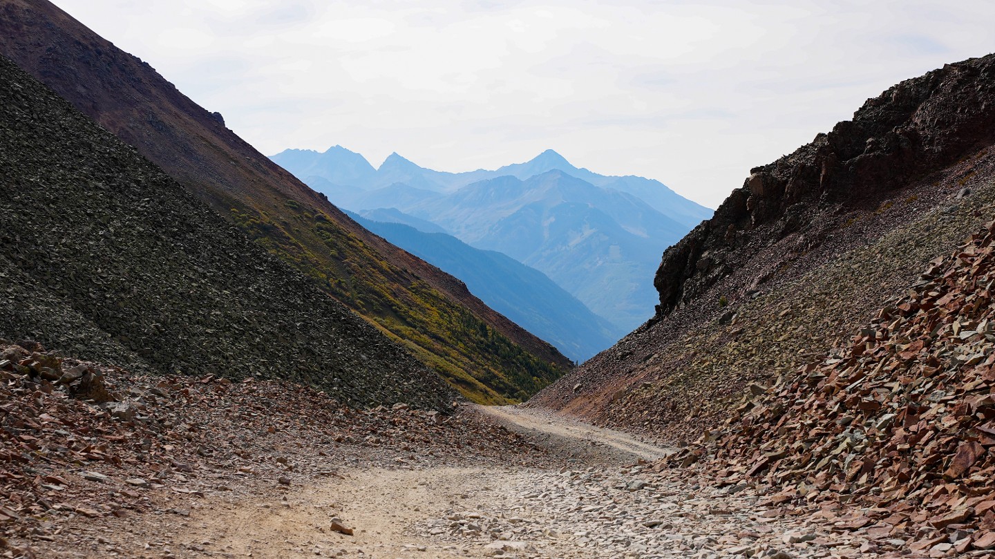
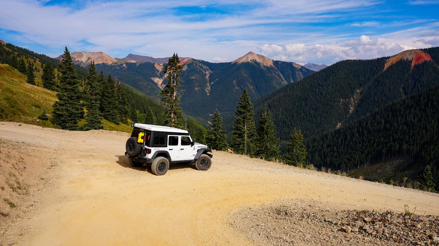
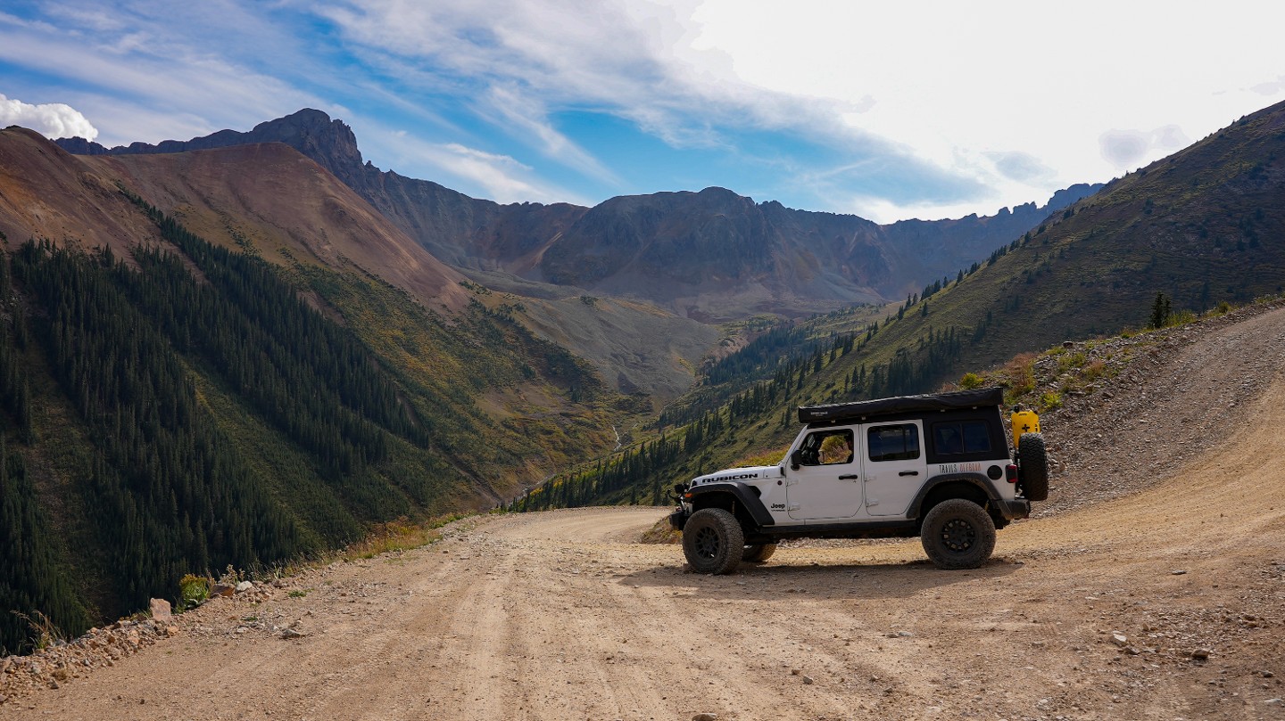
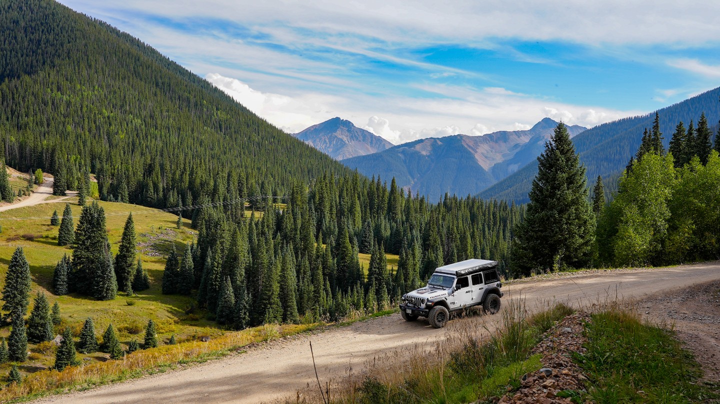
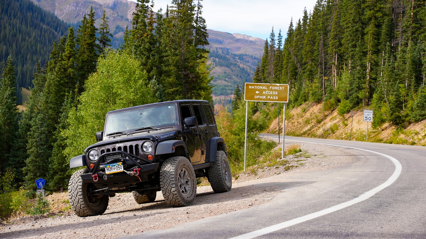
Climbing to 11,789 feet and passing through both the Uncompahgre National Forest and the San Juan National Forest, Ophir Pass is a spectacular mountain pass that offers alpine views of the upper Ophir Valley and neighboring peaks. This pass has been traversed for hundreds of years for many different reasons. The pass was originally used by the Navajo natives on hunting trips between the San Miguel and Animas Valleys. In 1878, the tiny mining town of Ophir was established, and by 1881 the new Ophir Pass Toll Road began to carry goods between early mountain settlements. The arrival of the railroad decreased the use of the pass in the early 1890s, and the road became a rarely used wagon road. Finally, in 1953, the modern Ophir Pass that we know today was first opened to Jeeps and other off-road vehicles.
While the shelf roads may test your fortitude, the views off of this iconic trail are well worth an afternoon.
For Jeep owners, this road is 1 of 6 trails in Colorado recognized as a Badge of Honor Trail. Don't forget to use the Badge of Honor app to check in and get a special badge showing trail completion.
Trail Difficulty and Assessment
Recommended Vehicle:
Stock SUV with High Clearance and 4 Low
Concerns:
Summary:
The trail is most difficult between Waypoints 8 and 10, where low-range 4WD is needed along the narrow shelf road.
Community Consensus
Be the first to start building the community consensus.
Leave a trail review below.
Mandatory
3 -
MODERATE
The hardest part of the trail that you
cannot bypass - you have to drive it.
Optional
3 -
MODERATE
The hardest part of the trail that is
purely optional - you can bypass it.
Typically, more rock or undulated road surface. Potential rocks and/or tree stumps less than 12" tall and/or vertical ledges less than 12" tall and/or near vertical ledges or waterfalls less than 24" inches. Tire placement becomes more difficult. Can be steep. Read More about our Rating System
Start your next adventure on Ophir Pass

Upgrade your Membership
Unlock all of the details on every Trail Guide and Scout Route.
Start a 7-day Free TrialUploading to Gaia GPS
Share Trail
Trail Navigation
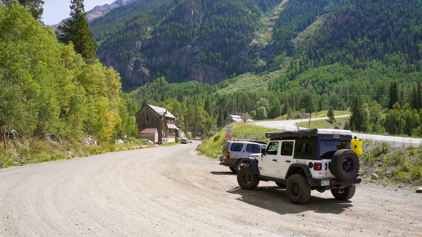
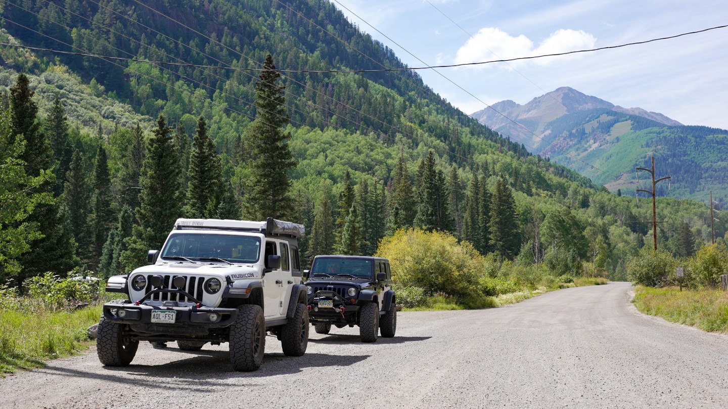
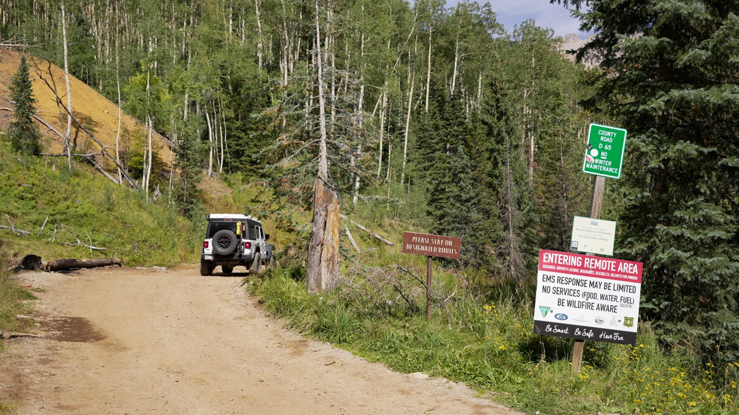
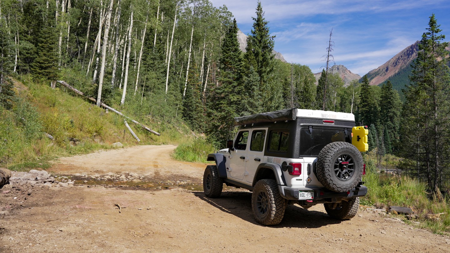
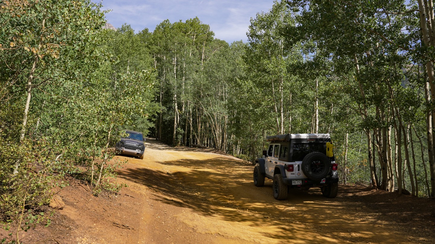
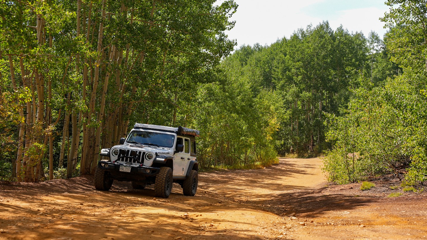
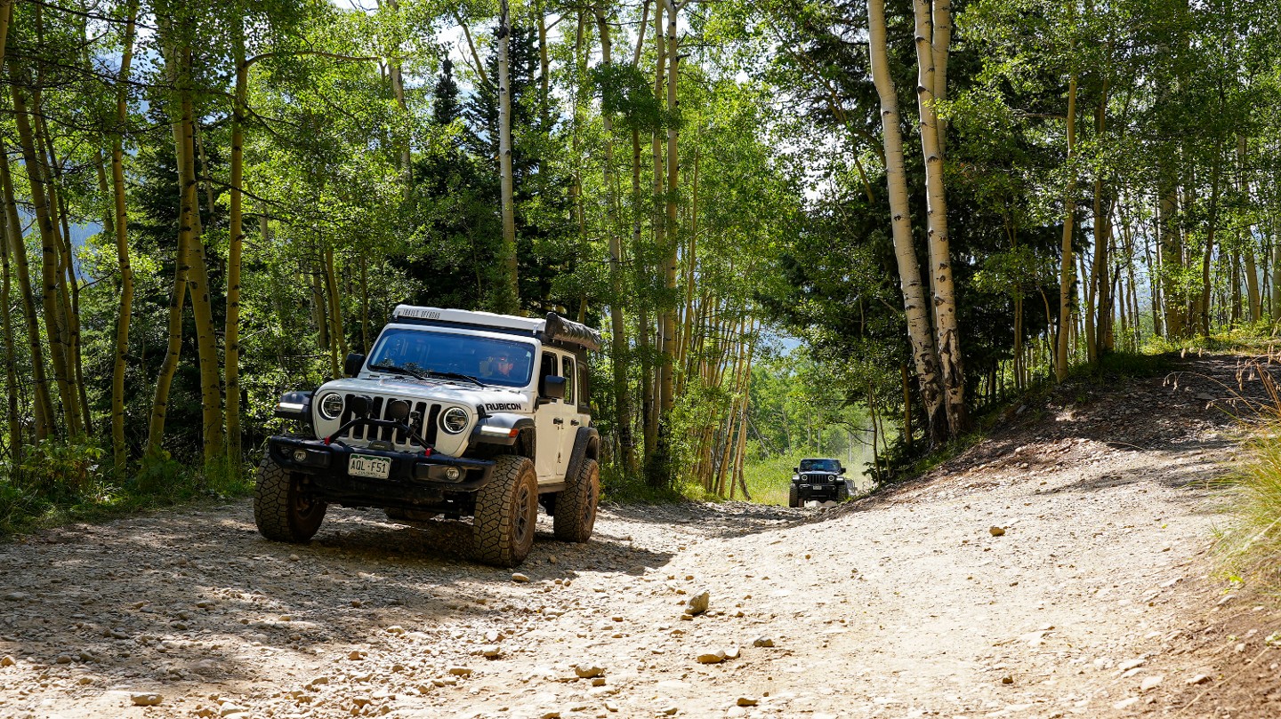
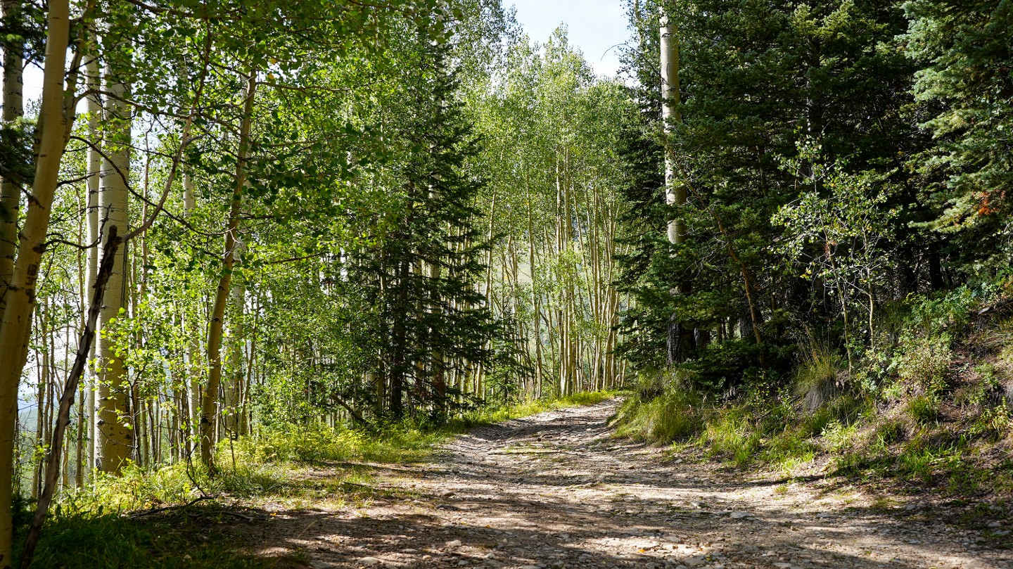
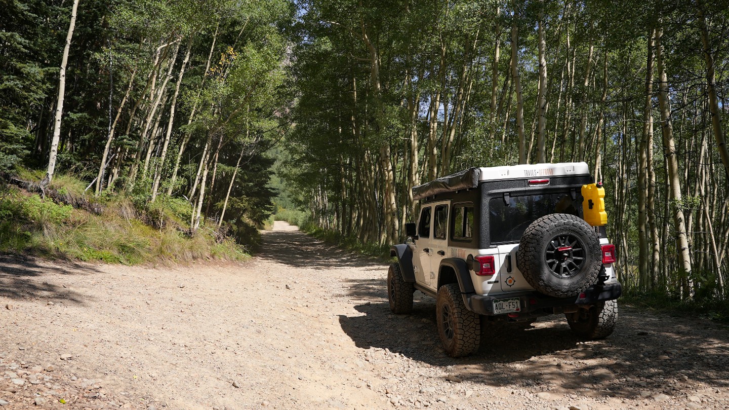
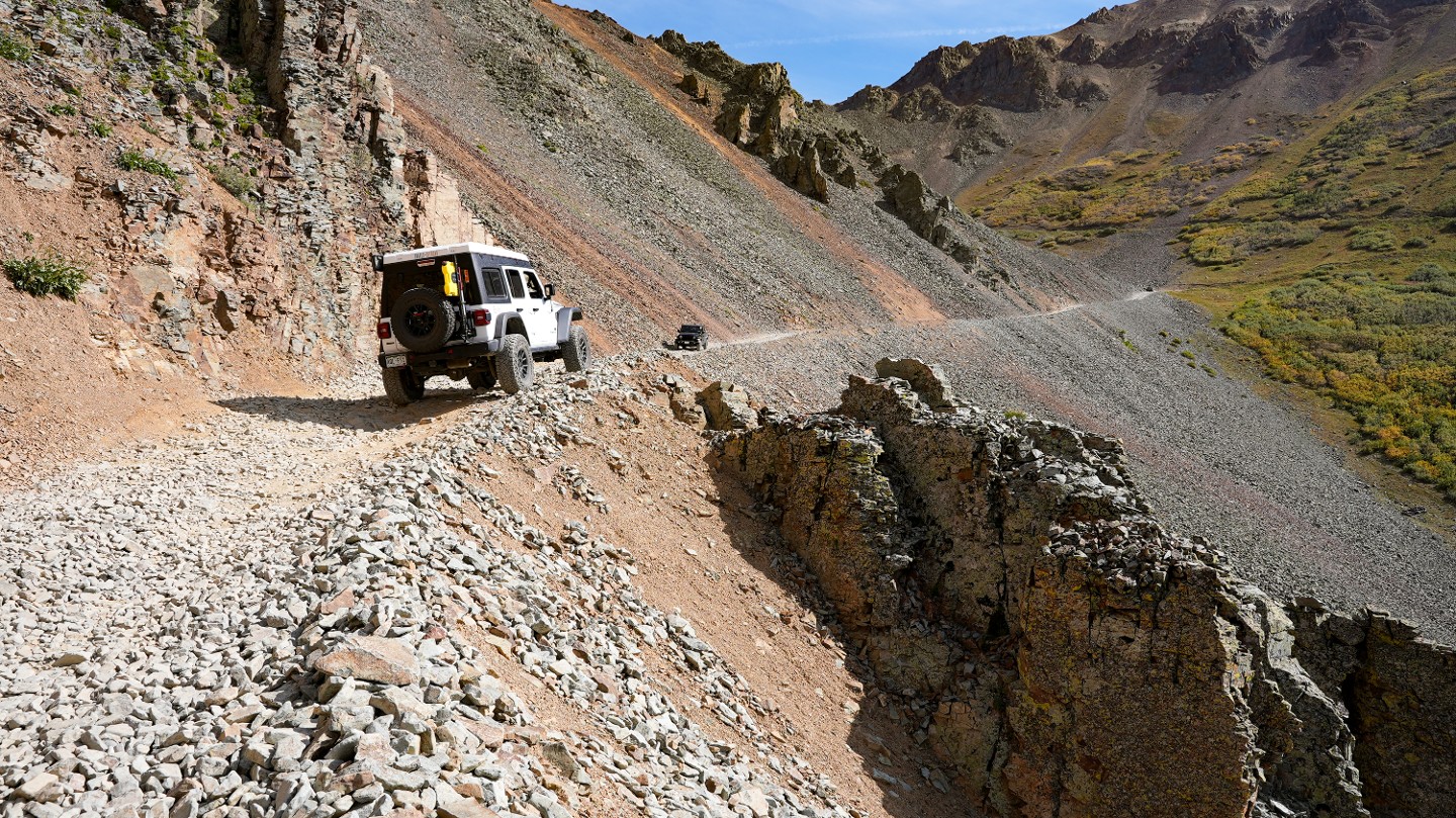
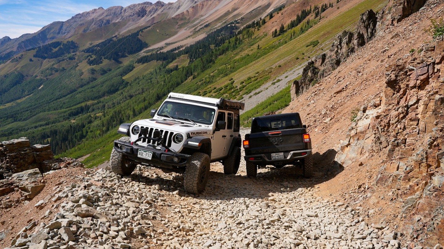
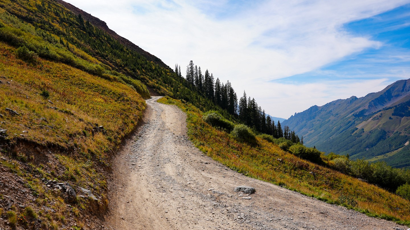
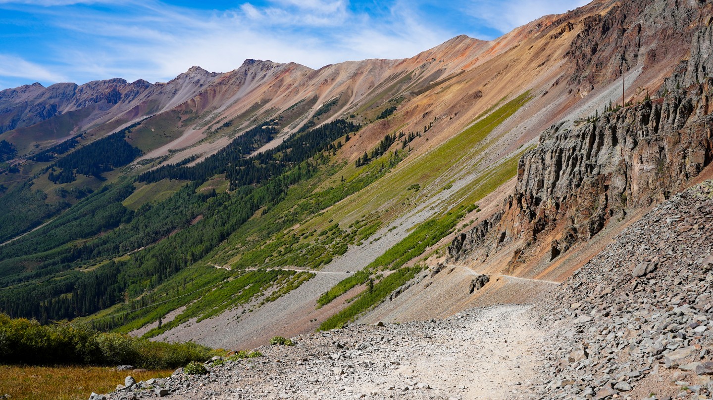
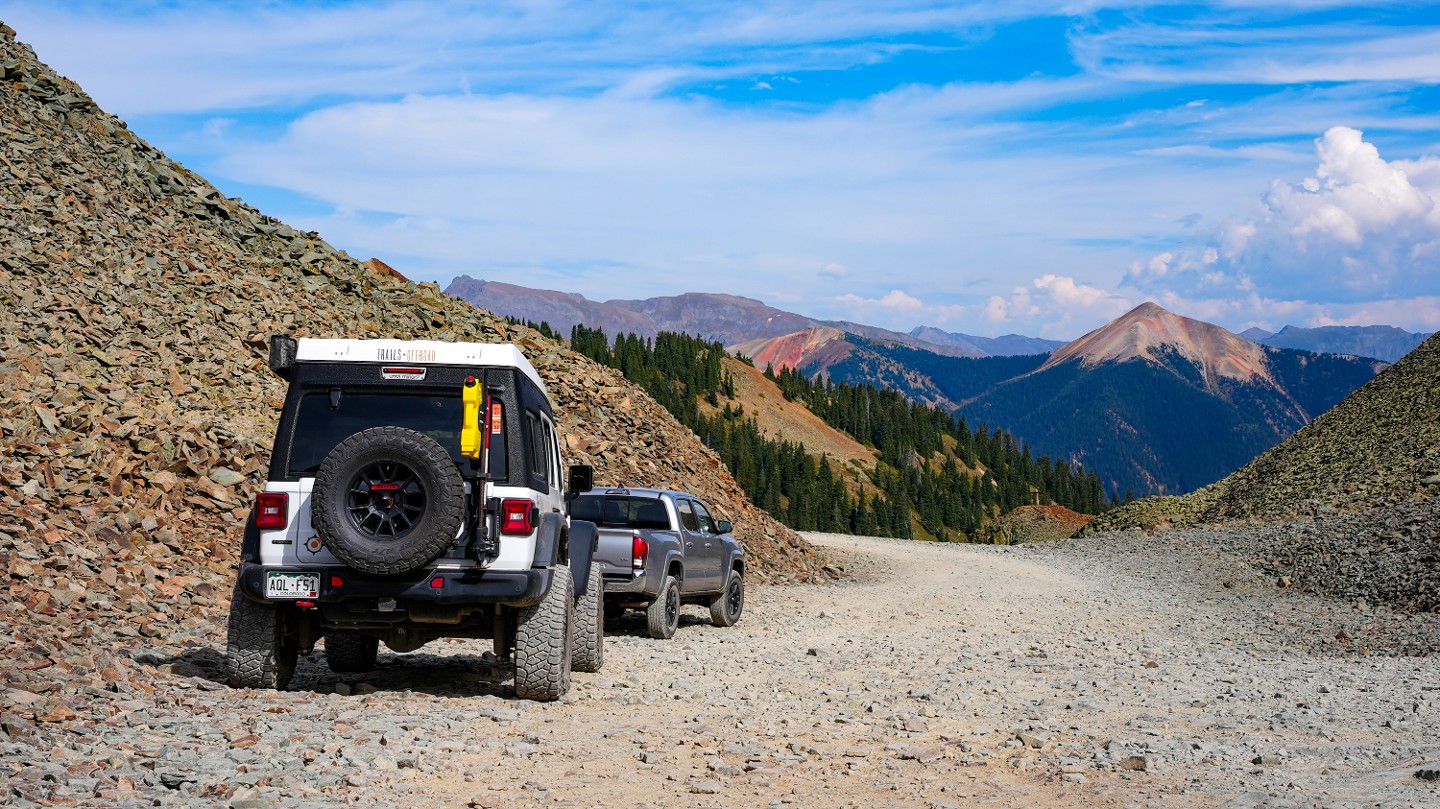
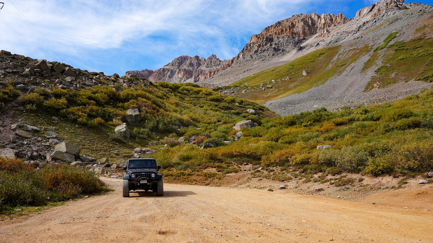
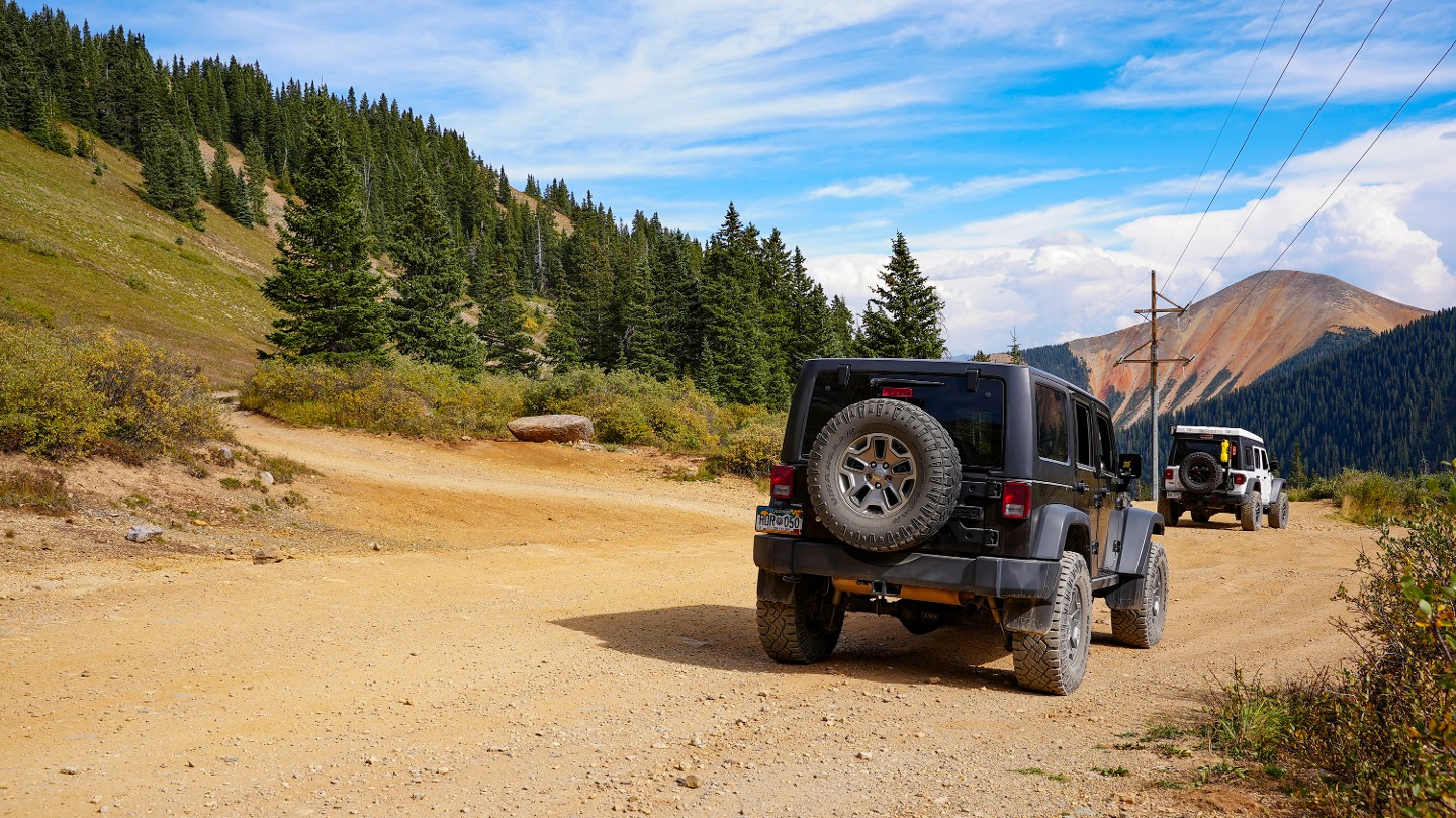
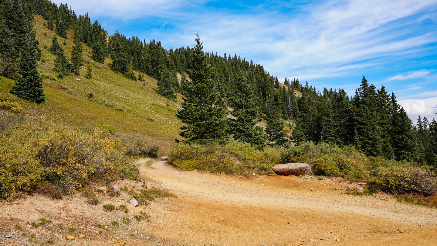
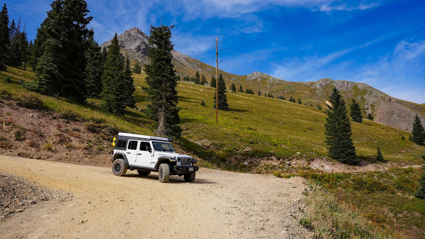
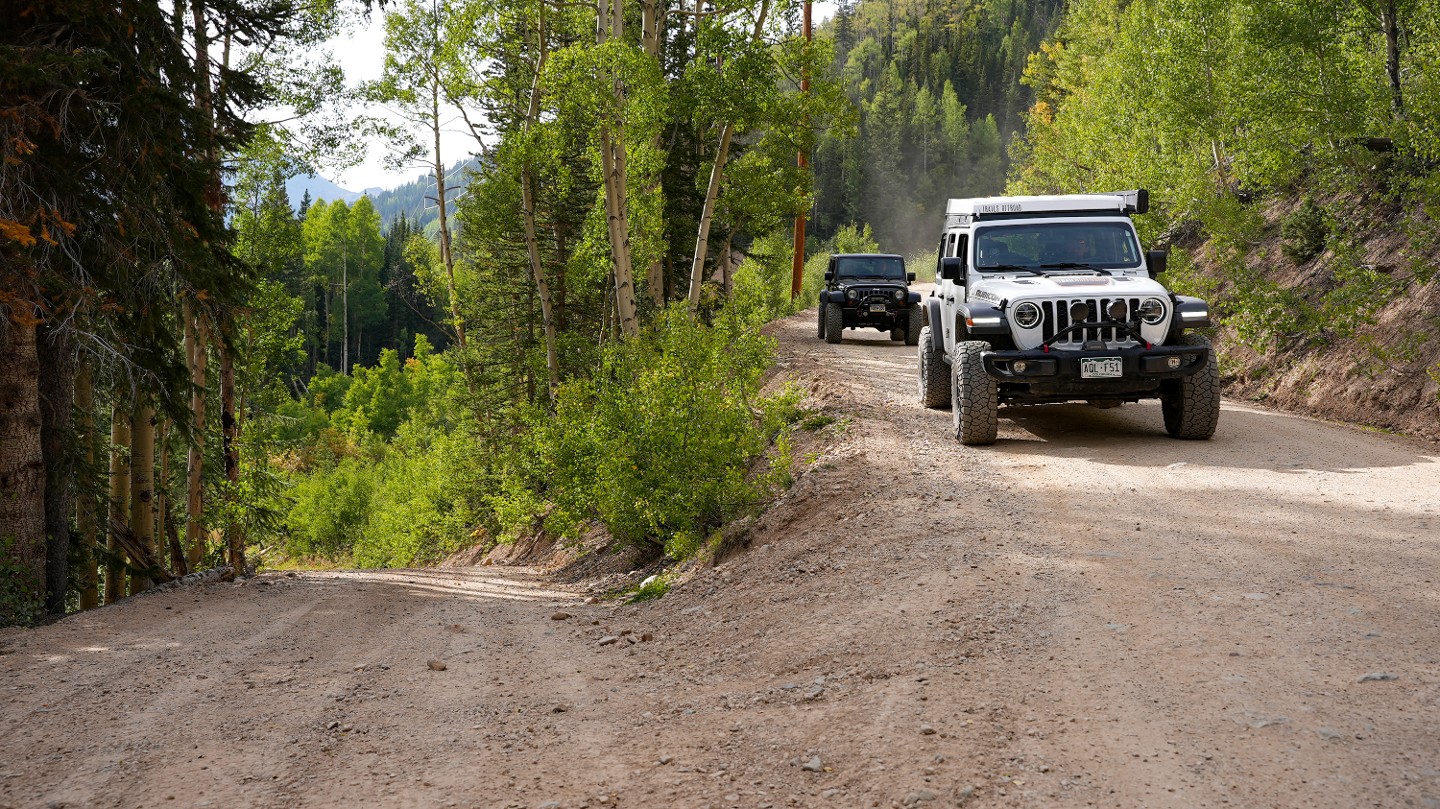
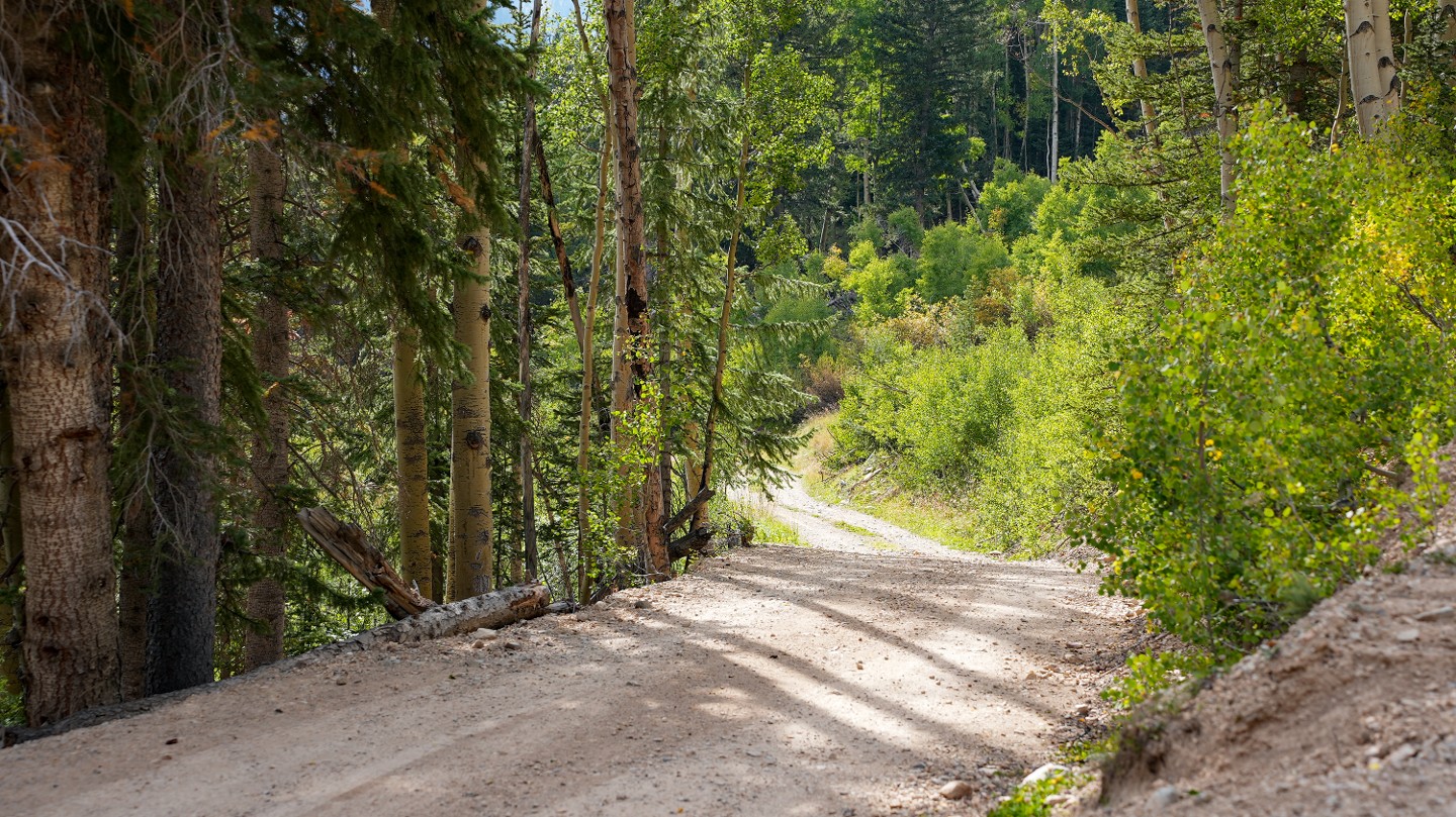
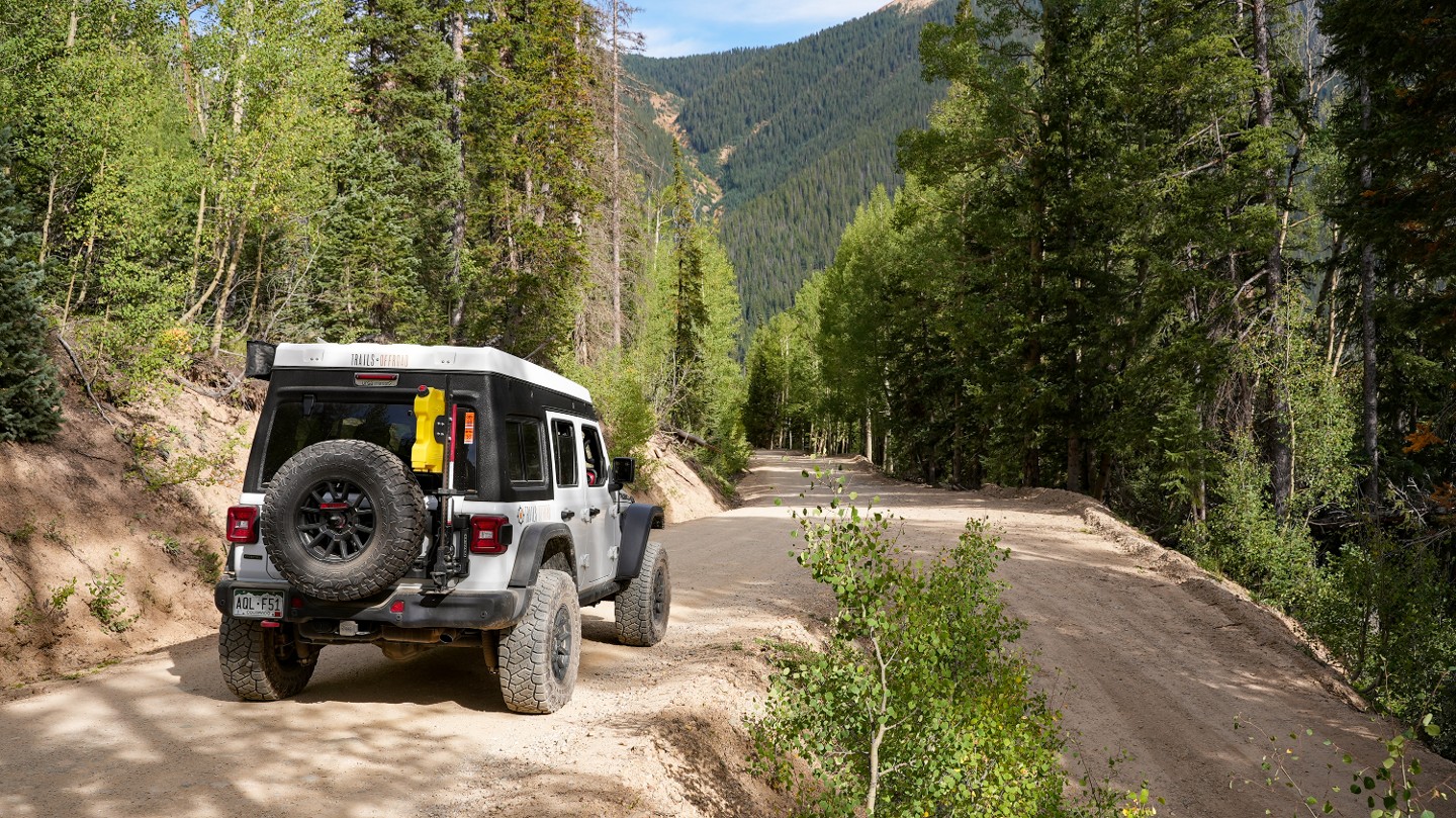
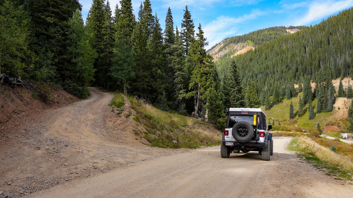
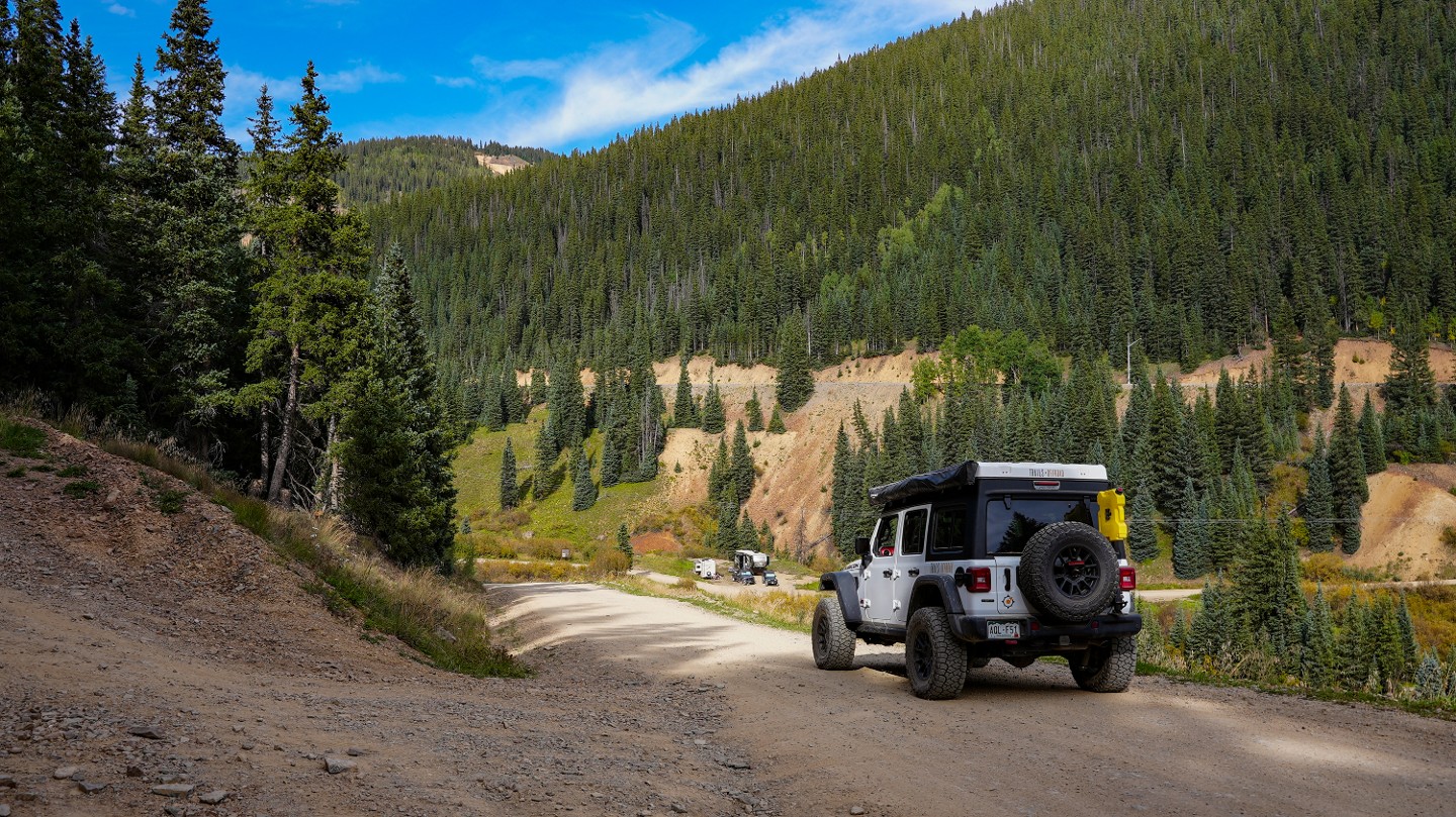
Ophir Pass is a high alpine 10-mile mountain pass from Highway 145 to Highway 550, connecting Ophir and Silverton. The pass is naturally closed by snowfall each year and plowed open by county road crews late each Spring. The road is bumpy, packed dirt that is well traveled as you leave the town of Ophir and begin ascending 2,000 vertical feet to the summit. There are several small stream crossings but no significant obstacles until you reach the treeline. The final push to the summit is extremely rocky and rough along a loose, narrow shelf road covered with tallus rock that can test the nerves. There are limited passing opportunities above the treeline on the west side, but visibility is very good. Once cresting the summit, the road widens and begins a gradual descent down a hard-packed, dirt road. East of the summit, the road number changes as you travel into the San Juan National Forest.
Since this trail is fairly easy on vehicles, any stock high-clearance vehicle with 4WD should easily get through here in good conditions. Airing down will make your ride a bit smoother. Lingering snow, water, or bad weather can make this trail treacherous.
This trail is popular. Expect heavy 4x4 and dirt-bike traffic.
1. Western Trailhead (0 mi)
Just right off the highway, you will find the western trailhead off Highway 145. There is ample parking and enough room for several vehicles to meet up and air down.
2. Ophir Post Office (0.4 mi)
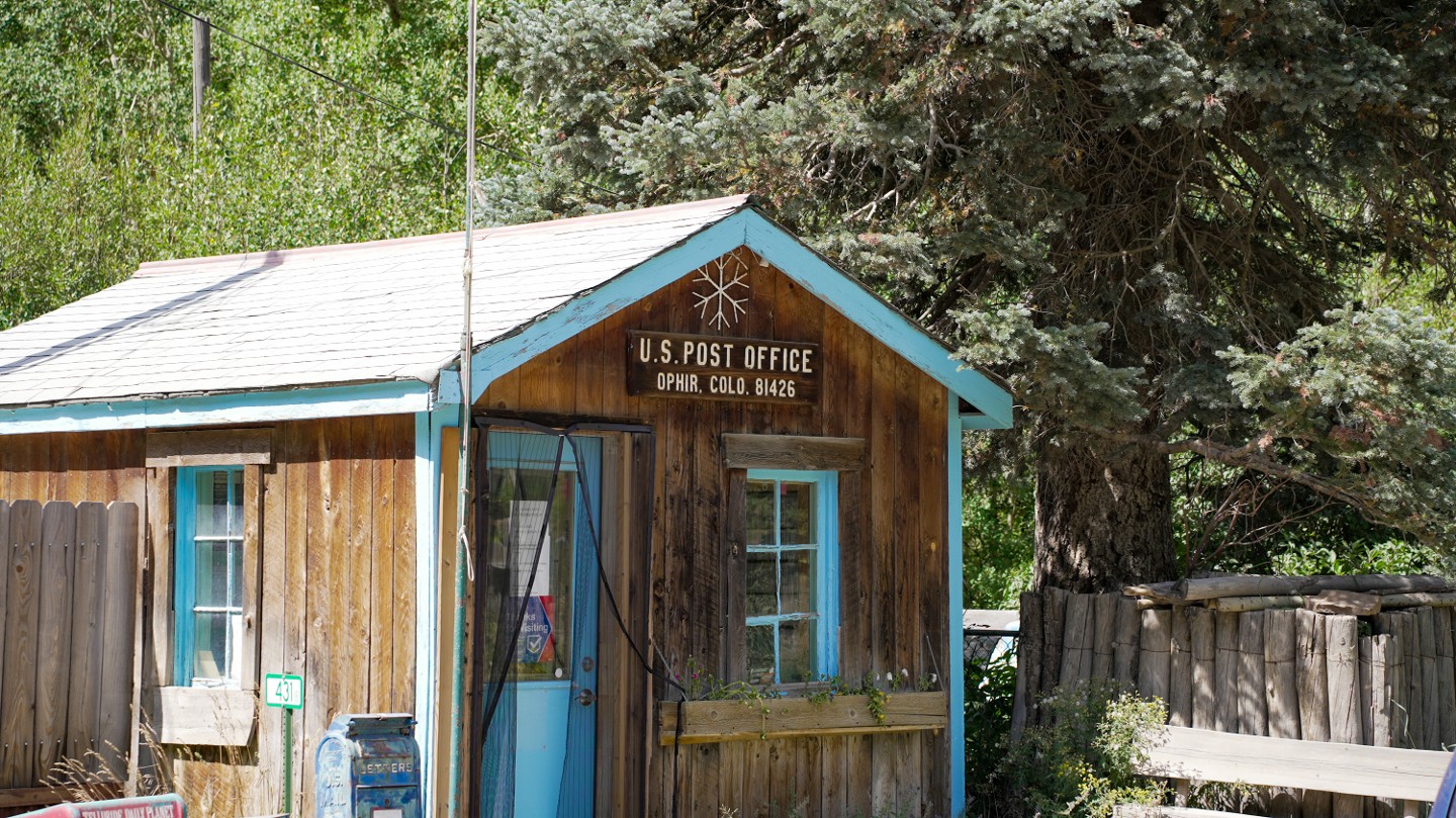
The Ophir Post Office, established in 1878, is another good place to air down if you want to do it a bit further away from the highway.
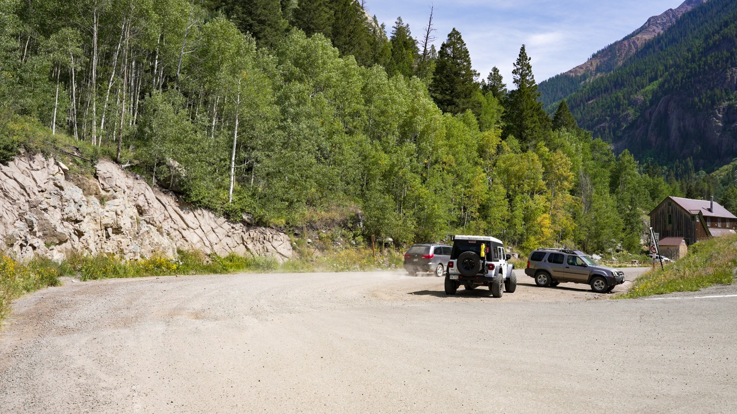
3. Town of Ophir - Stay Right (2.11 mi)
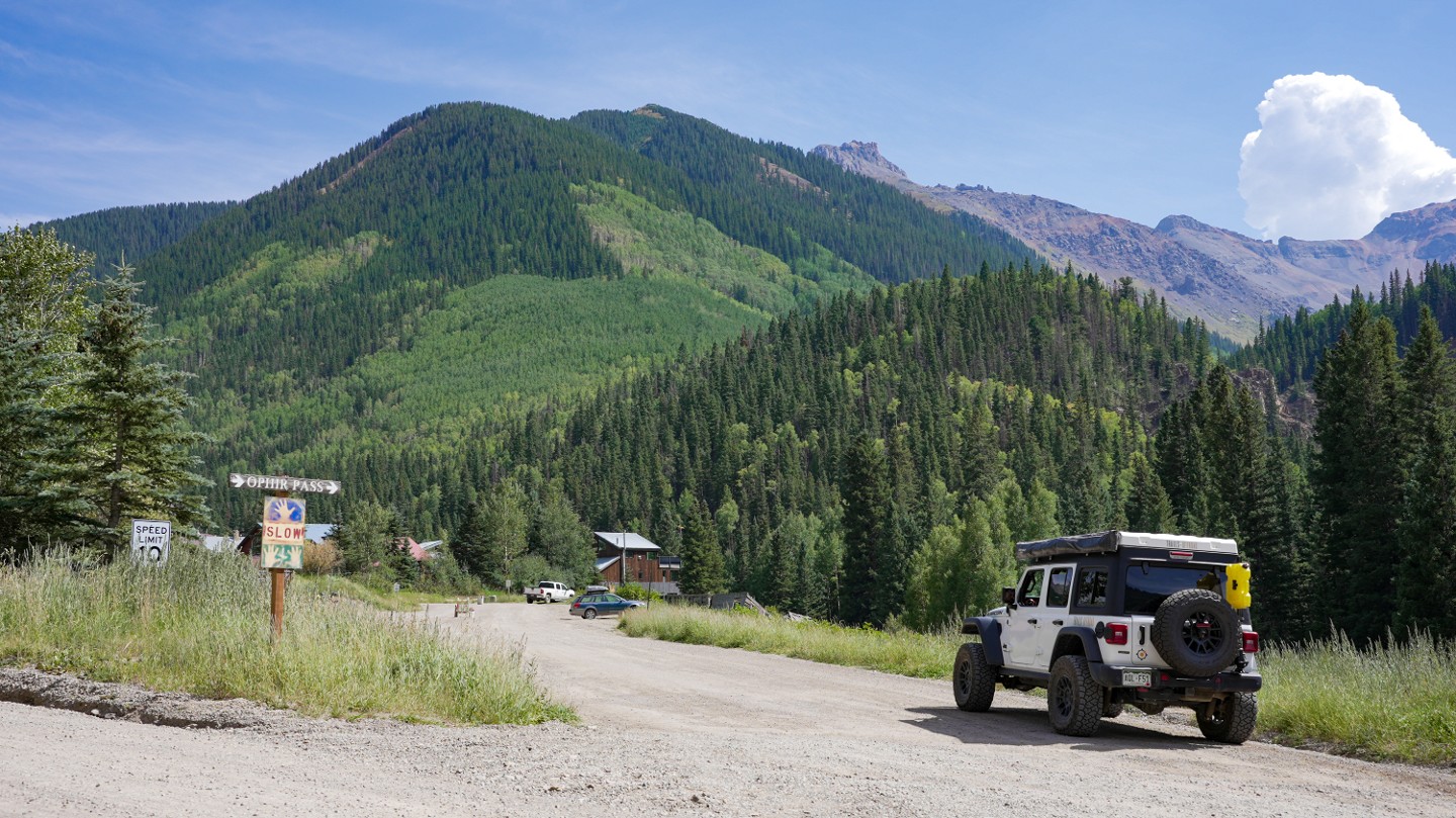
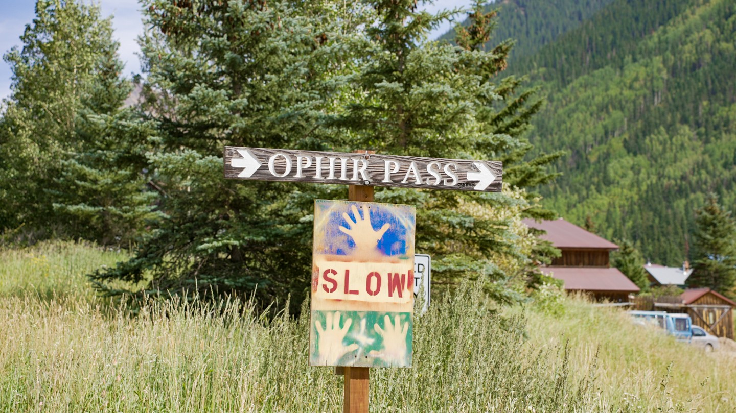
The town of Ophir was named after a biblical mine that brought gold to King Solomon. Pass through the town slowly, and keep your eyes peeled for the signs that show the direction toward Ophir Pass.
4. Water Crossing (2.84 mi)
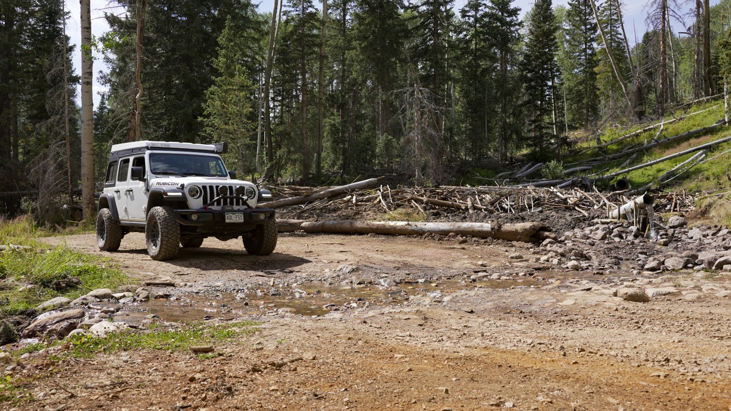
You will cross over the first of several water crossings at this Waypoint. There are relics of old mining history here as well as beaver ponds. Continue straight.
5. Water Crossing and Unnamed Spur - Continue Straight (3.34 mi)
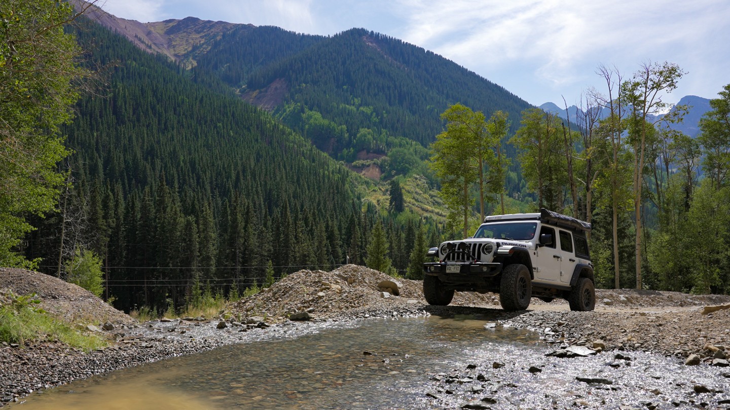
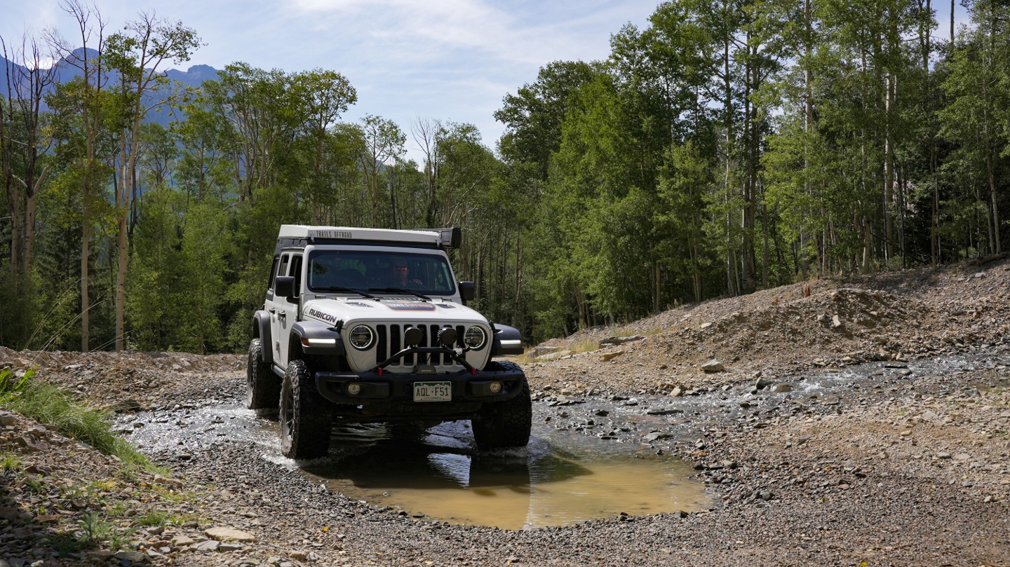
As you make your way up Ophir Pass, you will encounter another water crossing. There is also an unnamed spur road heading south, which is not on the MVUM.
6. FS 630.2C - Stay Left (3.62 mi)
Stay left to continue on Ophir Pass. Swamp Canyon (630.2C) to the south dead-ends several hundred feet off Ophir Pass.
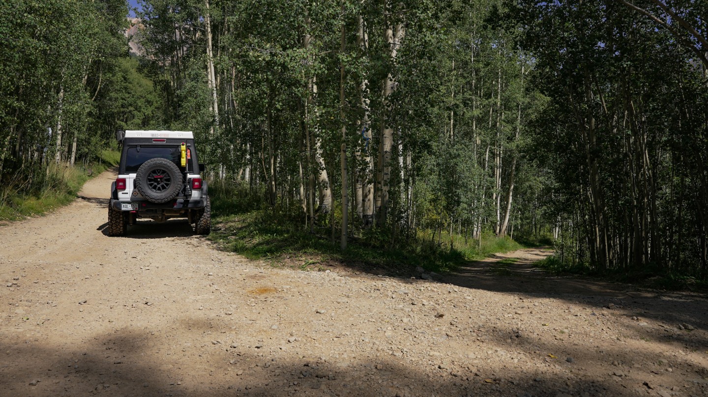
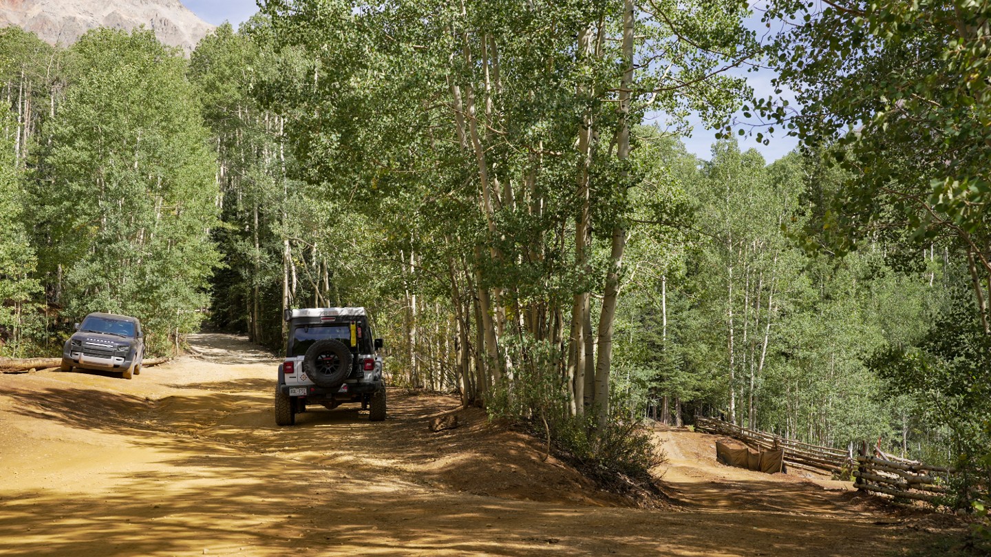
7. Unnamed Road - Stay Straight (3.92 mi)
An unnamed road lies right off the trail to the north. Stay straight to continue up to the beginning of the scenic part of Ophir Pass.
8. Begin Shelf Road - Limited Passing Opportunities (4.91 mi)
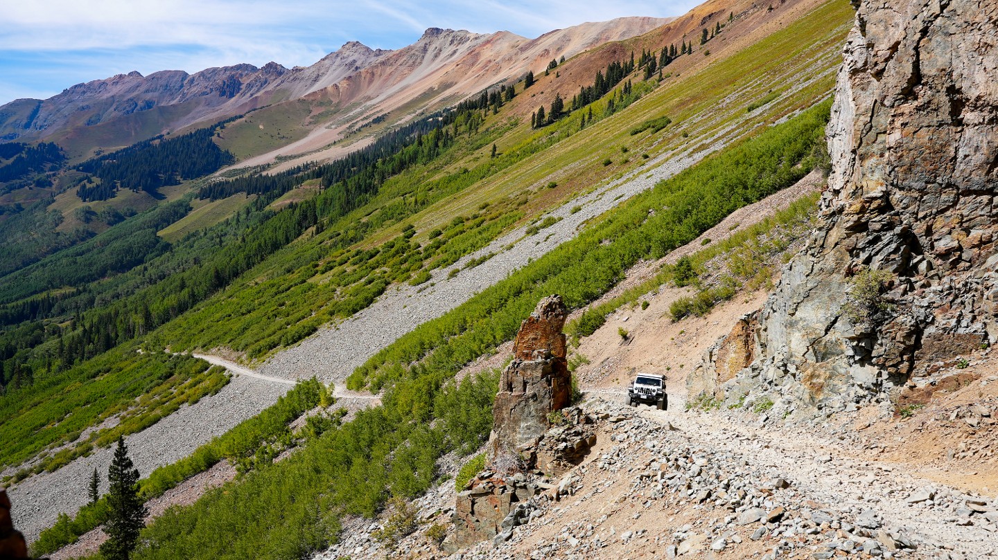
A long, narrow shelf road begins here with very limited passing opportunities for the next half mile. From this point, visibility is good, allowing you to see oncoming traffic. The next passing opportunity is just over a tenth of a mile away and only good for 1-2 vehicles.
9. Pull Out Opportunity (5.04 mi)
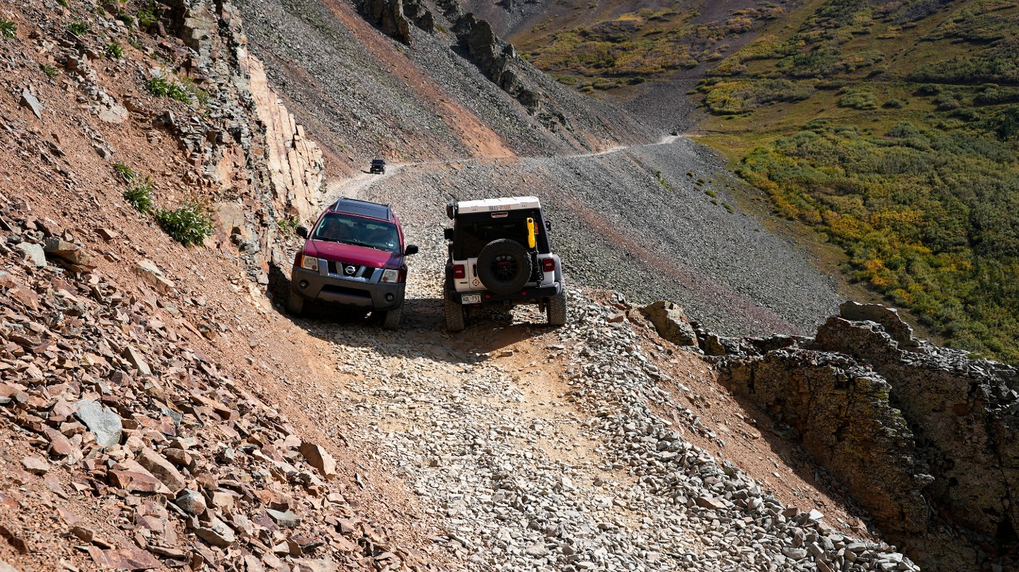
Here is a small area wide enough to pass oncoming traffic. This wide spot is only suitable for a few vehicles depending on vehicle length. Continue to look ahead for oncoming traffic. This section of shelf road ends in a quarter mile.
10. End of Shelf Road (5.27 mi)
The road widens ending any oncoming traffic fears. Continue through the switchback heading towards the summit.
11. Ophir Pass Summit (5.82 mi)
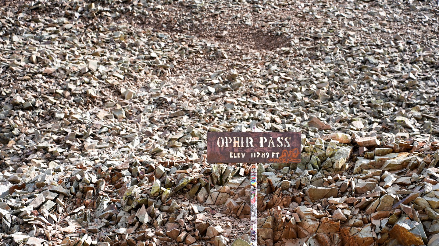
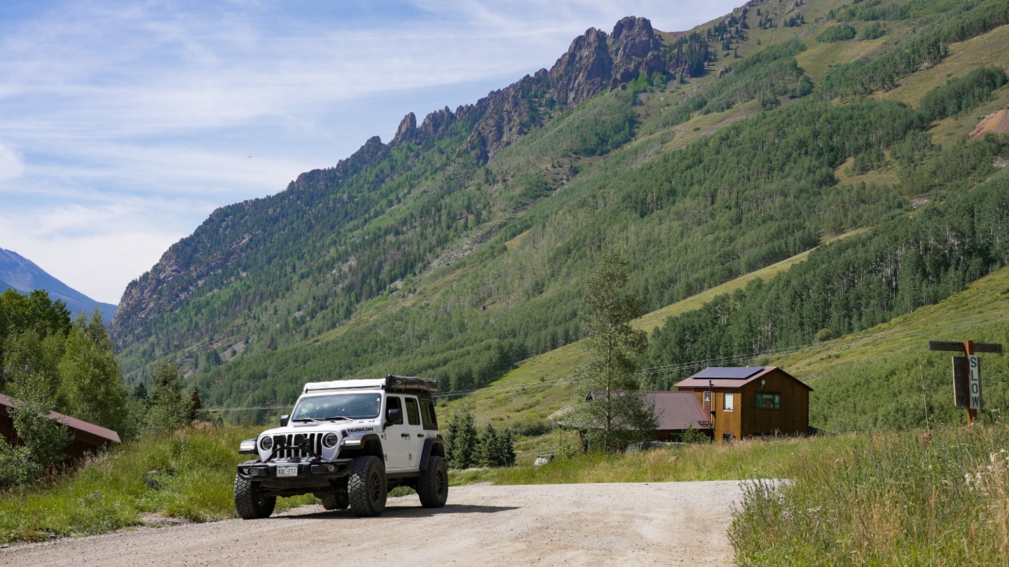
Here is the summit of Ophir Pass. There is plenty of parking and opportunities to enjoy the summit. There is also a short but steep hike to Crystal Lake just to the south. The road number changes here from 630 to 679.
12. OPUS Hut Parking (6.32 mi)
Continue downhill, passing the entrance to the OPUS Hut, which stands for Ophir Pass Ultimate Ski. First opened in 2011, this hut is a full-service European-style backcountry hut where you can rent a sleeping spot.
13. Unnamed Road - Stay Right (6.78 mi)
Continue downhill to the right, passing this old, unnamed road that enters private property and once led to the Freda Mine.
14. FS 819 - Stay Straight (9.02 mi)
FS 819 breaks off to the southwest for 0.3 miles and leads to the Zinc King Mine and Bonner Mine. Continue straight following 679.
15. FS 820 - Stay Straight (9.58 mi)
Continue straight, passing FS 820. FS 820 is a short spur road that leads back to Highway 550, 0.67 miles north of the eastern trailhead for Ophir Pass.
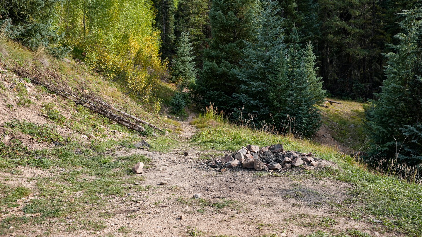
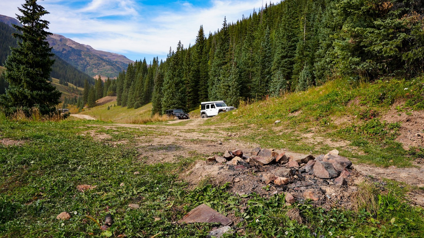
16. Bridge Campsite (9.73 mi)

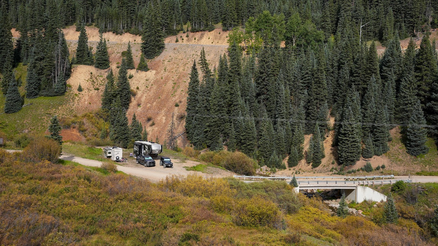
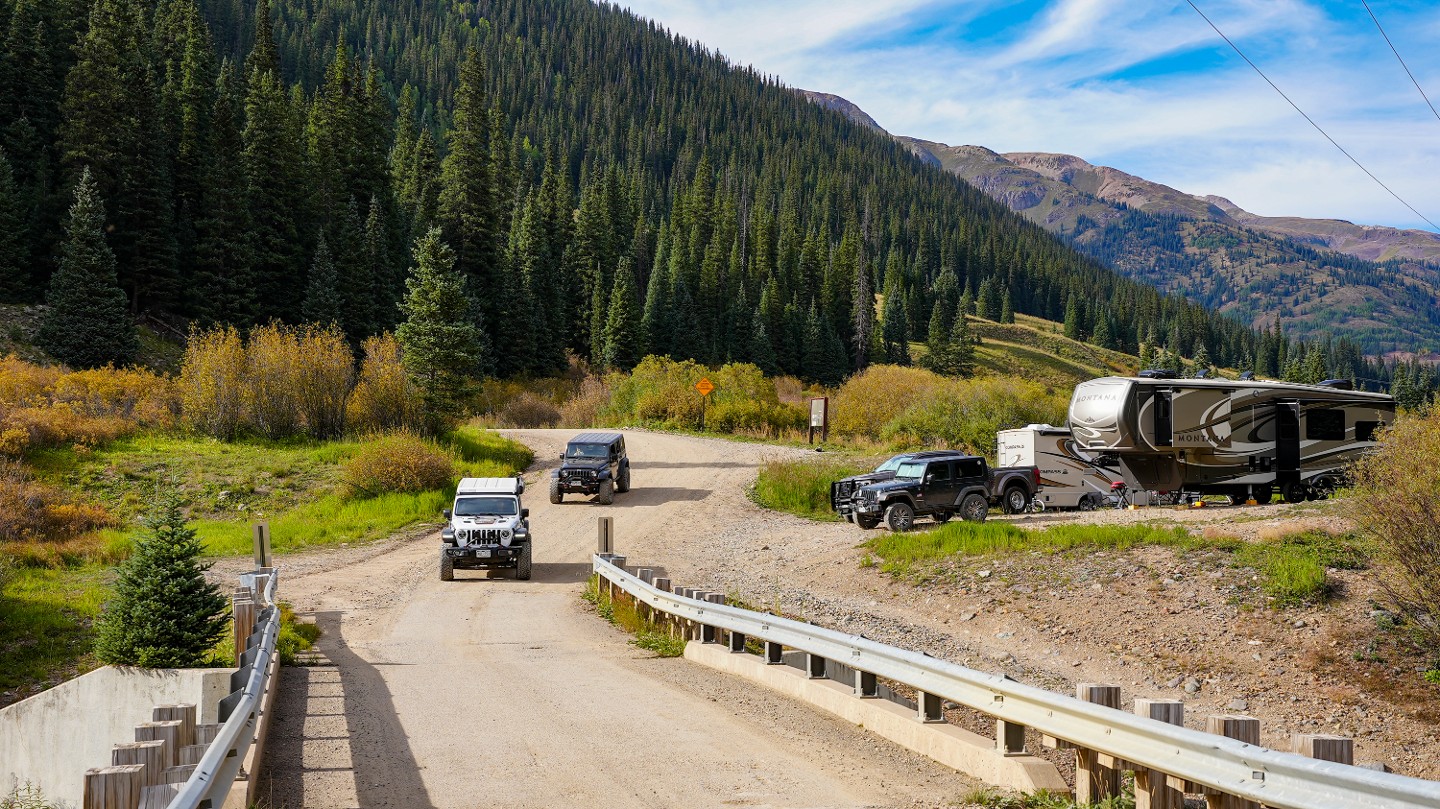
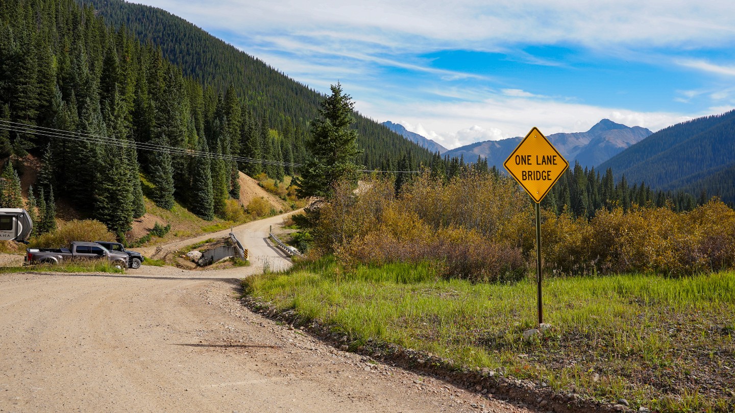
This large campsite beside the bridge over Mineral Creek is great for trailers and RVs.
17. Eastern Trailhead (9.98 mi)

The trail ends as it intersects with Highway 550. The area here is wide enough for a group to air up and offers several small campsites. Travel north to reach the town of Ouray in about 45 minutes. Travel south to reach the village of Silverton in about 10 minutes.
Dispersed
The only dispersed camping along the trail is near the eastern trailhead in several established dispersed sites. Camping is difficult along the rest of the trail due to terrain or private property.
More dispersed camping options can be found on the east side along South Mineral.
On the west side, Matterhorn Campground offers improved camping options.
Both Telluride and Silverton offer traditional lodging.
Starting Point
Telluride
Western Trailhead: From The traffic circle west of Telluride, head south on Highway 145, passing the Telluride Brewing Company and Mountain Village. Follow Highway 145 for 7 miles turning left on FSR 630 and following signs for the town of Ophir and Ophir Pass.
Eastern Trailhead: From Silverton, head northwest out of town on Highway 550. Travel for 4.2 miles along the highway, turning left on FSR 679 following signs for Ophir Pass.
Trail Reviews
4.8/5 (87)
This trail guide's difficulty was changed on
09/21/2022
Open
Rated
3/5
Visited: 09/11/2022
Difficulty Accuracy:
Spot On
A bit conflicted on this trail. Amazing views, boring trail. A transfer case is highly advisable. I would personally not do this trail in an AWD or 2WD rig, but I am sure it's been done. This would be a great beginner trail or stock vehicle-friendly trail, otherwise, I put this on the bottom of the bucket as far as the San Juans go. Ophir is a trail I am glad I did once, but will probably bypass it in favor of the more interesting trails in the area.
Open
Rated
4/5
Visited: 09/05/2022
Great trail! Awesome views! I did this in my stock beat up Jeep Liberty on street tires… the shelf road area was tough on the little Jeep but the skid plates held up Hahah! I would not take a Subaru on this one for sure. With a little trial etiquette the shelf road is doable with some pull outs here and there. For sure an easy pass compared to most of the trials in the area.
Open
Rated
5/5
Visited: 08/28/2022
Difficulty Accuracy:
Spot On
Finally drove the full length of this east to west. Overall a scenic and easy drive. I think it took like 20 minutes to get to the summit on the east side, and the west side went quick too. No passing on the shelf section so look ahead before continuing up or down it. If you look down while driving the shelf you'll see the old car of someone that apparently went for a rough ride down the moutain.
Open
Rated
5/5
Visited: 08/27/2022
Difficulty Accuracy:
Spot On
Pretty easy trail as the guide suggests. Great views and little traffic on a saturday. Stayed in 2WD until the descent into Ophir. There is a hole forming at the switchback on WP 9 but nothing bad. A great trail to start on!
Open
Rated
5/5
Visited: 07/23/2022
Difficulty Accuracy:
Spot On
We took Ophir Pass as we were leaving Mountain Village and headed back home. While we went the non preferred route of west to east I wouldn’t have it any other way. After experiencing the Alpine Loop and Imogene Pass earlier in the week Ophir was a walk in the park. As you will read, the greatest obstacle is the shelf road as it is both relatively narrow and rock can be deep and loose. There are places though to pull off and let others pass as needed but you can plan ahead as there is good visibility all the way up the shelf road. Reason I would prefer the west to east direction is that I prefer to have better control going uphill on the shelf road with the loose rock and also the fact that descending on the east side of the pass is relatively easy since the elevation change isn’t that significant plus the loose rock is very limited on the east side.
Open
Rated
5/5
Visited: 07/19/2022
Difficulty Accuracy:
Spot On
Definitely a must do if you're in the area. I took Ophir over to Telluride and then Imogene back to Ouray which is a nice loop. I agree with others that this is probably the easiest pass of all of them, but the descent from the summit is a pretty narrow and rocky shelf road. Nothing to worry too much about, but just be prepared for that. There's lots of visibility, so it's easy to see if there's any oncoming traffic.
Open
Visited: 06/05/2022
Difficulty Accuracy:
Spot On
We made it to beginning of the trail around 7pm so light was beginning dwindle. My buddy who's a local of the area gave us a waypoint for a campsite a few hundred yards into the trail. We set up camp and were eating by 7:30. Several Jeeps were coming down the pass on the Western side as it dark...we even had a vehicle come through around midnight. Conditions were really good the next morning...about 55 and sunny. As we rounded our way up to the Summit we could see quite a bit of snow still. Once you get close though you could tell the trail was wide open between the snow banks. We drove between about 5 feet of solid snow/ice on our way to the summit. Overall a really cool trail that almost any stock vehicle should be able to conquer. Cheers!!
Open
Rated
5/5
Visited: 09/19/2021
Difficulty Accuracy:
Spot On
Ophir Pass seems like the perfect San Juan Mountain trail to get you warmed up and acclimated to driving the passes in this area.
We didn't encounter anything difficult, just a whole lot of spectacular scenery. We documented the highlights of our trip up and over the pass in the video linked here, so feel free to watch it if you want a good idea of what to expect along the route!
Open
Rated
5/5
Visited: 09/19/2021
Difficulty Accuracy:
Spot On
Did Ophir Pass East to West, the trail gets very rocky above the tree line but is not particularly challenging. We did come upon a tow truck blocking the trail while the driver picked up a stranded motorcycle. The driver was very accommodating and pulled onto the shoulder at a switch back to let us pass. The view was fantastic and well worth the trip. And as stated by another reviewer, this is good trail to get experience before taking on the more challenging trails in the area.
Open
Rated
4/5
Visited: 09/07/2021
Great trail to start your San Juan "Badge of Honor" Jeep trail run. Great views, good introduction to shelf roads, fair amount of rocks to deal with and a few obstacles to traverse.
If you start with this trail then run Imogene on the same day it's a good progression as Imogene has everything Ophir has but the shelves are narrower, the climbs/descents steeper, the obstacles bigger and the trail longer.
Open
Rated
4/5
Visited: 07/22/2021
This is accurately rated and if not comfortable with shelf roads would get you uncomfortable quickly. With so many passes closed in the area due to slides, this one was a bit busy. Nice easy shelf though for beginners and the trail guides were surprisingly accommodating to the uphill right of way, every single one pulled over for us as we came up from the Telluride side.
Open
Rated
5/5
Visited: 07/14/2021
Ophir pass was the first trail we hit in the Ouray area. It was beyond incredible! There is really nothing challenging about this trail, but it is a great alternative to taking black bear pass if you want to go from Ouray to Telluride. I'd highly recommend this trail as a starter to get warmed up for the rest of the trails in the area.
Open
Visited: 07/03/2021
Went on a holiday weekend, decently crowded but the trail is wide enough in most places to manage easily. Little snow left. Very easy trail, the shelf road is Rocky but no major obstacles, just keep an eye out for uphill traffic and wait for a chance. Good alternate to running black bear to get to Telluride from 550, did that and then took Immogene Pass back in the afternoon for a nice long day on the trails.
Open
Rated
5/5
Visited: 06/29/2021
This was the first real trail for my stock sport Gladiator and it was awesome! The trail is pretty easy for a stock 4x4, not sure about 2wd for the whole route. Couple small water crossings. The shelf road is very cool, made my wife nervous but it was not a big deal. Marmots near the top of the pass were plentiful and some great hiking up there!
Open
Rated
4/5
Visited: 06/22/2021
Difficulty Accuracy:
Harder
Beautiful drive. First time traversing a scree field, was a bit nerve wracking. But the views are worth it. I'm rating this as "harder" because the week before we did this, a box truck tried using the route and got stuck in the scree field, and had to be towed out. This left the deep, loose, big rocks, deeply rutted.
Open
Rated
5/5
Visited: 06/15/2021
We came up from Silverton side which is a very easy drive to the top. There was Snow at the top of the pass, but there was enough room for a 4-5 Jeeps to park and take a photo. Road down the west side is the roughest part. There was some deep loose rock which I took to be a threat to my tire's side walls. Last thing you want to do is change a tire on the west side narrow shelf. Turned out all was good. Great views, Great drive. (If you have a choice, start on the Silverton side as the views are better and the loose rock on the west side is easier to drive down than up.)
Not Reported
Rated
4/5
Visited: 03/22/2021
This trail is nice little jaunt between Ouray and Telluride, the views are spectacular. I will say I am pretty sure that a Subaru could do this trail the only issue I could see them having is clearance. Rocky and loose shale at the top could make it moderately difficult at just the summit area the Telluride side being worse than the Silverton/Ouray side. We did this trail last year in Late August and there was no snow at all, it was raining when we did it and foggy at the top. The rain didn't make it harder just slippery in spots. I will say this the town of Ophir is not very 4x4 friendly they have posted signs that say if your vehicle is not registered to drive on asphalt that it is not allowed in Ophir. ALL Side by sides, Motorcycles, and Buggys must turn back before city limits. We did not see or hear of any issues while passing through this little town.
Open
Rated
5/5
Visited: 10/17/2020
This was actually our first trail as a family. We had a blast! We went on a Saturday so I was expecting a lot more waiting but we got really lucky. The tundra with a 6" lift and 35s had no problem with the trail. The rocky section on the Telluride side of the pass was a little exciting but nothing too scary. Had no issues and can't wait for the next adventure.
Open
Rated
5/5
Visited: 10/11/2020
2018 Subaru Crosstrek
1.5" Lift
235/75R15 Toyo AT2
Fun trail but fair warning the trail has changed quite a bit from when it was originally mapped. Over all the trail is easy, however between Waypoints 8 (the summit) and 10 the trail is covered in really loose slate rock. This will pose more of a challenge for vehicles running radial passenger tires, but still doable.
We traveled the trail from the Silverton side to the Telluride side which made the shelf roads easier in my eyes as we descended down the summit ever so slowly, as apposed to climbing up the slate rock.
Beautiful views and I would definitely do the trail again next time I am in town.
Open
Rated
4/5
Visited: 09/19/2020
Second time running this trail and it was much more enjoyable the second time around. Was traveling some some family, one of which does not like longer offroad ventures, and she absolutely loved the pass. The shelf road is pretty easy, just go slow. This time around, we took our time, stopping for some pictures and to appreciate the colors changing down towards Ophir.
Open
Rated
5/5
Visited: 09/18/2020
Waypoint 9 has changed dramatically. The scree starts just at the top of the pass and gets worse as you head down that first section. A rock rolled from under the tire and I took a terrific hit to the oil pan and started dumping oil. (4 hours later and I had things back under control.) Ahead of us were 3 motorcycles that had no business being on the trail. They were dumping their bikes almost every 50-75 feet.
We had fun (all except the oil part). The aspens were turning and the scenery was great.
One thing we all need to remember is that when you see a vehicle stopped by the side of the road with the hood up, stop and ask if everything is OK. Only three people out of about 30 stopped to see if I needed help.
Open
Rated
3/5
Visited: 09/06/2020
Simple trail we ran from Telluride and the little town of Ophir to the Million Dollar Highway / 550. Very busy pass with many Subarus coming from 550. Had a 20 minute wait while traffic came downhill off the cliff line. View were nice going up, and on the downhill, but the pass is very rocking with limited views.
Open
Rated
5/5
Visited: 09/03/2020
This was our first Jeep "Badge of Honor" trail. We're doing this in a stock 2020 Cherokee Trailhawk, so we wanted an easier trail to begin with. Beautiful views and the trail wasn't too crowded on a Thursday. We did meet a person in a Wrangler at the summit who asked if we were going down the west side of the summit "in that" (referring to our Trailhawk). I just said of course. The trail can be done in any stock Jeep 4WD vehicle without the need for a lift, big tires, or an Wrangler ego.
Open
Rated
5/5
Visited: 08/30/2020
Difficulty Accuracy:
Spot On
Fun, easy trail with some amazing views and shelf roads that are enough to add some excitement without being scary (depending on how much experience you have on shelf roads I guess). The little town of Ophir was cool to drive through and then ending at the Million Dollar Highway with a beautiful drive into Ouray was great.
Open
Rated
5/5
Visited: 08/16/2020
Easy trail, helps to have clearance. We drove east to west. Heading west toward the peak is easy with minimal grade. As soon as you leave the peak heading toward Ophir you are on the shelf road. High clearance helps make it an easy decent. Plenty of passing spots on the shelf road. We came across a Honda Pilot on the shelf road packed with college aged guys. With a careful eye from both our vehicle and a two Jeeps behind them, the Pilot made it safely down. At the bottom we asked why they took that road and their response was Apple Maps said it was the shortest path to Telluride from Ouray!
Open
Rated
5/5
Visited: 07/13/2020
Easy for a stock wheelbase mid size SUV/Jeep. Only issues to be concerned were the pucker factor while heading west toward Telluride. Steep downhill line, reasonably narrow shelf with 2-3'000 foot fall off, 6-12" rocks for part of the westbound downhill section. Motorcycles abundant. Everyone is polite about directional travel and the stop and wait at certain areas for those vehicles. Slow through the town of Ophir. Lots of kids and dogs. Water crossings are a nice place to get out and get wet with parking for several rigs on both western side crossings.
One thing not mentioned here is the an amazing place called opushut.com. A hike in only old school sustainable building about 1/2 mile from the summit of Ophir Pass. All inclusive includes afternoon soup, dinner and breakfast as well as an al a carte kitchen. Open year round it sits at 11,600' and has some of the most spectacular hiking in the area.
Open
Rated
5/5
Visited: 07/04/2020
I personally really like this trail - it's not super hard, and pretty bumpy the whole way, but the view is awesome and the way the geography and rock formations change is something cool to see.
I think you could do this trail in a stock subaru outback - it's not hard. Again, just bumpy. The long rocky stretch on the Ophir side has basically no passing spots - keep and eye out for oncoming traffic and wait your turn so that nobody has to back up - could be dangerous to try it.
Open
Rated
5/5
Visited: 06/07/2020
Difficulty Accuracy:
Spot On
We left the 100 degree temperatures of Moab for Telluride. Ophir was the only trail that was open, so we gave it a shot. We ended up running it in reverse, which worked out fine. It was amazing to be at nearly 12,000 feet and 50 degrees, having come from Moab just a few hours prior.
Ophir is very easy, but the steep drop off and narrow trails between Waypoints 7 and 10 can be a bit nerve wracking. Still, we can’t wait to go back to Colorado, and try the other mountain passes in the area.
Open
Rated
4/5
Visited: 09/14/2019
Ophir Pass at sunset, late in the season--fantastic!
Found the road in good condition, remarkably still pretty wet at the lower elevation near Ophir. Red Mountain/Silverton side was dry and good condition, nearly as if it has been graded recently on the lower elevation segment.
Open
Rated
5/5
Visited: 08/20/2019
Started this on the 550 side and easily cruised up the east half. Starting down from the summit, the downhill on the west side is much different than the easy dirt you just drove up. As others have said, the rocks are 4-7 inches and loose in areas. Passing areas are limited in the shelf area, so I highly recommend waiting to start your descent until you've made sure nobody else is coming up the road for as far as you can see. I'm not sure I agree with the recommendation to take a stock vehicle on this though. I know it must be doable, but I wouldn't take my stock 4WD daily driver on this due to this section I described, and the potential that you may have to back up hill in a rocky shelf section to allow an uphill person to pass. Dont let the fact that this trail is rated a 2 make you think it's a walk in the park for your stock 4WD car.
Open
Rated
5/5
Visited: 08/16/2019
First trail we hit in the area, was a great way to break into the mountains. Once we came to the pass there were a few motorcycles trying to make in up the rough part of trail, there's some rough rocks leading up to the pass from the West side, a bit much for the motorcycles coming up. We had to get out with some other Jeeps and help a couple motorcycles up the trail so we could make it down. Overall a great trail with some beautiful views.
Open
Rated
5/5
Visited: 08/03/2019
Great views, in good weather its doable in any SUV/crossover with an experienced driver (must not be afraid of heights/shelves). Highly recommend making a loop with Imogene Pass, stop midday in Telluride. Summit is a little anti-climatic. One interesting section on the downhill to Ophir you are driving entirely on 4-6 inch rocks, sounds like you are driving over broken glass. If you're looking for a great mountain pass experience, without the pucker/damage factor of a Black Bear or Poughkeepsie - this is the trail for you!
Open
Rated
5/5
Visited: 06/27/2019
Ran the pass from East to West on opening day. The crews did a good job clearing the road and left it in great condition. First switchback west of the summit along shelf road caught me off guard, a lot tighter due to snow bank but a cautious 3 point turn was all it took. This is a good beginner pass.
Open
Rated
5/5
Visited: 09/21/2018
Great day to be on the trail! The fall colors are amazing right now in the area. Saw quite a bit of traffic, but probably not as busy as peak summer season. I would say the only thing this guide is missing is the historic post office on the west end between the highway and ophir. It's a really cool building to stop and visit.
Open
Visited: 08/26/2018
This trail is awesome. Nothing challenging as long as you're comfortable on a shelf road on the west side It's one car wide but you can see almost the whole road before going up or down so just make sure no one is on the road. Absolutely stunning views and a great way to pass over to Telluride from the east without going all the way around. Ran it in a stock Grand Cherokee.
Open
Rated
5/5
Visited: 07/01/2018
Ophir Pass is a fairly straight forward pass, but is absolutely picturesque from top to bottom. We headed up Eastbound from Ophir towards 550. The going is a bit rough down low between Ophir and the talus field. Once up to the edge of the talus, the trail is completely comprised of large talus rocks that you can feel move under the weight of your 4x4. It's a little unsettling, given the steep slope of the field, but it's very stable as long as you stay away from the edge.
We had the added excitement of a radiator cap failing on us as we reached the talus. - A small, but easily overlooked part when you're restoring a 20 year old vehicle, but a solid lesson to remember the finest details for safety sake.
Instagram: @overland_pajero
Seasonal Closure
Visited: 10/25/2017
The FS has announced that as of today this trail is closed at the top by snow and that they will not recover vehicles on these trails until spring. The trail is impassable at this time but trailsoffroad will update the status as soon as the trail opens back up in the spring.
Partially Open
Visited: 10/10/2017
Please note that the time of year where daily closures are upon us in the San Juans. While they have not closed the trail yet, Ophir Pass is on a daily watch for weather. It's been closed on past days but is open as of this report. There is snow and ice reported by the county. While trailsoffroad will try to keep the trail as up to date as possible, please check this link to the county for the latest.
We will update this page when the trail is officially closed for the season.
Open
Visited: 09/24/2017
Beautiful drive over Ophir Pass. The visual combination of snow above 10k' with fall colors below was stunning.
We were a little worried the day after a snowstorm but most of the snow had been driven over enough to be packed down or melted. A little icy above ~11k. Passed a handful of other drivers on our way up (we were eastbound) that provided reassurance on the trail conditions. Smooth enough that my son slept through the whole thing. Also, a convenient route from Telluride back to Silverton if you don't want to drive all the way up to Ridgway.
Open
Visited: 07/19/2017
This was our group's first of four trails in two days and was a great intro into the San Juans. The shelf areas were rough on those with heights issues but the beauty more than made up for the pucker factor. Everyone made it through this trail safe and the trail appeared to be in good shape all the way through.
Not Reported
Rated
5/5
Visited: 07/03/2017
I think this trail should be rated 3 because of the rocky narrow shelf section on the west side. Paradise divide is rated 3 and this trail is definitely more challenging than that. It is still a relatively easy trail and can be done in stock vehicles with good clearance, I just think it is better to be more consistent on the ratings.
From the Community
Be the first to ask a question!
JD Marshall
Mapping Crew - Colorado
Jen & JD moved to Colorado from Chicago in May of 2015 for work and brought with them a 2001 stock Jeep Wrangler that had been garage bound for two years. Within a month of arrival, all rusty 170,000 miles of it was shaking on Colorado trails and they've never stopped. As time as gone on, their 2001 TJ had to be traded and a 2015 Jeep JK has been added to the family.
JD works as a Systems Engineer for a cable company and Jen runs a business from their home during the week to pay the bills. When the weekend hits, they're almost always hitting the trail. When Sunday night rolls around, the question turns to, 'so what's next week?!'.
Visit Profile
Start a free trial and get this level of detail on every trail
guide
Start Free Trial
Print Trail Guide
Purchase
Company
Community
Recent Updates
By clicking "ACCEPT", you agree to be the terms and conditions of each policy linked to above. You also agree to the storing of cookies on your device to facilitate the operation and functionality of our site, enhance and customize your user experience, and to analyze how our site is used.